Explore Cyprus with Our Interactive Map

Explore our top stories and discover ideas worth your time.

Cyprus Volcanic Rocks

Cyprus Volcanic Rocks

Cyprus holds a unique position in geological science. The island contains Earth's best preserved ophiolite complex, a rare slice of ancient oceanic crust and upper mantle thrust upward onto land. This exceptional geological heritage shaped both the island's dramatic landscapes and its human history, particularly through copper deposits that gave Cyprus its very name. sandatlas.org The Troodos Massif formed 90 million years ago during the Upper Cretaceous period at the bottom of the ancient Tethys Ocean. The rocks visible today once existed 8,000 meters below sea level at a mid-ocean ridge spreading center, where new oceanic crust continuously forms as tectonic plates pull apart. Geologists call this complete sequence an ophiolite complex. sandatlas.org Troodos was not metamorphosed during uplift, allowing scientists to study pristine oceanic rocks without submarines. This makes Cyprus an on-land analogue for modern mid-ocean ridges. The collision of African and Eurasian tectonic plates pushed the oceanic lithosphere upward rather than downward into a trench. Troodos first rose above sea level about 20 million years ago, with uplift centered around Mount Olympus at 1,952 meters. Erosion exposed deeper layers, allowing visitors to walk from rocks that once existed in Earth's mantle to rocks that formed at the ancient seafloor. Complete Rock Sequence from Mantle to Seafloor The ophiolite exposes a perfect vertical sequence. At the deepest level lie…

Read more
Pelendri Cyprus Historic Village Vineyards Churches

Pelendri Cyprus Historic Village Vineyards Churches

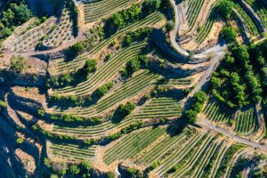
Pelendri is a mountain village in the Limassol district known for its UNESCO World Heritage church, traditional architecture, and established wine production. It’s located in the Pitsilia region at 880 meters altitude and 40 kilometers from Limassol. The village combines medieval history with contemporary viticulture in a setting of steep valleys and high peaks. mytroodos.com Despite being built on relatively barren slopes, the area benefits from approximately 750 millimeters of annual rainfall, which supports diverse cultivation and natural vegetation. Several tributaries cross through the area, providing water resources that sustain both agriculture and forest growth. The administrative boundaries of Pelendri include portions of the Troodos state forests and monastery forests. Natural vegetation includes pines, wild olives, plane trees, and various indigenous shrubs, with uncultivated areas maintaining rich plant diversity. Historical Background Historical records confirm Pelendri as an established settlement during the medieval period. Louis de Mas Latrie, documenting Cyprus during Lusignan rule, refers to the village as Pelendres or Pelondres. In 1353 it was a fief of John de Lusignan, Prince of Antioch and a member of the royal family of Cyprus. Medieval chronicler Georgios Boustronios mentioned the village twice in his writings. He recorded that around 1461, a wealthy merchant named Satin lived in Pelendri, indicating commercial activity in the settlement. Boustronios also documented two farmsteads in the Pelendri…

Read more
Stavrovouni–Lefkara Protected Landscape

Stavrovouni–Lefkara Protected Landscape

The Stavrovouni-Lefkara Hills region forms a distinctive landscape in southeastern Cyprus where forested mountain slopes meet traditional agricultural communities. The Stavrovouni Forest has an extent of approximately 19 square kilometres, with its highest peak reaching 688 metres at the center, where the historic monastery stands. alltrails-com This protected landscape extends from the Stavrovouni Forest in the east through the rolling hills surrounding the villages of Pano and Kato Lefkara. The terrain features pine-covered ridges, rocky outcrops, cultivated terraces, and valleys carved by seasonal streams. There are over 200 types of plants in the Stavrovouni Forest, 22 of them being endemic. The area serves as an important ecological corridor connecting different habitat types and supporting diverse wildlife populations across varying elevations and microclimates. From Ancient Pilgrimage Routes to Conservation Priority The Stavrovouni region holds centuries of human history alongside its natural heritage. According to tradition, Stavrovouni Monastery was founded by Saint Helena and Saint Constantine around AD 327-329, establishing this mountain as a sacred site from early Christian times. The monastery's presence influenced settlement patterns and land use throughout the surrounding hills for over 1,600 years. Traditional agriculture developed in the lower elevations, with villages like Lefkara becoming renowned for lace-making and silverwork. The forest areas provided timber, charcoal, and grazing land for local communities. British colonial authorities began formal forest…

Read more