Cyprus scenic lanes wind through agricultural fields, olive groves, and mountain villages far from coastal tourist centers. These narrow roads connect rural settlements and farmland, offering glimpses into traditional Cypriot life that has changed little over generations.
The countryside lanes range from paved roads between villages to dirt tracks through vineyards and wheat fields. Unlike major highways, these routes meander through natural landscapes where farmers still tend crops by hand and donkeys carry loads up hillsides.
Travelers who venture beyond main roads discover the authentic rhythm of rural Cyprus. Stone houses with wooden balconies, elderly residents sitting in doorways, children playing in village squares, and farmers working terraced fields create scenes that feel timeless. The slower pace allows observation of details easily missed from expressways.
Agricultural Routes Through History
Cyprus has maintained agricultural roads for thousands of years. Ancient pathways connected farms to market towns, enabling trade in wheat, olives, wine, and copper. Many modern lanes follow routes established during Byzantine times or earlier.
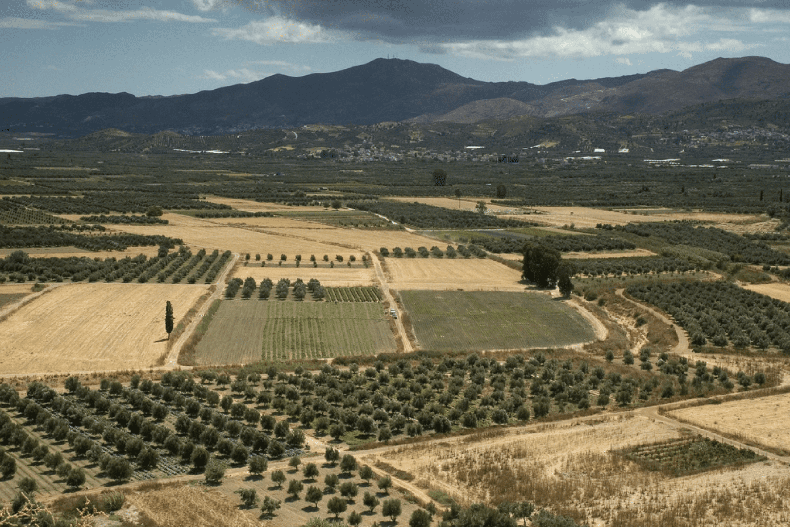
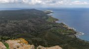
The Mesaoria Plain, stretching between the Troodos and Kyrenia mountain ranges, developed an extensive network of agricultural roads. This central plain became the island’s breadbasket, producing cereals that fed communities across Cyprus. Farmers needed reliable routes to transport harvests to coastal ports for export.
Mountain roads evolved differently. Villages in the Troodos range required paths that could handle steep gradients and sharp curves. Stone bridges crossed seasonal streams, some structures still standing after centuries. These mountain lanes connected isolated communities to each other and to lowland markets.
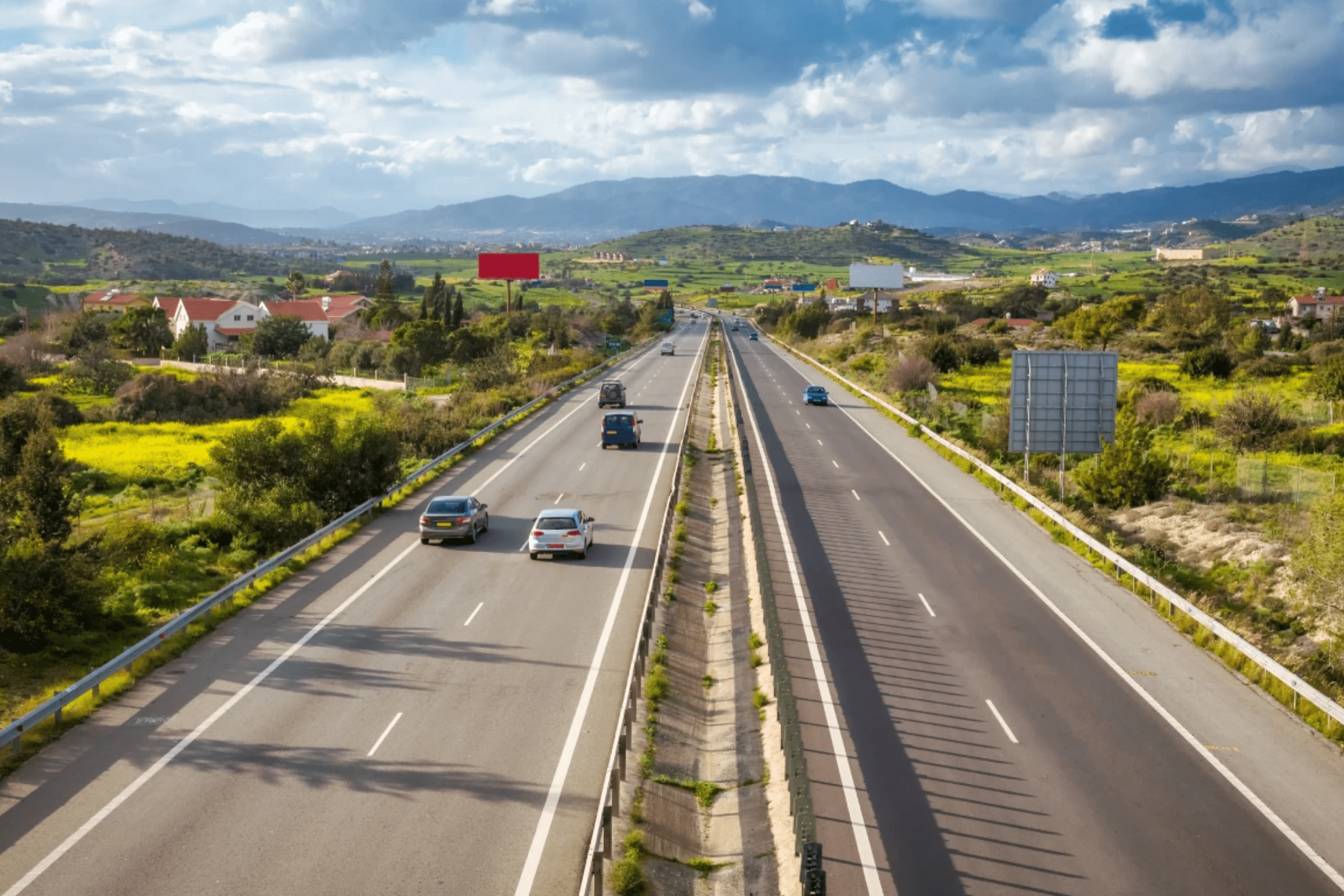
The 20th century brought paved surfaces to many rural roads. However, countless dirt lanes remain, especially those serving individual farms or leading to remote fields. Cyprus maintains about 2.3 kilometers of roads per square kilometer, with agricultural areas showing particularly dense networks at 3.07 kilometers per square kilometer.
Wine Village Routes in Mountain Foothills
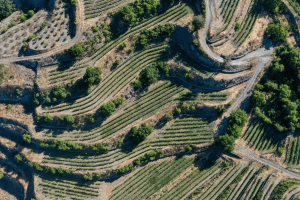
The wine regions of Cyprus feature some of the island’s most scenic rural lanes. Roads climb through the foothills below Troodos, passing terraced vineyards and small wineries.

The route from Limassol to Omodos winds upward through villages like Kolossi, Arsos, and Vouni. Each turn reveals new views of valleys filled with grapevines. Stone walls line many roads, built centuries ago to support terraces and prevent erosion.
Narrow lanes branch off main routes to family wineries and individual vineyards. These side roads often remain unpaved, requiring careful navigation but rewarding drivers with solitude and spectacular vistas. Spring brings wildflowers to roadside verges, adding splashes of color to already beautiful landscapes.
The village of Omodos serves as the unofficial capital of Cyprus wine country. Cobblestone streets in the village center accommodate only pedestrian traffic, but surrounding lanes provide access to numerous wineries. Traditional architecture and wine-making heritage create an atmosphere distinct from coastal areas.
Autumn transforms wine village roads into busy thoroughfares as harvest season arrives. Trucks loaded with grapes navigate narrow lanes between vineyards and production facilities. The smell of fermenting grapes fills the air around wineries, particularly noticeable on warm September evenings.
Mountain Village Connections
Roads connecting Troodos mountain villages rank among Cyprus’s most dramatic rural routes. Hairpin turns, steep gradients, and overhanging cliffs characterize these lanes that link communities at different elevations.
The road to Prodromos, Cyprus’s highest village at 1,380 meters, passes through pine forests and apple orchards. Views extend across mountain ranges to distant coastlines. Side lanes branch to individual farms where families cultivate cooler-climate crops impossible to grow in lowlands.
Villages like Kakopetria, Pedoulas, and Kalopanayiotis connect via winding mountain roads that showcase traditional stone architecture. Houses cling to hillsides, accessed by steep lanes too narrow for large vehicles. Residents park at village edges and walk final distances to homes.
Spring transforms mountain roads into corridors between blossoming orchards. Apple, cherry, peach, and pear trees create stunning displays of white and pink flowers. The aromatic scent of wild herbs growing on road verges intensifies in warm spring sunshine.
Winter brings different challenges to mountain lanes. Snow can close roads at higher elevations, isolating villages for days. Residents maintain supplies for such periods, accepting isolation as part of mountain life. The scenic beauty compensates for occasional inconvenience.
Roads That Connect Past to Present
Cyprus scenic lanes represent more than transportation infrastructure. They embody connections between generations of farmers who worked the same fields, between villages that have supported each other for centuries, and between traditional ways of life and modern realities.
Many agricultural families maintain emotional attachments to specific roads and landscapes. Elderly residents recall walking these same lanes as children, driving them as young adults bringing harvests to market, and now watching grandchildren navigate familiar routes. Each curve holds memories.
The quiet beauty of rural lanes attracts photographers, cyclists, and hikers seeking alternatives to beach tourism. These visitors bring income to villages without fundamentally changing character. Small guesthouses, family tavernas, and local shops benefit from thoughtful tourism that respects community rhythms.
Preservation challenges exist. Young people leaving villages for city employment means fewer residents to maintain lanes and farms. Some tracks fall into disuse as fields lay fallow. However, agrotourism initiatives and government support programs help sustain rural infrastructure.