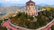
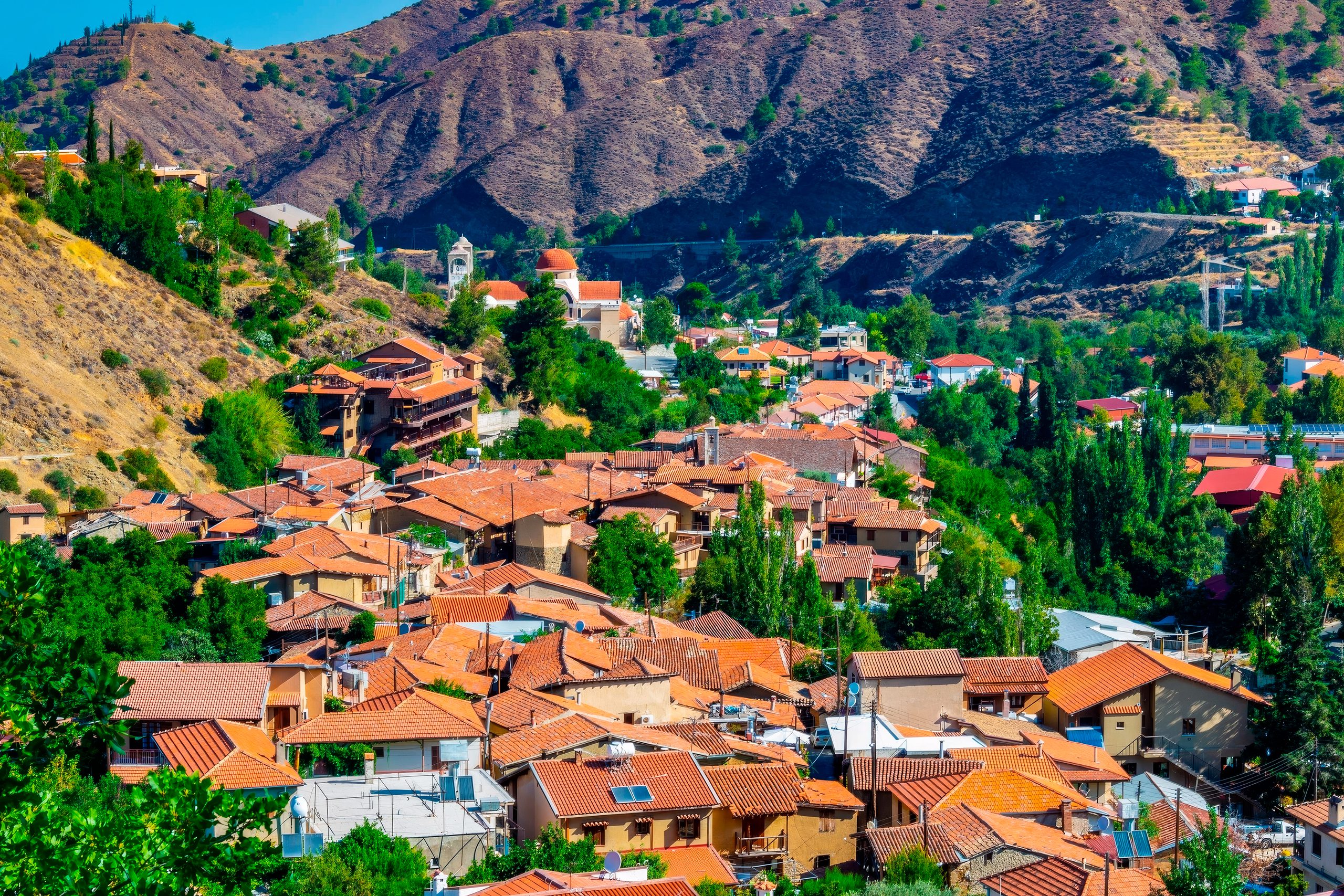
Kakopetria Gorge forms around the meeting point of two permanent mountain streams in the Troodos range. The Karkotis and Garillis rivers converge in this valley at 667 meters elevation, creating the Klarios River that flows 24.75 kilometers to Morphou Bay. The gorge sits in the heart of the Solea Valley, 55 kilometers from both Nicosia and Limassol, surrounded by dense pine forests and traditional stone villages that have preserved their character for centuries.
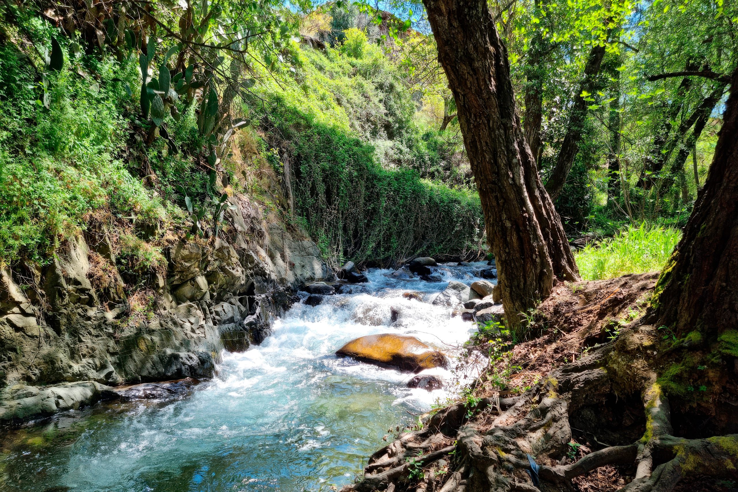
The gorge takes form along the banks of two rivers that maintain year-round flow, unusual for Cyprus where most streams run dry during summer. The Karkotis originates from the northwestern slopes of Papoutsa peak, while the Garillis flows from the northeastern slopes of Mount Troodos. Hundreds of springs feed both rivers as they descend through the mountains before joining at Kakopetria village. The continuous water flow created the Solea Valley, one of Cyprus’s most fertile mountain regions.
Artificial canals branch from the rivers, directing water to surrounding villages for irrigation and domestic use. The reliable water supply supports extensive fruit orchards, vegetable gardens, and vineyards that thrive in conditions rare elsewhere on the island. The area forms part of the Natura 2000 network of protected sites, designated code CY2000012 under European conservation directives. The designation recognizes the valley’s importance for diverse natural habitats and agricultural landscapes that depend on the river system.
The Story Behind an Unusual Name
Two explanations exist for the village name Kakopetria, which translates literally as “bad rock.” The first comes from the Greek words “kako” meaning bad and “petra” meaning stone or rock, possibly referring to the rocky, steep terrain that challenged early settlers. The second version involves a local legend about a massive boulder called “Petra tou Androgynou” or Couples’ Rock. According to tradition, newlywed couples would sit on this rock as part of wedding celebrations. The legend claims the boulder rolled over one couple, killing them, and villagers thereafter called it the bad rock.
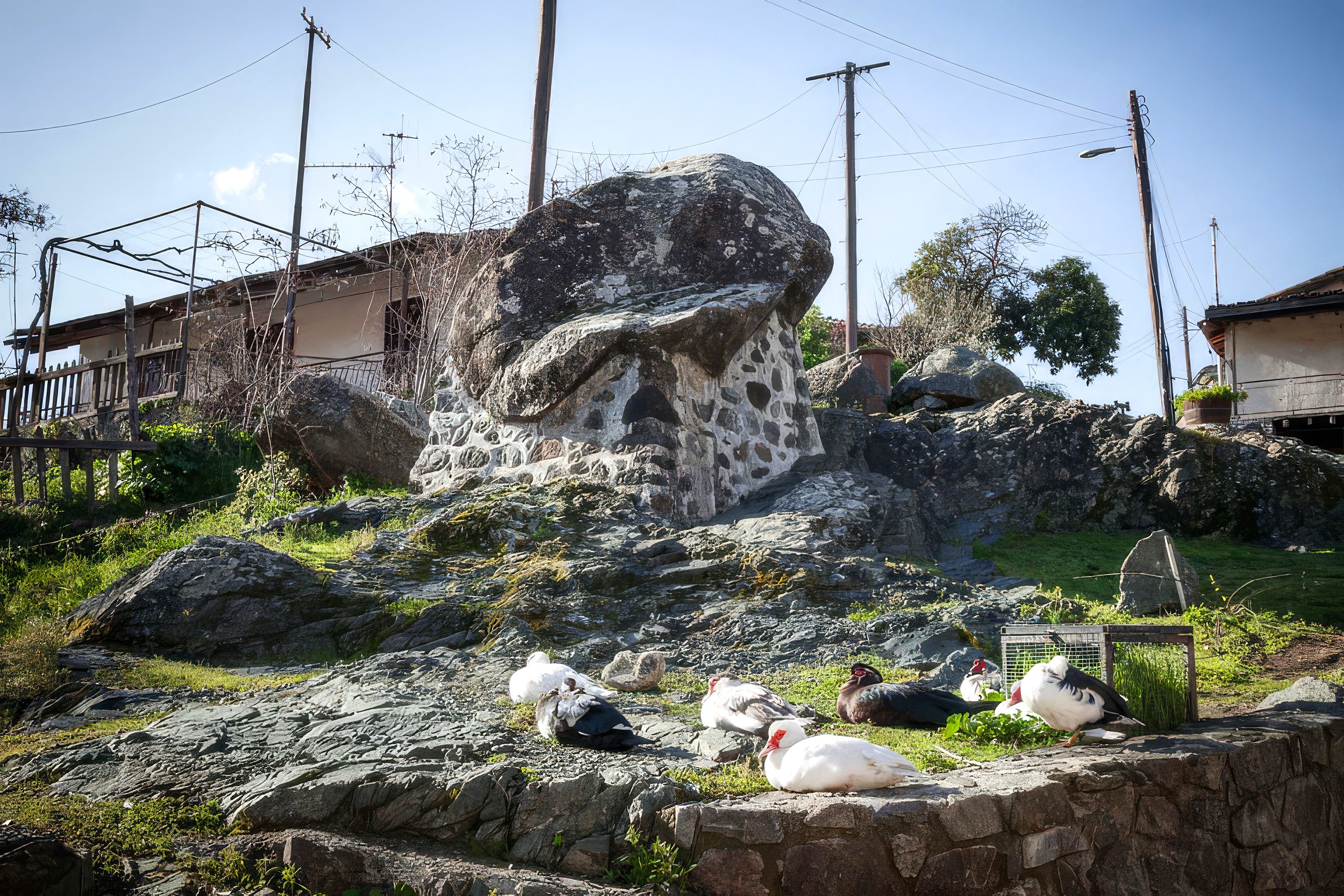
The boulder still stands near the bridge in old Kakopetria, visible to visitors who walk the riverside paths. Archaeological excavations in 1938 uncovered evidence of much earlier settlement. Researchers found a dispenser from an ancient shrine, most probably dedicated to the goddess Athena, along with numerous terra-cotta artifacts depicting both Athena and Hercules. The findings date to the Archaic and Classic eras of Cyprus, roughly the 6th to 7th centuries. These artifacts now reside in the Archaeological Museum of Nicosia. The settlement expanded significantly during the Frankish Lusignan Period from 1192 to 1489, when wealthy families discovered the area’s cool climate and built summer residences.
The Meeting Point of Rivers and Stone
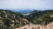
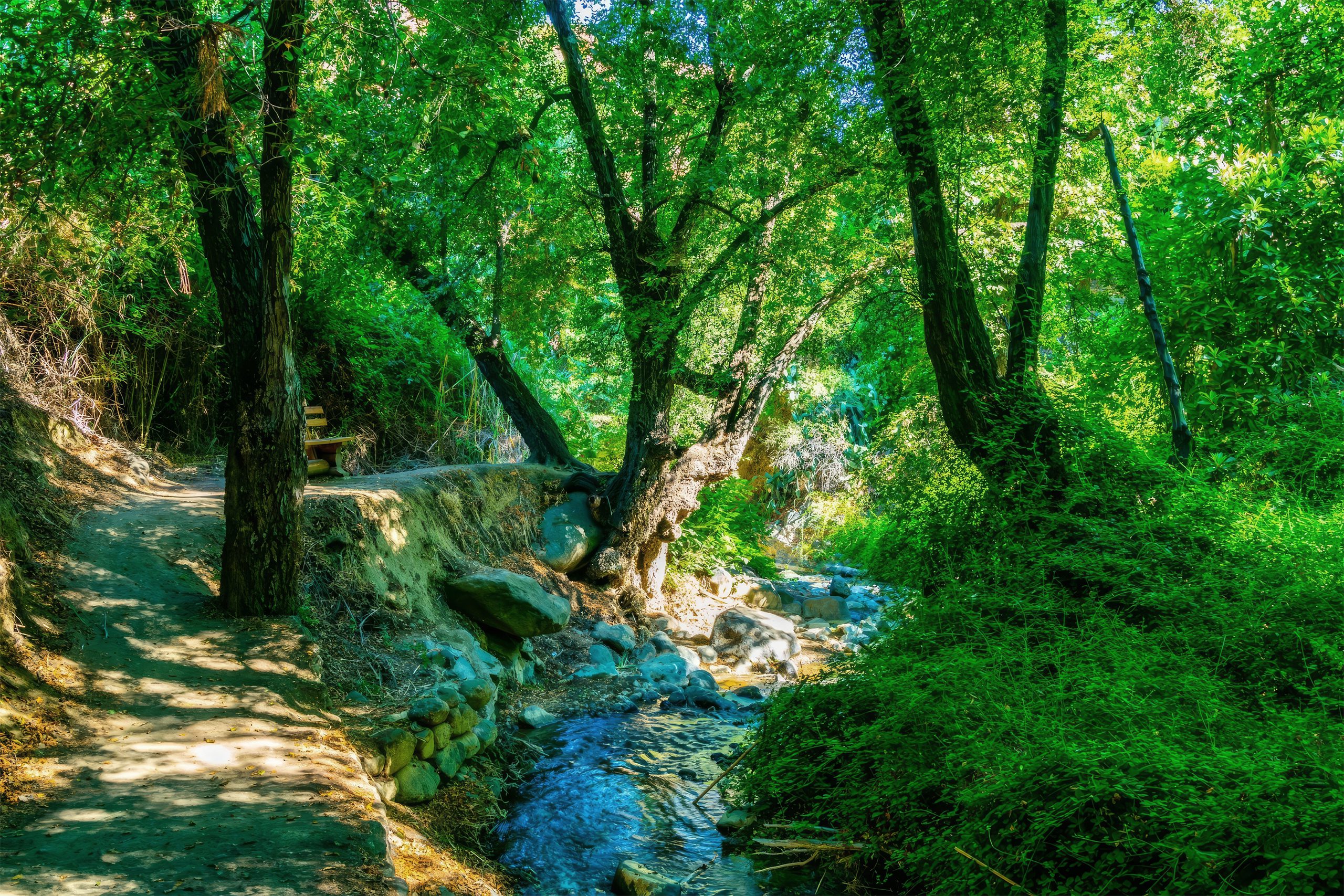
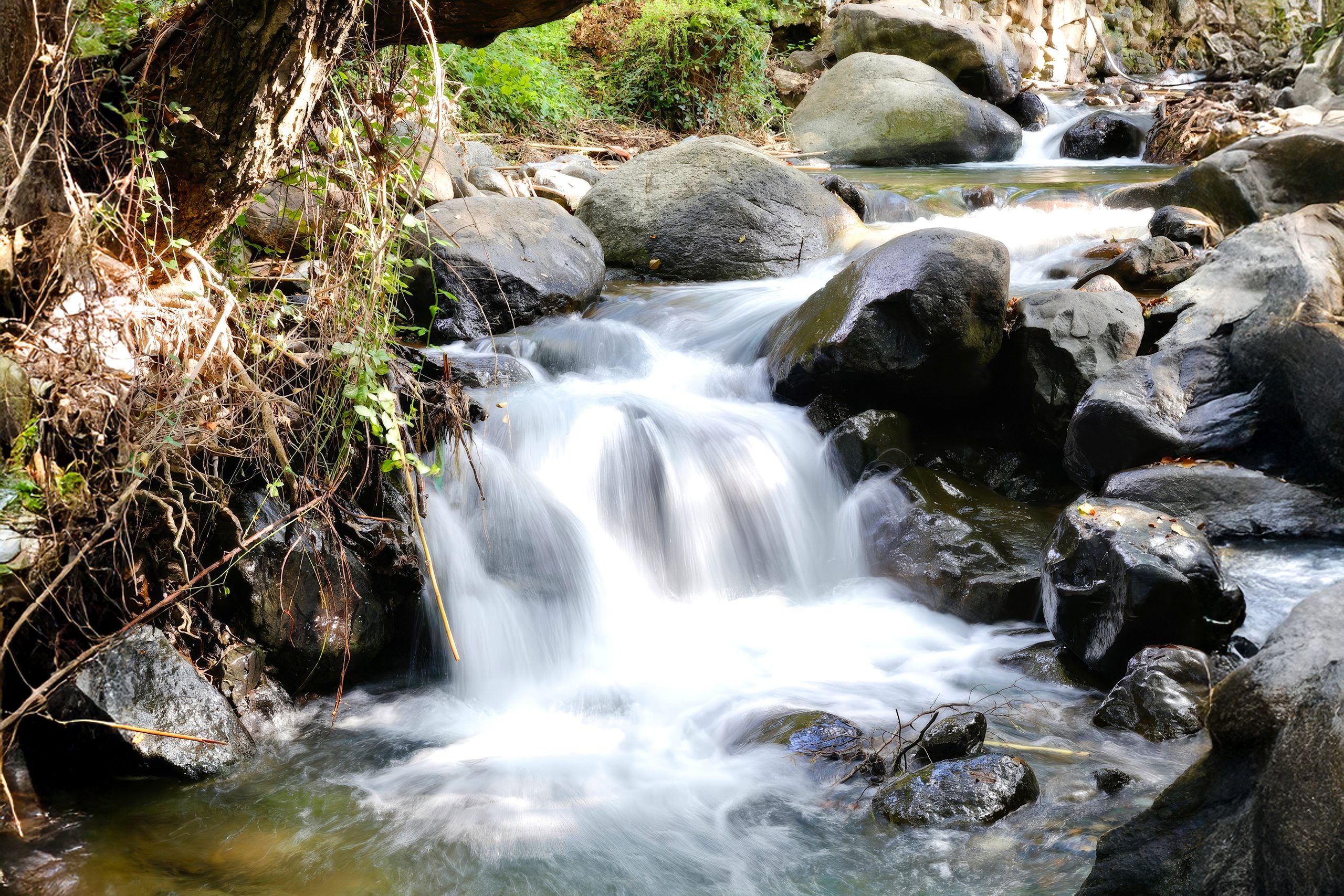
The gorge itself consists of steep-sided valleys where the two rivers carved through underlying rock over millennia. The Karkotis and Garillis create dramatic cliff faces and deep channels before their confluence point between old and new Kakopetria. Tall plane trees, pines, poplars, and alders line the riverbanks, their roots stabilizing the soil against erosion. The dense canopy creates cool, shaded passages even during summer’s peak heat. Stone bridges cross the rivers at multiple points, some dating back centuries and built with traditional methods that have withstood countless floods.
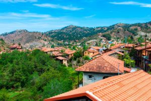
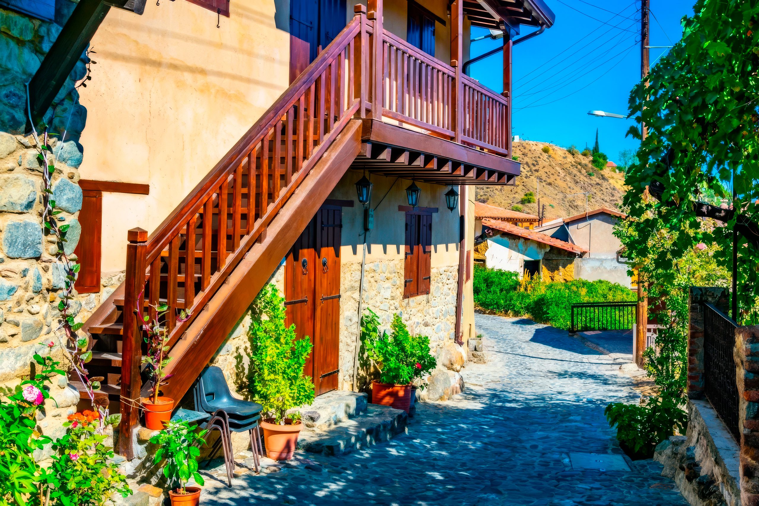
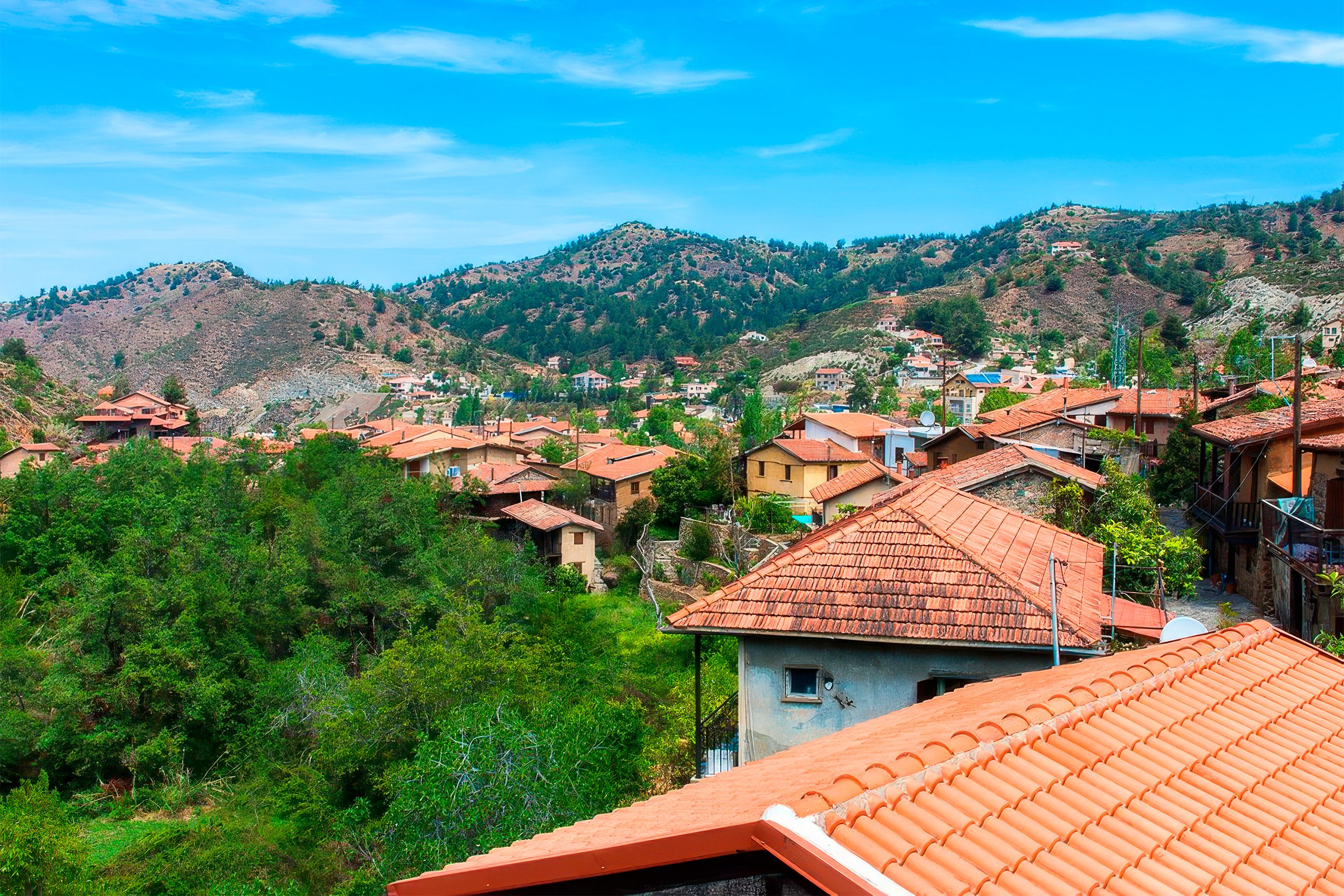
The old village occupies a narrow ridge between the two river arms, accessible by steep stone paths and stairways. This precarious position gives the settlement its distinctive character, with houses appearing to cling to the hillside. The rock formations consist mainly of igneous material from the Troodos ophiolite complex, ancient ocean floor pushed up approximately 90 million years ago. These rocks weather differently than limestone, creating unique soil conditions that support specific plant communities.
Historic Silk Industry and Wartime Production
Kakopetria operated as a major silk production center for centuries, renowned throughout Cyprus for silkworm breeding and silk processing. The industry continued until after World War II, providing employment and income for many families. During the war years, British authorities requisitioned all silk production from Kakopetria and other Cypriot villages for military use, particularly parachute manufacturing.
At the war’s start, most parachutes used Japanese silk valued for its strength and light weight. When Japan’s attack on Pearl Harbor cut off supplies in December 1941, Britain needed alternative sources. Cyprus’s silk industry became strategically important, contributing to the war effort through expanded production. The first nylon parachute was tested in June 1942, and by the war’s second half, synthetic materials largely replaced silk.
However, Cyprus continued producing silk through the conflict, supporting Allied operations in the Mediterranean theater. After the war, cheaper synthetic fabrics and changing economic conditions ended commercial silk production in Kakopetria. The village transitioned to tourism and fruit cultivation, particularly apples which became Kakopetria’s signature crop known throughout Cyprus for exceptional quality.
Wildlife Adapted to Mountain River Environments
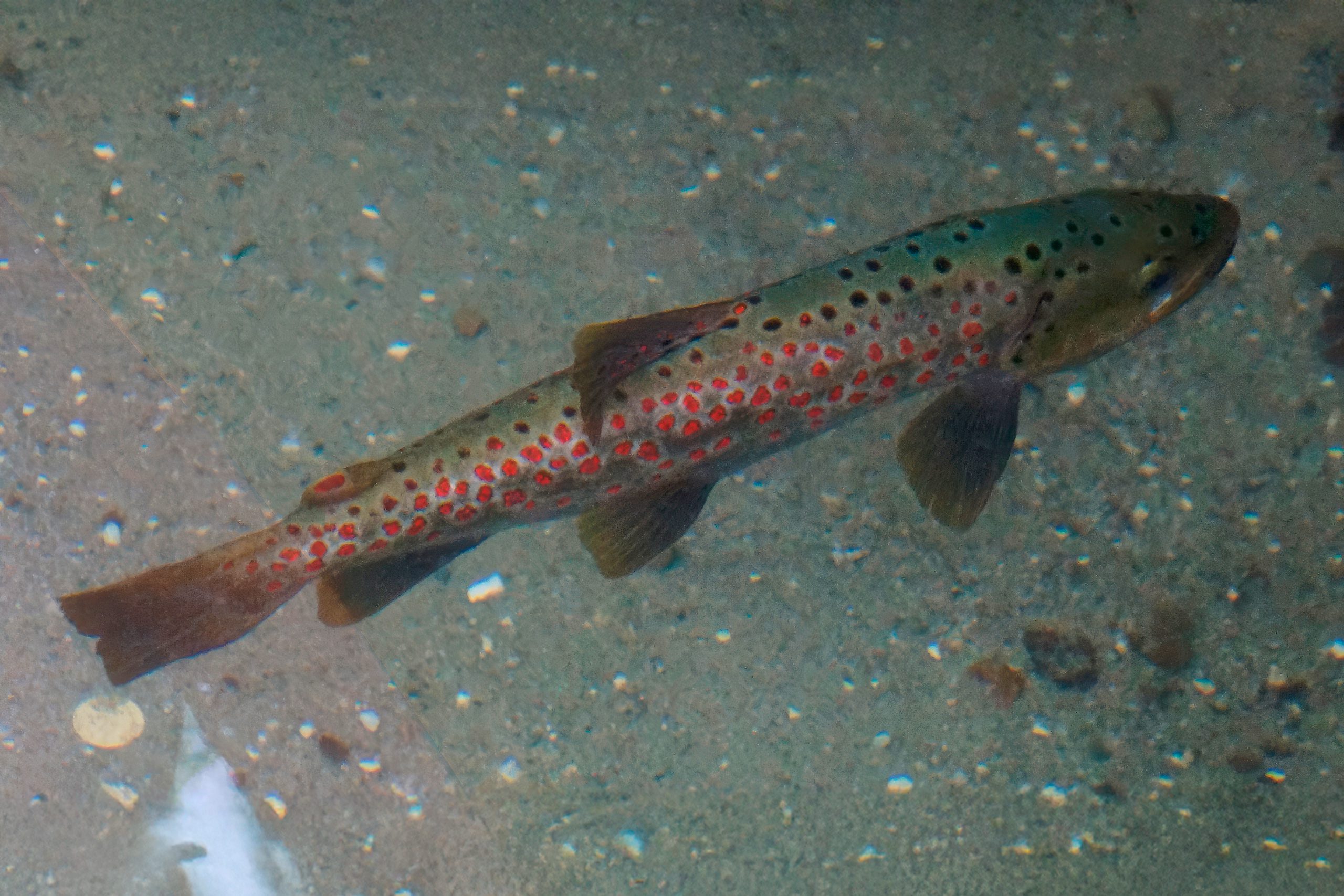
The permanent water flow supports diverse animal populations. Freshwater trout swim in the rivers, with several commercial trout farms operating along the streams. These farms supply restaurants throughout the region with fresh fish, making trout a local specialty dish. Rainbow trout were introduced for aquaculture, taking advantage of the cold, oxygen-rich water that flows year-round. Ducks inhabit the riverbanks, adding movement and sound to the landscape.
Various bird species nest in the surrounding forests, including endemic Cyprus warblers and Cyprus wheatears found only on the island. Wood pigeons, rock doves, and ravens appear commonly. The cool, moist environment supports populations of marsh frogs and tree frogs whose calls echo through the gorge during spring and summer evenings. Small mammals including foxes and hares inhabit the forested slopes. The constant moisture creates ideal conditions for insects, including several dragonfly and damselfly species that breed in slower-moving sections of the rivers.
Protected Forest Status and Conservation
The Kakopetria Forest covers most of the surrounding Troodos Mountains and holds status as a National Forest Park managed by the Department of Forests. The forest connects to the Adelphi Forest, which occupies 128.8 square kilometers and forms part of the Natura 2000 network. These protected forests bear rich flora and fauna with significant ecological, scientific, and economic value. The Solea Valley conservation area protects the river system and its dependent ecosystems.
Management priorities include maintaining water quality, preventing erosion, protecting endemic species, and balancing public access with habitat preservation. The reliable water flow makes the valley particularly vulnerable to agricultural pollution and excessive water extraction. Conservation guidelines regulate irrigation practices and monitor water levels to ensure adequate flow for both human use and ecological needs.
The forests face threats from climate change, which brings increased temperatures and reduced precipitation. These changes potentially alter moisture patterns that support current species distributions and affect water availability for both natural systems and human communities.
Why This Valley Matters Today
The Solea Valley demonstrates successful integration of natural conservation with human settlement and agriculture. The rivers support both traditional farming practices and modern tourism, providing economic benefits while maintaining ecological integrity. The area attracts researchers studying Mediterranean river ecosystems, traditional water management systems, and agricultural adaptation to mountain conditions. The valley serves as a model for sustainable development in mountainous regions.
Educational programs use the site to teach about watershed management, endemic species protection, and the historical relationship between water resources and human settlement patterns. The traditional canal system represents centuries of accumulated knowledge about efficient water distribution and community cooperation in resource management.
For modern Cyprus, the valley highlights the importance of protecting mountain water sources as the island faces increasing water scarcity. Climate projections suggest decreased precipitation and higher temperatures, making permanent streams like the Karkotis and Garillis increasingly valuable for both ecological and economic reasons.
A Testament to Water’s Shaping Power
The Kakopetria Gorge represents the fundamental role of permanent water sources in shaping both natural landscapes and human settlement patterns. The meeting of the Karkotis and Garillis rivers created conditions that sustained communities for millennia, from ancient shrine builders to medieval settlers to modern residents and visitors. The combination of reliable water flow, fertile soil, cool climate, and dramatic topography makes the valley unique in Cyprus.
The traditional water management systems demonstrate sophisticated understanding of hydraulic principles and community cooperation essential for survival in mountain environments. As Cyprus confronts climate change and water scarcity, the Solea Valley provides lessons in sustainable resource use and the critical importance of protecting mountain watersheds. The ancient forests, endemic species, and year-round streams connect modern visitors to ecological processes that have sustained life in these mountains for millions of years.