When summer temperatures on coastal Cyprus climb past 40 degrees Celsius, the mountain valleys offer something different. These elevated landscapes carved into the Troodos Mountains maintain temperatures 10 to 15 degrees cooler than the scorching lowlands. The valleys provide more than comfortable weather. They create microclimates where fruit trees thrive, rivers flow year-round, and villages preserve centuries of mountain culture.
Temperature drops about 5 degrees Celsius for every 1,000 meters of elevation gained. In July and August, when lowland areas reach 34 to 40 degrees, the mountain valleys average 28 degrees at their highest points. Night temperatures fall to comfortable levels, often 10 degrees cooler than daytime peaks. This temperature difference transforms the valleys into natural air conditioning systems for an island known for intense summer heat.
- Cedar Valley and the Paphos Forest Sanctuary
- The Solea Valley and Its Year-Round Water
- Marathasa Valley and the Cherry Harvest
- How Mountain Valleys Create Their Own Climate
- Traditional Villages Built for Mountain Living
- Summer Tourism in the Mountain Valleys
- Agricultural Traditions in Valley Microclimates
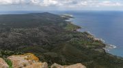
Cedar Valley and the Paphos Forest Sanctuary
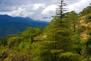
Cedar Valley sits at the intersection of three districts, nestled within the 70,000-hectare Paphos Forest at elevations above 1,000 meters. The valley takes its name from 130,000 Cyprus cedars that grow nowhere else on Earth. Cedrus brevifolia represents an endemic subspecies closely related to the famous cedars of Lebanon. These trees, with their upright trunks and broad foliage, can reach 40 meters in height.
The cedar forest shares space with Calabrian pines, which thrive in the Mediterranean climate and can grow to similar heights over 100 to 110 years. The area holds protected status as a Natura 2000 site, recognizing its ecological importance. Within the forest boundaries live 36 species of flora and fauna, including the endangered mouflon, a species of wild sheep found exclusively on Cyprus.
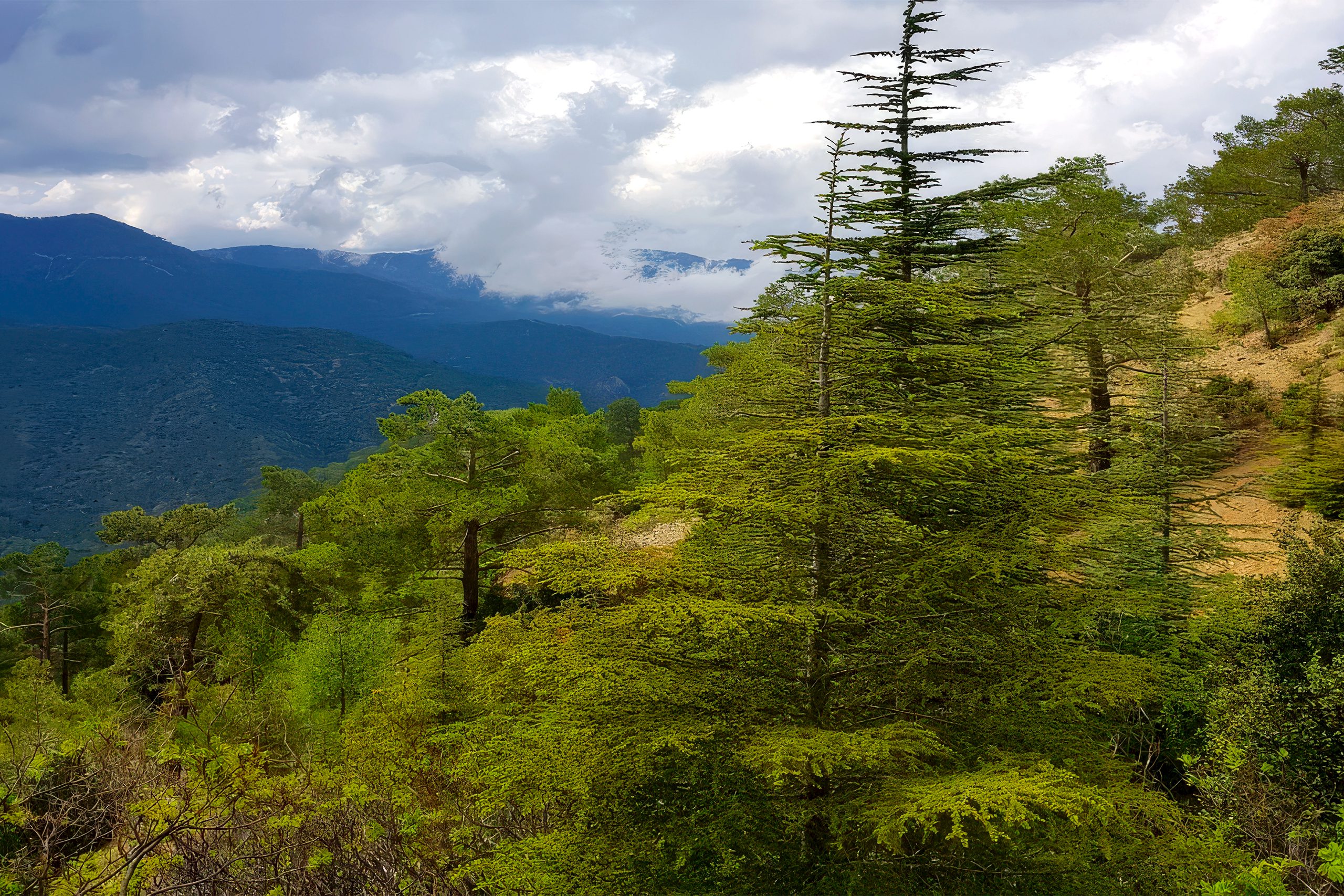
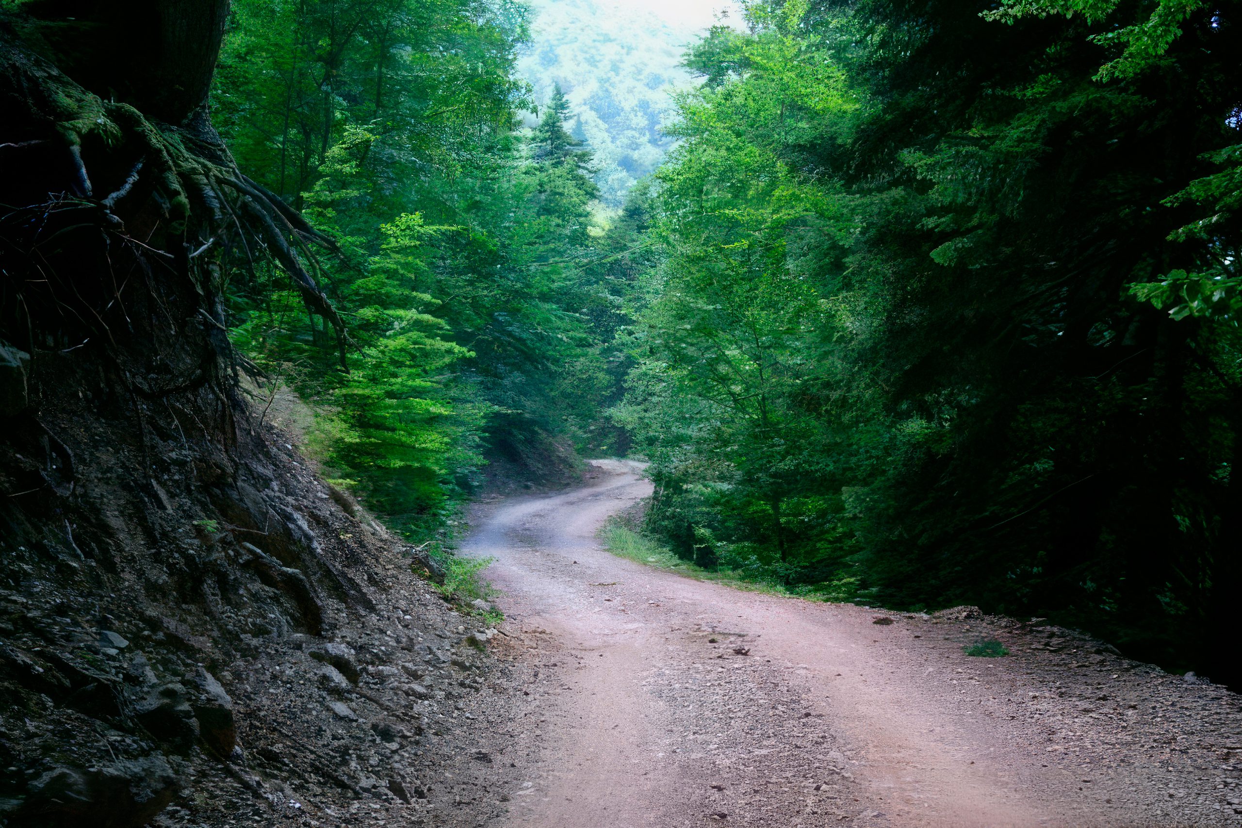
Access to Cedar Valley requires commitment. The picnic area marks only the starting point. To experience the actual cedar forest, visitors hike a 2.5-kilometer trail that climbs to the third-tallest peak in Cyprus. The path follows a narrow stream, crosses it, and ascends steadily along the mountainside where the cedars dominate the landscape. The remoteness preserves the tranquility that draws visitors seeking peaceful seclusion.
The Solea Valley and Its Year-Round Water
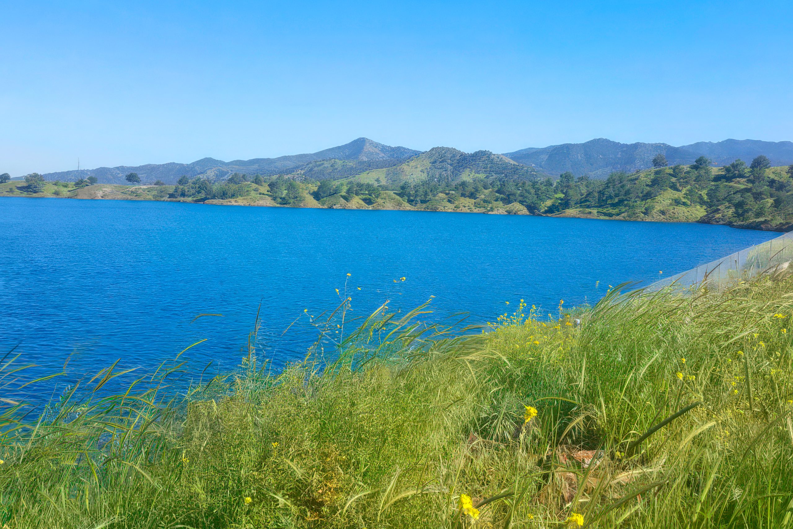
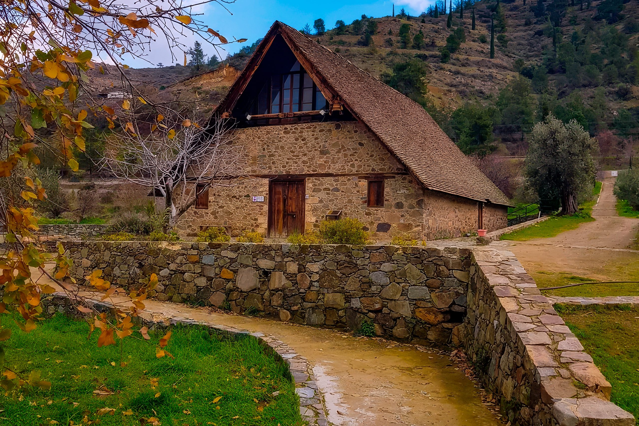
The Solea Valley runs along the northern slopes of Troodos, carved by the Karkotis River over millennia. This 28-kilometer waterway represents one of only two Cyprus rivers with substantial summer flow. The geological explanation lies beneath the surface. While most of Troodos consists of diabase rock that holds water only in fissures, the mountain peak contains gabbro, a permeable rock that acts as a natural aquifer. During dry summer months, this underground reservoir slowly releases water, maintaining river flow when other streams run dry.
This reliable water supply has sustained valley agriculture since at least 3000 BCE. Villages sprang up along the riverbanks, taking advantage of irrigation possibilities that allowed year-round cultivation. The valley floor between elevations of 440 and 667 meters receives high annual rainfall compared to coastal areas, with villages like Kakopetria recording 648 millimeters per year.
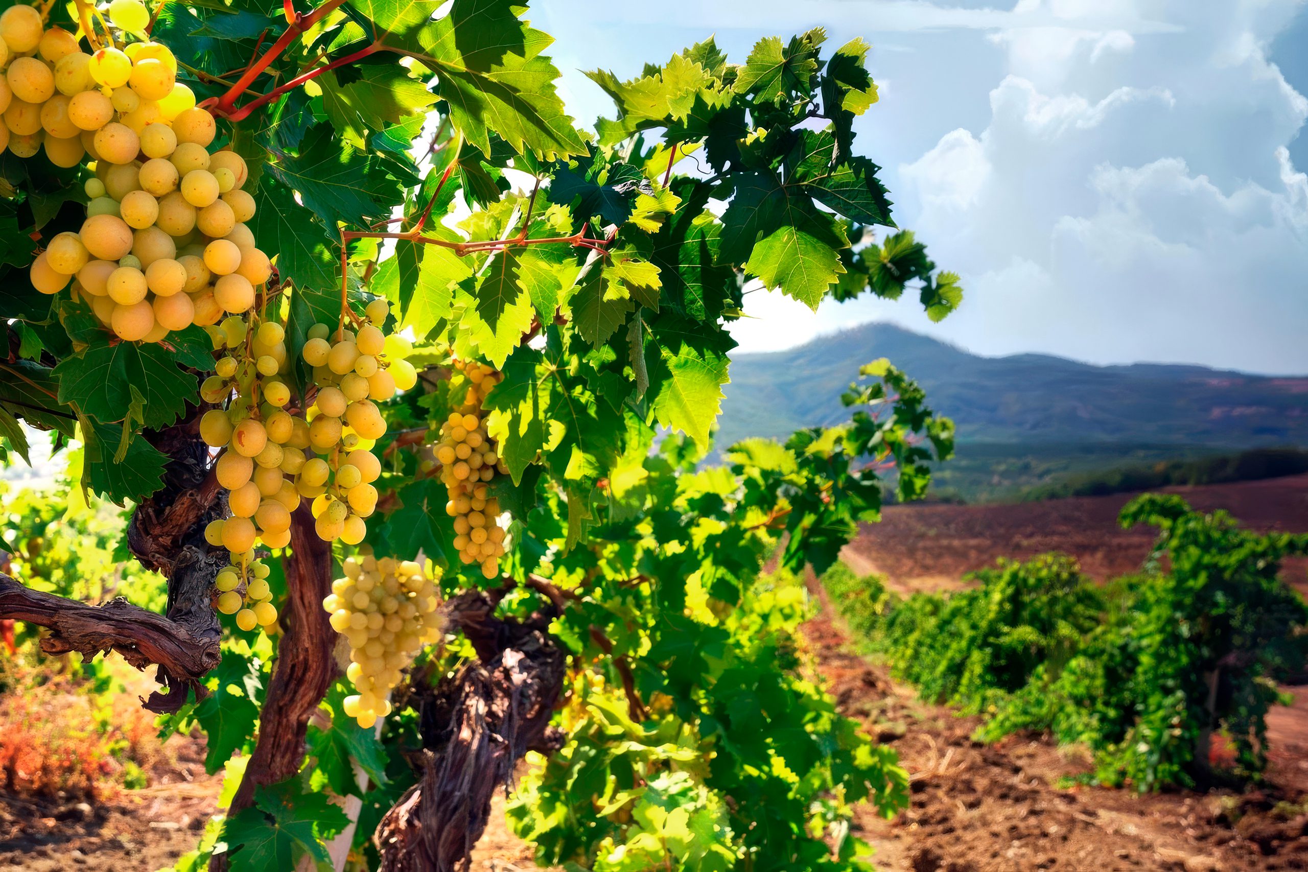
The combination of water availability and moderate temperatures creates ideal conditions for fruit production. Apple, pear, plum, apricot, and peach trees flourish in the valley. Villages like Evrychou built their economies around fruit cultivation, particularly apples of exceptional quality. The Karkotis River provides not just irrigation but also scenic beauty, with watermills, traditional stone bridges, and cobblestone paths preserved along its banks.
Marathasa Valley and the Cherry Harvest
The Marathasa Valley climbs even higher into the mountains than Solea, with villages perched at elevations between 1,100 and 1,370 meters. Pedoulas, at 1,100 meters, represents the loftiest village in this valley and once served as the cultural and commercial center for 14 surrounding communities. The cool climate at these elevations supports fruit trees that require conditions impossible to replicate in lowland Cyprus.
Cherry cultivation defines the Marathasa economy and culture. The delicate fruits bloom in late spring and ripen from late May through June. Two varieties grow here: the larger purple-black petrokeraza and the smaller pinkish-white cherry. Villages celebrate the brief harvest season with cherry festivals that draw visitors from across the island. Pedoulas hosts the major two-day festival each June, featuring traditional products, local wines, honey, and entertainment.
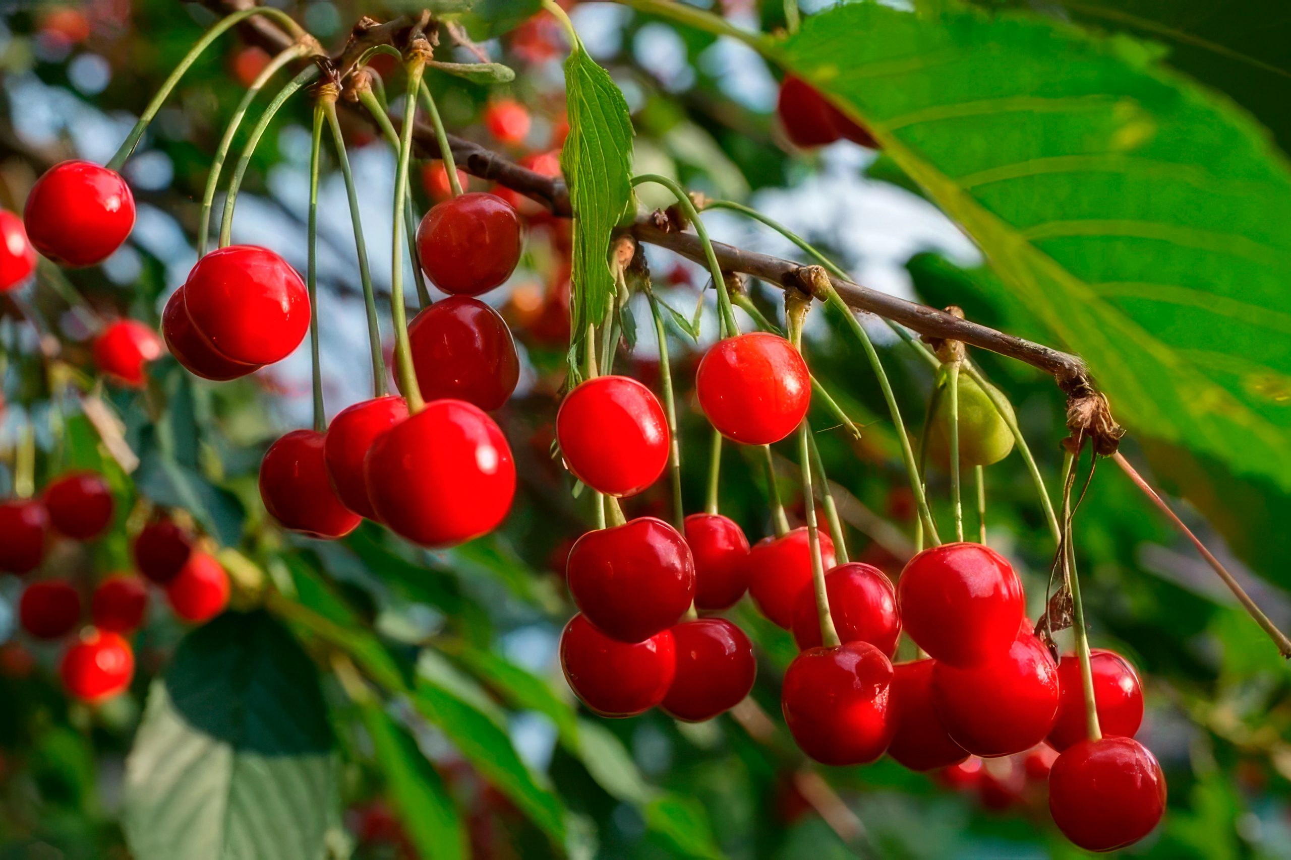
The valley also produces apples, pears, and other fruits that benefit from the cool microclimate. Winter temperatures at Prodromos, the highest village in Cyprus at 1,370 meters, average around negative 8 degrees Celsius in January, climbing to only 22 degrees in July. These temperature ranges allow cultivation of deciduous fruit trees that need cold winters to produce properly.
How Mountain Valleys Create Their Own Climate
The valleys function as natural climate moderators through several mechanisms. Elevation provides the primary cooling effect, but valley shape and vegetation contribute significantly. Dense forest cover, particularly the extensive pine and oak woodlands, moderates temperature extremes through shade and transpiration. Trees release water vapor that cools the surrounding air.
The mountain topography creates air circulation patterns that bring fresh breezes through the valleys. Cool air settles in valley bottoms overnight, while warm air rises during the day. This circulation prevents the stagnant heat that builds up in lowland basins. Rivers and streams add moisture to the air, increasing humidity and providing natural evaporative cooling.
Precipitation patterns differ markedly from coastal zones. The Troodos Mountains receive significantly more rainfall, with higher elevations getting double or triple the annual precipitation of Nicosia or Limassol. This rainfall supports lush vegetation that reinforces the cooling effect through a self-sustaining cycle. More plants mean more shade and transpiration, which maintains the microclimate that allows those plants to thrive.
Traditional Villages Built for Mountain Living
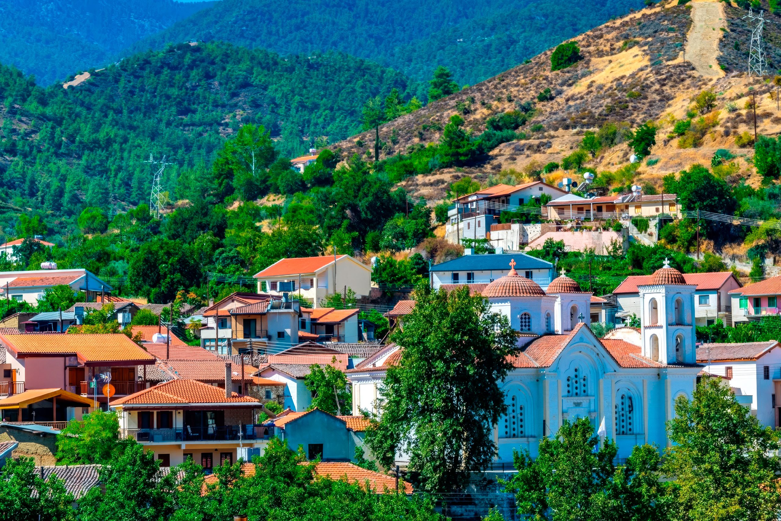
Valley villages developed architectural styles suited to mountain conditions. Stone construction dominates, using local materials that provide thermal mass to moderate indoor temperatures. Houses feature thick walls that stay cool in summer and retain heat in winter. Many structures include two stories, with ground floors staying naturally cool even on hot days.
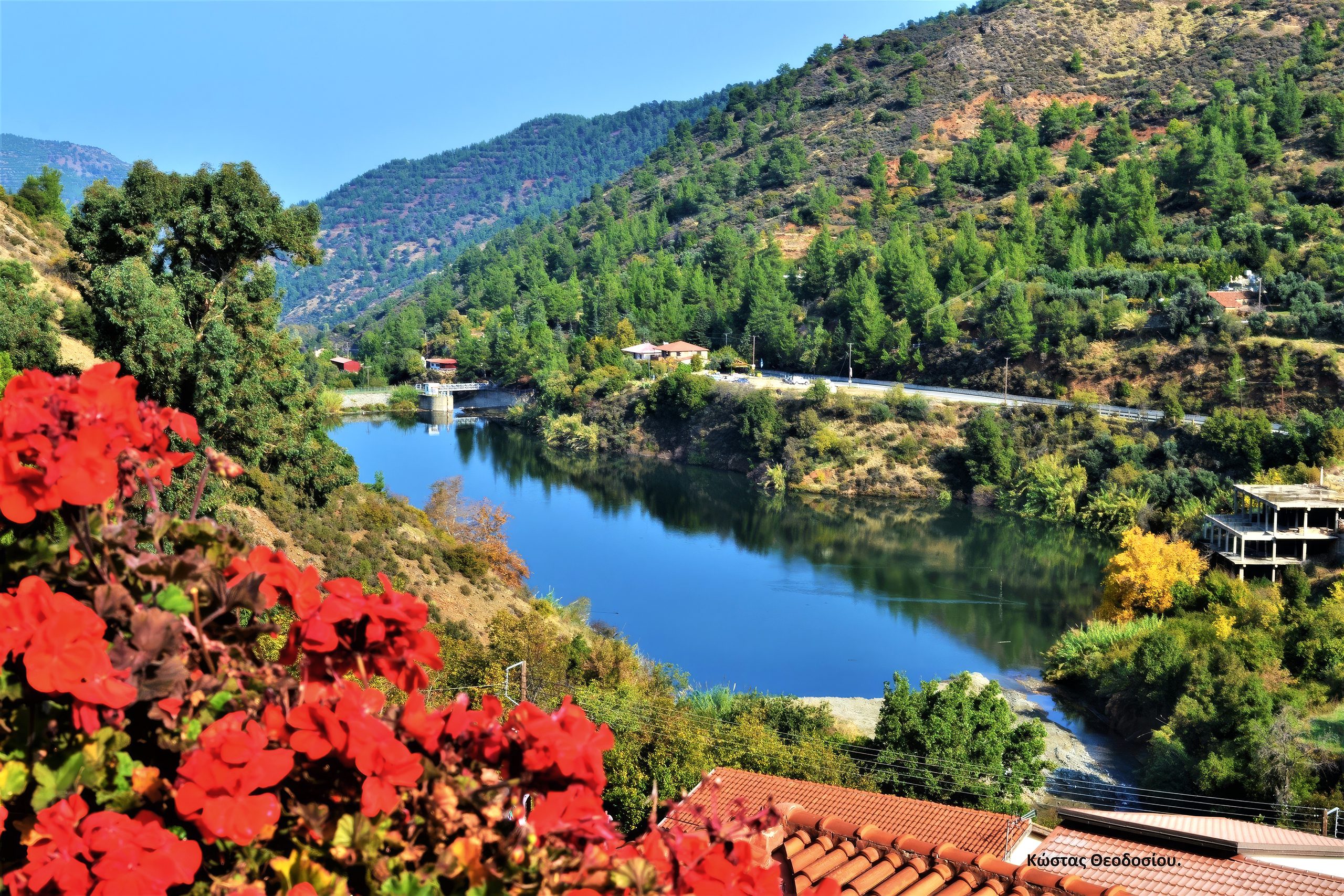
Kakopetria preserves one of the finest examples of traditional mountain architecture. The old quarter features stone houses with wooden balconies, built close together along narrow cobblestone alleys. Roofs nearly touch, creating covered passages that provide shade while allowing air circulation. This dense construction pattern dates to Byzantine times and served multiple purposes beyond cooling, including defense and efficient land use on steep slopes.
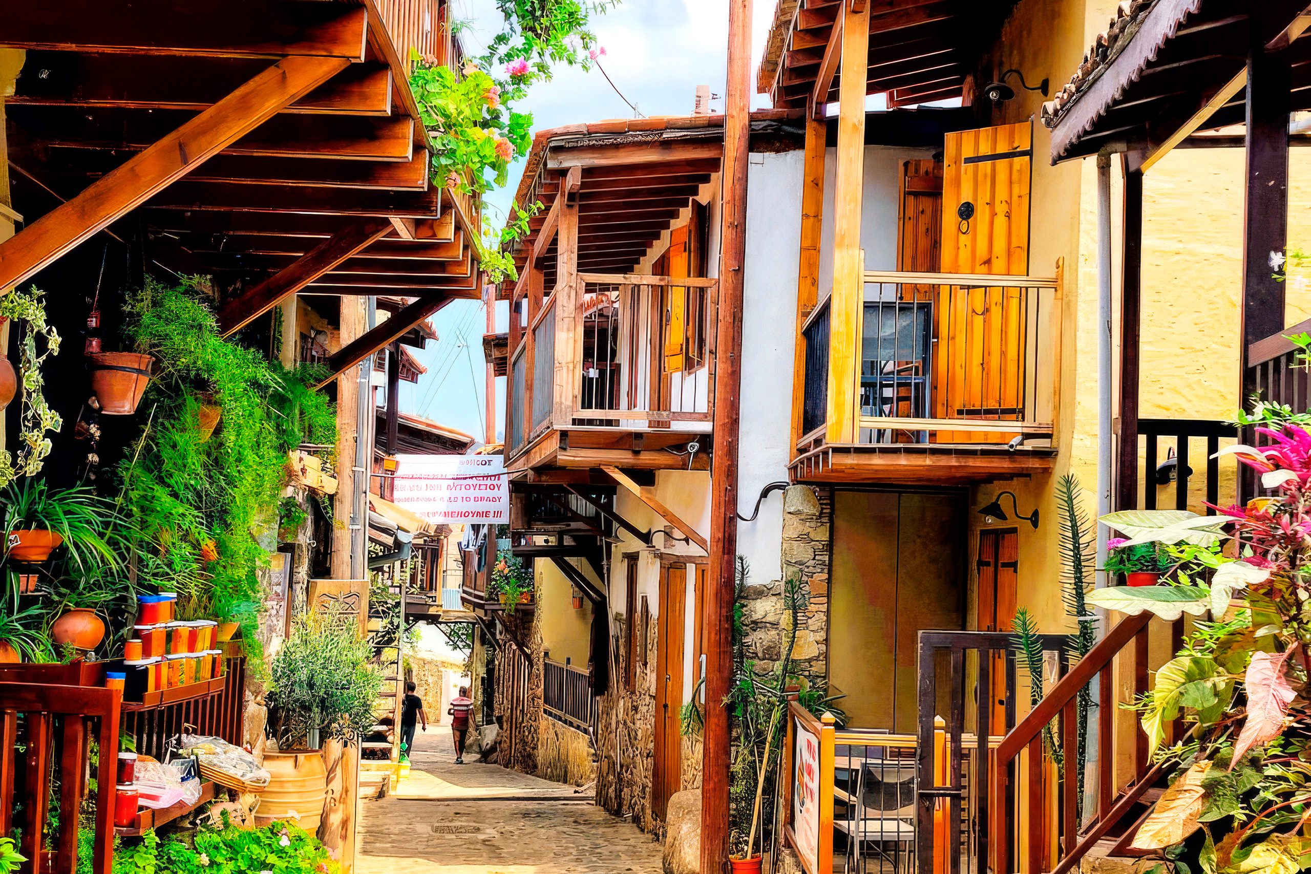
Villages positioned themselves strategically along water sources. The Karkotis River flows through Kakopetria, while Galata sits where this river joins tributaries. Artificial canals branched from rivers to distribute water throughout settlements, providing drinking water, irrigation, and power for watermills. Some of these traditional water distribution systems still function after centuries of use.
Summer Tourism in the Mountain Valleys
The valleys have attracted summer visitors for over a century. Wealthy families from Nicosia and Limassol began arriving by wagon in 1918 to escape lowland heat. Kakopetria opened its first hotel in 1910. This tradition continues today, though now visitors arrive by car along paved mountain roads rather than wagons on dirt tracks.
Modern mountain resorts offer hotels, restaurants, and cafes while preserving traditional character. Galata and Kakopetria maintain their rustic appeal despite tourist infrastructure. Visitors walk nature trails through pine forests, explore Byzantine churches decorated with medieval frescoes, and dine in tavernas shaded by plane trees. The sound of running water provides constant background music in villages built along rivers.
The appeal extends beyond temperature relief. Valley villages offer cultural experiences distinct from beach resorts. UNESCO World Heritage churches dot the landscape, containing frescoes from the 12th to 16th centuries. Watermill museums demonstrate traditional grain processing methods. Folkloric exhibitions preserve rural customs and crafts. Cherry festivals, wine tastings, and traditional food experiences connect visitors to agricultural traditions.
Agricultural Traditions in Valley Microclimates
Valley agriculture differs fundamentally from lowland farming. Cool temperatures and reliable water allow cultivation of crops impossible elsewhere on the island. Cherry orchards require cold winters and moderate summers. Apple varieties grown in Kakopetria need specific temperature ranges during fruit development. These crops made the mountain valleys economically viable despite the challenges of steep terrain and isolation.
Terraced agriculture maximizes usable land on valley slopes. Stone terrace walls transform steep hillsides into level plots suitable for orchards and vineyards. These terraces also manage water flow, preventing erosion while directing irrigation to crops. Many terrace systems date back centuries, maintained through generations of continuous use.
Modern valley agriculture faces challenges as younger residents move to cities. Some orchards fall into disuse, though others transition to niche markets. High-quality mountain fruits command premium prices. Organic production appeals to consumers seeking products from pristine environments. Wine production from high-elevation vineyards creates distinctive products marketed to tourists and specialty buyers.
The mountain valleys of Cyprus offer quantifiable relief from summer heat while preserving ecosystems and cultures shaped by their unique climates. Temperature reductions of 10 to 15 degrees transform the experience of summer on an island where coastal areas regularly exceed 40 degrees. The valleys combine this cooling effect with year-round water supplies, fertile soils, and centuries of accumulated knowledge about mountain agriculture. As climate pressures intensify across the Mediterranean, these valleys demonstrate how topography creates microclimates that sustain both human communities and natural ecosystems. The cedar forests, cherry orchards, and river valleys represent more than scenic destinations. They function as living laboratories showing how elevation, water, and vegetation interact to create habitable zones in otherwise challenging environments.