The Akrotiri Peninsula in the Limassol District marks the southernmost tip of Cyprus and also the southernmost part of Europe. This 123 square kilometer area contains the largest complex of natural wetlands on the island, centered around Akrotiri Salt Lake.
\n\n\n\n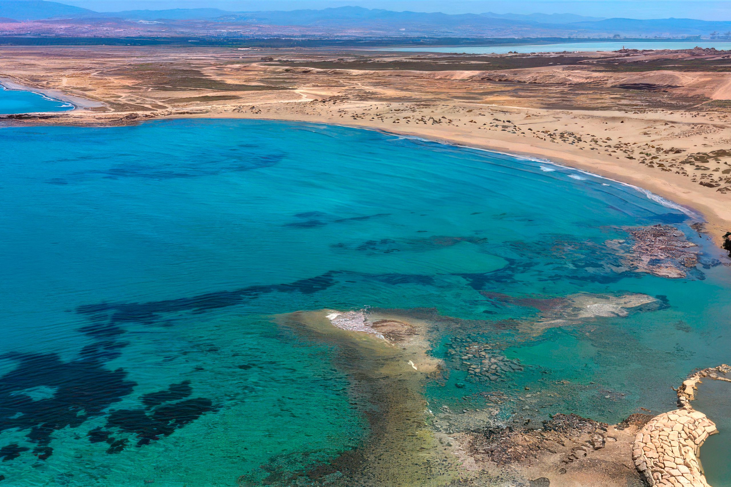
The peninsula hosts over 300 recorded bird species, more than 800 indigenous plant species representing roughly 40 percent of all plants found on Cyprus, and critical habitats ranging from coastal sand dunes to Mediterranean juniper forests. Most of the peninsula lies within the British Sovereign Base Area of Akrotiri, territory retained by the United Kingdom when Cyprus gained independence in 1960.
\n\n\nFrom Ancient Island to Protected Reserve
\n\n\n\nThe Akrotiri Peninsula was once a small island that merged with the rest of Cyprus through processes spanning thousands of years, creating what geologists call a double tombolo. The Kouris River carried sediment to create a land bridge on the western side at least 56,000 years ago, while the Garilis River later formed a second connection on the eastern side. This gradual process trapped seawater between the two land bridges, forming Akrotiri Salt Lake.
\n\n\n\nThe south cliffs of the peninsula, known as Aetokremmos, host the earliest known archaeological site in Cyprus and are believed to be the first part of the island inhabited by people during the pre-Neolithic period.
\n\n\n\nThe site contains 12,000-year-old fossilized bones of pygmy hippos and pygmy elephants that were probably driven to extinction by early human hunters. Throughout subsequent centuries, the area maintained continuous importance. Greek, Roman, and Byzantine records describe the salt lake as a valuable resource for salt extraction and fishing. During the Frankish period, nobles captured hunting hawks from the area for sport. Venetians later supplied the Ottoman sultan with these same hawks while studying the peninsula for potential fortress construction.
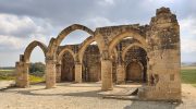
\n\n\n\nThe Monastery of Agios Nicolaos of Cats, situated on Cape Gata southeast of Akrotiri Salt Lake, dates to the late 4th century, making it perhaps one of Cyprus’s first Byzantine monasteries. Legend holds that Constantine the Great sent cats to the area to clear a snake infestation during a severe drought. The wetlands to the north of the salt lake were drained before 1950 to control mosquitoes and reclaim land for agriculture, though significant marsh areas survived.
\n\n\n\nDiverse Habitats Across a Small Area
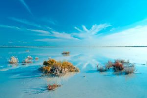
\n\n\n\nThe peninsula contains a remarkable variety of ecosystems within its compact geography. Akrotiri Salt Lake occupies the center, measuring three times larger than Larnaca Salt Lake and ranking as the largest lake in Cyprus.
\n\n\n\nThe lake shifts dramatically between seasons. Winter rains fill it with brackish water that creates a vast shimmering mirror reflecting the sky. As spring progresses, evaporation concentrates the salt content. By summer, the lake dries completely, leaving white salt flats that sparkle under intense sunlight.
\n\n\n\n
Surrounding the main lake, Zakaki Marsh and Akrotiri Marsh provide freshwater reed beds and grazing marshes. The gravel pits area, known locally as merras, contains dry terrain that floods seasonally. Bishop’s Pool adds another small wetland component. These varied water bodies support different ecological niches.
\n\n\n\nCoastal areas feature sand dunes, salt meadows, and the five-kilometer Lady’s Mile Beach. Episkopi Cliffs rise on the western edge, their white limestone faces reaching approximately 150 meters height and providing nesting sites for raptors and vultures.
\n\n\n\n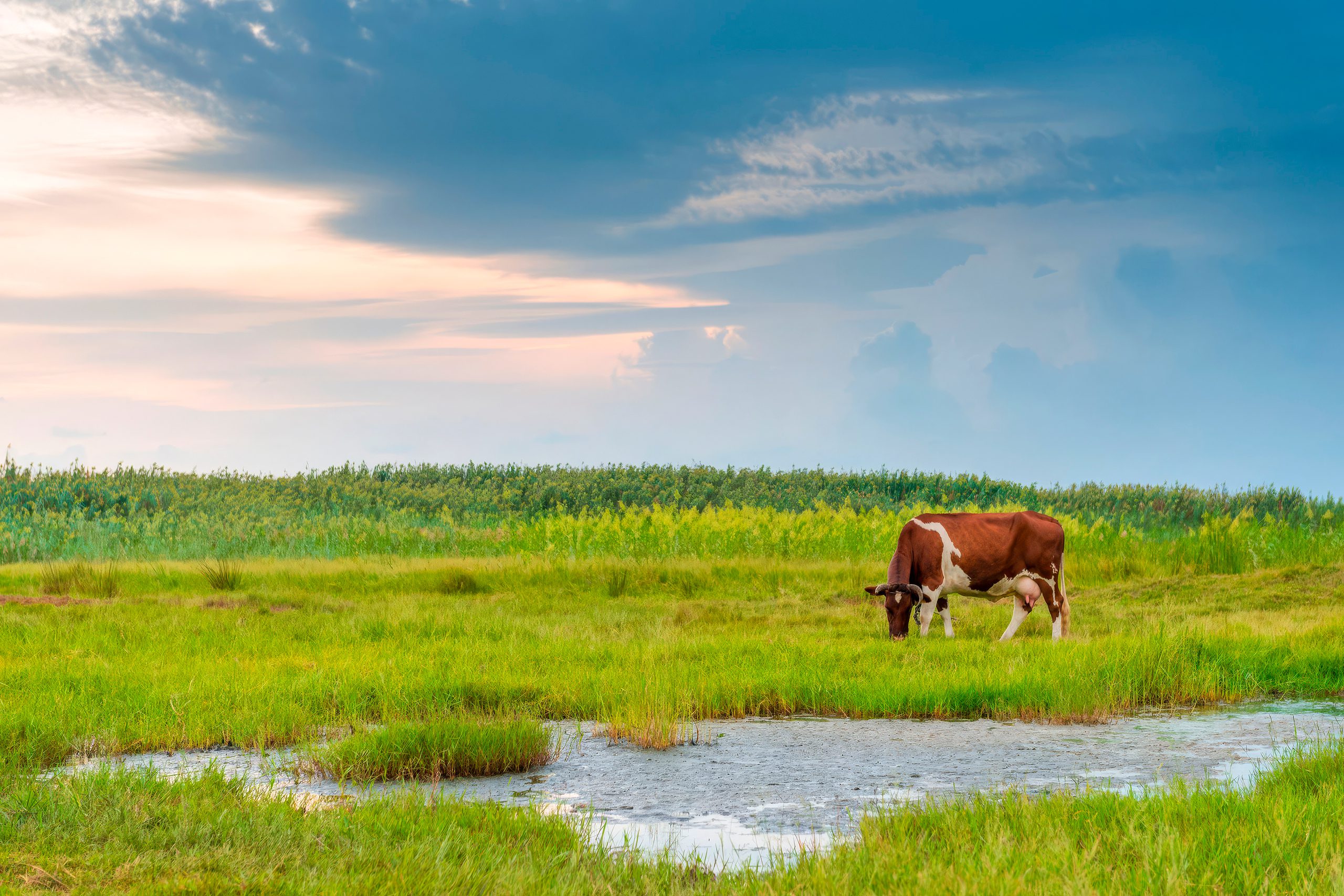
Mediterranean maquis scrubland covers much of the peninsula’s interior, interspersed with juniper forests and agricultural land. The mosaic of habitats creates conditions suitable for extreme biodiversity despite the relatively small area. Cyprus signed the Ramsar Convention, and the wetlands received designation as a Ramsar Wetland of International Importance in 2003. British Bases legislation designated the area as equivalent to Special Protection Area status in 2010 and Special Area of Conservation status in 2015.
\n\n\n\nFive Critical Facts About the Peninsula
\n\n\n\nOver 300 bird species have been recorded at Akrotiri Peninsula, making it arguably the most important bird area in Cyprus. Up to 20,000 birds may gather at Akrotiri Salt Lake at any one time, with globally important numbers of Greater Flamingos and Eurasian Curlews. Flamingos usually arrive around November and stay until March, with peak season gatherings creating pink flocks across the shimmering lake alongside an additional 250 bird species. The area serves as the best location in the western palearctic to observe Demoiselle Cranes during migration, when roughly half the African population stops here to rest between mid-August and early September.
\n\n\n\nThe Ferruginous Duck, a globally threatened species, has nested at the lake since 2005. Other breeding species include Black-winged Stilt, Kentish Plover, Spur-winged Lapwing, Stone Curlew, Black Francolin, Cyprus Wheatear, and Cyprus Warbler. Episkopi Cliffs support the most important Griffon Vulture breeding colony on the island, along with nesting pairs of Eleonora’s Falcon and Peregrine Falcon. Autumn brings over 3,000 migrating raptors including Egyptian Vulture, Pallid Harrier, Saker Falcon, and Red-footed Falcon.
\n\n\n\n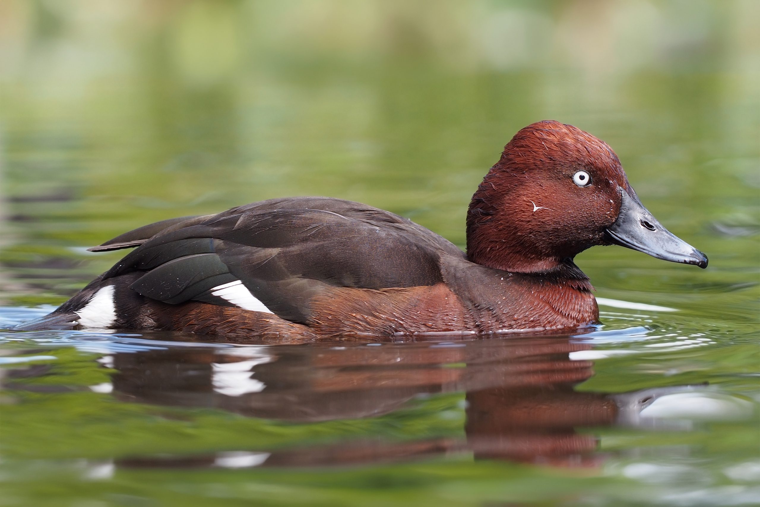
The peninsula serves as a bottleneck on one of eight major bird migration routes connecting Europe, Asia, and Africa. Birds familiar to watchers across continental Europe depend on this staging area to rest and refuel during their journeys.
\n\n\n\nThe surrounding seas contain Posidonia oceanica seagrass meadows, major food sources for marine turtles. Both Loggerhead and Green Turtles nest on peninsula beaches during summer months. Sea caves provide breeding refuges for the critically endangered Mediterranean Monk Seal.
\n\n\n\n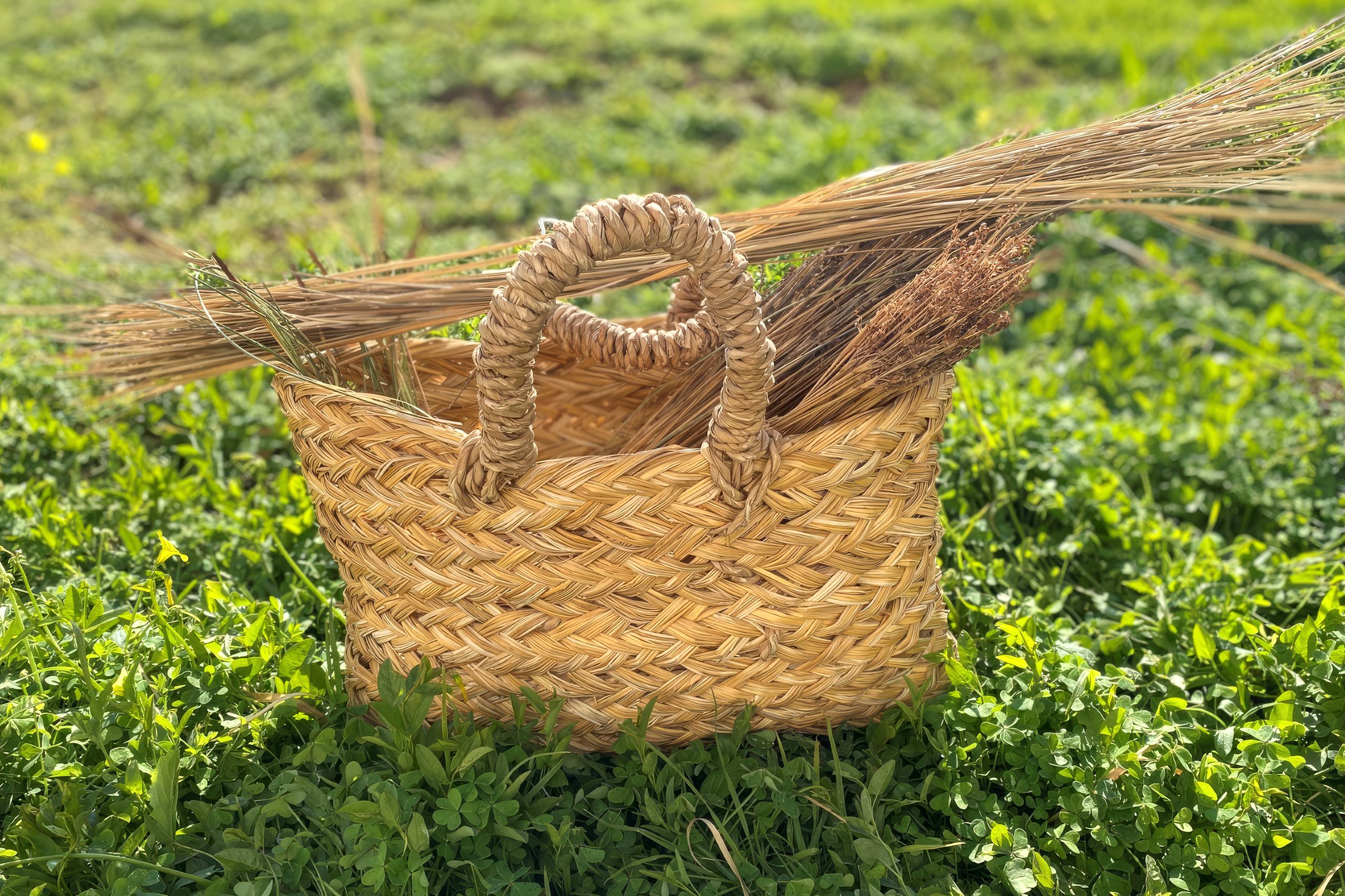
Traditional basketry remains practiced in Akrotiri village, one of Cyprus’s oldest handicraft traditions. Raw materials for basket making came mainly from plants found in wetlands, and the constant need for this material contributed to wetland conservation. A unique black flamingo, probably the only completely black individual in the world with just a small tuft of white feathers near its rump, appeared at the salt lake multiple times after first being spotted in Israel in 2014.
\n\n\n\nCurrent Conservation Status and Challenges
\n\n\n\nThe Akrotiri Peninsula Environmental Management Plan, published in September 2012, provides a framework for the protection and sustainable use of the area’s natural resources. BirdLife Cyprus maintains regular monitoring programs, with monthly surveys tracking population changes and habitat conditions. The Darwin Plus 141 Project ran from 2021 to 2024, focusing on habitat restoration and promotion of wildlife-friendly tourism. The Akrotiri Environmental Education Centre operates year-round, offering programs that explain the area’s ecological importance.
\n\n\n\nDespite protective designations, the peninsula faces mounting pressures. Surrounding development, including golf courses, villa complexes, casino resorts, and photovoltaic parks, encircles the wetlands. Changes in water inputs from the Kouris Dam affect natural flooding patterns and water quality. The biological cycles that support brine shrimp populations, which feed flamingos and give them their pink coloration, depend on precise seasonal drying patterns. Disrupted hydrology threatens these cycles.
\n\n\n\nRecent years showed dramatic flamingo population declines, with numbers dropping from annual expectations of 3,500 to 4,000 birds to less than 100 in some recent seasons, though 2024 saw a partial recovery with 300 birds returning. Visitor disturbance, off-road driving, feral cat predation, illegal shooting and trapping, antenna installation creating collision risks, and illegal dumping compound the threats. The Non-Military Development Agreement signed between Cyprus and the United Kingdom in 2014 raised concerns about future planning regulations within the Sovereign Base Area.
\n\n\n\nVisiting the Akrotiri Peninsula Today
\n\n\n\nPublic access to most areas remains open throughout the year. The salt lake can be viewed from multiple points along the surrounding roads. Birdwatchers use observation hides at Zakaki Marsh, positioned at the eastern end and one-third along the western road. These provide views without disturbing nesting and feeding birds. The ideal time for wildlife photography is early morning or late afternoon, with conditions best during sunsets and sunrises when reflective play on the lake surface amplifies colors.
\n\n\n\n
Bus number 24 from Limassol’s Emel Station reaches Akrotiri village, with stops near the salt lake. Drivers from Limassol take the B6 road southwest for approximately 25 minutes. From Paphos, the A6 highway toward Limassol connects to the B6 south to Akrotiri, covering roughly 70 kilometers in one hour. Free parking exists at various access points. Visitors should remain on designated paths and roads, as the RAF Akrotiri base itself and the southern cliffs are fenced and restricted.
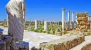
\n\n\n\nLady’s Mile Beach provides swimming and windsurfing opportunities along the eastern shore. The beach contains ecological importance beyond recreation, with small saline pools and salt meadows crucial for breeding birds. Walking trails connect various habitats, though exploring comprehensively requires a full day. Ancient Kourion city ruins and Kolossi Castle sit within easy reach, adding archaeological interest to natural attractions. The gravel pits area, accessible via roads through Akrotiri village past Saint George Chapel, attracts migrating passerines and offers views over barren terrain that floods in winter.
\n\n\n\nWhy Akrotiri Peninsula Matters Beyond Cyprus
\n\n\n\nAkrotiri Peninsula demonstrates that small areas can hold disproportionate ecological value when they contain rare habitat types and strategic geographic positions. The seasonal salt lake habitat comprises only approximately 0.5 percent of global wetland surface area, making every example precious. The peninsula’s position at the intersection of three continents creates a natural concentration point for migration routes serving bird populations across Europe, Asia, and Africa.
\n\n\n\nThe health of this single location affects species breeding thousands of kilometers away. European birdwatchers familiar with common species in their home countries depend on Akrotiri’s continued function as a staging area for those same populations. The site provides tangible evidence that local actions carry continental consequences, particularly for mobile species that cross international boundaries during their life cycles.
\n\n\n\nFor Cyprus specifically, Akrotiri represents irreplaceable natural capital. The concentration of endemic plants, the diversity of habitats, and the sheer abundance of wildlife create tourism opportunities based on ecological rather than beach resort development. The peninsula offers educational value through direct observation of conservation principles in action, showing how protective measures preserve resources that would be impossible to recreate once destroyed.
\n\n\n\nThe ongoing challenges facing Akrotiri also demonstrate the difficulty of balancing development pressures with environmental protection, even when legal frameworks exist. The outcome here will influence how Cyprus approaches conservation across the entire island, setting precedents for whether protected status provides actual protection or merely delays inevitable development.
\n\n\n\n\n