For much of antiquity, Cyprus was less an island on the map and more a working platform of the sea. Positioned between the Aegean, the Levant, and Egypt, it became a testing ground where Phoenician and Greek seafarers refined ships, navigation, and maritime organisation. This article explains how those two cultures approached the sea differently, why Cyprus mattered to both, and how their overlapping naval traditions quietly transformed the island into one of the Mediterranean’s most connected societies.
- An Island That Made Sense Only from the Water
- Two Seafaring Cultures, Two Ways of Seeing Cyprus
- Ports Before Cities
- Ships Built for Distance, Not Display
- Learning to Navigate an Unpredictable Sea
- Shipyards, Organisation, and Naval Scale
- Trade That Reshaped the Island
- Shared Gods of the Sea
- A Multilingual Coastline
- Traces You Can Still Follow Today
- Why This Naval Past Still Matters
An Island That Made Sense Only from the Water
Cyprus’s importance is easiest to understand when viewed from a ship’s deck. Sitting at the eastern edge of the Mediterranean, the island lies directly along the sea lanes linking the Aegean world with the Levant and North Africa. Any vessel moving between these regions benefited from a stop that offered fresh water, timber, copper, and sheltered anchorages.
The coastline itself encouraged maritime use. The south and east are broken into bays and coves that provide natural protection from storms, while prevailing currents make Cyprus a logical waypoint rather than a detour. Long before political borders mattered, geography had already decided the island’s role.
This is why Cyprus rarely functioned in isolation. Its history unfolded in dialogue with the sea, shaped by those who knew how to use it.
Two Seafaring Cultures, Two Ways of Seeing Cyprus
The Phoenicians and the Greeks both depended on the sea, but they approached Cyprus with different priorities.
The Phoenicians, originating from the Levantine coast, saw Cyprus primarily as an extension of their commercial network. They were traders first, settlers second. Their interest lay in resources such as copper and timber, and in ports that could support long-distance voyages linking the Near East with the wider Mediterranean.
Greek involvement began earlier through Mycenaean traders and later intensified with settlement. For Greeks, Cyprus became a place to found city-kingdoms, establish political authority, and anchor myth and identity to land as well as sea. Trade mattered, but so did permanence.
These differing approaches created tension at times, especially when larger empires became involved. Yet they also produced cooperation, intermarriage, and cultural blending that defined Cypriot coastal life for centuries.
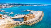
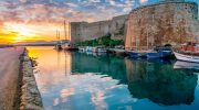
Ports Before Cities
Maritime activity shaped Cyprus from the shoreline inward. Early urban centres often developed around harbours rather than inland strongholds. Places like Kition, Salamis, Paphos, and Amathus were not chosen at random. Each offered access to calm water, nearby resources, and overland routes leading into the island’s interior.
For Phoenicians, Kition became a focal point. What began as a trading presence evolved into a structured colony tied closely to Tyre. From here, Phoenician merchants managed copper exports and coordinated shipping across the eastern Mediterranean.
Greek-controlled cities such as Salamis followed a different pattern. They combined maritime strength with royal authority, using fleets to project influence while embedding naval power within a broader political framework. Harbours were not just economic assets. They were symbols of control.
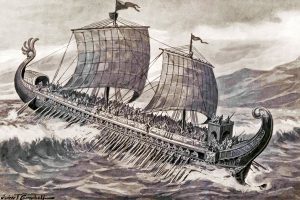
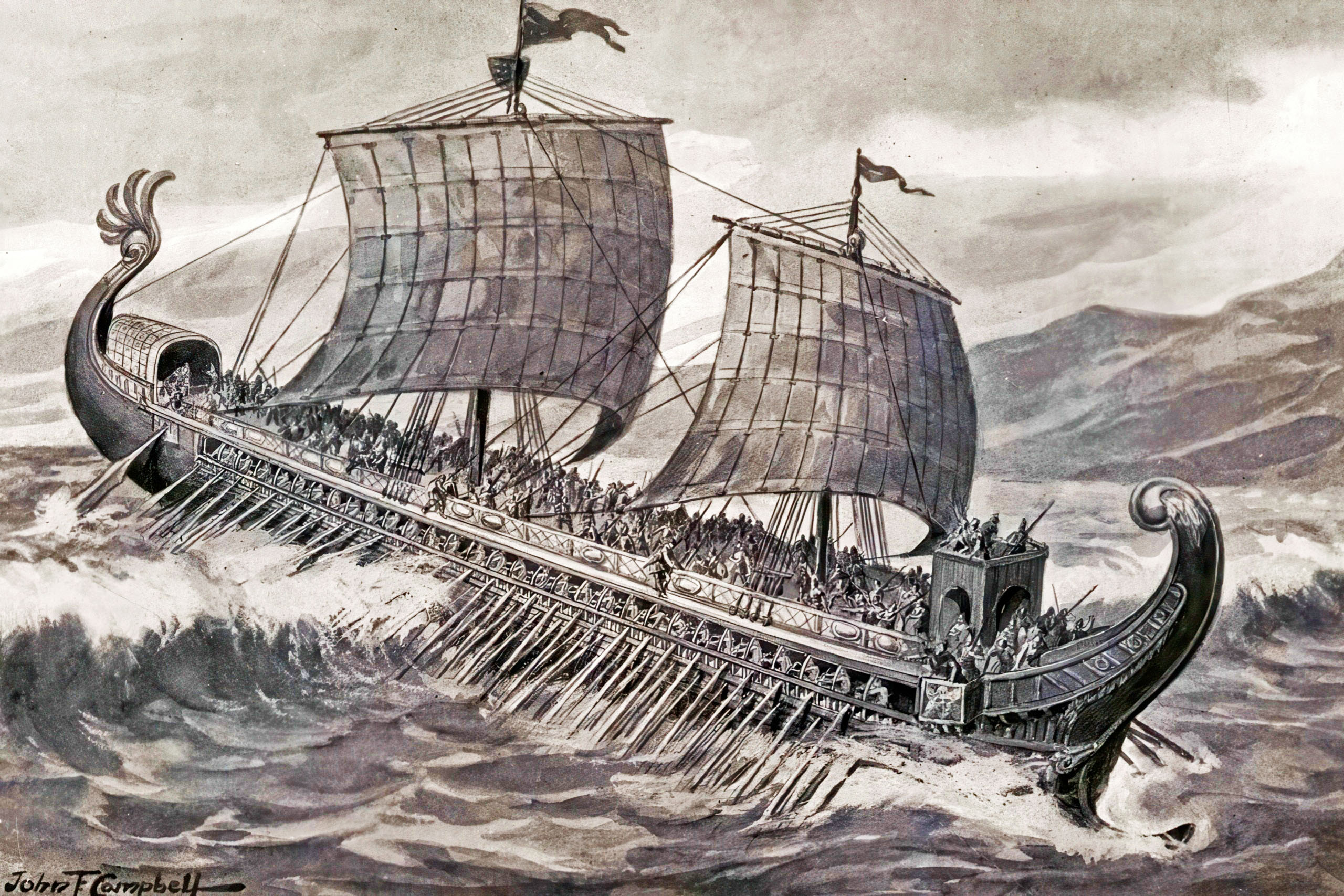
Ships Built for Distance, Not Display
Naval influence in Cyprus was ultimately about technology. Both Phoenicians and Greeks introduced shipbuilding methods that allowed vessels to travel farther, carry heavier cargo, and survive open-sea conditions.
Phoenician shipwrights pioneered strong hull construction using locked mortise-and-tenon joints. This technique bound planks together tightly, creating flexible yet durable hulls capable of enduring long voyages. Their ships were built for endurance and cargo capacity rather than speed alone.
Greek shipbuilders adopted these methods and refined them. The best-known example is the Kyrenia merchant ship, discovered off the northern coast of Cyprus. Built in the late fourth century BCE, it reveals careful craftsmanship, local timber use, and innovations such as lead sheathing to protect against marine damage.
These ships were tools, not symbols. Their success lay in reliability, not ornament.
Learning to Navigate an Unpredictable Sea
Advanced ships required equally advanced navigation. Ancient sailors did not rely on instruments as later mariners would. Instead, they developed a practical science of observation.
Phoenician sailors were particularly known for night navigation. They used the Pole Star to maintain direction, allowing them to sail beyond sight of land when conditions required it. This skill gave them a significant advantage in long-distance trade.
Greek sailors relied more heavily on seasonal patterns, coastal landmarks, and shared maritime knowledge passed through experience. Over time, these traditions blended. Routes around Cyprus became well understood, governed by predictable winds, currents, and safe anchorages.
Navigation was not theoretical. It was learned through repetition, risk, and memory, and Cyprus sat at the centre of that learning process.
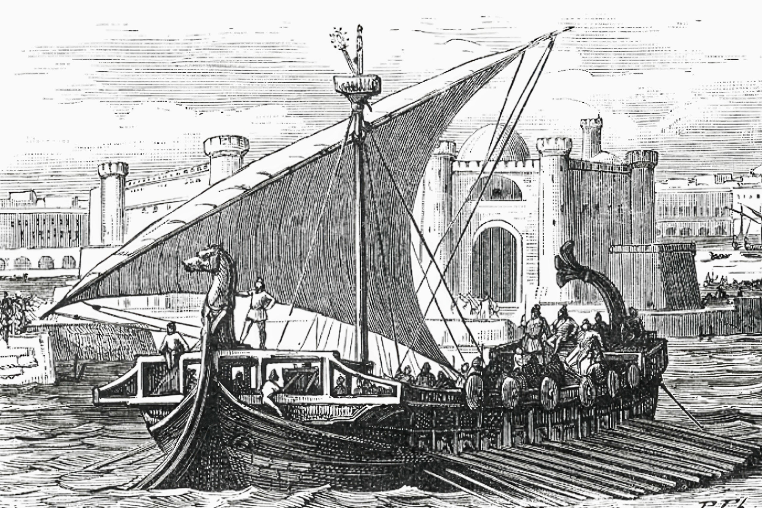
Shipyards, Organisation, and Naval Scale
True naval influence requires infrastructure. In Cyprus, this became especially visible during the Classical period.
At Kition, archaeologists have uncovered remains of large shipsheds built to house warships. These structures allowed vessels to be hauled out of the water, repaired, and protected from decay. Their scale suggests organised fleets rather than isolated ships.
Such facilities point to administrative systems capable of maintaining crews, supplies, and coordination. Naval power here was not improvisational. It was managed, funded, and integrated into urban life.
Greek-controlled cities followed similar paths, especially under later Hellenistic rule, when military harbours became increasingly monumental. Cyprus was no longer just a stopover. It had become a naval asset worth defending.
Trade That Reshaped the Island
Maritime networks transformed Cyprus economically. Copper was the most important export, shipped in standardised ingots that travelled as far as Egypt and the Levant. In return, Cyprus received ceramics, luxury goods, timber, and food supplies.
Phoenician traders specialised in high-value, low-bulk items such as dyed textiles and crafted goods. Greek trade introduced fine pottery and wine, which became markers of status within Cypriot society.
Ships were loaded strategically. Heavy items doubled as ballast and merchandise, ensuring stability while maximising profit. Nothing was wasted. The sea demanded efficiency, and Cypriot trade reflected that reality.
Shared Gods of the Sea
Maritime life also shaped belief. Sailors carried religion with them, and Cyprus became a meeting point of divine traditions.
The Great Goddess worshipped at Paphos was known to Greeks as Aphrodite and to Phoenicians as Astarte. Though names and rituals differed, her association with fertility, protection, and the sea remained constant. She was invoked by sailors seeking safe passage and successful trade.
Anchors, offerings, and inscriptions reveal how deeply faith was tied to navigation. The sea was unpredictable. Appeasing divine forces was part of managing risk.
A Multilingual Coastline
Naval interaction created a culturally complex society. Greek, Phoenician, and local languages coexisted, especially in port cities where sailors, merchants, and administrators interacted daily.
Inscriptions show borrowing of terms related to harbours, governance, and trade. This linguistic exchange mirrors the practical reality of maritime life. Cooperation was often more useful than division.
Cyprus did not belong entirely to one culture or another. It functioned as a shared space shaped by movement rather than borders.
Traces You Can Still Follow Today
Cyprus’s naval past is not hidden. It remains visible to those who know where to look.
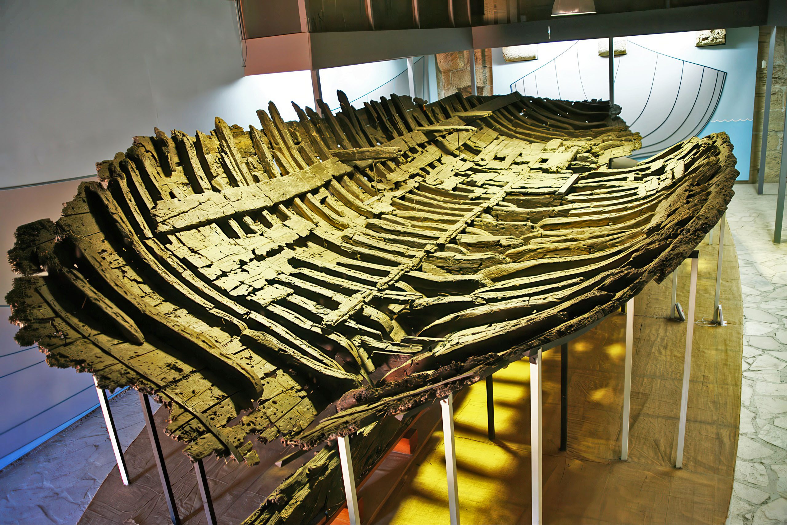
At Kyrenia Castle, visitors can see the remains of the ancient shipwreck that preserves Greek shipbuilding at its most practical. At THALASSA Municipal Museum, replicas and models illustrate how ships were built and sailed.
Along the coast near Amathus and Larnaca, submerged harbour remains still trace ancient shorelines. These are not isolated ruins. They are fragments of a system that once connected Cyprus to the wider Mediterranean world.
Why This Naval Past Still Matters
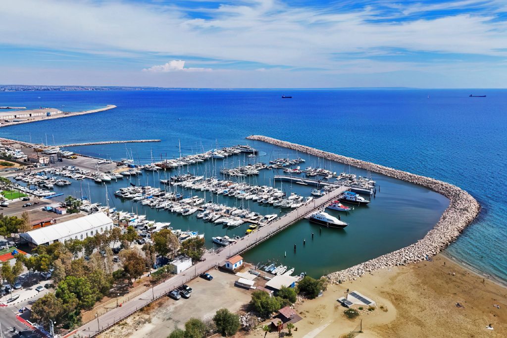
Modern Cyprus remains a maritime nation, hosting one of the world’s largest merchant fleets. While technology has changed, the underlying logic has not. Location, connectivity, and trust still define success at sea.
The foundations of that identity were laid by Phoenician traders and Greek sailors who treated Cyprus not as an endpoint, but as a hub. Their ships, routes, and shared knowledge shaped the island in ways that still influence its economy and outlook today.
To understand Cyprus, it helps to stop thinking of it as land surrounded by water. For most of its history, it was water that gave the land meaning.