Explore Cyprus with Our Interactive Map

Explore our top stories and discover ideas worth your time.

Byzantine Cyprus: Eastern Mediterranean Defense

Byzantine Cyprus: Eastern Mediterranean Defense

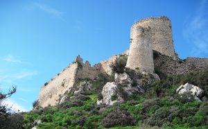
Cyprus was never a distant outpost of the Byzantine Empire. From late antiquity through the Middle Ages, it functioned as a frontline maritime shield, protecting the sea lanes that connected Anatolia, the Levant, and the Aegean. Byzantine naval defense on Cyprus was not limited to fleets and battles. It was a layered system combining geography, coastal fortifications, mountain surveillance, communication networks, and naval presence. Together, these elements allowed the empire to detect threats early, control movement at sea, and preserve stability in one of the Mediterranean’s most contested regions. An Island Positioned to Watch the Sea Cyprus sits at a natural crossroads of the Eastern Mediterranean. From its shores, routes radiate toward southern Anatolia, Syria and Palestine, Egypt, and the Aegean. This position made the island unavoidable for any power seeking maritime dominance in the region. For the Byzantine Empire, Cyprus acted as a forward sentinel. Control of the island meant early visibility over naval traffic moving between the Islamic-controlled Levant and the Byzantine heartlands of Asia Minor. Losing Cyprus would have meant losing advance warning, leaving the southern coast of Anatolia and the Aegean islands exposed to sudden raids. This strategic reality shaped every aspect of Byzantine policy on the island. From Roman Province to Maritime Bastion In the early Roman and late antique periods, Cyprus was relatively peaceful.…

Read more

Kakkaristra – Apalos Trail

Kakkaristra – Apalos Trail

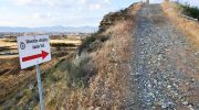
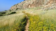
The Kakkaristra-Apalos Trail is an exceptional, lesser-known hiking route located just on the outskirts of Nicosia, within the Latsia region of Cyprus. Famously known for its exposed geological formations and rich marine paleontology, it provides hikers with a direct glimpse of how Cyprus emerged from the sea millions of years ago. Each section of the track reveals a new perspective of the deep ravines and the smooth white cliffs. The path follows the natural flow of the watercourse to offer a steady pace for the hiker. It represents a perfect harmony of scientific value and quiet beauty for every visitor. Trail Overview Location: Latsia, Nicosia Distance: 3.1 miles (5 km) Route Type: Circular (Loop) trail Difficulty: Easy Elevation Gain: 256 to 295 feet (78 to 90 meters) Duration: 45 Minutes Best Time to Visit: January – April Terrain: Narrow paths, dirt tracks, and small climbs Starting Point & Navigation Details Trailhead and Starting Point Location  The trailhead sits directly southwest of Nicosia within the boundaries of Latsia. The most reliable reference point for parking and departure is the Cyprus Pedagogical Institute. Once you arrive, there is a clear informational trailhead kiosk provided by the Latsia Municipality that details the route mapping, trail guidelines, and native biodiversity.  Trail Navigation Details The initial portion of the hike runs parallel to the impressive…

Read more
Protaras Beach

Protaras Beach

Protaras sits on the southeastern coast of Cyprus in the Famagusta District, approximately 70 kilometers from Larnaca International Airport. This coastal resort developed specifically for tourism offers 10 kilometers of coastline along the Mediterranean Sea. The beaches here feature fine golden sand and exceptionally clear waters that earned international recognition. Fig Tree Bay was named Europe's third best beach by TripAdvisor in 2011, though rankings shifted in following years. Unlike the party atmosphere of nearby Ayia Napa, Protaras built its reputation as a quieter alternative better suited to families and domestic Cypriot tourism. Historical Context In ancient times, the area now known as Protaras was home to the old city-state of Leukolla, which had a small, safe harbor where Demetrius Poliorketes sought refuge in 306 BC. For centuries afterward, the coast remained sparsely populated due to pirate threats that made settlement dangerous. The area earned the nickname "the land of windmills" from agricultural equipment that once dotted the landscape. The first windmills appeared in Paralimni in the early 20th century and were imported from Chicago, Toronto, and later Great Britain. Tourism development began in earnest during the late 20th century following the 1974 events that closed Famagusta to Greek Cypriot tourism. Protaras transformed from agricultural land into a major resort destination. The population of the broader Paralimni area grew from…

Read more