Explore Cyprus with Our Interactive Map

Explore our top stories and discover ideas worth your time.

Ariadni Nature Trail

Ariadni Nature Trail

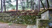
The Troodos Mountains host a remarkable path known as the Ariadni Nature Trail. This route offers a direct look into the heart of the forest. Nature enthusiasts travel here for the calm atmosphere. The air stays cool even in the heat of the summer months. It serves as a sanctuary for many local plants. The terrain consists of diverse rock formations and dense tree cover. Hikers find a sense of peace among the tall pines. Each step reveals a new view of the deep valleys below. The site remains a top choice for those who seek quiet beauty. It provides a unique window into the island’s wild interior. This journey starts near the village of Gerakies and winds through the woods. The path is clear and easy to follow for most visitors. It connects several points of interest within the state forest. People admire the craft of the old stone walls along the way. This trail stands as a testament to the natural wealth of the region. Trail Overview Location: Gerakies Village Troodos Mountains Distance: 3.1 miles (5 km) Route Type: Point to Point Difficulty: Moderate Elevation Gain: 650 feet (200 meters) Duration: 2 to 2.5 hours Best Time to Visit: April to June or September to November Terrain: Forest Floor and Rocky Slopes Geological Context The Ariadni Nature Trail…

Read more
Kaledonia Waterfall Trail

Kaledonia Waterfall Trail

The Kaledonia Waterfall Trail offers one of Cyprus's most scenic forest hikes. This 3-kilometer nature trail follows the Kryos Potamos River through dense pine and oak forests in the Troodos Mountains, leading to a spectacular 12-meter waterfall at 1,330 meters elevation. The trail takes its name from the Kaledonia waterfall at its center point, though many maps also spell it Caledonia. The path maintains a mostly shaded route under tall pine trees along the riverbank, creating a cool microclimate even during Cyprus's hot summer months. The sound of rushing water accompanies hikers throughout the journey as they cross the Kryos Potamos River six to seven times before reaching the main cascade. The trail sits within Troodos National Forest Park, a protected area covering 9,147 hectares around Mount Olympus. Wooden bridges span the stream at key points, though hikers must also step across river stones polished smooth by centuries of water flow. Business Insider ranked this waterfall as the 14th best in Europe in 2015, bringing increased international attention to what was previously a lesser-known local hiking destination. Historical Background In 1878, a Scottish expedition visited the Platres region during the early period of British colonial administration in Cyprus. When the Scots encountered the waterfall and surrounding landscape, they found remarkable similarities to the waterfalls and forested gorges of their homeland.…

Read more
Millomeris Waterfall Trail

Millomeris Waterfall Trail

The Millomeris Waterfall Trail sits in the Kryos Potamos river bed within the Limassol district. It represents one of the highest natural falls in Cyprus at an elevation of 1,050 meters above sea level. This specific route bypasses the direct road access to provide a more immersive forest experience. Every segment of the path highlights the unique geology of the Troodos igneous complex. The area maintains a significantly lower temperature than the coastal plains during the summer. Moisture from the waterfall creates a microclimate that supports dense vegetation. Local history suggests the name Millomeris stems from the Greek words for "moist" and "place." This environment serves as a critical habitat for endemic species in the Troodos National Forest Park. Hikers find the trailhead near the church of Faneromeni in Pano Platres. The path is well-marked and maintained by the Department of Forests. It offers a direct connection between the village center and the base of the falls. This walk provides a practical alternative to the tourist-heavy vehicle access points located further south. Trail Overview Location: Pano Platres, Troodos Mountains, Cyprus Distance: 1.4 miles (2.2 km) Route Type: Out & Back Difficulty: Moderate Elevation Gain: 130 feet (40 meters) Duration: 1 hour Best Time to Visit: March to June Terrain: Dirt path, stone steps, and wooden bridges Geological Profile of the…

Read more