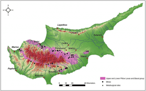
Cyprus holds a unique position in geological science. The island contains Earth’s best preserved ophiolite complex, a rare slice of ancient oceanic crust and upper mantle thrust upward onto land. This exceptional geological heritage shaped both the island’s dramatic landscapes and its human history, particularly through copper deposits that gave Cyprus its very name.
The Troodos Massif formed 90 million years ago during the Upper Cretaceous period at the bottom of the ancient Tethys Ocean. The rocks visible today once existed 8,000 meters below sea level at a mid-ocean ridge spreading center, where new oceanic crust continuously forms as tectonic plates pull apart. Geologists call this complete sequence an ophiolite complex.
Troodos was not metamorphosed during uplift, allowing scientists to study pristine oceanic rocks without submarines. This makes Cyprus an on-land analogue for modern mid-ocean ridges. The collision of African and Eurasian tectonic plates pushed the oceanic lithosphere upward rather than downward into a trench. Troodos first rose above sea level about 20 million years ago, with uplift centered around Mount Olympus at 1,952 meters. Erosion exposed deeper layers, allowing visitors to walk from rocks that once existed in Earth’s mantle to rocks that formed at the ancient seafloor.
- Complete Rock Sequence from Mantle to Seafloor
- Copper Deposits from Black Smoker Vents
- Four Thousand Years of Mining History
- Modern Mining Technology Transforms Production
- Beyond Copper – Other Mineral Resources
- Geological Tourism and Scientific Research
- Cyprus Helped Establish Plate Tectonic Theory
Complete Rock Sequence from Mantle to Seafloor
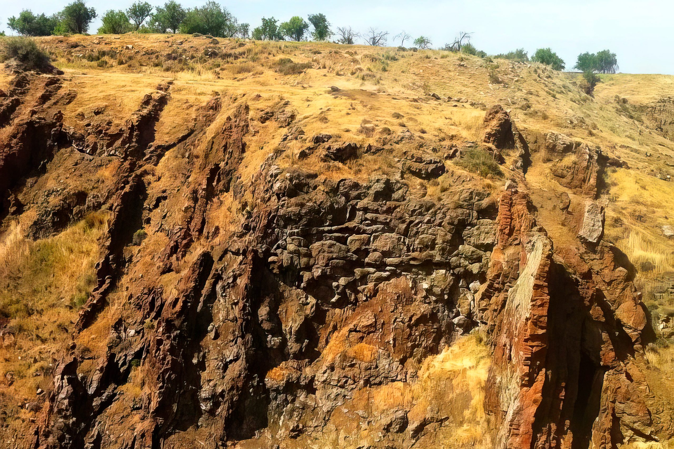
The ophiolite exposes a perfect vertical sequence. At the deepest level lie mantle rocks called peridotites, specifically harzburgite and dunite. These dense rocks consist primarily of olivine with orthopyroxene. Through serpentinization, water reacts with peridotite to create serpentine minerals with lower density, contributing to continued uplift.
Above the mantle lies layered gabbro made of plagioclase feldspar and clinopyroxene. This represents the magma chamber beneath the mid-ocean ridge where molten rock slowly crystallized. The sheeted dike complex sits above the gabbro layer. This remarkable formation consists of hundreds of vertical basaltic dikes standing parallel like walls. These served as conduits carrying magma from the magma chamber to the seafloor, providing direct evidence of seafloor spreading.
The uppermost volcanic layer consists of pillow lavas formed when basaltic lava erupted into cold seawater 2,000 meters deep. Rapid cooling created distinctive pillow shapes, each typically one to three meters in diameter. Above the pillows, deep-sea sediments accumulated over millions of years before the oceanic crust was thrust upward.
Copper Deposits from Black Smoker Vents
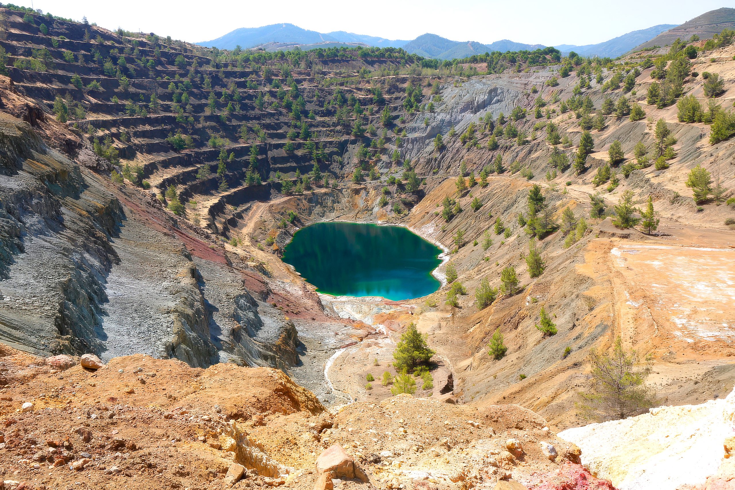
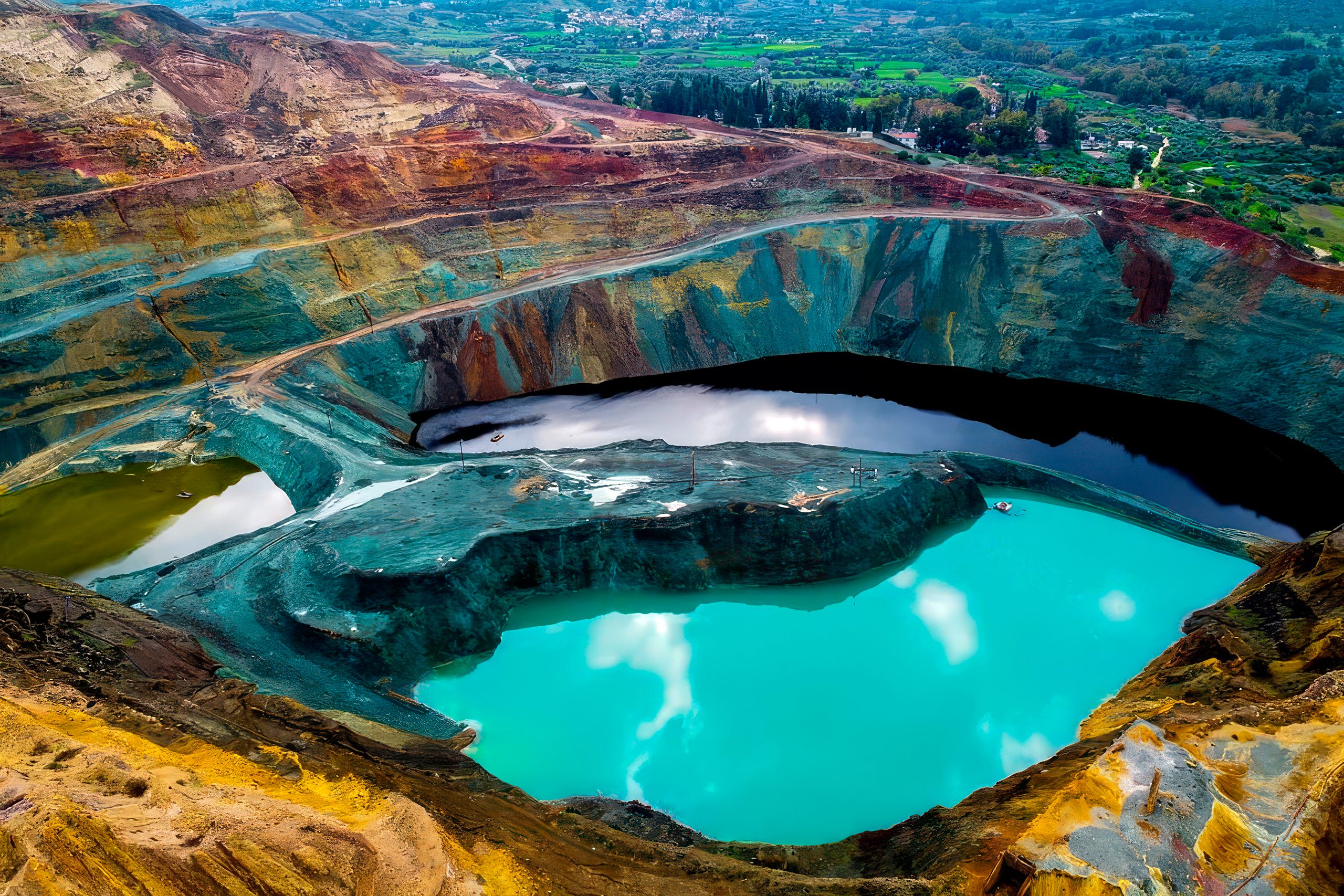
Cyprus hosts over 90 massive sulfide deposits formed at ancient black smoker vents. These contain primarily pyrite and chalcopyrite, the primary copper ore. Seawater seeps down through fractures, reaching depths where temperatures exceed 400 degrees Celsius. The superheated water dissolves metals including copper, zinc, iron, and manganese. Because hot water is less dense, this mineral-rich fluid rises back toward the seafloor.
When hot fluid erupts at seafloor vents and mixes with cold seawater, dissolved metals precipitate instantly, creating black smoker chimneys. Over time, these accumulate to form massive sulfide deposits. In Cyprus, these occur in the pillow lava formation around the Troodos periphery. The largest deposit is Mavrovouni, where 16.5 million tonnes averaging 4.5% copper was extracted between 1929 and 1974.
Four Thousand Years of Mining History
Copper mining dates to 4000 BC during the Chalcolithic period. Cyprus provided most of the world’s copper during the Roman Empire. Ancient Cypriots extracted approximately 200,000 tonnes of copper ingots using primitive methods. The Greek name for copper, Kúpros, derives from Cyprus, reflecting how central this metal was to the island’s identity.
Ancient miners initially worked with native copper requiring no smelting. By the Bronze Age, sophisticated operations developed. Miners followed surface gossans, the oxidized iron-rich cappings above sulfide deposits. Below these rust-colored rocks, they discovered high-grade ores. A layer called Devil’s Mud above massive sulfide bodies contained particularly high gold and silver concentrations, sometimes reaching 50 ounces of gold per ton.
Smelting copper required charcoal at high temperatures. Estimates suggest the charcoal consumed equaled 16 times the entire wooded potential of ancient Cyprus. Despite massive deforestation, the island’s fertile soil and rainfall allowed forests to regenerate over millennia. Roman operations reached 600 feet underground at Skouriotissa. The physician Galen visited in AD 166 and described horrific conditions where slaves worked in suffocating air, with cave-ins frequently killing workers.
Modern Mining Technology Transforms Production
Modern large-scale mining commenced in the 1920s when foreign companies gained control. Over 50 years, more than 74 million tonnes of ore was extracted from approximately 30 deposits. Operations suspended during World War II, resumed, then faced disruption during the 1974 conflict that divided Cyprus. Combined with near-complete extraction of high-grade deposits and falling copper prices, companies ceased production by 1979.
In 1996, Hellenic Copper Mines reopened Skouriotissa using innovative technology. Rather than traditional mining, they process low-grade waste through bioleaching. Ore is piled and sprinkled with acidic solution containing bacteria that dissolve copper from the ore. The solution undergoes solvent extraction followed by electrolysis, producing 99.99% pure copper cathodes. Between 1996 and 2016, this yielded 63,443 metric tonnes.
Beyond Copper – Other Mineral Resources
Chromite deposits occur in ultramafic mantle rocks. This chrome-rich mineral was historically mined for chromium used in stainless steel production. A total of 64 chromite occurrences have been mapped around Mount Olympus, though most are subeconomic.
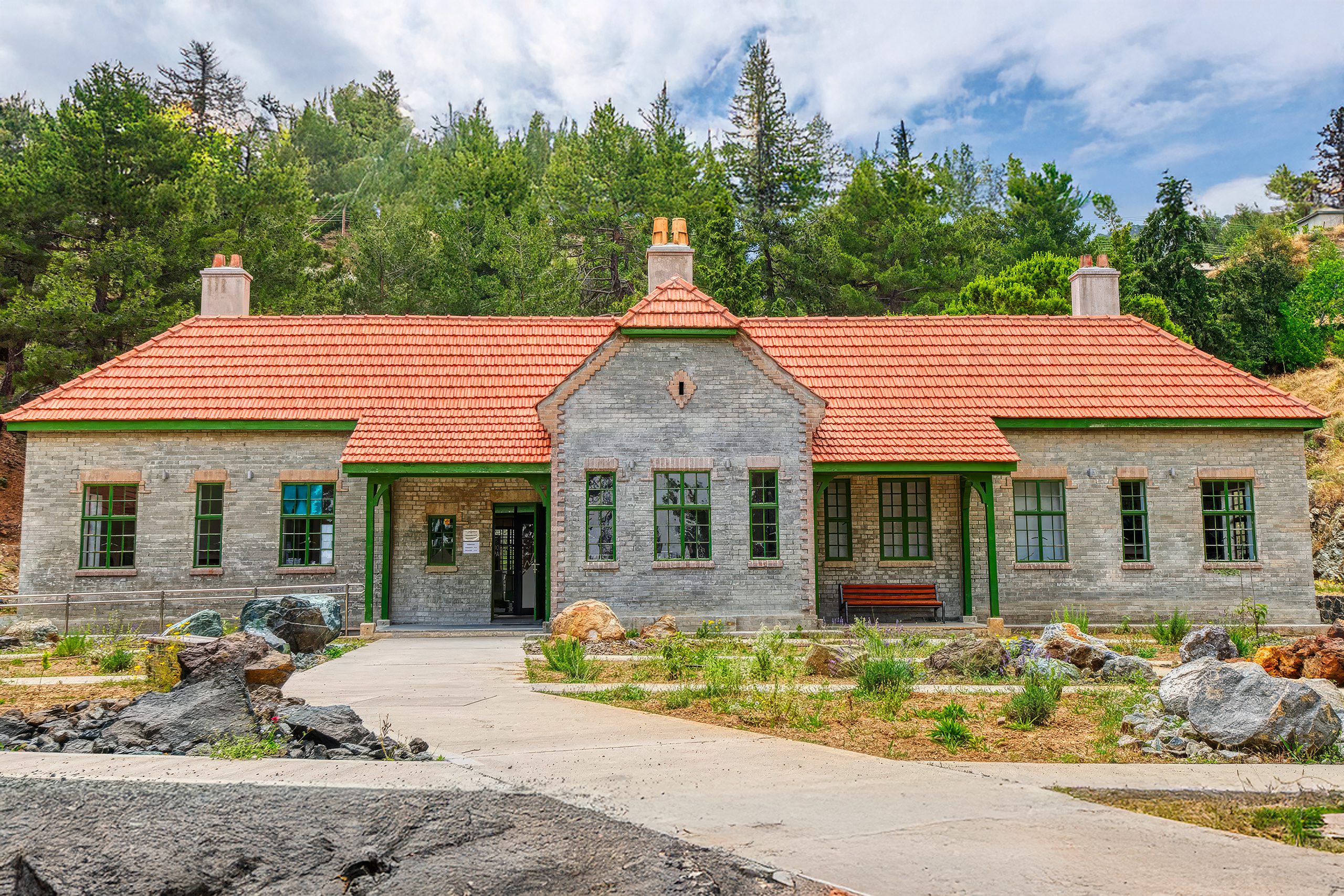
Asbestos formed in serpentinized ultramafic rocks through hydrothermal alteration. The Amiantos mine was among the world’s largest, operating from 1904 until 1988. Today the former site hosts the Troodos Geopark Visitor Centre. Gypsum deposits occur in sedimentary formations as evaporite minerals from ancient seas. Umber and ocher, mixtures of iron and manganese hydroxides, formed as chemical sediments above sulfide deposits and were used as pigments.
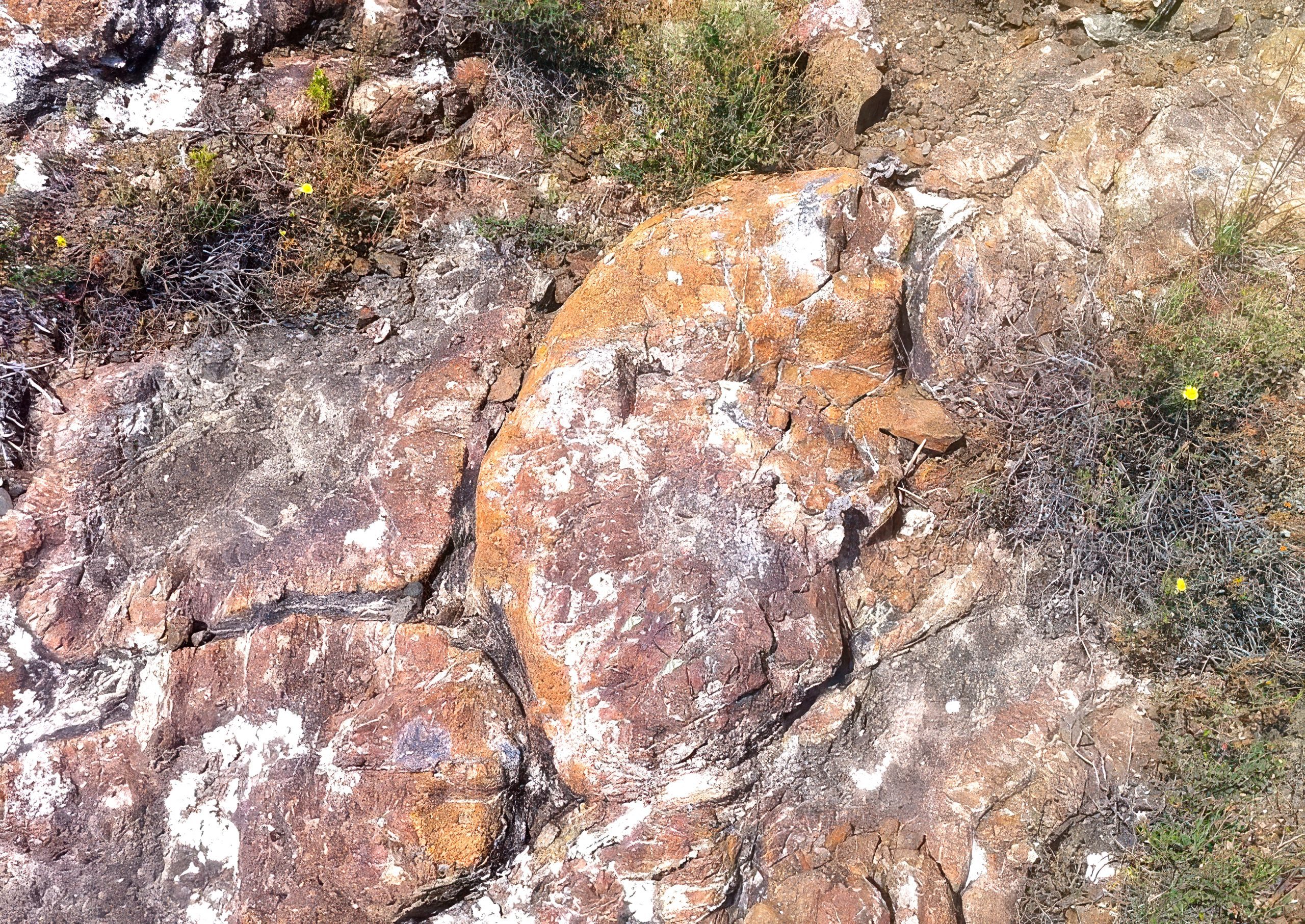
Secondary copper minerals create beautiful specimens. Malachite produces striking green crystals, while azurite creates vibrant blue formations. Both form in oxidized zones as groundwater alters chalcopyrite. Gold occurs in pyrite as submicroscopic particles. Silver associates with chalcopyrite and concentrates in weathered zones. Platinum group metals occur in trace amounts in chromite and ultramafic rocks.
Geological Tourism and Scientific Research
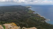
In 2015, UNESCO designated Troodos as a Global Geopark. The island serves as an open-air laboratory where researchers study mid-ocean ridge processes without submarines. Since the 1960s, scientists have completed over 120 PhD dissertations and 60 Master’s theses on Troodos geology.
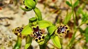
The geopark operates hiking trails with labeled outcrops. The Artemis Geo-Trail, a 7-kilometer loop around Mount Olympus, passes through exposed mantle rocks including peridotite, harzburgite, pyroxenite, and dunite. The Teichia Tis Madaris Geo-Trail showcases the sheeted dike complex with spectacular black basalt fins. Both wind through ancient black pine forests and endemic plants that grow exclusively on serpentine-derived soils.
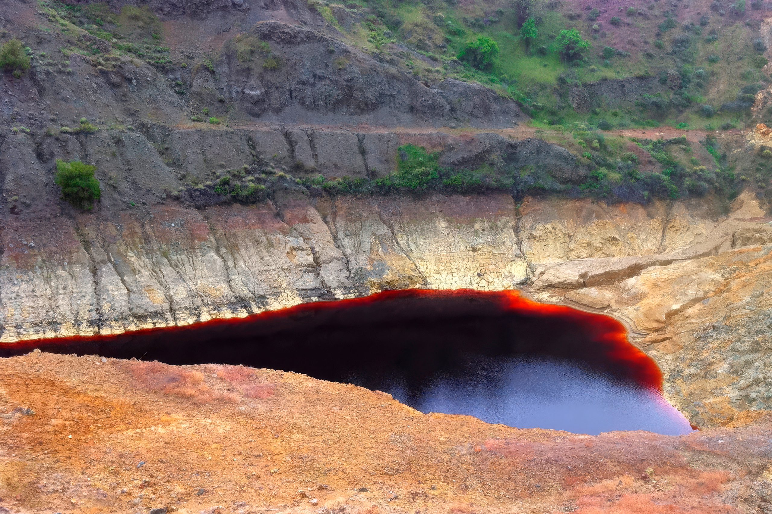
Coastal areas display weathered pyrite-rich rocks that produced unusual rusty brown beach sand. The original pyrite oxidizes to form iron oxides including goethite and limonite, highlighting sulfide mineral instability when exposed to air and water.
Cyprus Helped Establish Plate Tectonic Theory
The revelation that sheeted dike complexes could only form through seafloor spreading helped establish plate tectonic theory in the 1960s. British geologist Ian Gass first described the Troodos sheeted dikes in detail. Eldridge Moores and Fred Vine realized seafloor spreading was the only plausible mechanism for creating such structures. This insight, combined with evidence for oceanic crust destruction in trenches, provided the framework for modern plate tectonics.
Ophiolites mark locations of ancient plate collisions. Most worldwide are dismembered by faults and incomplete, making Troodos exceptionally valuable. Recent research suggests it formed at a trench-ridge double junction during subduction initiation, similar to the modern Izu-Bonin-Mariana arc system.
The geology of Cyprus reveals how dynamic processes beneath our feet create the landscapes we see. Ongoing tectonic activity continues uplifting Troodos as the African plate subducts beneath the Eurasian plate at the Cyprus Arc. Understanding these processes through Cyprus helps geologists interpret rocks worldwide and reconstruct ancient ocean basins. The rocks tell stories of ancient seafloor spreading, hydrothermal circulation, and plate collisions that shaped both the island’s geology and its human civilization through copper deposits that fueled trade and prosperity for four millennia.