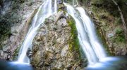
Avakas Gorge is a 3-kilometer-long limestone canyon located in the Akamas Peninsula, 16 kilometers west of Paphos. The gorge was created by the Avgas River, a seasonal stream that flows only in winter and spring. Over countless thousands of years, this modest river carved through layered limestone and created walls that reach 30 meters high in some sections.
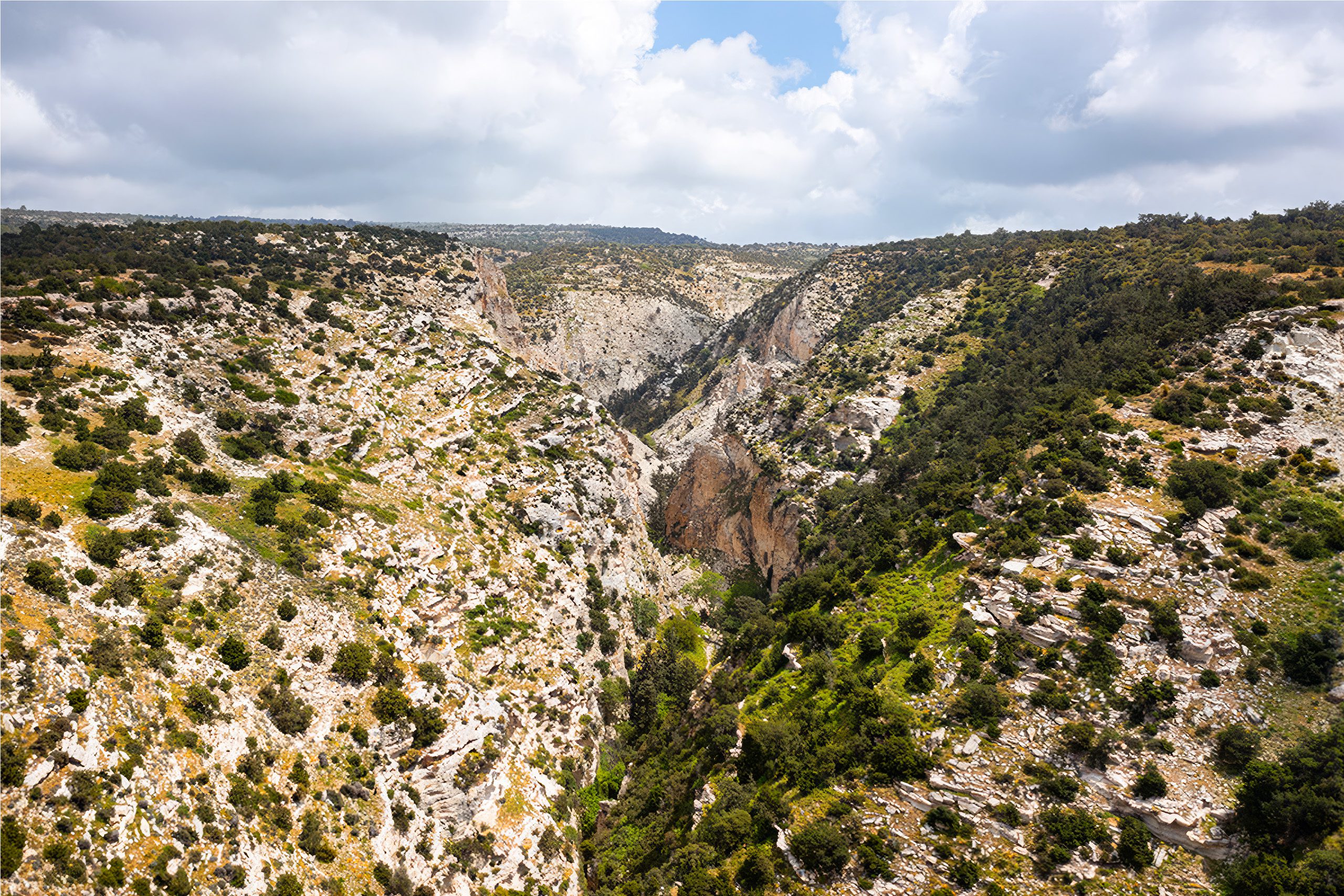
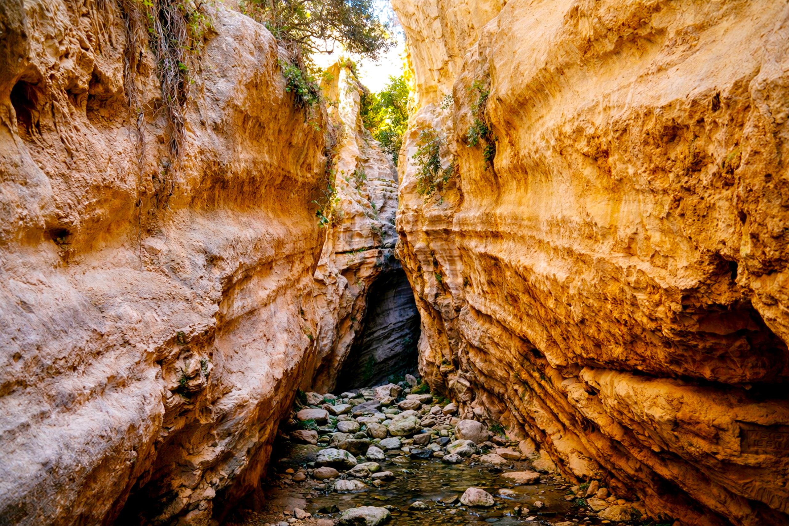
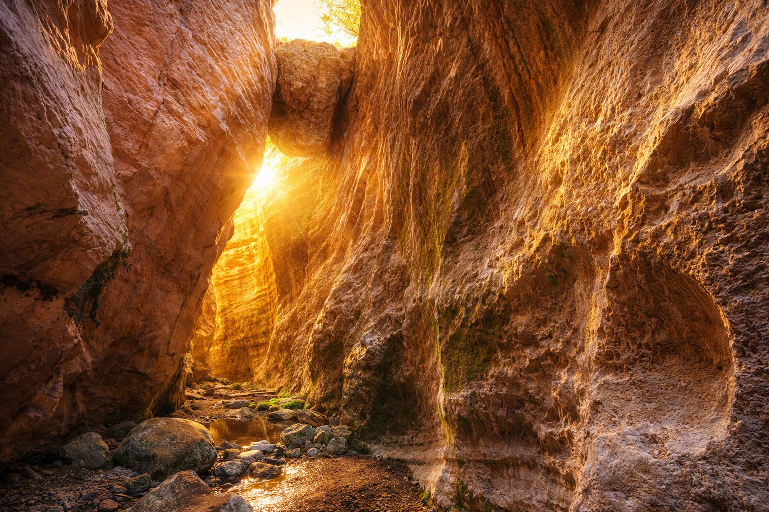
The gorge is part of the Natura 2000 protected area network and attracts roughly 100,000 visitors per year according to forestry authorities. What makes it special isn’t just the height of the walls but how narrow the passage becomes. In places, the gorge squeezes down to only 4 meters wide with cliffs towering on both sides and a strip of sky visible overhead. This creates dramatic light effects as sun filters down through the gap.
- Historical Background
- The Cave Systems Hidden in the Walls
- Plants That Grow in Impossible Places
- The Seasonal River and Flash Flood Danger
- Wildlife That Uses the Gorge
- Why Avakas Gorge Matters for Conservation
- How to Visit Avakas Gorge Safely
- The Experience of Walking Through the Canyon
- A Natural Wonder Worth Protecting
Historical Background
The rock that forms Avakas Gorge is limestone from the Mamonia Complex and was deposited in warm seas during the Mesozoic era millions of years ago. This limestone contains layers of reef formations, shell fragments, and marine sediments that hardened into stone. When Cyprus rose from the ocean and these rocks emerged on land, they became vulnerable to erosion.
Limestone is soft enough that water can dissolve it chemically and carve it physically. During the Pleistocene era, roughly 2 million to 12,000 years ago, the Avgas River began to cut down through the limestone. Every flood carried sand and gravel that acted like sandpaper and ground away at the rock. Chemical reactions between slightly acidic water and limestone dissolved the rock molecule by molecule.
This process created what geologists call a karst landscape. Karst forms when water dissolves limestone and creates caves, sinkholes, underground rivers, and dramatic surface features like gorges. The Akamas Peninsula contains numerous karst features beyond just Avakas Gorge, though this gorge represents the most spectacular example.
The Cave Systems Hidden in the Walls
Small caves and rock shelters dot the walls of Avakas Gorge, though most are inaccessible without climbing equipment. These caves formed when water found weaknesses in the limestone and dissolved the rock to create hollow spaces. Some caves are shallow alcoves only a meter or two deep, while others extend further back into the cliff face.
The caves served as shelter for wildlife and possibly for humans in prehistoric times. Griffon vultures once nested in the higher caves before their population declined in Cyprus. Bats still use some of the cave entrances as daytime roosts. Rock doves and other birds nest in the sheltered alcoves where predators cannot easily reach them.
One notable feature is a large boulder wedged high between the canyon walls and creates a natural arch or bridge. This massive rock fell from the cliffs above during an earthquake or flood event and became jammed in the narrow section of the gorge. Over time, smaller rocks and sediment accumulated around it. The boulder now appears permanent, though future floods could potentially dislodge it.
Plants That Grow in Impossible Places
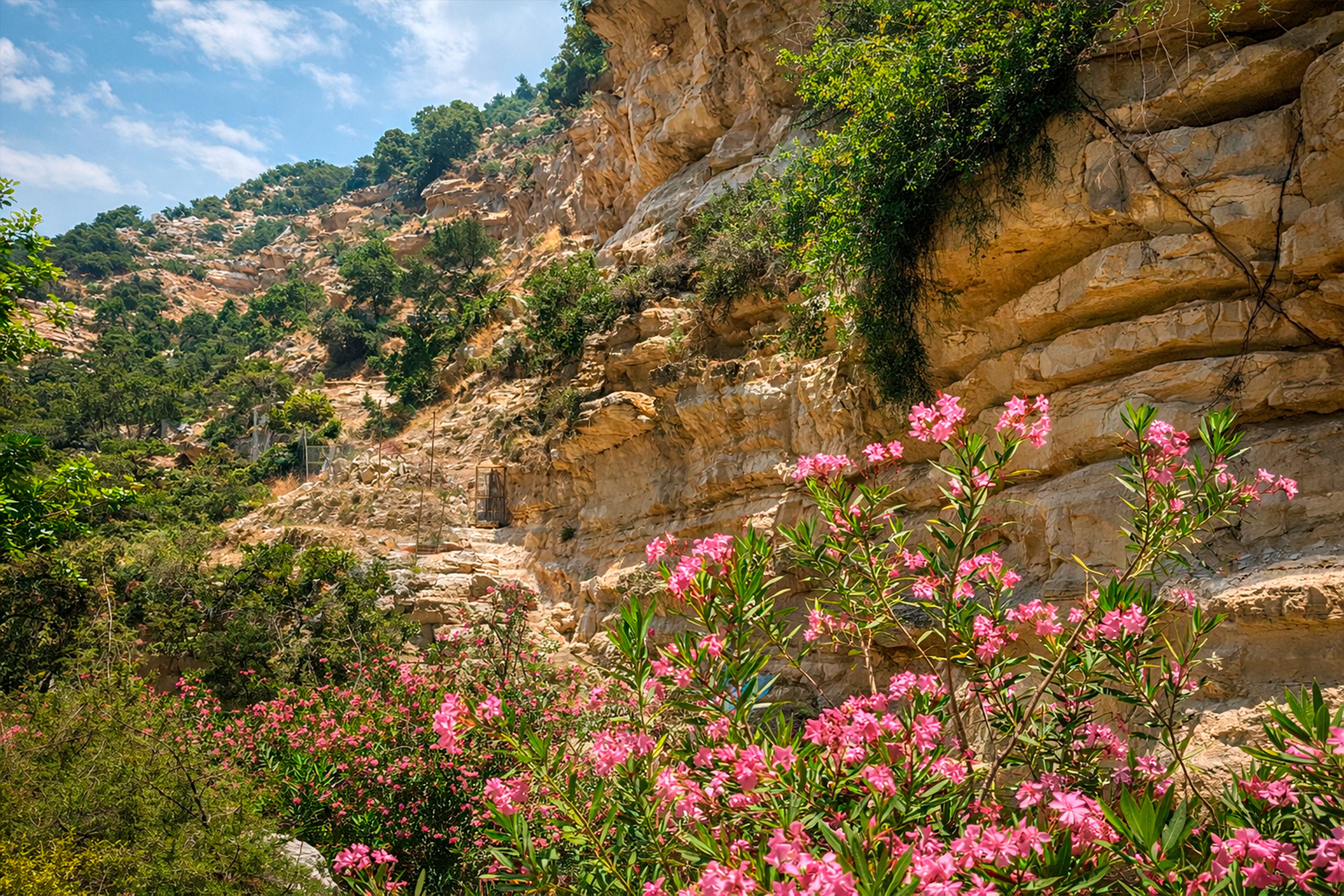
The microclimate inside Avakas Gorge allows plants to grow that wouldn’t normally survive in Cyprus’s dry climate. The narrow walls create shade and trap moisture, which means the gorge stays cooler and damper than the surrounding landscape. This allows ferns, wild figs, and other water-loving plants to thrive.
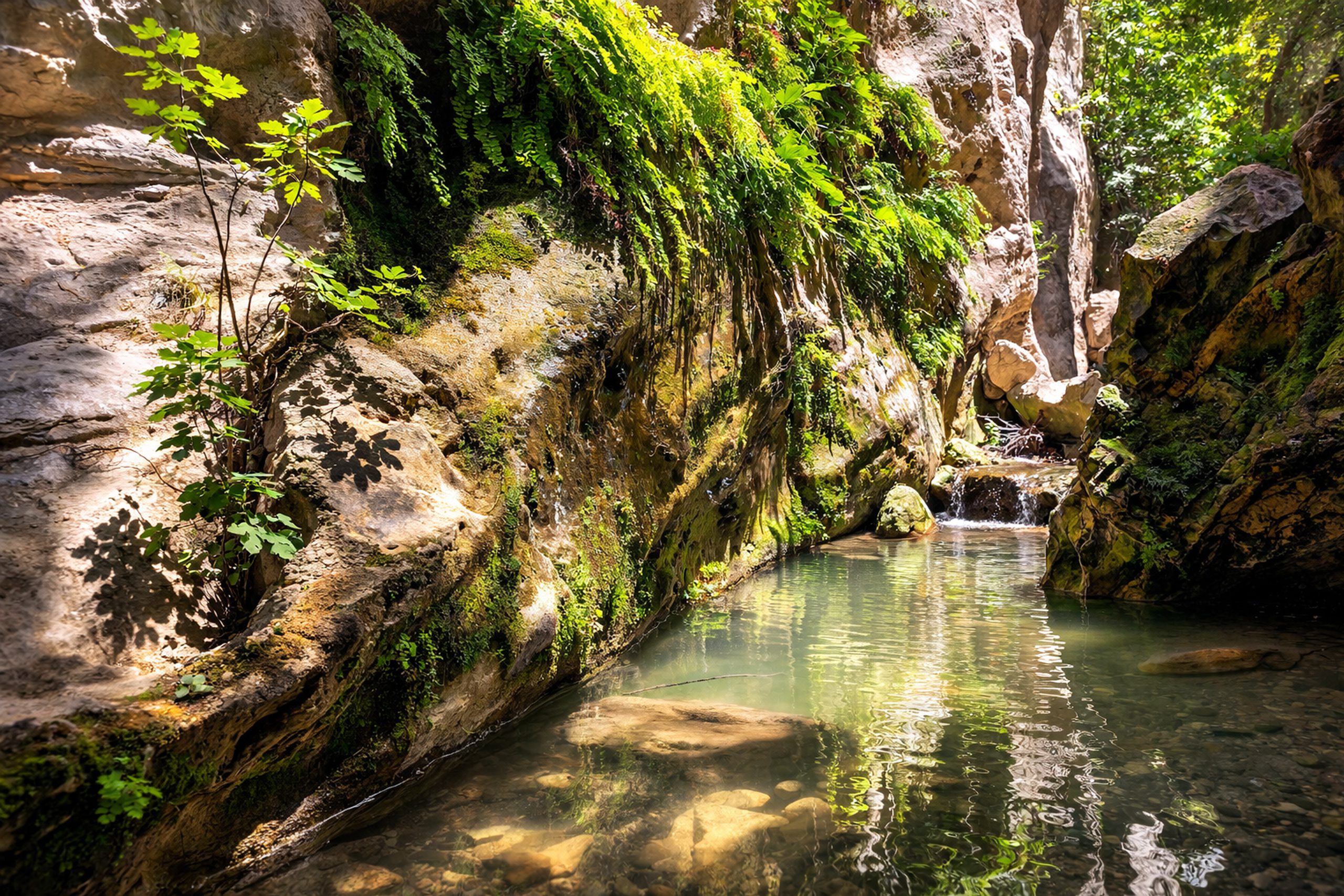
Wild fig trees grow directly from cracks in the rock walls where their roots find enough soil and moisture. These trees can live for decades despite having almost no soil, their roots penetrating deep into the limestone to find water. During the dry summer months when the riverbed is completely dry, these plants survive on moisture trapped in the porous rock.
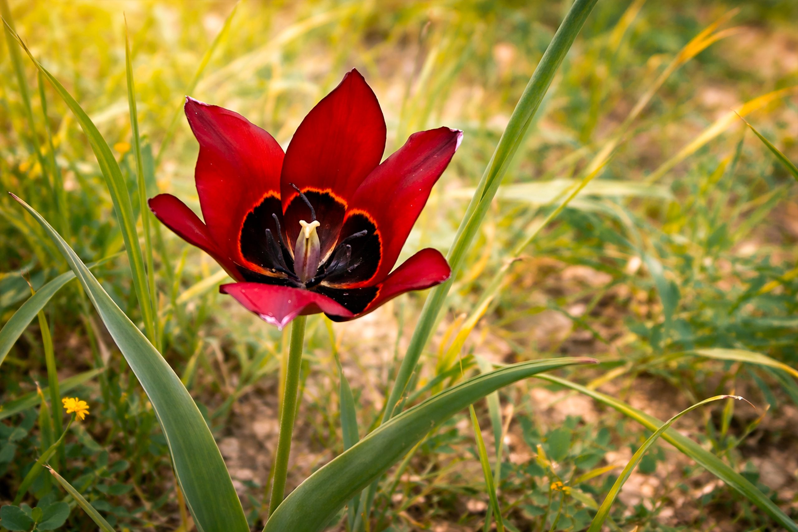
The endemic Cyprus tulip grows on the gorge slopes during spring. Two rare plant species, Centaurea akamantis and the Akamas tulip, exist nowhere else on Earth except in Avakas and two nearby gorges. The vertical walls provide habitat that grazing animals cannot reach, which protects these rare plants from being eaten.
The Seasonal River and Flash Flood Danger
The Avgas River flows only during the rainy season from roughly November through March. During this time, winter storms in the Troodos Mountains send water rushing down to the coast. The gorge channels this water through the narrow canyon and creates a torrent that can be dangerous.
Flash floods remain a real risk in Avakas Gorge. The catchment area upstream collects rainwater and funnels it into the gorge. Because the walls are so high and narrow, there’s no escape route if water suddenly appears. Warning signs at the entrance advise visitors not to enter the gorge if rain is forecast or if dark clouds are visible over the mountains.
During summer, the riverbed is completely dry except for occasional pools in deeper sections. These pools provide water for wildlife during the hottest months. The contrast between the winter torrent and summer drought demonstrates how extreme seasonal variation can be in Mediterranean climates.
Wildlife That Uses the Gorge
Beyond the bats and birds that nest in the caves, Avakas Gorge hosts diverse wildlife. Foxes use the gorge as a corridor to move between the coast and the interior mountains. Their tracks are often visible in the sandy riverbed. During winter when water flows, frogs and toads breed in the pools that form.
Snakes are common in the gorge, particularly the Cyprus whip snake, which hunts lizards on the rock walls. Most snakes in Cyprus are harmless to humans, though visitors should watch where they put their hands when climbing over rocks. The starred agama, Cyprus’s largest lizard, sunbathes on the warm rocks and can grow up to 30 centimeters long.
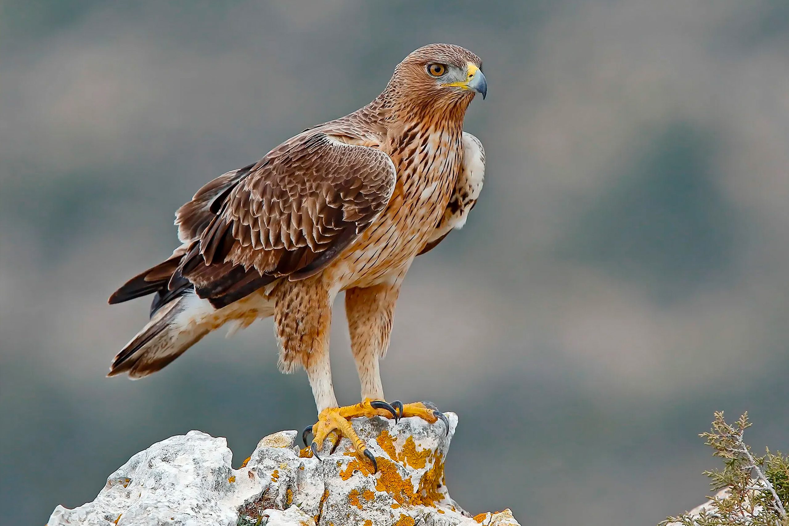
The gorge also provides hunting territory for birds of prey. Eleonora’s falcon migrates through Cyprus during spring and autumn and sometimes hunts in the gorge. The rare Bonelli’s eagle occasionally appears overhead. These predators take advantage of the gorge’s concentration of prey animals in a relatively small area.
Why Avakas Gorge Matters for Conservation
Avakas Gorge represents one of the few remaining wild areas on Cyprus’s southern coast. The gorge escaped development because of its steep terrain and seasonal flooding, which made it unsuitable for agriculture or construction. This accidental protection preserved a slice of landscape that shows what much of coastal Cyprus looked like before modern development.
The gorge’s designation as part of Natura 2000 provides legal protection from development. This status recognizes the area’s importance for rare plants and as habitat for protected species. The gorge also serves as a genetic reservoir for plants and animals that have disappeared from other parts of Cyprus.
For geologists, the gorge provides excellent examples of how water erosion shapes limestone landscapes. The exposed rock layers show the geological history of the region and can be studied without excavation. Students and researchers use the gorge as an outdoor classroom to learn about karst processes.
How to Visit Avakas Gorge Safely
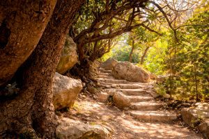
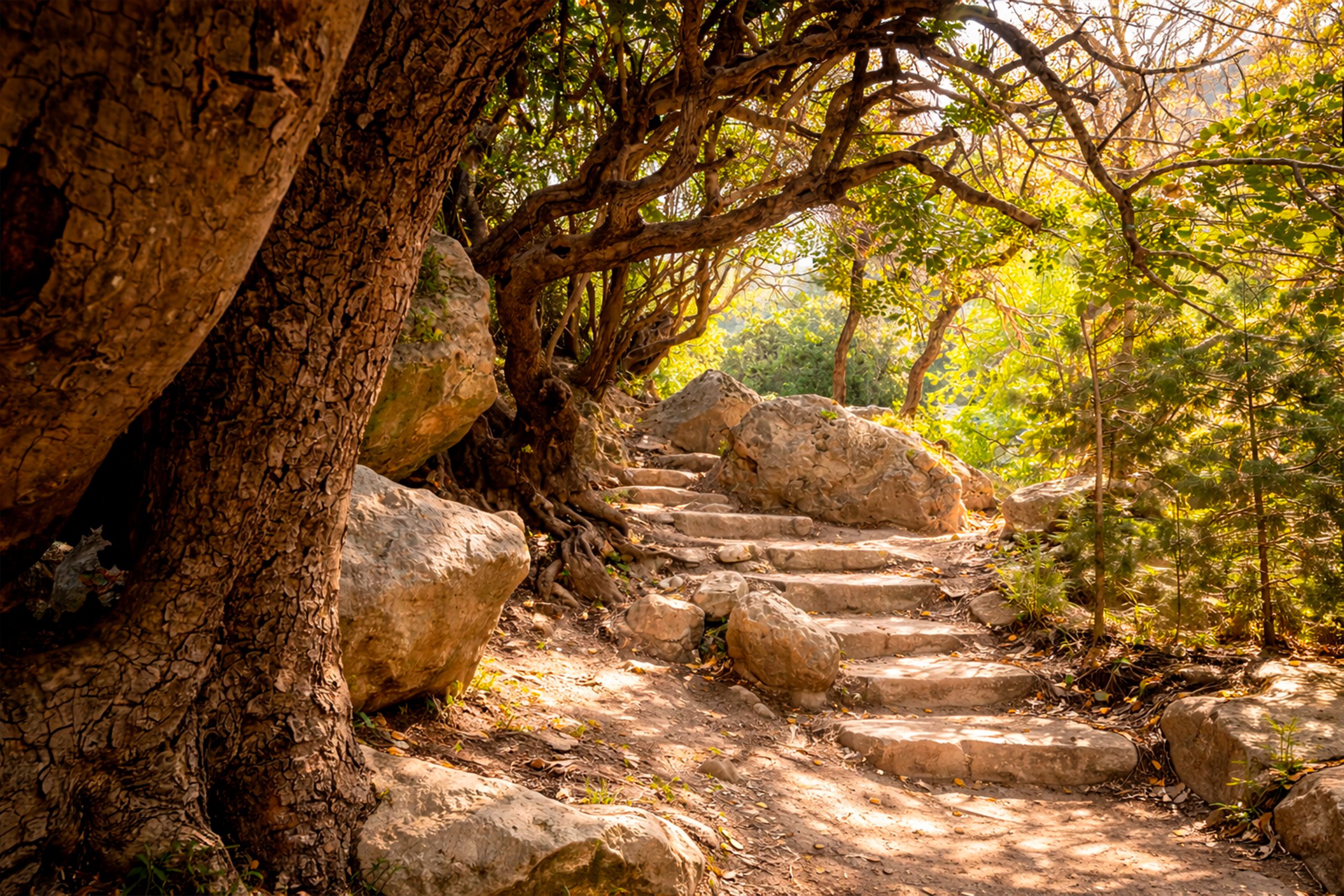
The main entrance to Avakas Gorge is accessible from the village of Agios Georgios Pegeia. A dirt road suitable for most cars leads to a parking area near the gorge entrance. From there, a marked trail follows the riverbed into the canyon. The hike is approximately 3 kilometers round trip and takes 2 to 3 hours to complete.
The trail involves rock hopping across the dry riverbed and occasionally scrambling over boulders. Good hiking shoes with ankle support are essential because the rocks can be slippery when wet and uneven. During winter and spring when water flows, visitors may need to wade through shallow pools, so water shoes or sandals are useful.
The gorge can be hot and exposed during summer months, though the narrow sections provide some shade. Bring plenty of water as there are no facilities inside the gorge. Sun protection is important for the walk to the entrance and the return journey. The best times to visit are early morning or late afternoon when temperatures are cooler.
Children can visit the gorge but need close supervision because of the uneven terrain and occasional drop-offs. The trail is not suitable for people with mobility limitations. Visitors should check weather forecasts before entering and never go into the gorge if rain is expected or if water is already flowing.
The Experience of Walking Through the Canyon
The walk into Avakas Gorge starts in a relatively wide riverbed surrounded by low hills. As visitors walk deeper into the canyon, the walls gradually close in and rise higher.
The most dramatic section is about halfway through where the walls are tallest and closest together. Sunlight reaches the canyon floor only for a few hours around midday. The smooth rock surfaces show the power of water erosion with curves and hollows carved by centuries of floods. The scale makes visitors feel small and reminds them of nature’s patient power.
Wild fig trees grow from cracks in the walls and their roots create natural ladders down the rock face. Birds nest in the high alcoves and their calls echo through the canyon. The silence can be profound when no other visitors are present, broken only by the sound of wind through the gorge or the occasional call of a bird.
A Natural Wonder Worth Protecting
Avakas Gorge matters because it shows what happens when water and rock interact over geological time. The caves, the narrow walls, and the smooth erosion patterns all demonstrate natural processes that continue today. Every winter flood changes the gorge slightly and continues the work that began millions of years ago.
The gorge also matters as habitat for species found nowhere else. The rare plants that grow on its walls exist because this specific combination of limestone, moisture, and protection from grazing created conditions they needed. If the gorge were destroyed or significantly altered, these species would disappear forever.