The Ayia Napa Sea Caves represent one of Cyprus’s most photographed coastal features. Located just outside the resort town, these caves attract visitors year-round with their combination of geological beauty and recreational opportunities.
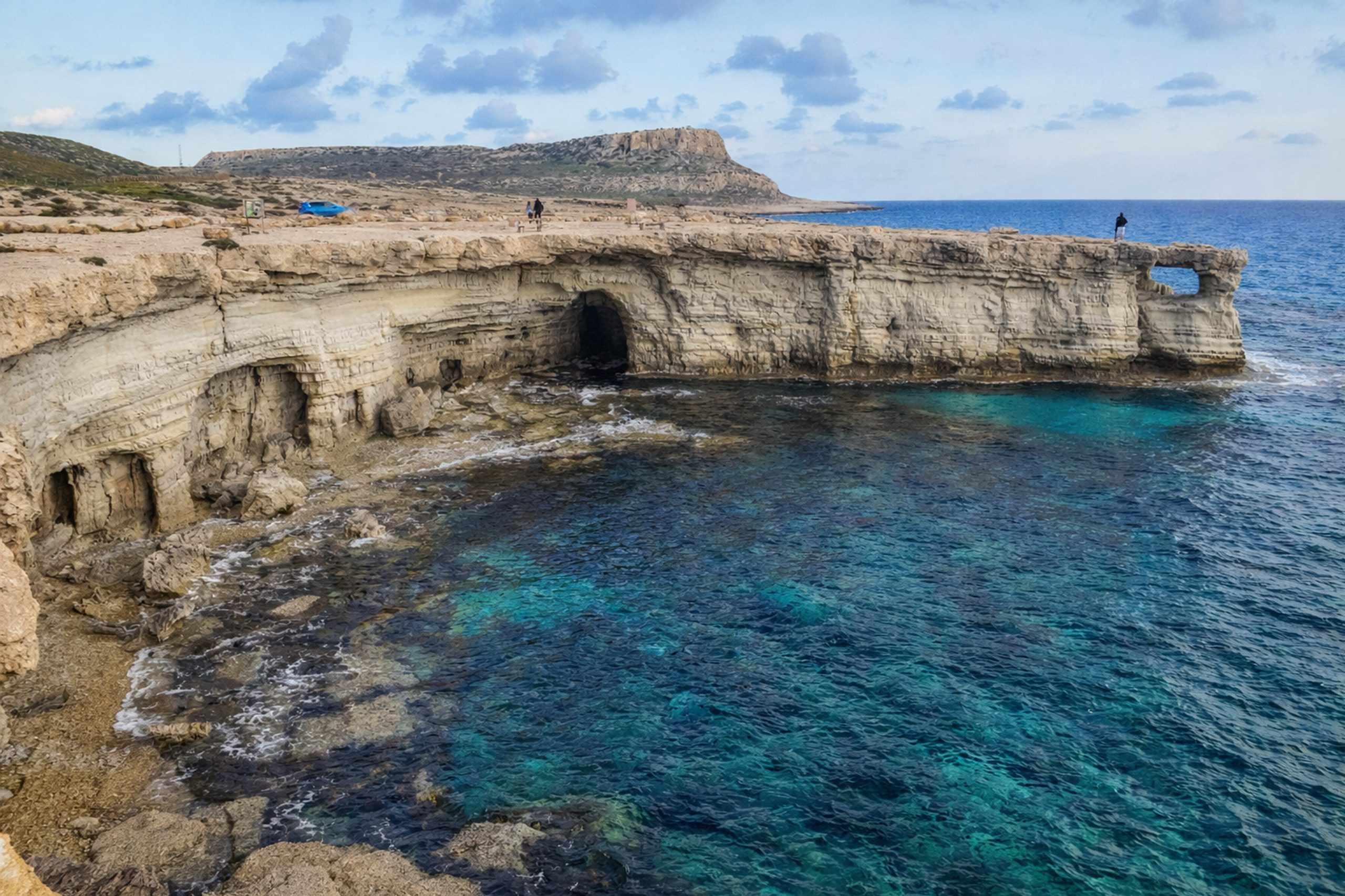
The sea caves form part of the rugged coastline around Cape Greco National Forest Park, positioned between Ayia Napa and Protaras on the southeastern edge of Cyprus. The caves themselves are carved into limestone cliffs that rise 6 to 12 meters above the sea.
Some caves extend up to 80 meters into the rock. The area marks the western boundary of the 385-hectare Cape Greco National Forest Park, designated as protected land in 1993.
Historical Background
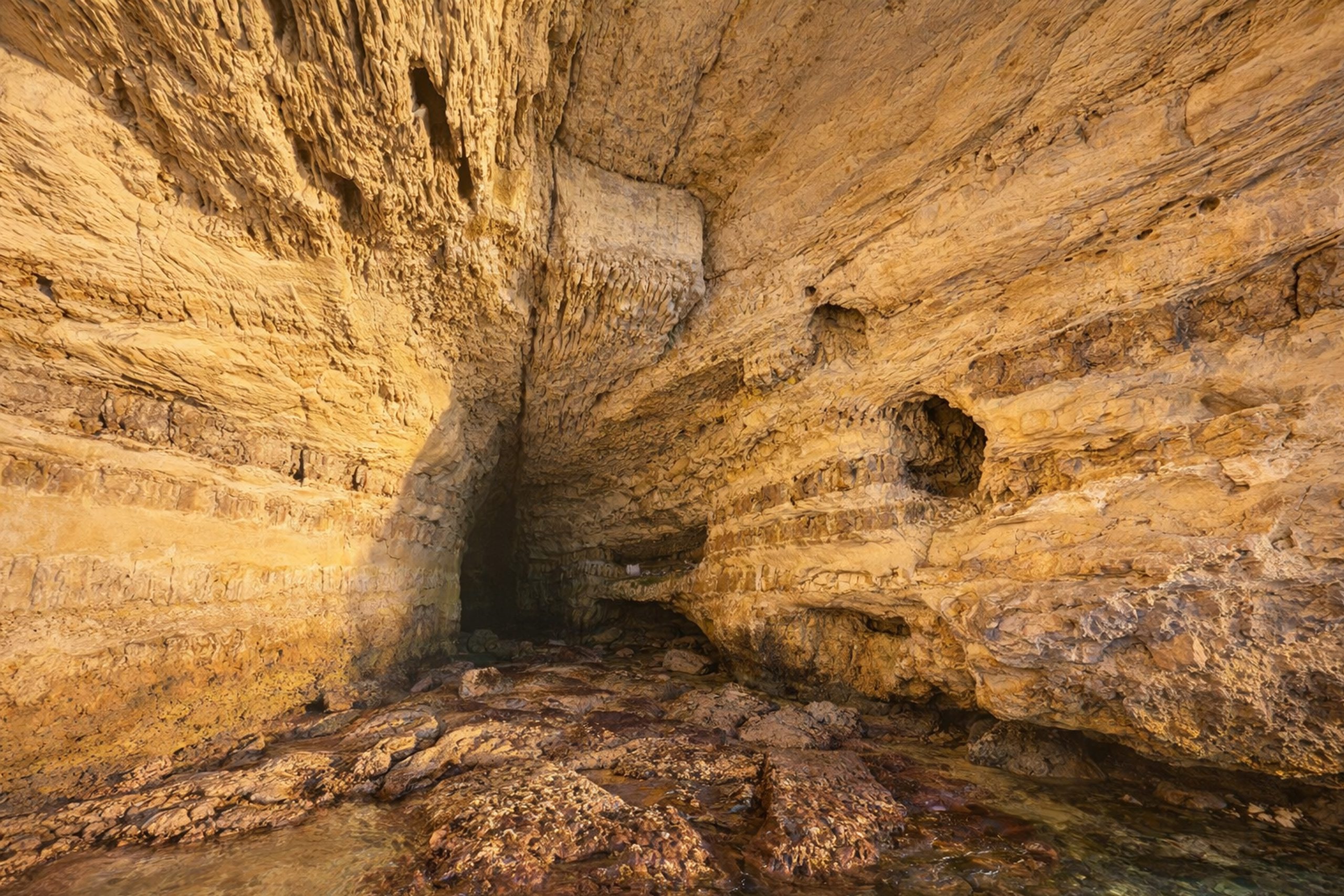
The formation of these caves demonstrates basic geological erosion over thousands of years. The cliffs consist of layered limestone, with each layer having different hardness levels. The middle layer is softer limestone that erodes more easily when waves crash against it repeatedly. The upper layer, made of harder rock, resists erosion better and creates a protective cap over the caves. This prevents collapse while the waves continue hollowing out the softer material underneath. The lowest layer, also harder, forms a natural platform or ledge several meters wide.
Because the layers are not perfectly horizontal, parts of this ledge sit underwater while other sections remain dry. The irregular erosion patterns created by more resistant patches in the soft limestone mean the layer was not completely worn away, leaving natural pillars and rock formations. This process continues today, though changes happen slowly over geological time.
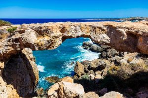
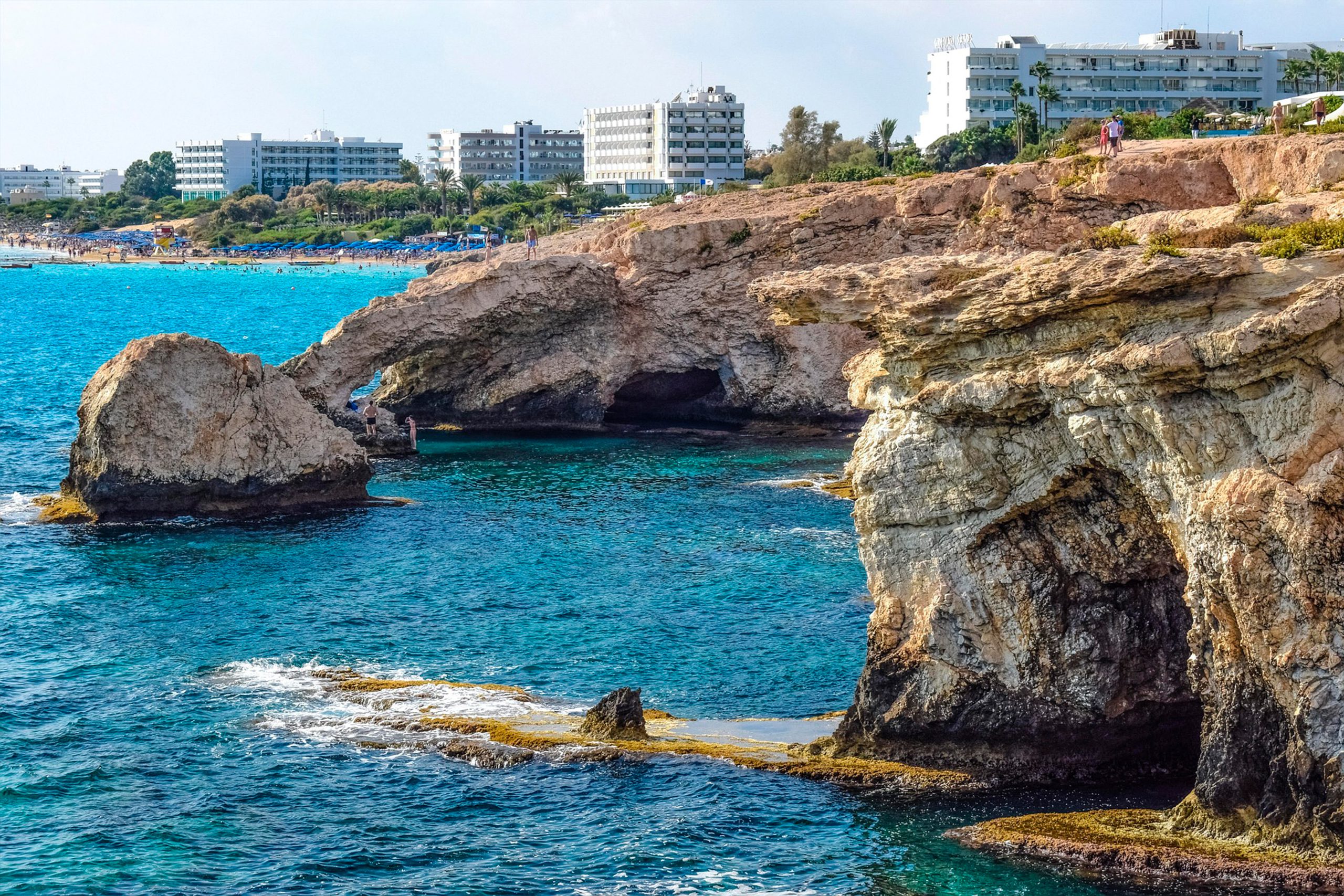
The contrast between the golden-brown limestone cliffs and the electric blue water creates the distinctive visual impact that makes the location popular for photography. The water clarity results from the rocky seabed composition and absence of sediment, producing shades of turquoise and azure that intensify in sunlight.
What Makes These Caves Unique
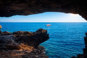
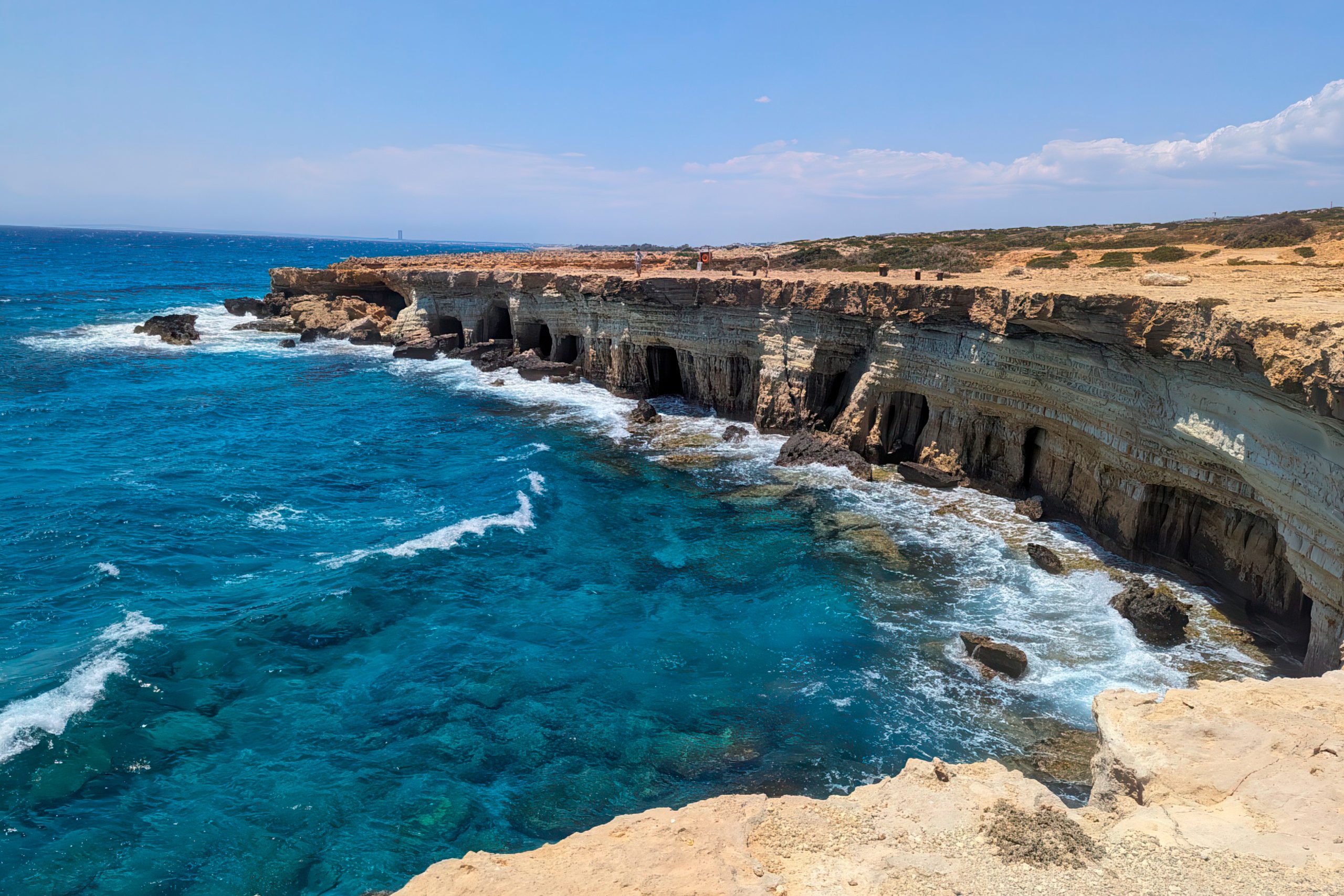
The caves accessible from land differ from those reachable only by water. The main cave, easily approached on foot, offers views across the entire coastline and provides a popular spot for photography. Other formations, including the Palace Caves and Smugglers Caves, require swimming or boat access. These deeper passages can be explored during calm seas at low tide, when some become walkable.
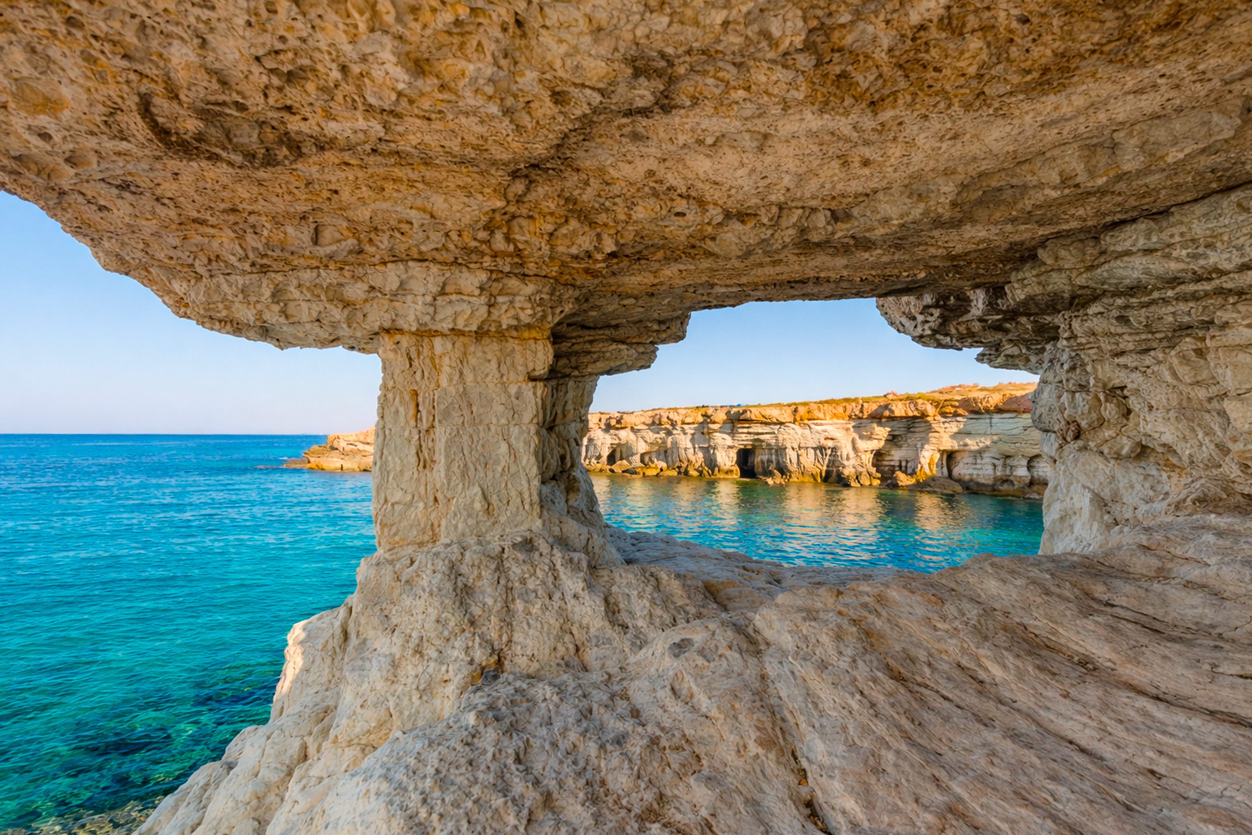
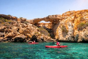
Rock formations include natural arches, tunnels, and chambers created by selective erosion. Some caves feature openings that frame views of the sea like windows, creating natural photo opportunities. The rocky shoreline around the caves drops quickly into deeper water, making it suitable for snorkeling and diving.

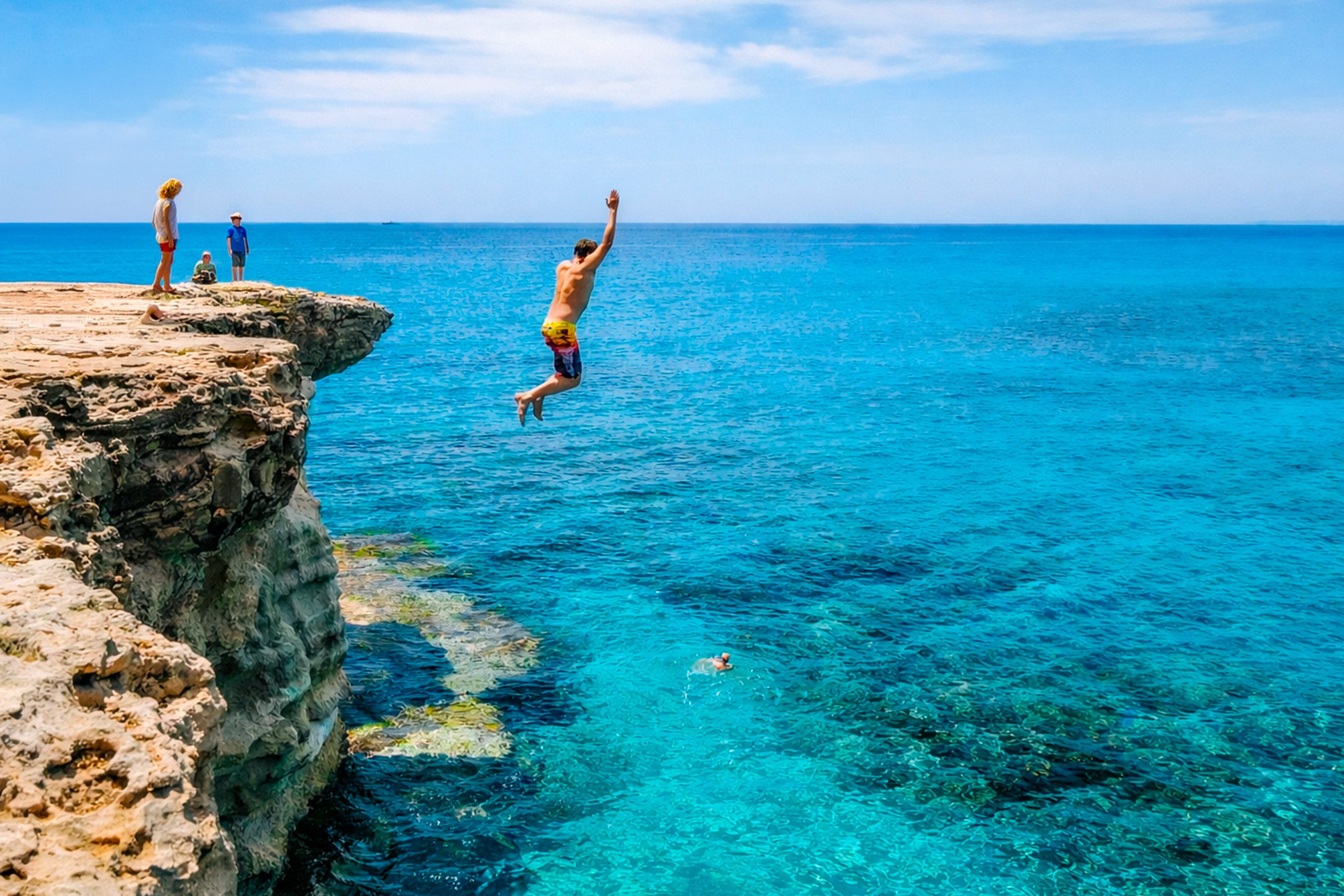
The cliff heights vary from 3 to over 12 meters, creating jumping points for those interested in cliff diving. The most popular jumping areas have been used for years, though water depth and conditions should always be checked before attempting jumps.
Water temperatures remain comfortable throughout summer and into autumn. The rocky seabed supports marine life including fish, octopus, and various invertebrates visible to snorkelers. The underwater visibility typically exceeds 20 meters on calm days.
Interesting Facts About the Location
Local legend suggests pirates and smugglers used these caves during earlier centuries to hide contraband and stolen goods. The deep passages and multiple chambers would have provided concealment from authorities, while the rocky coastline made approach difficult except by sea. While historical evidence of pirate activity remains limited, the stories persist in local tradition.

The area is completely free to visit with no entrance fees. It remains accessible year-round, though conditions vary significantly between summer and winter. Storm activity during colder months creates larger waves that make swimming dangerous and obscure the views with spray.
One particular rock formation called the Love Bridge features a natural stone arch extending from the cliff into the water. Local folklore claims that couples who kiss while standing on the bridge and make a wish will see that wish come true. The formation has become popular for wedding photographs and proposals.
The sea caves mark the starting point for several coastal hiking trails that wind through Cape Greco National Forest Park. These paths offer elevated views of the coastline and connect to other landmarks including the Agioi Anargyroi Chapel and various viewpoints.
Most boat tours departing from Ayia Napa Harbour include the sea caves as a major stop, allowing visitors to view the formations from water level and enter caves not accessible from land.
Current Use and Visitor Experience
The sea caves serve multiple purposes in contemporary Cypriot tourism. They function as a natural attraction that draws visitors away from crowded resort beaches toward a more rugged coastal environment. The area appeals particularly to photographers, adventure seekers, and families looking for natural beauty combined with swimming opportunities.
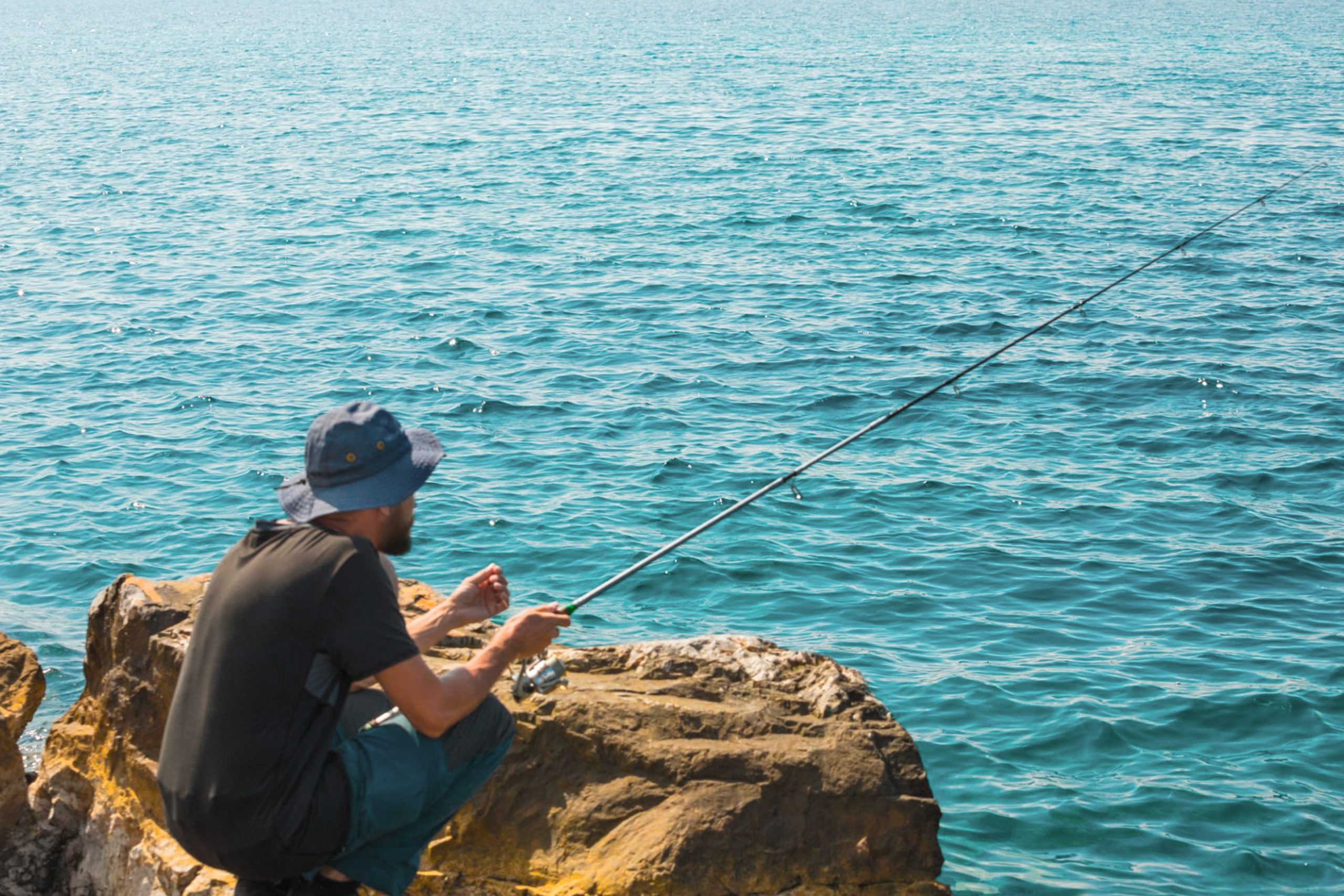
Local fishermen favor the rocky areas around the caves, particularly in early morning hours when they fish for octopus and various Mediterranean species. The 10-meter cliffs have become established as cliff jumping spots, with locals and tourists alike using them for adrenaline activities. Safety remains personal responsibility, as no lifeguards or official supervision exists at the location.
The caves are featured heavily in social media content about Cyprus, making them a recognized landmark that many visitors seek out for photos. Sunrise and sunset provide optimal lighting conditions, transforming the limestone into warm gold and pink tones while casting dramatic shadows across the rock faces.
Several activity providers offer guided kayaking tours that allow participants to paddle directly into cave mouths and explore formations up close. These tours typically launch from nearby Konnos Bay and include equipment and instruction.
Practical Information for Visitors
By car, the sea caves lie approximately 10 minutes east of central Ayia Napa. Follow signs toward Cape Greco and the Grecian Park Hotel, then turn right onto the dirt track marked by a lone carob tree with a bench underneath. The 600-meter unpaved road leads to free parking areas. The road surface is bumpy with loose gravel, making four-wheel drive vehicles, quad bikes, or buggies more comfortable than standard cars.
Public bus routes 101 and 102 run between Ayia Napa and Protaras, stopping at the Cape Greco entrance near the sea caves. Single tickets cost €1.50, while day passes cost €5. The bus drops passengers at the turnoff, requiring a 15 to 20-minute walk down the dirt road to reach the cliff edge. Buses run every 20 to 30 minutes during peak season, less frequently in winter.
Why This Natural Feature Matters
The Ayia Napa Sea Caves demonstrate how geological processes create recognizable landmarks through persistent natural forces. The visible layers in the limestone cliffs serve as evidence of ancient marine environments and sediment deposition over millions of years, now exposed by uplift and erosion.

For Cyprus, the caves represent accessible natural beauty that requires no development to attract visitors. Unlike constructed attractions, these formations exist through geological processes, connecting modern tourism to the island’s ancient geological history.
The balance between accessibility and natural preservation at the site shows how popular destinations can remain largely undeveloped while still serving thousands of visitors annually. The absence of facilities maintains the raw character that makes the location distinctive.
The caves contribute to the broader Cape Greco National Forest Park ecosystem, which protects 385 hectares of coastal and terrestrial habitat. This protection ensures endemic plant species, migratory birds, and marine environments remain intact despite tourism pressure in surrounding areas.
For visitors, the sea caves offer an experience of Mediterranean coastal geology in an active environment where erosion continues to shape the landscape. The combination of dramatic cliffs, clear water, and multiple access methods makes the location suitable for various visitor types, from those seeking adventure to those preferring observation from safe viewpoints.