Explore Cyprus with Our Interactive Map

Explore our top stories and discover ideas worth your time.

Troodos Ophiolite Cyprus

Troodos Ophiolite Cyprus

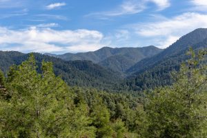
If you ever want to surprise someone in Cyprus, do not take them to a museum. Take them to Troodos. As you drive up from any direction you will first pass citrus groves, almond orchards and vineyards. Then pine appears. The air cools. The road winds higher. Somewhere above the clouds you stop, step out of the car and pick up a stone. And you are holding a piece of the Earth that once lay kilometres beneath a vanished ocean. This is not a poetic exaggeration. Troodos is one of the very few places on the planet where a complete section of oceanic crust and upper mantle stands above sea level. What scientists normally reach only with deep-sea drilling ships, submarines and expensive research programmes lies here beside hiking paths, picnic sites and village roads. Within roughly fifty kilometres you can travel from rocks that formed deep inside the mantle to rocks that erupted on the seafloor, then into sediments that later surrounded the rising island. You are not simply climbing or going down a mountain. You are walking through the internal anatomy of the Earth itself. In the 1960s geologists were still debating whether continents actually moved. The theory of plate tectonics existed but needed proof. Troodos provided it. Here, predictions matched reality: magma chambers, feeder dykes and submarine…

Read more
Cape Greco Sea Cliffs And Caves

Cape Greco Sea Cliffs And Caves

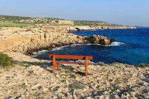
Cape Greco rises from the Mediterranean Sea at Cyprus's southeastern tip, where limestone cliffs drop sharply into turquoise waters, and erosion has carved spectacular sea caves that extend up to 80 metres into solid rock. Cape Greco, also known as Capo Greco or Kavo Greko, forms a rocky peninsula jutting into the Mediterranean between the resort towns of Ayia Napa and Protaras. The headland marks the easternmost point of both the Republic of Cyprus and the European Union, excluding outlying territories. The area covers 385 hectares protected as National Forest Park under the Cyprus Forestry Department since 1993, with additional recognition as part of the Natura 2000 network for its European ecological significance. Historical Background The limestone cliffs at Cape Greco formed from sediments deposited when shallow seas covered the region millions of years ago. Marine organisms including mollusks, corals, and microscopic creatures contributed calcium carbonate that accumulated on the seabed and eventually compressed into rock layers. Tectonic activity lifted these sediments above sea level, creating the elevated plateau that characterizes the cape today. Wave erosion shaped the detailed features that make Cape Greco distinctive. Constant pounding by Mediterranean storms exploits weaknesses in the limestone, gradually hollowing out caves, cutting through narrow points to form arches, and creating vertical channels where waves compress and release with explosive force. This process…

Read more
Rural Farming Life in Cyprus

Rural Farming Life in Cyprus

Agriculture constituted the backbone of Cyprus's economy when the country achieved independence in 1960, consisting mostly of small farms and sometimes even subsistence operations. In the early 1970s, Cypriot farms, still overwhelmingly small owner-run units, furnished about 70 percent of commodity exports and employed about 95,000 people, or one-third of the island's economically active population. The traditional rural landscape featured fragmented holdings where families worked terraced hillsides and valley floors, producing grapes, olives, wheat, barley, carobs, and seasonal vegetables. This farming pattern shaped village life for centuries, creating rhythms of planting, harvesting, and communal celebration that defined Cypriot identity as much as the Orthodox church or family structures. How Villages Worked the Land Landholdings remained generally small, highly fragmented, and dispersed under traditional laws of inheritance. When a father died, his land divided equally among all children, creating increasingly smaller parcels with each generation. A single family might own a dozen tiny plots scattered across the village territory, requiring farmers to travel between distant fields throughout the day. This fragmentation made mechanization difficult and reduced efficiency. Traditional irrigation relied on natural springs, small rivers, and rainfall patterns. Farmers channeled spring water through stone aqueducts and earthen channels to reach thirsty crops during summer months. Villages located near reliable water sources prospered, while those depending solely on rainfall struggled during dry…

Read more