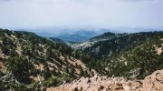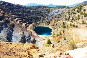
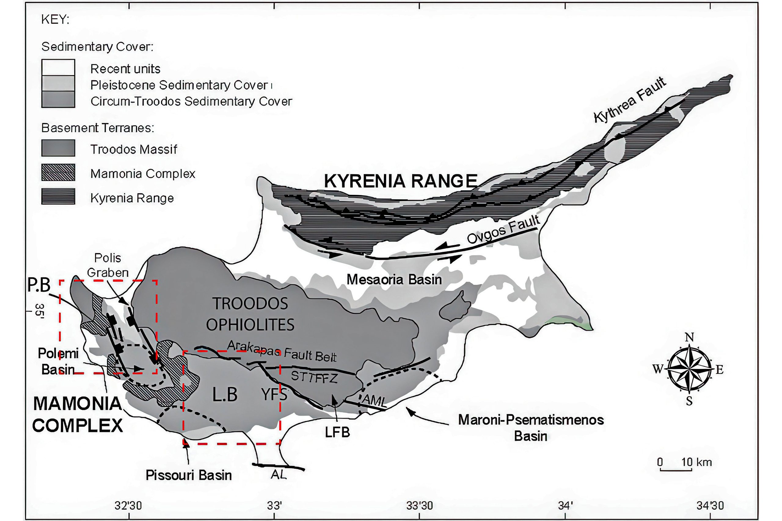
The Limassol-Lefkosia region contains several major fault systems, with the Southern Troodos Transform Fault Zone being the most significant. This fault zone runs along the southern margin of the Troodos ophiolite, the massive block of ocean floor rock that forms the central mountains of Cyprus. The fault is at least 5 kilometers wide in some places and trends east to west across the island.
Transform faults are places where two tectonic plates slide horizontally past each other rather than colliding or pulling apart. The Southern Troodos Transform Fault formed around 90 million years ago on the ocean floor when Cyprus was still underwater. The fault separated two spreading ridges where new ocean crust was being created, much like the San Andreas Fault in California separates two plates today.
Historical Background
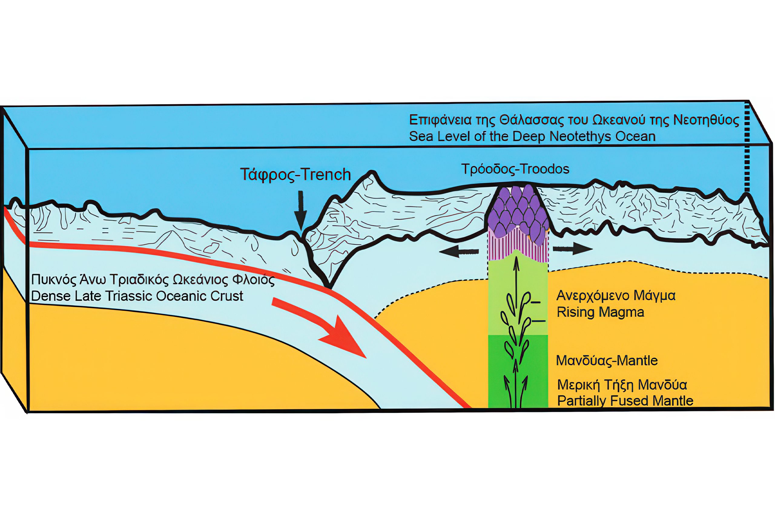
About 90 million years ago, during the Late Cretaceous period, Cyprus didn’t exist as an island. Instead, the rocks that now form the Troodos Mountains were part of the Neotethys Ocean seafloor. At underwater spreading ridges, hot magma rose from deep in the Earth and created new ocean crust. This process happened in a region above a subduction zone where one tectonic plate was diving beneath another.
The transform fault developed perpendicular to these spreading ridges and allowed different sections of ocean floor to move past each other. As the seafloor spread, the fault zone became a complex area of broken and rotated rock blocks. Some blocks twisted clockwise by more than 100 degrees while others only tilted slightly. This created the chaotic geology we see today in the Limassol Forest area.
Around 8 to 2 million years ago, the African tectonic plate began pushing northward into the Eurasian plate. This collision forced the Troodos ocean floor upward out of the sea. The center of the ophiolite, now Mount Olympus at 1,952 meters elevation, rose highest because it sat above a fragment of continental crust being pushed underneath. The transform fault zone along the southern edge tilted and rotated as the whole mass lifted up.
The Arakapas Fault Belt
The northern boundary of the transform zone is marked by the Arakapas Fault Belt, which runs east to west and separates the main Troodos ophiolite from the Limassol Forest Complex. This roughly 1-kilometer-wide zone contains coarse sediments, hydrothermally altered rocks, and submarine lava flows that erupted directly on the ocean floor along the fault.
Cross-cutting relationships show that the rotations happened during the creation of the oceanic crust, not later. This means the transform fault was active while new seafloor was being made and not a feature that developed after the ocean floor had already formed.
What Makes This Fault System Special
The Southern Troodos Transform Fault Zone is one of the best-preserved examples of an ancient ocean transform fault anywhere on Earth. Most transform faults remain on the ocean floor where they’re hard to study. The few that have been pushed onto land are usually so deformed by later tectonic events that their original features are destroyed.
Cyprus is different because the Troodos ophiolite was gently lifted without being squeezed or twisted too much. This means the transform fault zone looks almost exactly as it did when it was on the ocean floor. Geologists can walk across rocks that were once several kilometers below the sea and see structures that normally require submarines or deep drilling to observe.
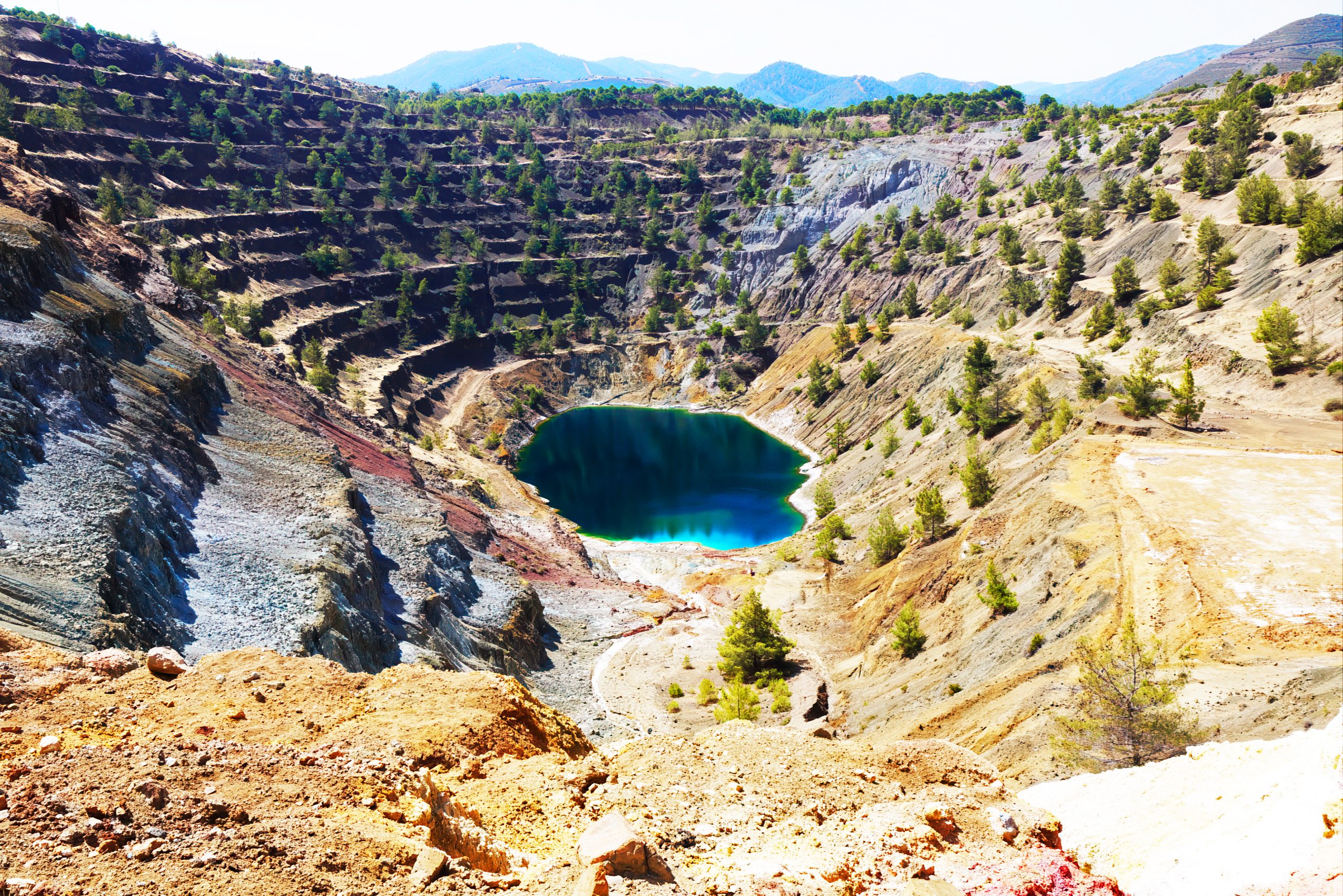
Over 90 locations in the Limassol Forest preserve ancient “black smoker” mineral deposits where hot water rich in metals erupted onto the seafloor. These deposits formed along cracks in the transform fault zone where seawater circulated deep into hot rocks and dissolved copper, iron, and sulfur before returning to the seafloor. Modern equivalents of these black smokers are being mined on the ocean floor today.
Cyprus and Active Tectonics
Cyprus sits in one of the most tectonically active regions on Earth. The African plate continues to push northward into the Anatolian microplate at about 10 millimeters per year. This ongoing collision causes earthquakes and continues to uplift the Troodos Mountains. Mount Olympus rises about 1 to 2 millimeters per year, a slow but measurable process.
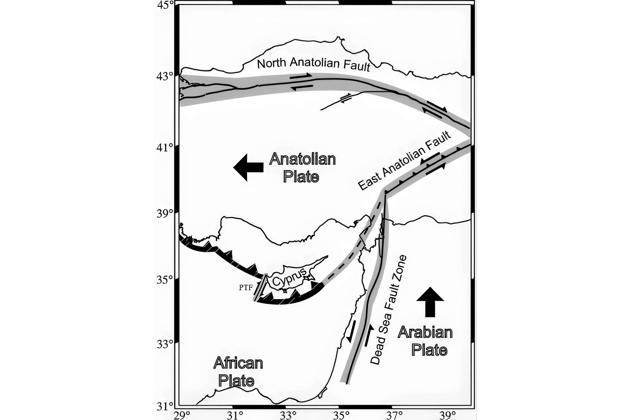
The Cyprus Arc, a curved zone south of the island, marks where the African plate is being pushed beneath the Anatolian plate in a process called subduction. This is the same geological setting where Troodos originally formed 90 million years ago, creating an interesting parallel between ancient and modern tectonic processes.
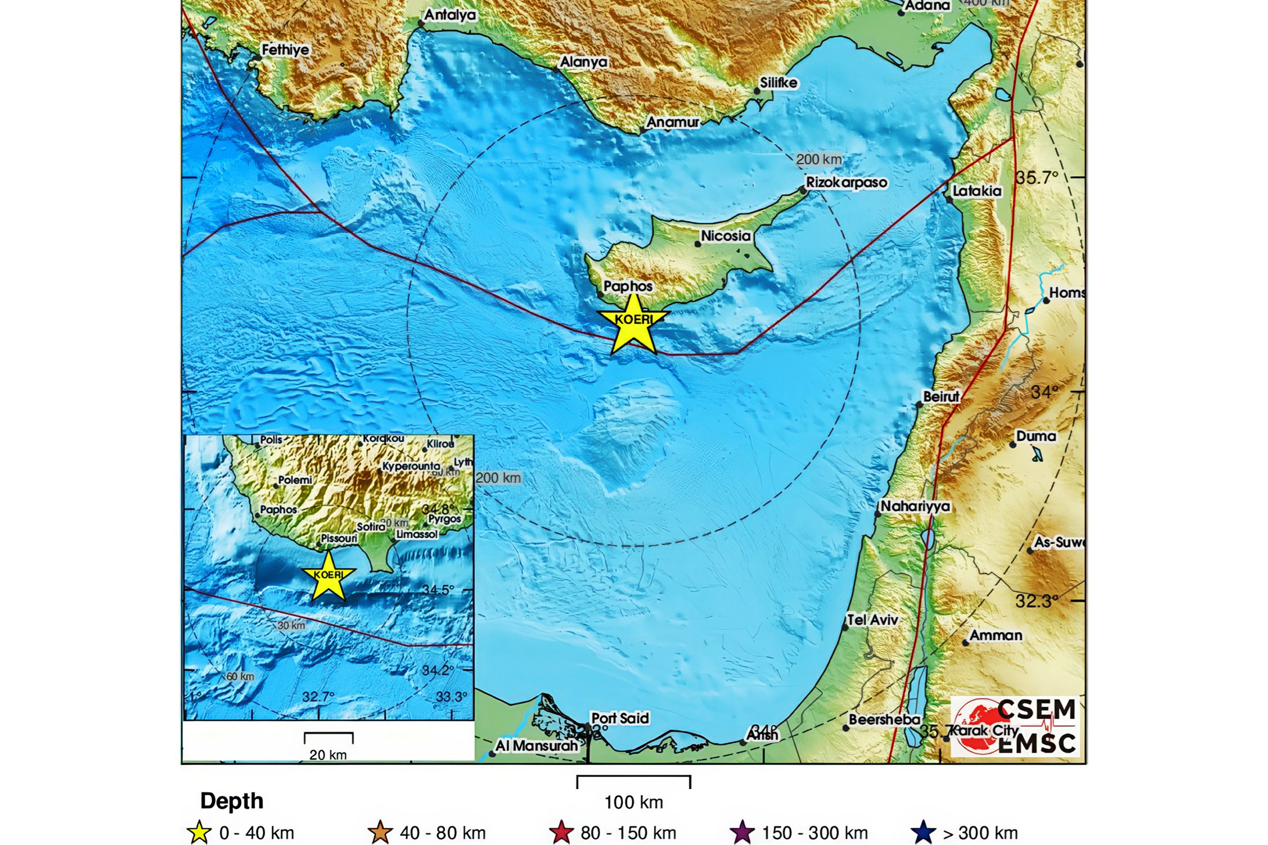
Earthquakes occur regularly in Cyprus, especially in the Limassol and Paphos districts. Most are small and cause no damage, but historical records document destructive earthquakes in 15 AD, 332 AD, 342 AD, and more recently in 1953 and 1995. These earthquakes happen along faults related to the ongoing collision between Africa and Anatolia.
Why Geologists Study These Fault Zones
Scientists from around the world come to Cyprus to study the transform fault zone because it provides a natural laboratory for understanding ocean floor processes. The exposed rocks allow detailed mapping and sampling that’s impossible on the deep seafloor. Researchers can walk along former fault planes and examine exactly how the rocks deformed.
The fault zone also helps us understand how copper and other metals concentrate in the Earth’s crust. The black smoker deposits in the Limassol Forest formed by the same processes that create valuable ore deposits on the modern seafloor. Mining companies study these ancient systems to help find new mineral deposits in similar geological settings.
Climate scientists use the fault zone rocks to study how carbon dioxide gets locked into ocean floor rocks. When seawater reacts with mantle rocks to form serpentinite, it removes CO2 from seawater. Understanding this process helps predict how the oceans will respond to increasing atmospheric CO2.
UNESCO Recognition
In 2015, UNESCO designated the Troodos ophiolite as a Global Geopark in recognition of its exceptional geological significance. The transform fault zone is specifically highlighted as one of the key features that make Troodos globally important. This designation helps protect the area and promotes geological education and sustainable tourism.
The geopark designation means that development in the area must consider geological heritage. Quarries cannot be opened in scientifically important locations, and road construction must avoid damaging key outcrops. This helps preserve these rocks for future scientific study and education.
Visiting the Fault Zone Areas
The main road between Limassol and Nicosia (A1 motorway) passes near but not directly through the fault zone. To see the transform fault rocks up close, take the old road through villages like Arakapas, Ora, and Kato Mylos. These smaller roads wind through the Limassol Forest and provide access to areas where the fault zone rocks are exposed.
The Troodos Geopark has established several geosites with information panels explaining the geology. The Arakapas Forest geosite includes walking trails through serpentinite and gabbro with views of the fault structures.
For the best experience, visit in spring (March to May) when wildflowers bloom and temperatures are mild. The area gets very hot in summer and can be muddy and cold in winter. Bring water, sun protection, and sturdy shoes suitable for walking on rocky, uneven terrain.
A Window Into Earth’s Interior
The Limassol-Lefkosia fault zones matter because they give us a rare glimpse into processes that normally happen far beneath our feet or deep under the ocean. The rocks here started in the Earth’s mantle, moved up to form new ocean crust at spreading ridges, slid sideways along transform faults, got pushed up onto land, and now sit in forests where we can touch them and study them.
This journey from mantle to mountain preserves a record of how our planet works. The transform fault in particular shows how ocean floors break apart and slide past each other, creating the complex seafloor topography that controls ocean currents, marine life, and mineral resources.