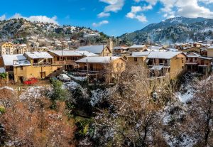
Kakopetria is a mountain village in the Troodos range that combines well preserved traditional buildings with important Byzantine heritage. It lies fifty five kilometers from both Nicosia and Limassol, stands at six hundred sixty seven meters above sea level, and offers a clear picture of Cyprus rural life with several important religious monuments.

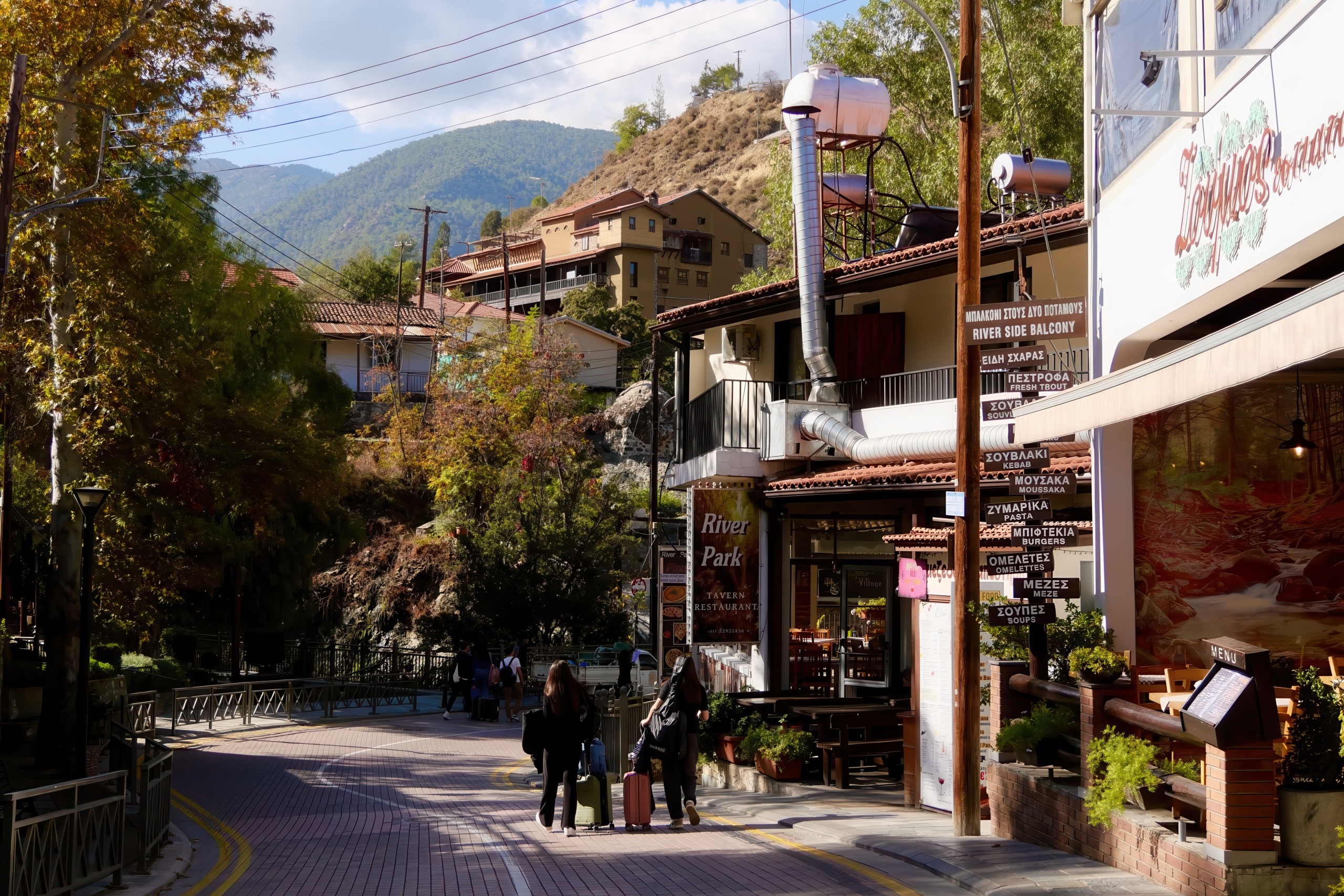
Two rivers, the Kargotis and the Garillis, pass through the village and join to form the Klarios River, which flows through the valley toward Morphou Bay. These rivers shaped the growth of the village and gave it a rich green landscape. Unlike many parts of Cyprus, Kakopetria has flowing water throughout the year. This supports dense vegetation such as plane trees, fruit gardens, and pine trees. The climate remains fairly dry with an average yearly rainfall of six hundred forty eight millimeters, while the higher elevation keeps temperatures cooler than coastal areas.
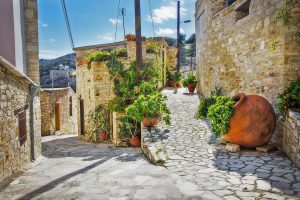
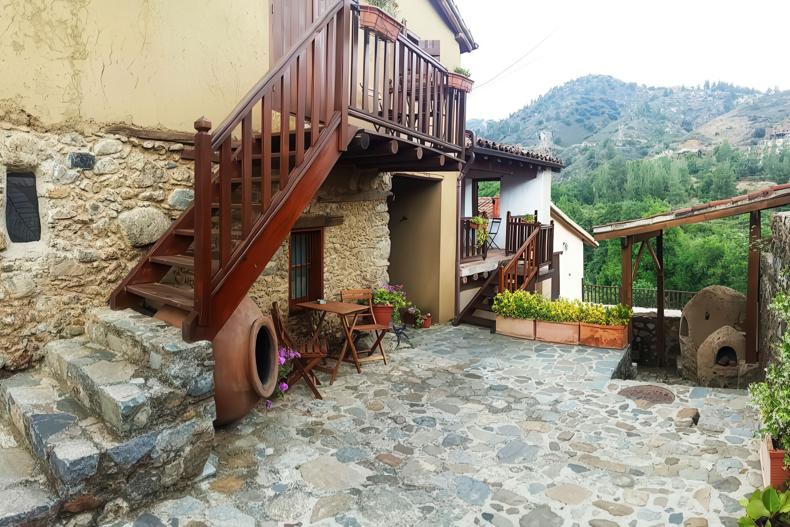
The village is divided into two main areas. Old Kakopetria, also called Palia Kakopetria, lies between the two rivers and keeps its traditional character through narrow stone streets and two story stone houses with wooden balconies. New Kakopetria stretches toward the eastern side of the valley and features newer buildings. The old section received protected cultural heritage status, which ensures the preservation of its eighteenth and nineteenth century architecture.
Historical Development
Archaeological evidence from 1938 excavations revealed artifacts dating to the 6th-7th centuries, including terra-cotta figures depicting the goddess Athena, limestone statues, and bronze and iron weapon fragments from the Archaic and Classical periods. These findings suggest the area was inhabited long before the medieval period. The settlement appears in medieval records under variations like Cacopetria and Chachopetria, indicating its existence during the Frankish period (1192-1489).
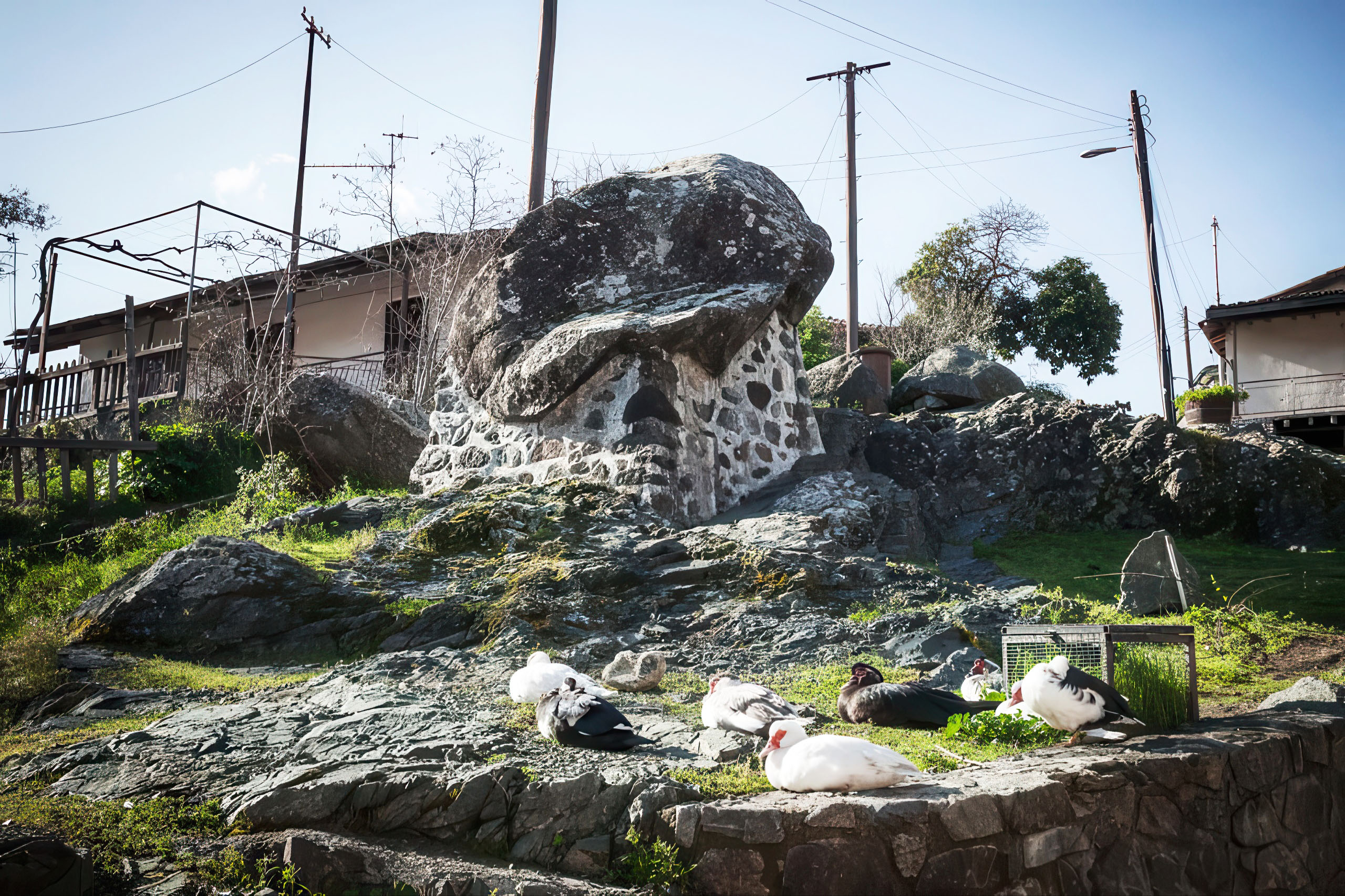
The village name derives from Greek words meaning “bad stone,” linked to a local legend. According to tradition, a large boulder called “Petra tou Androgynou” (Couples’ Rock) rolled over a newlywed couple, giving the rock and subsequently the village its ominous name. The boulder still stands near the village entrance, now secured to prevent movement.
The layout of New Kakopetria has its own historical context. In 1922, the Holy Archdiocese of Cyprus divided land formerly belonging to the Agios Nikolaos tis Stegis Monastery into 120 building plots distributed to residents by lottery. This led to organized development of the new village with its characteristic plane trees and central plaza.
For many years, Kakopetria was renowned for silkworm breeding and silk production, continuing until after World War II. During the war, British authorities requisitioned all silk production from Kakopetria and other Cypriot villages for parachute manufacturing. This industry represented a significant economic activity before tourism emerged as a major source of income.
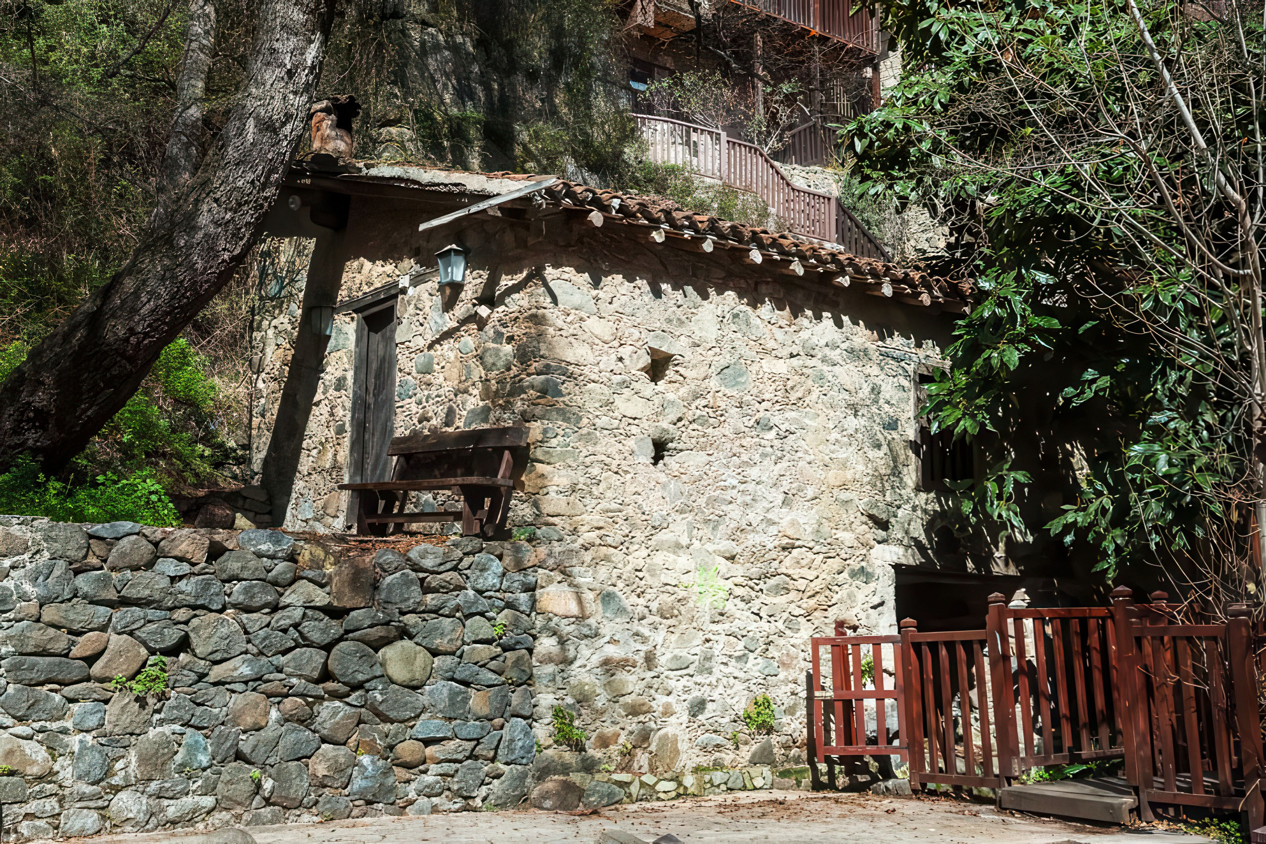
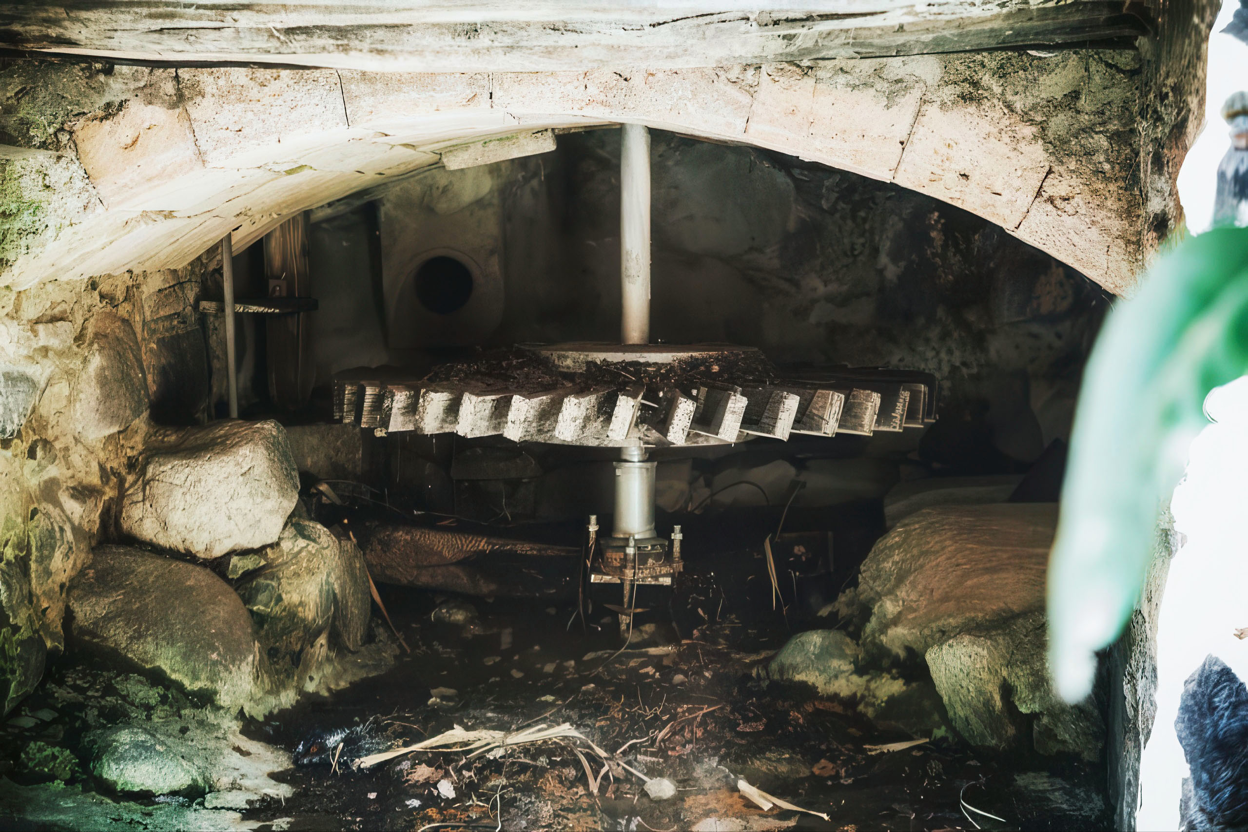
The rivers powered numerous water mills that processed grain and cereals. The watermill “Mylos tis Gonias” operated from 1754, grinding barley and grain. These mills were essential to the local economy and attracted people from across Cyprus, despite journeys that could take up to 12 days round trip. The village also developed a hydroelectric power station in 1926, initiated by resident Christos Vasiliou, marking an early adoption of modern technology in rural Cyprus.
Agriculture remains important, with the area producing apples (for which Kakopetria is particularly known), pears, plums, apricots, peaches, cherries, potatoes, tomatoes, and both table and wine grapes.
Byzantine Churches
The most important religious monument near Kakopetria is Agios Nikolaos tis Stegis, an eleventh century Byzantine monastery church and the only surviving Middle Byzantine katholikon in Cyprus from that time. It lies about five kilometers from the village and received UNESCO World Heritage status in 1985 as one of the ten Painted Churches of the Troodos Region.
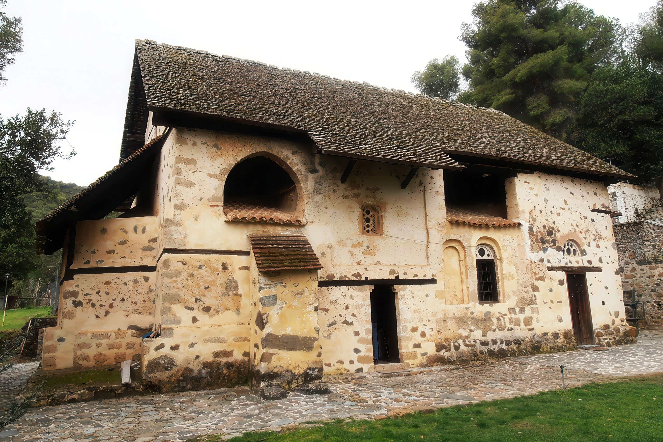
The church has a domed cross in square design and gained its special name, meaning “of the Roof,” from a steep wooden roof added in the twelfth century to protect the structure. Inside, the walls display frescoes that cover more than six hundred years of artistic work, with the oldest paintings dating to the eleventh century.
In the old village center stands the Church of the Transfiguration of the Savior, known locally as Metamorfosis tou Sotiros, built in 1520. This stone basilica served as the main village church until 1994 and can hold between one hundred and one hundred fifty worshippers. During expansion work in 1880 and 1960, workers uncovered fragments of frescoes beneath the floor, which suggests the presence of earlier painted decoration.
Cultural Preservation
Two museums in Old Kakopetria document traditional rural life. The Linos Museum occupies a renovated building on the main street and explores three themes: wine, bread, and olive oil production. Visitors can see the large grape press operated by donkeys, storage tanks for grape juice, and displays explaining traditional production methods. The museum building itself underwent restoration using European funds through cooperation between the Pancyprian Organization of Architectural Heritage and the Department of Town Planning and Housing.
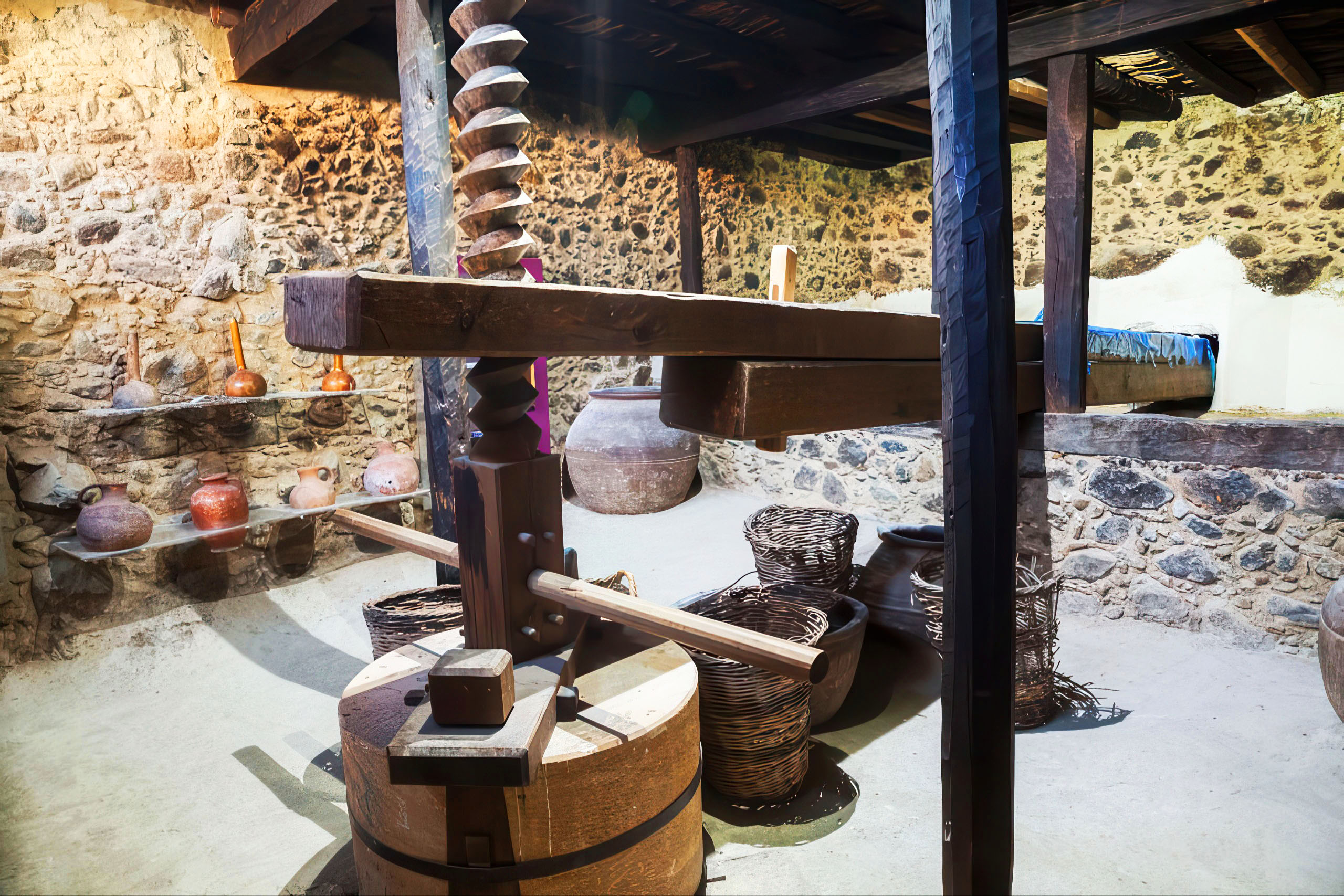
The Olive Mill Museum, housed in the courtyard of the Church of Sotiros, displays a traditional mill with its characteristic components. The mill used two stones: the “skoutellin” (a circular basin) and the millstone (a round stone with a central hole for a horizontal beam). Four men would push the beam in a circular motion to crush olives placed beneath the millstone. The resulting pulp was then pressed to extract oil. This mill no longer operates but demonstrates the labor-intensive nature of traditional olive oil production.
Tourism Development
The village’s cool climate, proximity to Nicosia and Limassol, and scenic setting attracted wealthy families for summer vacations beginning in 1918, when the first visitors arrived by wagon. This early tourism encouraged residents to develop accommodations and services. Today, Kakopetria maintains approximately 1,200 permanent residents, with numbers increasing during summer months when people return to their family homes or visit their summer properties.
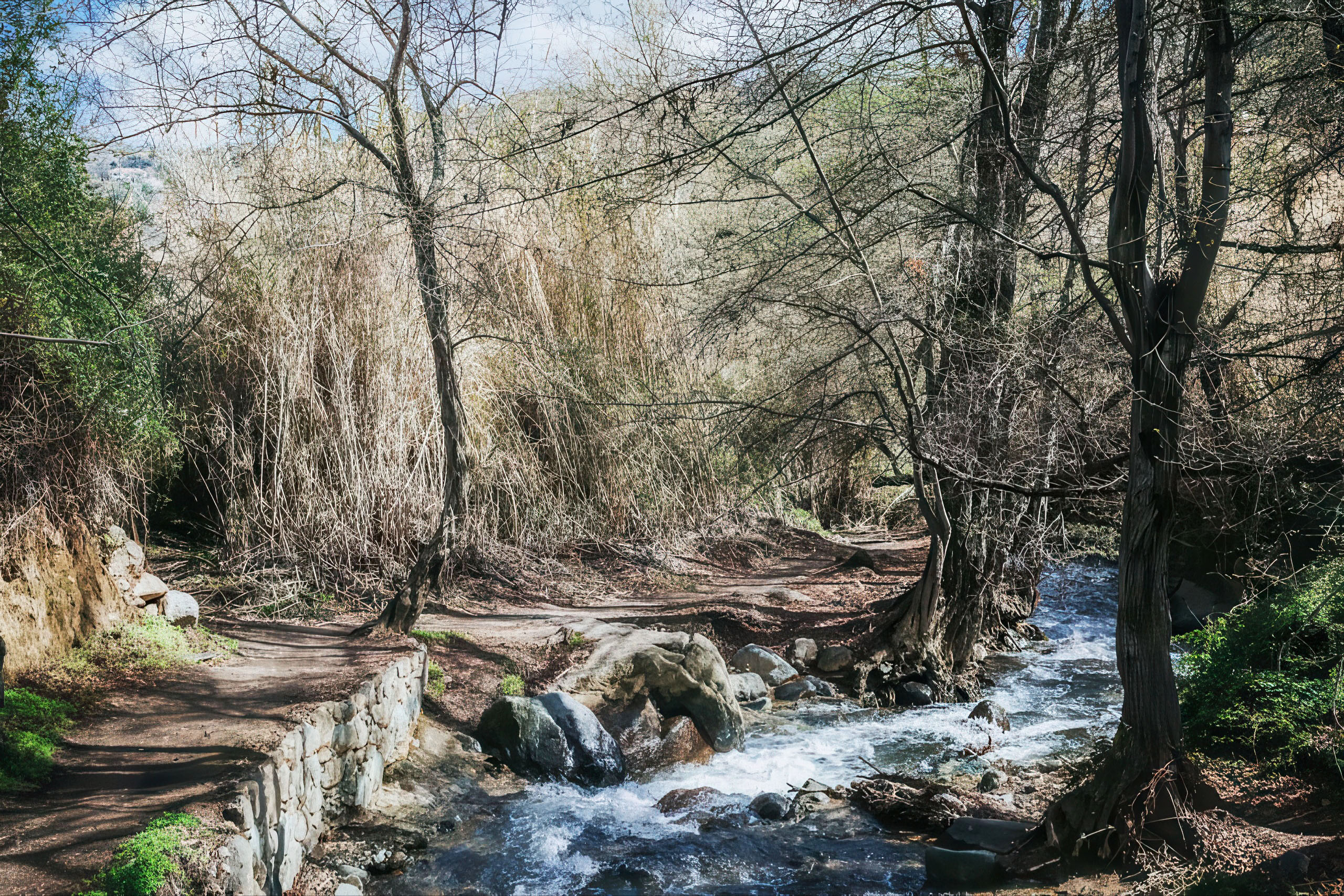
The village offers nature trails along the riverbanks, including paths through pine forests and past old water mills. The Troodos Forest surrounding Kakopetria covers extensive areas with opportunities for hiking and exploring. In autumn, the foliage displays golden and red colors unusual for Cyprus, while winter occasionally brings snow to the mountain peaks.
Contemporary Significance
Kakopetria stands as an important example of heritage conservation in Cyprus. The protected status of Old Kakopetria has encouraged careful restoration of traditional buildings, many of which now function as guesthouses, cafes, and craft shops. This adaptive reuse protects architectural character while also supporting the local economy through tourism.
The village continues to host traditional festivals and religious celebrations that welcome visitors and link present day life with long established customs. Local tavernas offer mountain cuisine prepared with ingredients from nearby farms, including slow cooked meat dishes, fresh trout, and locally produced wine and zivania, a traditional spirit.
The Byzantine churches, especially Agios Nikolaos tis Stegis, attract scholars and visitors with an interest in medieval art and architecture. The UNESCO designation has brought international recognition and strengthened conservation efforts. These monuments highlight Cyprus’s contribution to Byzantine artistic development and provide a direct connection to the island’s medieval past.
Enduring Value
Kakopetria shows how traditional mountain communities can respond to modern conditions while preserving their core identity. Protected architecture, active churches, working farms, and a resident population shape a living village rather than a static historical site. The Byzantine monuments add artistic and historical value that extends beyond Cyprus into the wider Mediterranean region. For those interested in traditional Cypriot mountain life and medieval religious art, Kakopetria offers direct access to both within a compact and easily accessible location.