The Akamas Peninsula juts into the Mediterranean Sea at Cyprus’s northwestern tip, covering 230 square kilometres of protected wilderness. Akamas represents the last significant untouched coastal area on Cyprus, a roadless peninsula where development remains minimal and natural processes continue largely undisturbed.
The area extends from the town of Peyia in the south to Polis Chrysochous in the northeast, with the actual headland pointing west into open Mediterranean waters. Unlike most of Cyprus, which shows clear evidence of thousands of years of human modification, Akamas retains a wild character through a combination of difficult terrain, limited water resources, and protective designations.
Until 2000, the British Army used Akamas as a training ground and firing range under the 1960 Treaty of Establishment, which allowed up to 70 days of annual military exercises. This restricted access inadvertently preserved natural habitats by preventing agricultural expansion and tourist development. When military use ended, conservation groups successfully argued for maintaining protection through different legal mechanisms.
Historical Background
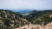
Geological processes spanning millions of years created Akamas’s distinctive terrain. Limestone formations dominate, deposited when seas covered the region during various periods. Tectonic uplift raised these sediments above sea level, creating the elevated plateau that characterizes the interior. Erosion carved gorges and sea caves where water cut through softer rock layers, exposing cross-sections of geological history.
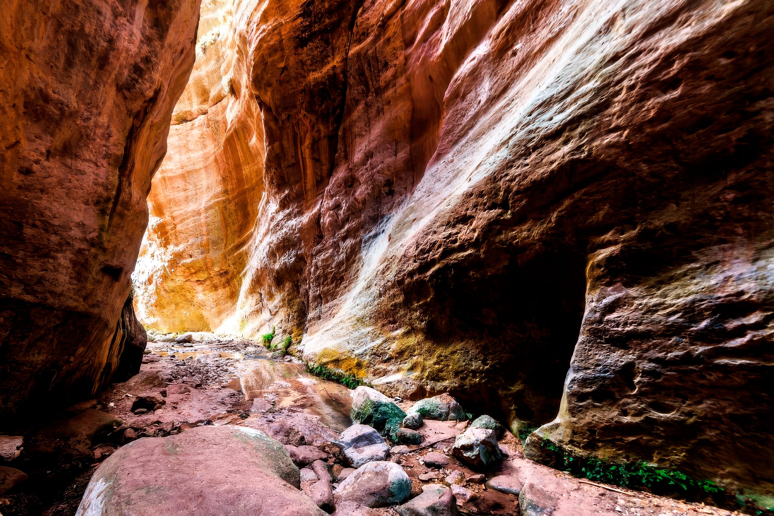
The Avakas Gorge exemplifies this process. Water flowing from winter rains and spring runoff carved a narrow canyon through limestone over thousands of years, creating vertical walls reaching 30 metres height in places while the gorge narrows to just 3 metres width at its tightest sections. The gorge stretches approximately 2.5 kilometres and demonstrates active erosion continuing to reshape the landscape.
According to Greek mythology, the peninsula takes its name from Akamas, son of the hero Theseus, who supposedly arrived here after fighting in the Trojan War and founded the nearby city-kingdom of Soli. Ancient writers including Ptolemy described Akamas as a thickly wooded headland divided by summits rising toward the north, suggesting denser forest cover existed in classical times compared to current conditions.
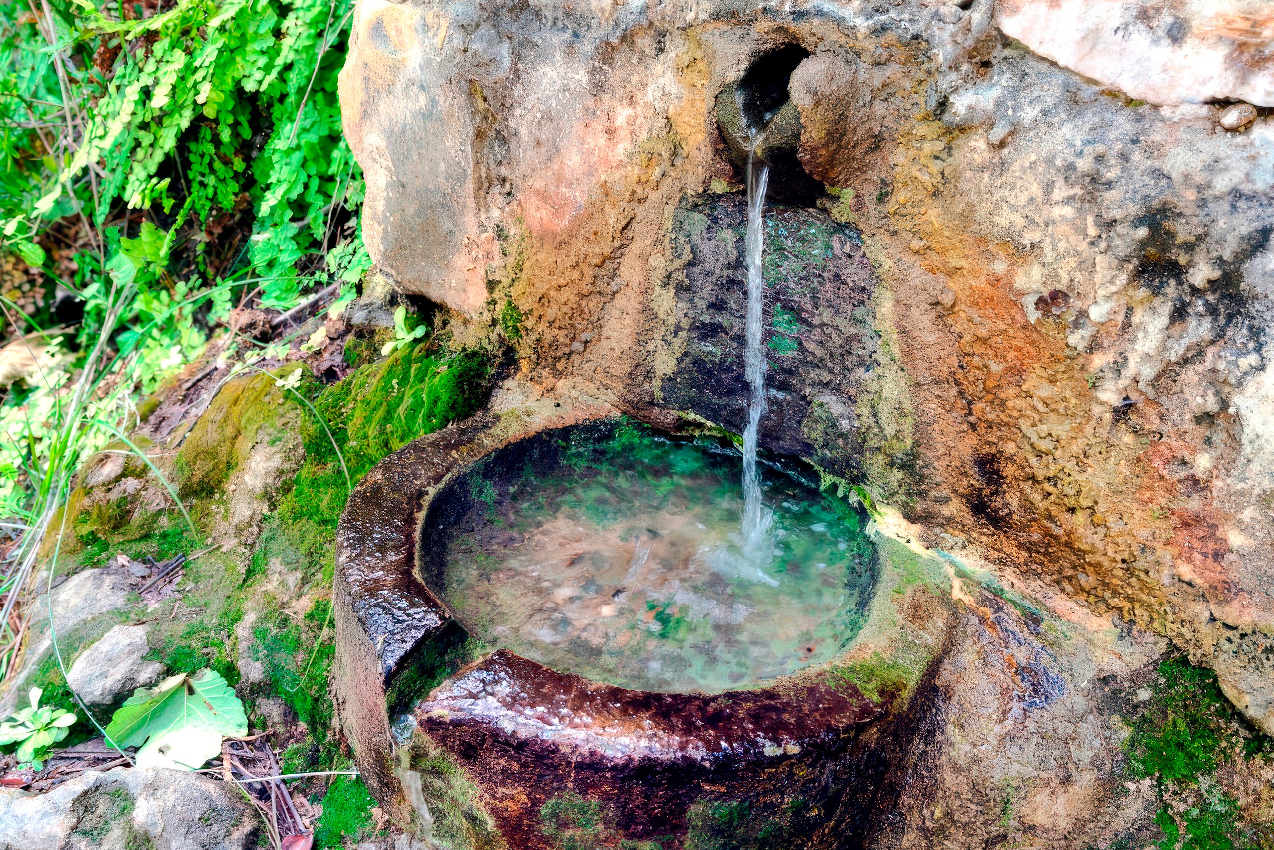
The region connects strongly to Aphrodite, the goddess of love, who emerged from sea foam near Cyprus according to myth. Local landmarks reference her story with Adonis, including the Baths of Aphrodite, where she supposedly bathed and first met her lover. Fontana Amorosa, meaning “spring of love,” is said to be her fountain where anyone drinking will experience renewed passion. These mythological associations attract visitors seeking connections between landscape and ancient stories.
What Makes Akamas Ecologically Exceptional
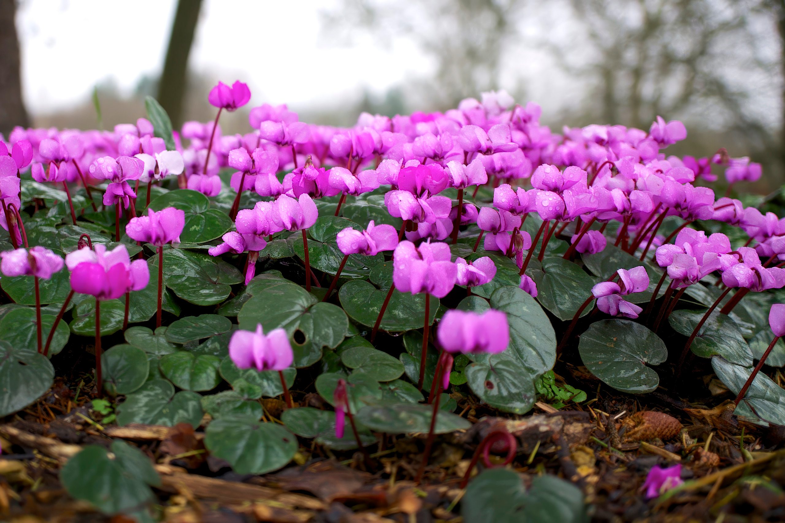
The peninsula supports over 600 plant species, with 39 of Cyprus’s 128 endemic species found within Akamas boundaries. Several grow nowhere else on Earth except in this specific area. Alyssum akamasicum exists only on Akamas. The Akamas tulip (Tulipa akamasica) and Akamas centaury (Centaurea akamantis) similarly occur nowhere beyond these limestone slopes. This extreme endemism reflects geological isolation and the peninsula’s position at the convergence of different climate zones.
Wildflowers transform the landscape during spring. Cyclamens emerge pink and white from rocky crevices. Turban buttercups add yellow highlights. Cyprus tulips bloom in protected locations. Over 20 orchid species appear across different elevations and microclimates, from coastal scrub to forested interior zones. Yellow gorse and white rock rose cover sun-exposed slopes with colour and fragrance that intensifies in warm conditions.
Endemic pine forests of Calabrian pine mix with golden oak, carob, and juniper species adapted to Mediterranean drought and poor soils. Some oak specimens reach substantial age and size, with one ancient tree identified as potentially the oldest on Cyprus. These forests support diverse bird populations and provide crucial cover for mammals avoiding midday heat.
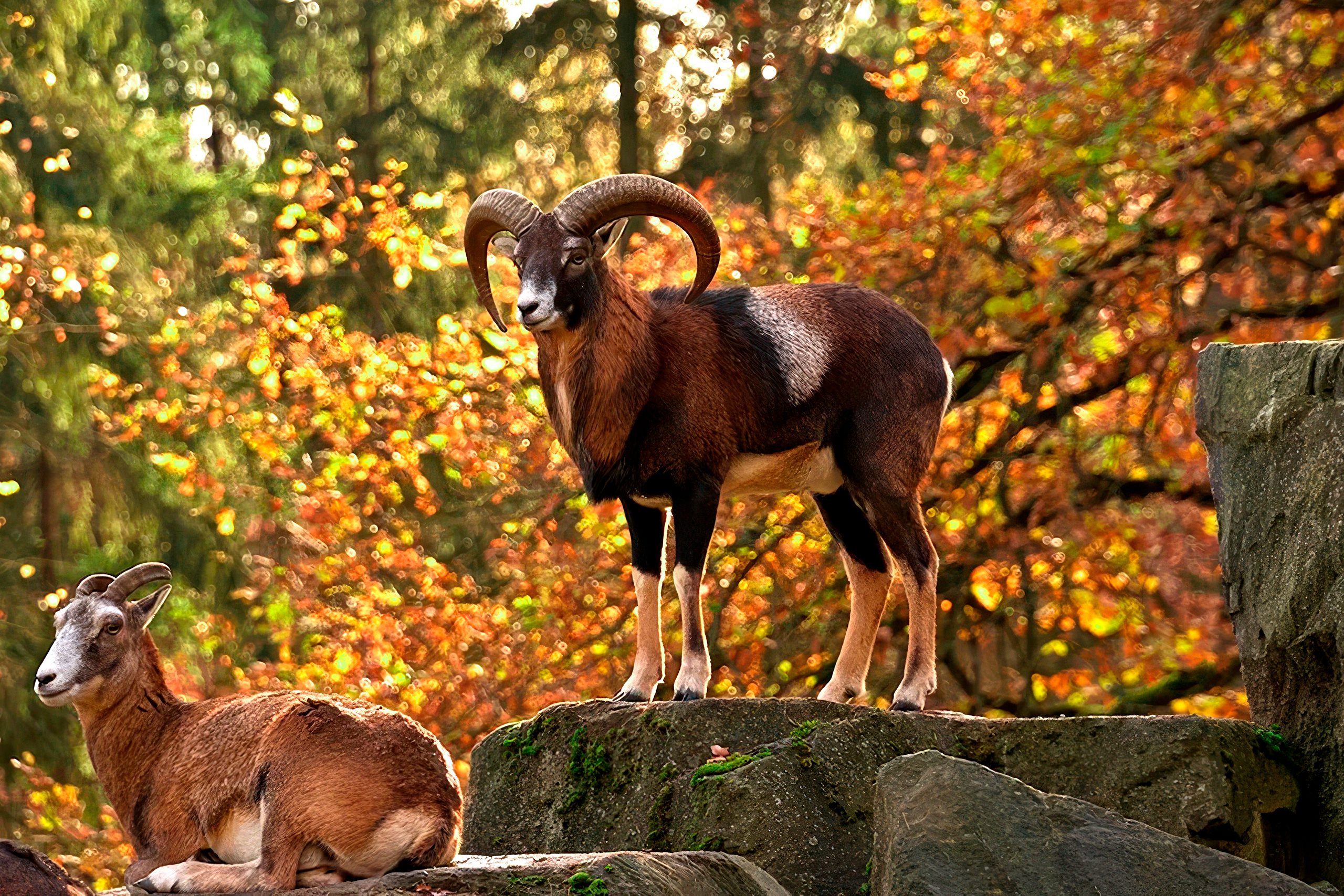
Wildlife includes 168 recorded bird species, making Akamas vital for Mediterranean bird conservation. Endemic Cyprus warblers and Cyprus wheatears nest in scrubland and forest edges. The Cyprus scops owl hunts at night, its calls echoing through gorges. Bonelli’s eagles patrol from elevated perches, scanning for hares and smaller prey. Migratory species including griffon vultures pass through or overwinter, using the peninsula as a stopover between European breeding grounds and African wintering areas.
Mammals remain less visible but include red foxes, hedgehogs, shrews, and multiple bat species that roost in limestone caves. Fruit bats filmed by David Attenborough for natural history documentaries demonstrate the caves’ importance as breeding sites. These bats feed on ripe fruit from wild trees and play crucial pollination and seed dispersal roles in maintaining forest health.
Interesting Facts About the Peninsula
Approximately 80 fires have occurred in or around Akamas National Forest Park since 2017, many deliberately set according to forestry officials. Fire timing often coincides suspiciously with scheduled meetings about enhancing protection or establishing full National Park status. Agriculture Minister Costas Kadis stated that economic interests appear behind arson attempts to sabotage conservation plans by destroying the natural values that justify protection.
The peninsula’s original designation covered more area than currently protected. In 2003, authorities proposed designating the entire terrestrial portion of Akamas as Natura 2000, but the 2009 final designation covered only 50 percent of that area. Pressure from landowners seeking development rights and tourism interests opposing access restrictions resulted in this reduction, frustrating conservation organizations campaigning for comprehensive protection.
Twenty-five distinct microecosystems of European importance exist within Akamas boundaries, each supporting specific plant and animal communities adapted to particular combinations of elevation, aspect, soil type, and moisture availability. This ecological diversity packed into relatively small geographic area makes the peninsula disproportionately valuable for conservation relative to its size.
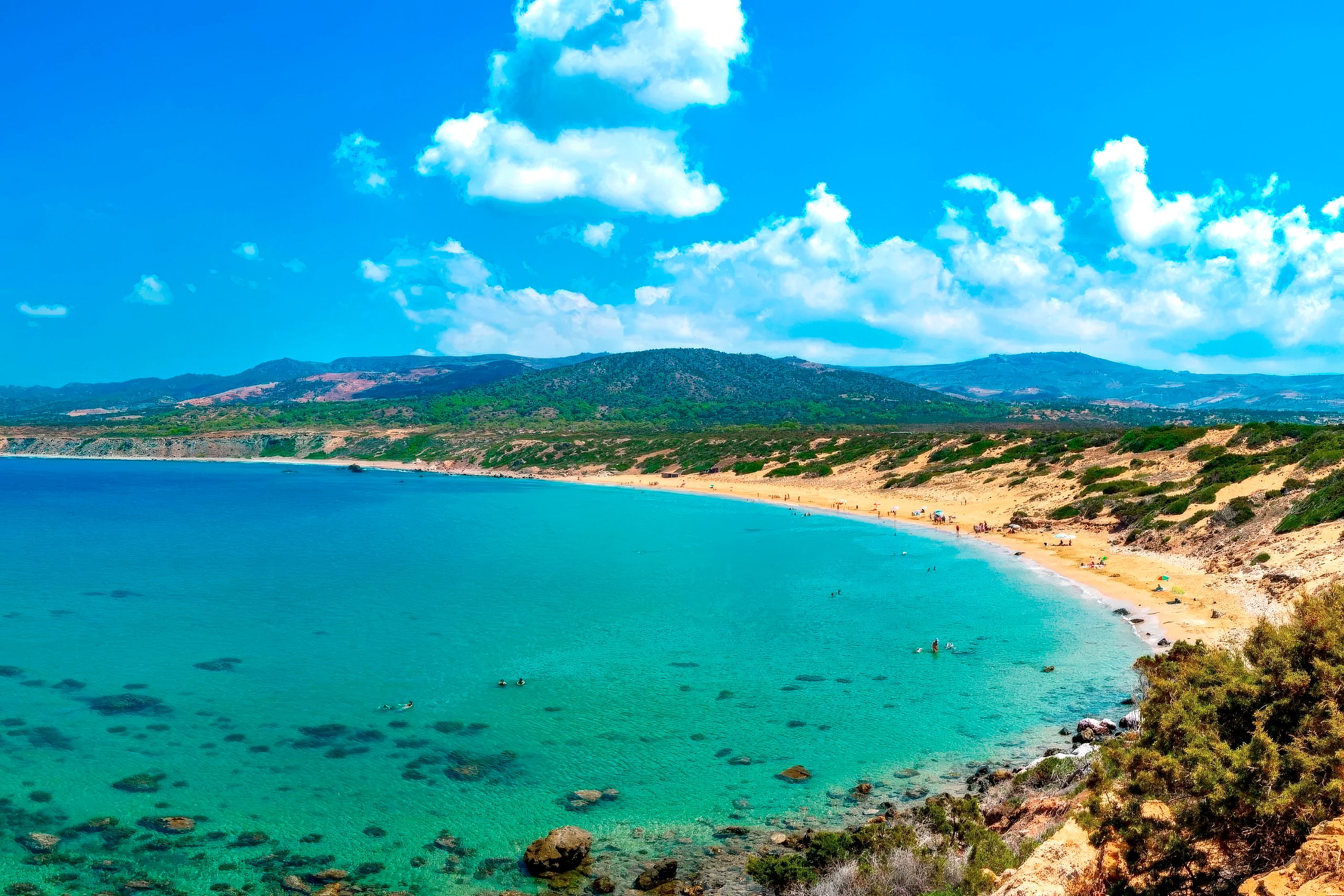
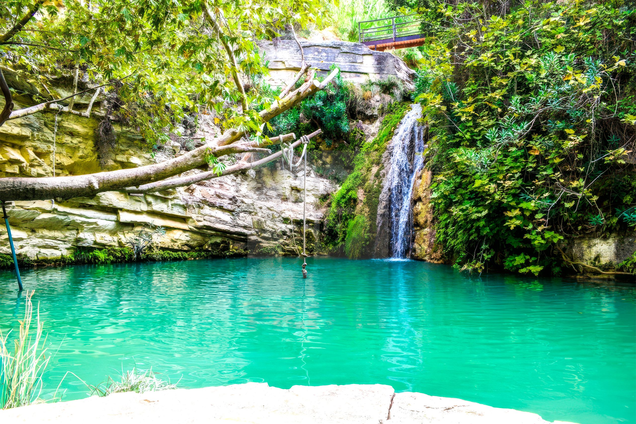
The Blue Lagoon, one of Cyprus’s most photographed locations, appears in countless social media posts showing crystal-clear turquoise water in a sheltered bay surrounded by rugged hills. The lagoon is accessible only by boat from Latchi harbor or via challenging 4×4 tracks, limiting visitor numbers compared to easily accessed beaches. The extreme water clarity results from minimal sediment input, rocky bottom reflecting light, and limited nutrients preventing algae growth.
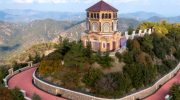
Traditional settlements existed on the peninsula’s edges, with 101 churches supposedly scattered across the landscape according to local tradition. Some remain standing, preserved as historic monuments blending cultural heritage with natural surroundings. These churches served farming communities that raised livestock, grew crops on terraced slopes, and extracted resources including timber and stone before conservation designations restricted such activities.
Exploring the Gorges and Trails
Avakas Gorge provides the most dramatic hiking experience on Akamas. The trail enters from the south near Agios Georgios Pegeia and follows a seasonal stream bed through increasingly narrow passages. Rock walls tower overhead, creating play of light and shadow that shifts throughout the day. Vegetation clings to vertical surfaces where water seepage maintains moisture. The hike covers approximately 2.5 to 3 kilometres one way and requires two to three hours return at moderate pace.
Why This Peninsula Matters Today
Akamas demonstrates that small areas can harbour exceptional biodiversity when protected from destructive development. The concentration of endemic species found nowhere else means their global survival depends entirely on this single peninsula. Losing Akamas habitat through fire, development, or mismanagement would drive multiple species to extinction, eliminating millions of years of evolutionary adaptation.
The turtle conservation program shows that targeted human intervention can help species survive when natural processes alone prove insufficient against modern threats. Green and loggerhead turtles face challenges including beach development destroying nesting sites, artificial lighting disorienting hatchlings, boat strikes injuring adults, and marine pollution affecting feeding areas. The protection measures at Lara Bay create safe conditions allowing successful reproduction that maintains Cyprus’s turtle populations.
Conservation organizations view Akamas as a test case for whether Cyprus can balance economic development with environmental protection. The peninsula represents what most of Mediterranean coastline looked like before tourism and urbanization transformed landscapes. Preserving this reference point provides scientific baseline for understanding ecological processes, studying climate change impacts on native species, and developing restoration approaches for degraded areas elsewhere.