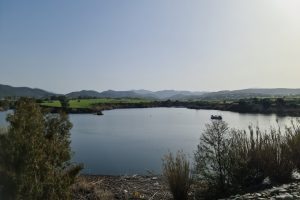
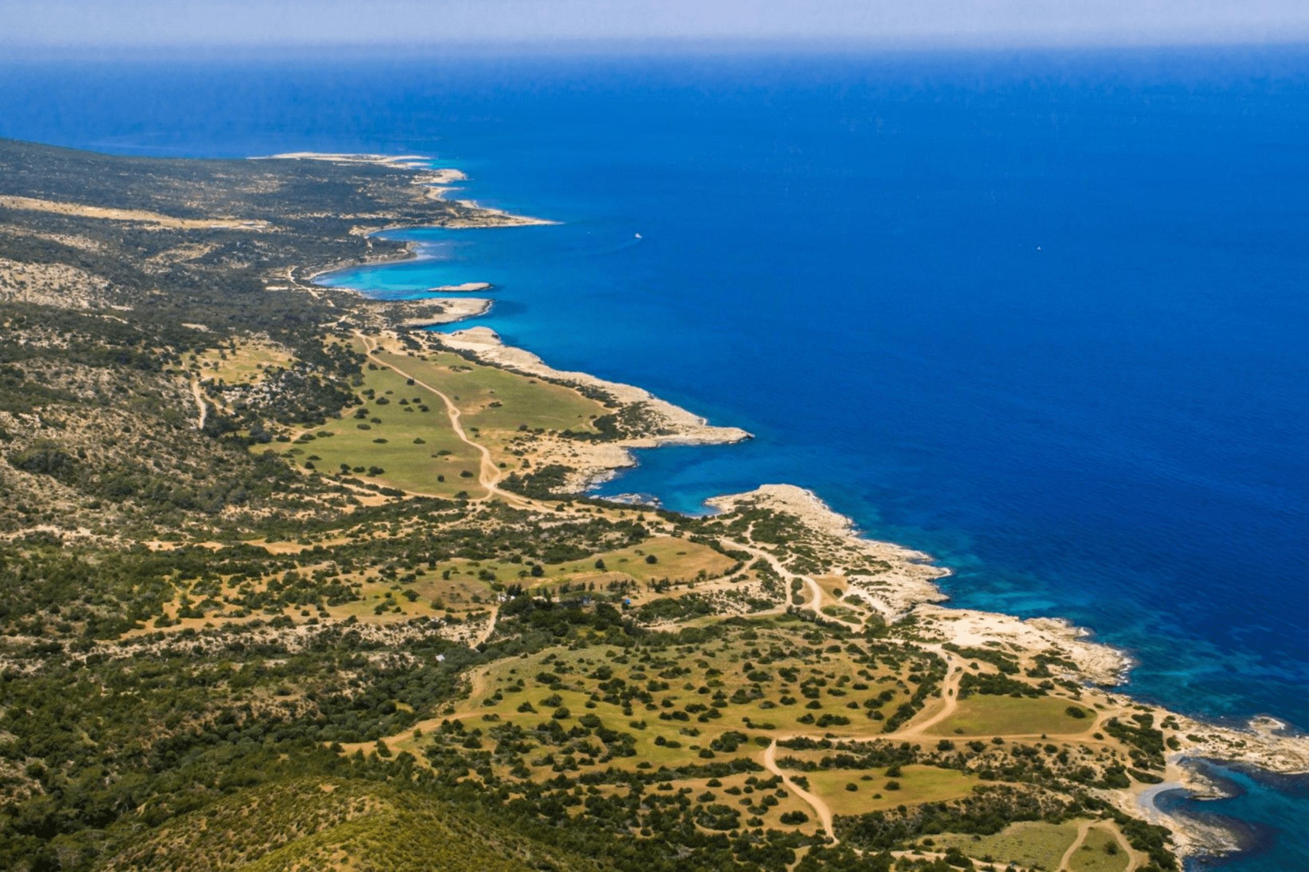
The rugged coastlines of Cyprus display dramatic geological contrasts where limestone cliffs plunge into turquoise Mediterranean waters, creating landscapes that combine raw natural beauty with mythological significance. The island’s 648-kilometer coastline features two primary wild areas, the Akamas Peninsula in the northwest and Cape Greco in the southeast, both protected under the Natura 2000 European network.
These areas showcase calcitic sandstones formed during glacial periods over the last 100,000 years, raised marine terraces representing ancient coastlines lifted by Cyprus’s gradual tectonic uplift, and deep gorges carved through limestone bedrock by erosion. The Akamas covers 230 square kilometers with elevations reaching 419 meters, while Cape Greco’s lower terrain emphasizes coastal features including sea caves, natural rock bridges, and vertical cliffs popular for cliff diving despite safety restrictions.
Beyond their geological significance, these coastlines harbor rare endemic species including the Akamas tulip with only 200 plants worldwide and provide critical nesting sites for endangered Mediterranean monk seals and green sea turtles.
Geological Formation and Ancient Uplift
The coastline of Akamas is dominated by calcitic sandstones called Aiolianites formed during the glacial period in the last 100,000 years, with very characteristic raised marine terraces. Each terrace ledge represents an old coastline formed by wave action and raised as a result of Cyprus’s tectonic uplift. This process continues today as the southern margin of the Anatolian Plate collides with the African Plate, creating the Cyprus arc and gradually lifting the entire island.
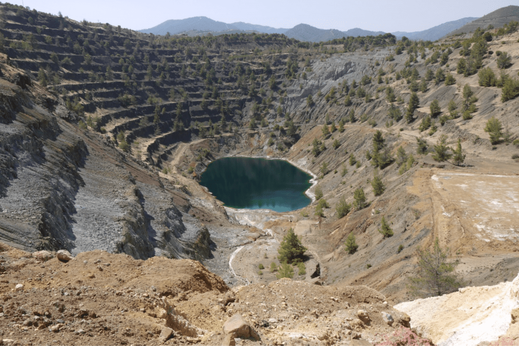
The Troodos Ophiolite, a slab of oceanic lithosphere formed approximately 90 million years ago, crops out across central Cyprus including the Akamas Peninsula. This exceptional geological feature preserves a complete section of oceanic lithosphere with crust composed of sheeted dikes, pillow basalts, and marine sediments overlying mantle rock. The visible exposure allows geologists to study ancient seafloor that would normally remain hidden kilometers beneath ocean waves.
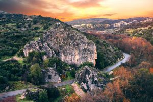
The Avakas Gorge and Coastal Canyons
The Avakas Gorge represents one of Cyprus’s most spectacular natural features, a narrow canyon with towering limestone walls carved by stream erosion over millennia. The sheer cliffs come progressively closer together until they nearly meet, creating passages where visitors walk beneath rock walls rising 30 meters overhead. Wild fig trees cling to crevices, while lush undergrowth thrives in the permanent shade and moisture.
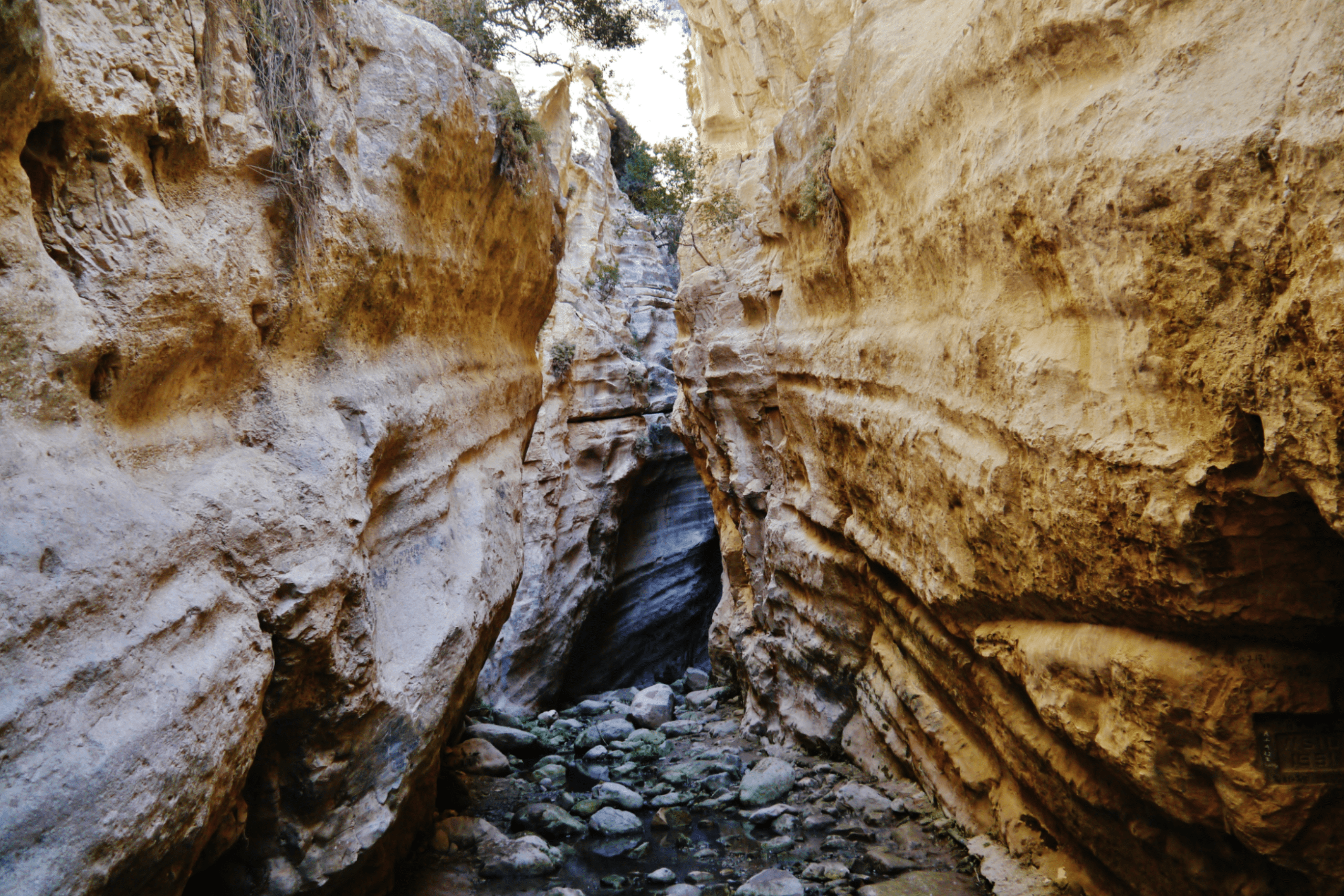
The gorge shelters some of the world’s rarest plants. Centaurea akamantis is found in only three Akamas gorges, with the entire world population consisting of no more than 800 plants found only on vertical cliffs in the Avakas gorge and two other nearby small gorges. This extreme endemic distribution demonstrates how isolated canyon environments can preserve unique species that cannot survive elsewhere.
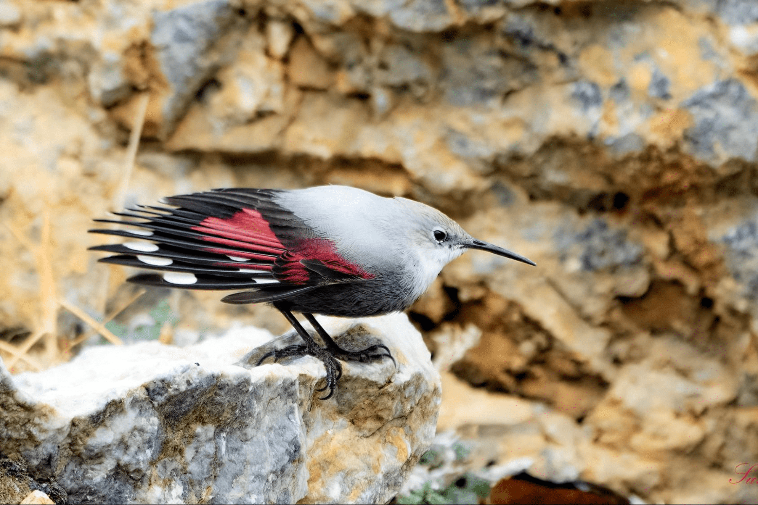
The very rare Wallcreeper, a bird species typically associated with high mountain ranges, occasionally appears on Avakas’s vertical cliffs during winter migrations. The bird’s presence in this coastal canyon illustrates how diverse microhabitats exist within compact geographical areas, creating ecological complexity that supports specialized species alongside more common Mediterranean fauna.
Cape Greco’s Dramatic Features
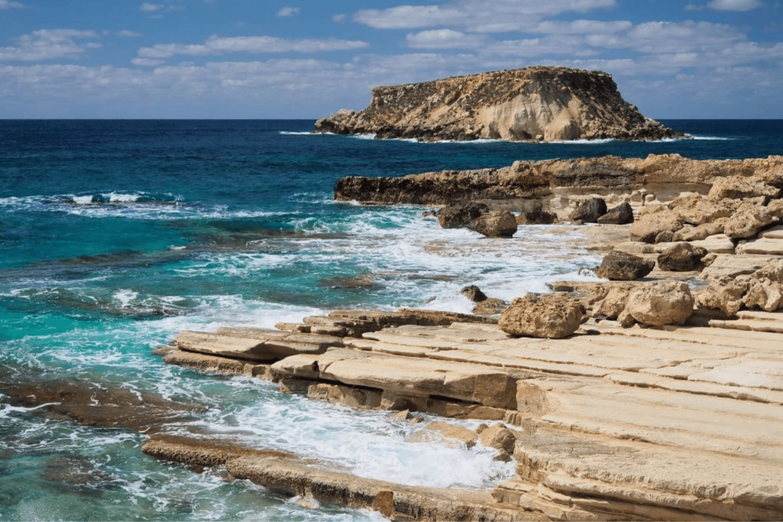
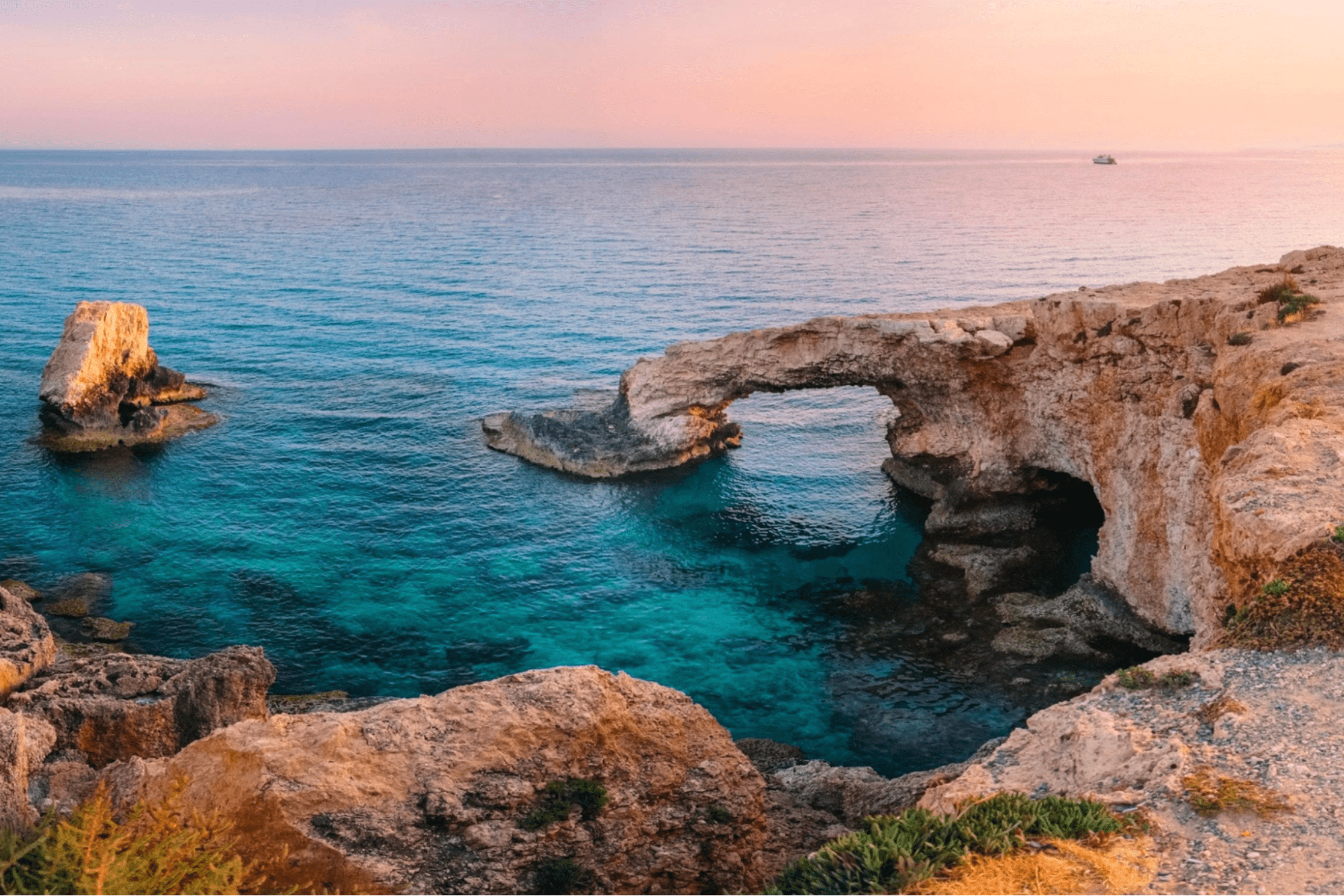
Cape Greco on Cyprus’s southeastern tip showcases different coastal characteristics than Akamas. The area features limestone cliffs, crystalline beaches, and numerous sea caves accessible by boat or adventurous swimming. The Love Bridge, a natural rock arch formed by wave erosion, has become an iconic landmark where visitors photograph the azure waters framed by white stone.
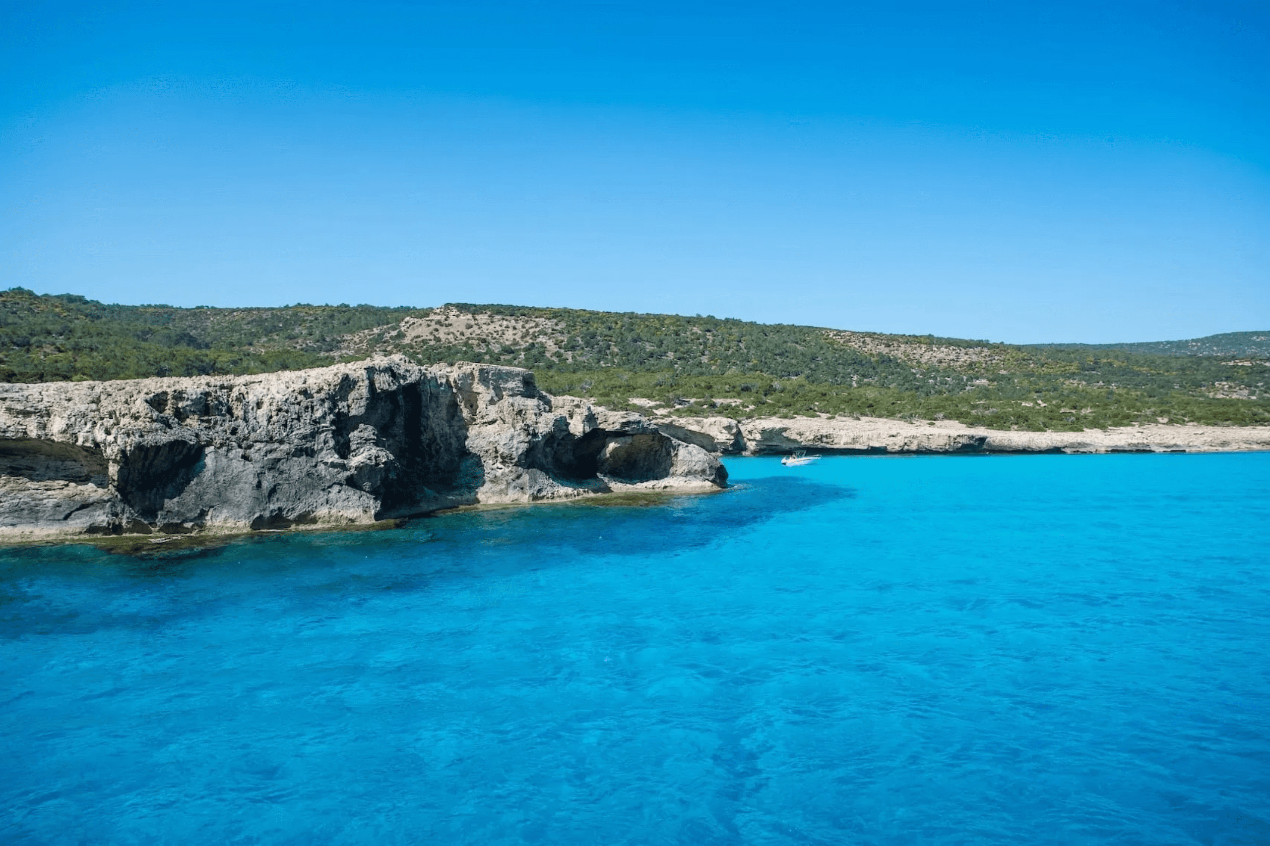
The Blue Lagoon within Cape Greco offers incredibly clear blue waters over sandy bottom interspersed with rocks and flanked by white cliffs. Access requires careful navigation through slippery coastal rocks, but the reward includes exceptional swimming and snorkeling in protected waters where marine life flourishes. The lagoon’s popularity has necessitated some access restrictions to prevent environmental damage from overuse.
Sea caves along Cape Greco’s coastline provide vantage points for admiring Mediterranean waters and dramatic rock formations. These caves, carved by millennia of wave action, create sheltered spaces where light reflects off water to illuminate stone ceilings with shifting patterns. Some caves remain accessible only by boat, preserving their wild character despite the peninsula’s proximity to developed resort areas.
Turtle Conservation and Beach Protection
Lara Bay on Akamas hosts a turtle hatchery where conservationists protect green turtle and loggerhead turtle eggs from predators and human disturbance. The nesting season runs from May through August, with hatching occurring mainly July through September. Guided visits to the conservation station educate visitors about protection efforts while restricted beach access minimizes disturbance to nesting females and emerging hatchlings.
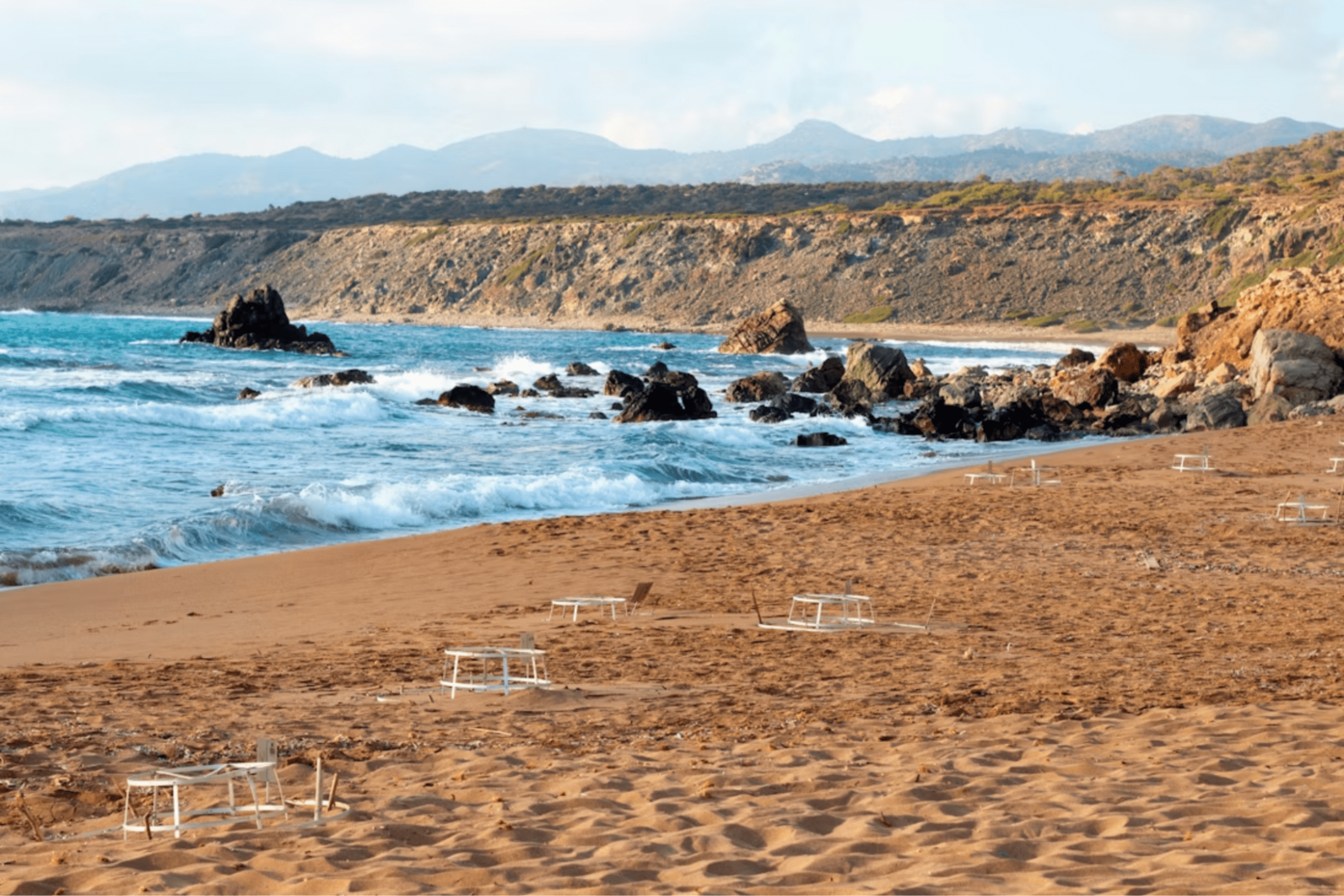
The turtles represent living connections to ancient Mediterranean ecosystems that have changed dramatically under human pressure. Coastal development, light pollution, and beach disturbance have eliminated many historical nesting sites across the Mediterranean. The Akamas beaches, protected within Natura 2000 network, function as critical refuges where these endangered species can complete their reproductive cycles without catastrophic human interference.
Hiking Trails and Visitor Access
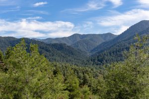
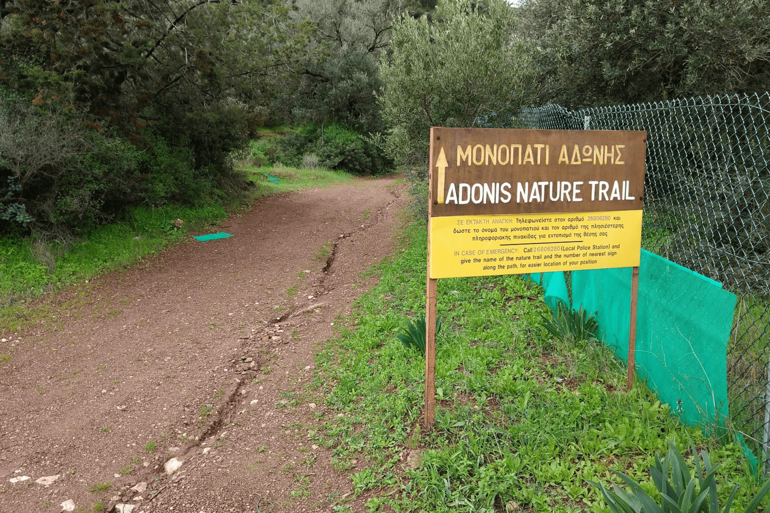
Well-marked trails allow visitors to experience Akamas landscapes without vehicles that would damage fragile soils and vegetation. The Aphrodite Trail and Adonis Trail, both approximately 7.5 kilometers, start near the Baths of Aphrodite and climb into hills with dramatic coastal vistas and dense pine forests. The trails pass through multiple vegetation zones where hikers observe seasonal wildflowers, migrating birds, and endemic plants identified by educational signage.
Four-wheel-drive vehicles can access some inland and coastal routes within Akamas, though environmental groups argue this motorized access causes erosion and disturbance incompatible with conservation goals. Boat tours from Latchi offer alternative coastal access without driving, allowing visitors to reach secluded coves and sea caves while minimizing terrestrial impacts. The debate over access methods reflects broader tensions between tourism promotion and nature protection.