Explore Cyprus with Our Interactive Map

Explore our top stories and discover ideas worth your time.

Lara Bay Beach

Lara Bay Beach

Lara Bay occupies a remote stretch of coastline on the Akamas Peninsula in western Cyprus, approximately seven kilometers from Agios Georgios Peyias. The beach serves as one of the Mediterranean's most important nesting sites for endangered green turtles and loggerhead turtles. Golden sand stretches along the coast framed by rugged cliffs and crystal clear Mediterranean waters. Unlike typical Cypriot beaches crowded with sun loungers, kiosks, and tourists, Lara Bay remains deliberately undeveloped. Building is strictly prohibited throughout this uninhabited area that forms part of Akamas Peninsula Natura 2000 protected area, the largest conservation area in Cyprus. The beach belongs to the Lara-Toxeftra Reserve, designated as a Specially Protected Area under the Barcelona Convention and part of the European Network of Biogenetic Reserves. Access requires a bumpy drive along unsurfaced dirt roads best suited to four wheel drive vehicles. The Turtle Conservation Station The Lara Bay Turtle Conservation Station operates under the Cyprus Department of Forests and Fishery to protect turtle eggs from predators and human disturbance. Female turtles come ashore from May to mid August to lay their eggs in the soft sand. Each turtle can lay around 80 to 120 eggs per nest, and a single female may nest multiple times during one season. Conservation staff mark protected nests with cages and warning signs to prevent accidental damage from…

Read more
Modern Naval Heritage

Modern Naval Heritage

Cyprus has never treated the sea as a boundary. For centuries, its coastline functioned as a working edge where trade, defense, administration, and daily life met. In the modern period, this relationship was shaped most clearly by two naval powers: the Ottoman Empire and the British Empire. Their presence did not simply leave behind forts and harbors. It reshaped how the island was governed, how its ports functioned, and how Cypriots understood their place within the wider Mediterranean world. This article explores how Ottoman and British naval priorities transformed Cyprus from a regional outpost into a strategic maritime asset, and why that legacy still defines the island’s identity today. An Island Positioned to Be Watched Cyprus sits at a crossroads of the eastern Mediterranean, close enough to Anatolia, the Levant, and Egypt to matter to every power operating in the region. This geography made neutrality impossible. Control of Cyprus meant visibility over key sea lanes, access to sheltered anchorages, and influence across multiple trading and military routes. Rather than isolating the island, the sea connected it outward. Cyprus became valuable not for its interior alone, but for how its coastline could support movement, surveillance, and supply. This strategic reality explains why naval priorities repeatedly shaped the island’s administration. What “Modern Naval Heritage” Really Means When discussing naval heritage in Cyprus,…

Read more
Papoutsa Peak Cyprus Eco Trails

Papoutsa Peak Cyprus Eco Trails

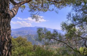
Papoutsa Peak stands at 1,554 metres in the eastern Troodos Mountains, surrounded by one of Cyprus's most important forest reserves. The forests are part of the Adelfoi Forest system, a vast protected area recognized within the Troodos Geopark for its ecological significance. The peak sits between Mount Olympus to the west and Madari to the north, creating a corridor of protected wilderness that covers over 120 square kilometres. Unlike more accessible Troodos peaks with developed facilities, Papoutsa maintains a wilder character with fewer visitors and more pristine ecosystems. The mountain lies within the Papoutsa and Adelfoi Forests mentioned by the Troodos Geopark as among the island's most noteworthy woodland areas. These forests protect crucial habitat for species found nowhere else on Earth. The combination of elevation, geology, and minimal human disturbance creates conditions where rare plants and animals can survive pressures that threaten them in more accessible locations. Historical Background The Troodos Mountains, including Papoutsa, emerged approximately 92 million years ago as oceanic crust from the ancient Tethys Ocean. Tectonic forces pushed this underwater rock upward through obduction, eventually creating the island's central mountain mass. Papoutsa consists of the same serpentinized harzburgite and peridotite rocks found throughout Troodos, representing mantle material from thousands of metres beneath the ancient seabed. These ultramafic rocks create unique soil chemistry with high concentrations of…

Read more