Explore Cyprus with Our Interactive Map

Explore our top stories and discover ideas worth your time.

Karpasia Peninsula Climate

Karpasia Peninsula Climate

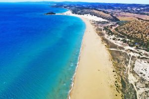
Karpasia Peninsula Sub-Humid Climate is marked by a slightly wetter profile in Cyprus's northern region, supporting lush scrub, wetlands, and seasonal agriculture. This climate, with higher rainfall than the island's interior, creates diverse habitats from coastal dunes to inland plains, fostering unique biodiversity and human activities. It shapes a landscape where moisture gradients influence everything from plant life to settlement patterns, highlighting the peninsula's role as a transitional zone in the eastern Mediterranean. A Wetter Northern Haven on the Island The Karpasia Peninsula, also known as the "panhandle" of Cyprus, extends 80 kilometers into the Mediterranean from the island's northeast, encompassing a sub-humid climate that distinguishes it from the drier central Mesaoria Plains. Annual rainfall averages 450-550 millimeters, about 20-30% higher than inland areas, concentrated in winter months from November to March, with mild temperatures ranging from 15-20°C. Summers are warm, with highs of 30-35°C moderated by sea breezes, and lower evaporation rates due to coastal proximity. This slight increase in moisture supports lush maquis scrub dominated by evergreen shrubs like lentisk (Pistacia lentiscus) and wild olive (Olea europaea), wetlands that form ephemeral lagoons, and seasonal agriculture focused on rain-fed crops like wheat and barley. The climate's balance creates isolated niches, where freshwater sources and salt marshes coexist, making Karpasia a biodiversity hotspot with over 600 plant species and a…

Read more
Cyprus’s Terraced Vineyards

Cyprus’s Terraced Vineyards

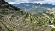
Across the slopes of Cyprus, especially in the Troodos Mountains, vineyards climb in careful steps supported by dry stone walls. These terraces were not built for beauty alone. They were shaped over centuries to manage steep land, scarce water, and intense sun. Today, they form one of the island’s most distinctive cultural landscapes, where wine, village life, and traditional craftsmanship remain visibly connected to the terrain. Cyprus’s terraced vineyards are not a natural feature you simply stumble upon. They are the result of long, patient work, repeated generation after generation. On the southern and western slopes of the Troodos Mountains, hillsides that would otherwise be too steep or fragile for farming have been transformed into narrow, horizontal bands. Each terrace creates just enough flat ground to support vines, olives, or carobs, while the stone walls beneath them hold soil in place and slow the movement of water downhill. Seen from a distance, these terraces read almost like contour lines drawn across the mountains. Up close, they feel more intimate: low walls, uneven stones, and vines planted by hand in spaces machines could never reach. Why terracing mattered in Cyprus Terracing in Cyprus was never an aesthetic choice. It was a practical response to geography. The island’s interior is rugged, with thin soils and long dry seasons broken by sudden winter…

Read more

Landscape Driven Villages of Cyprus

Landscape Driven Villages of Cyprus

Cyprus villages evolved through intimate relationship between human settlement and natural terrain, creating communities shaped by mountains, valleys, water sources, and agricultural land. The island's dramatic geography, dominated by the Troodos Mountains rising to 1,952 meters and the northern Kyrenia Range reaching 1,024 meters, determined where people built homes and how they organized village life. Between these ranges lies the Mesaoria Plain, Cyprus's agricultural heartland where lowland villages spread across fertile flatlands. Mountain villages cling to steep slopes, terraced into hillsides at multiple elevations with buildings accessible from streets at different heights. This landscape adaptation created sustainable settlement patterns that persisted for millennia, balancing human needs with environmental constraints while maintaining agricultural productivity. The terracing, water management, and compact building forms demonstrate sophisticated understanding of terrain that allowed dense population while preserving productive farmland surrounding villages. Geography Determines Settlement Patterns Cyprus's two mountain ranges and central plain created distinct regional settlement types. Troodos foothill villages occupy elevations between 400 and 1,200 meters where mineral-rich volcanic soils support vineyards, fruit orchards, and olive groves. These villages developed around copper mining from the Bronze Age through the 20th century, combining agriculture with metallurgical industries that connected Cyprus to Mediterranean trade networks. Villages like Politiko-Troullia in the Troodos foothills prospered from copper resources less than one kilometer away while maintaining agricultural terraces on…

Read more