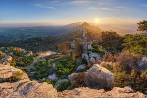
The Kyrenia Mountains form a dramatic limestone barrier along the northern coast of Cyprus. This narrow mountain range stretches for 160 kilometers from Cape Andreas in the east to Cape Kormakiti in the west.
The Kyrenia range, also known as Pentadaktylos Mountains, rises abruptly from sea level to reach its highest point at Mount Selvili, which stands at 1,024 meters. The mountains run parallel to the coast, separated from the sea by a narrow coastal plain. To the south, the range overlooks the wide Mesaoria Plain, which extends toward the Troodos Mountains in central Cyprus.
The name Pentadaktylos means “five fingers” in Greek and refers to a distinctive peak in the western section that resembles a hand with five fingers reaching toward the sky. This sharp ridge has become one of the most recognizable natural landmarks on the island.
Historical Background
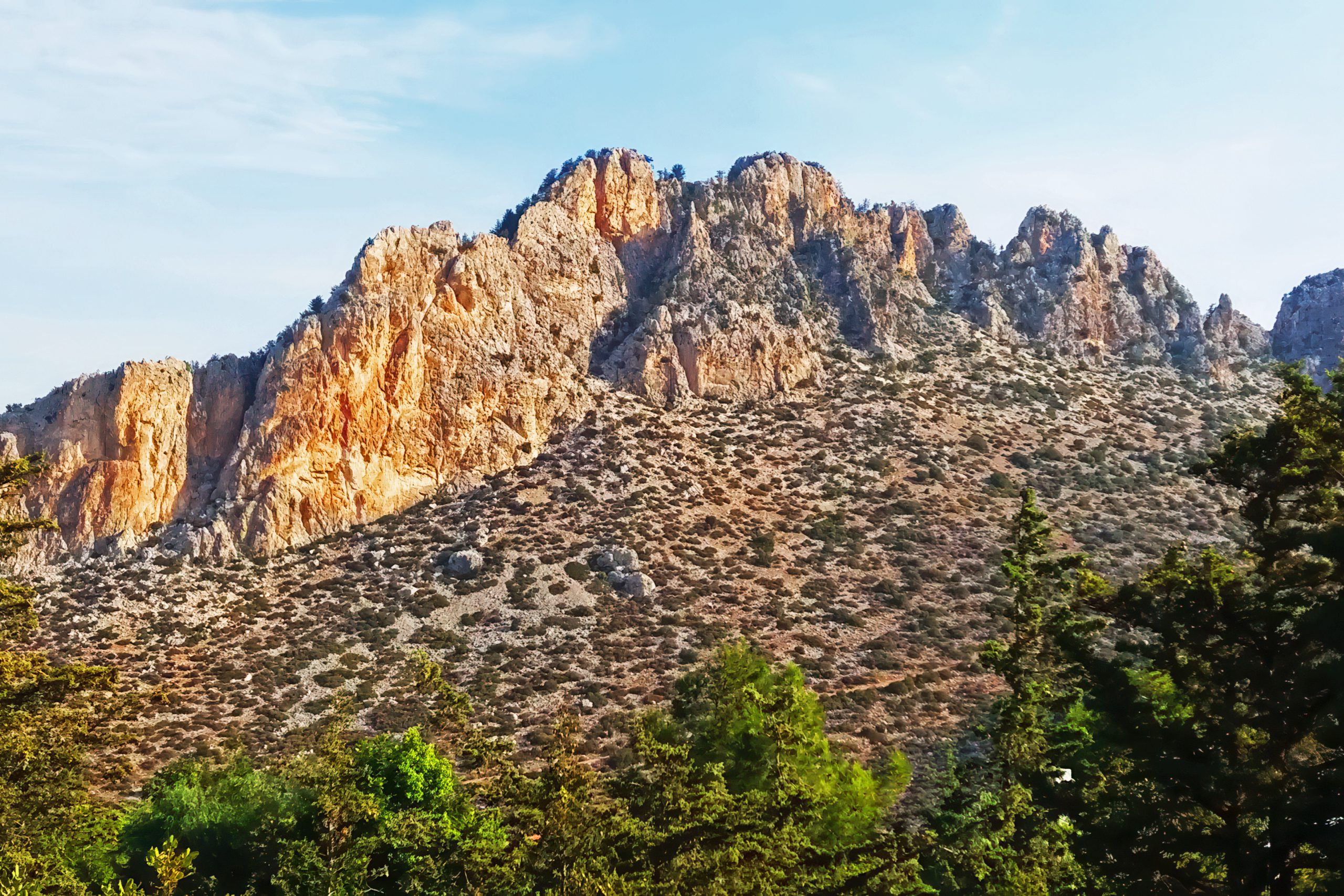
The Kyrenia Mountains consist of the oldest rocks in Cyprus, formed from sedimentary deposits that accumulated from the Permian period through the Middle Miocene. These sedimentary formations were pushed upward when the African and Eurasian tectonic plates collided millions of years ago. The range represents the very edge of the Eurasian plate.
The mountains are primarily made of hard crystalline limestone, with areas of dolomite and marble. This limestone composition creates a rugged landscape with steep escarpments and sharp ridges. Karst features such as caves and sinkholes developed over time as water dissolved the soluble limestone rock.
The geological age of these mountains makes them significantly older than the volcanic Troodos range. While the Troodos Mountains formed underwater during the Cretaceous period as oceanic crust, the Kyrenia range developed from continental shelf sediments accumulated over hundreds of millions of years.
The Story Behind the Five Fingers
Several legends explain the distinctive five-finger peak. According to one popular tale, a villager fell in love with the local queen and asked for her hand in marriage. The queen, wanting to rid herself of this impertinent suitor, demanded he bring water from the spring at Apostolos Andreas monastery in the remote Karpasia Peninsula, a dangerous journey in those days.
The determined man returned weeks later with the precious water. The queen was dismayed to see he had succeeded but still refused to marry him. In rage and frustration, he poured the water onto the ground, grabbed a handful of the resulting mud, and threw it at the queen’s head. She ducked, and the mud sailed across the plain to land on top of the mountain range. It remains there today, showing the impression of the angry villager’s five fingers.
Another version features the Byzantine hero Digenis Akritas, who reportedly leapt from Anatolia to save Cyprus from Saracen invaders. According to this legend, his hand gripped the mountain as he climbed from the sea, leaving his handprint forever in the rock.
Rich Forest and Plant Life
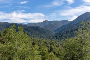
Pine and cypress forests clothe much of the mountain range, particularly on the northern slopes that face the sea. The dominant species is Pinus brutia, also known as Turkish pine, which thrives in the Mediterranean climate. Cypress trees, especially Cupressus sempervirens, add to the evergreen coverage.
The flora includes many shrubs and small trees typical of Mediterranean maquis vegetation. These include strawberry trees (Arbutus andrachne), mastic trees (Pistacia species), holm oak, azarolus, fig, and walnut. The plant communities vary with elevation and exposure, with the northern slopes supporting richer vegetation than the southern faces.
The Kyrenia range harbors 57 endemic plant species that exist only in Cyprus, with some found nowhere else on the island except in these mountains. Important plant areas identified along the range include Alevga, Buffavento, Beşparmak peak, Kormakitis, Karmi, St. Hilarion, and Kantara. These sites support critically endangered species such as Delphinium caseyi, a larkspur that grows on rocky peaks in the western section.
In spring, wild anemones, narcissi, and tulips carpet the slopes with color. Over 30 species of wild orchids bloom in various locations, including several species of bee orchids. The botanical diversity attracts both amateur enthusiasts and professional botanists who come to study the unique plant communities.
Wildlife and Birds
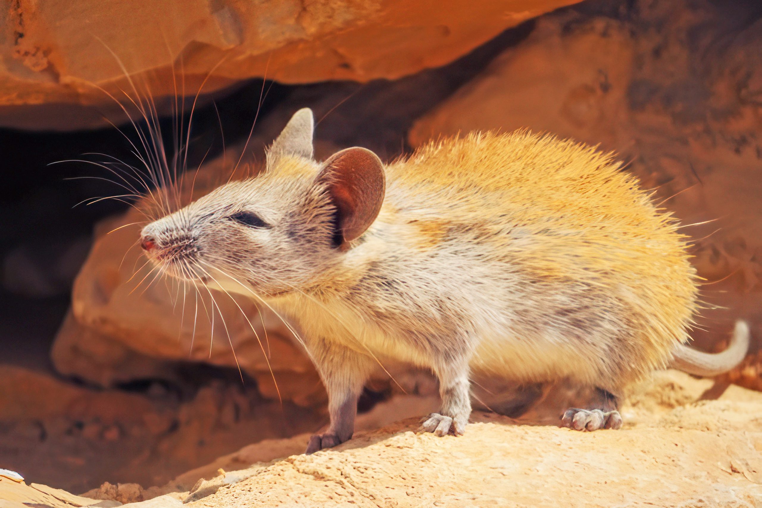
The mountains provide habitat for diverse wildlife despite Cyprus’s relatively limited mammal population. Foxes roam the forested areas, while hares inhabit open spaces. The Cypriot mouse, an endemic rodent, lives in rocky areas. Hedgehogs and bats occupy various ecological niches.
The range supports important bird populations as a stopover point for species traveling between Europe and Africa. Cyprus lies along major migration routes, and the mountains concentrate birds before they cross the Mediterranean. The Cyprus warbler and Cyprus wheatear, both endemic species, breed in the rocky terrain and scrubland.
Raptors use the mountains for hunting and resting during migration periods. Eleonora’s falcon breeds along the cliffs, while other species of eagles, buzzards, and kestrels pass through seasonally. The range around Kantara Castle provides excellent vantage points for bird watchers to observe species such as the spectacled warbler.
Reptiles include various harmless snakes such as the Cyprus whip snake, along with several lizard species that bask on sunny rocks. The Cypriot blunt-nosed viper, a large and dangerous but non-aggressive snake, inhabits rocky areas. Numerous invertebrates, including over 60 species of spiders, live throughout the mountains.
Medieval Castles and Historic Sites
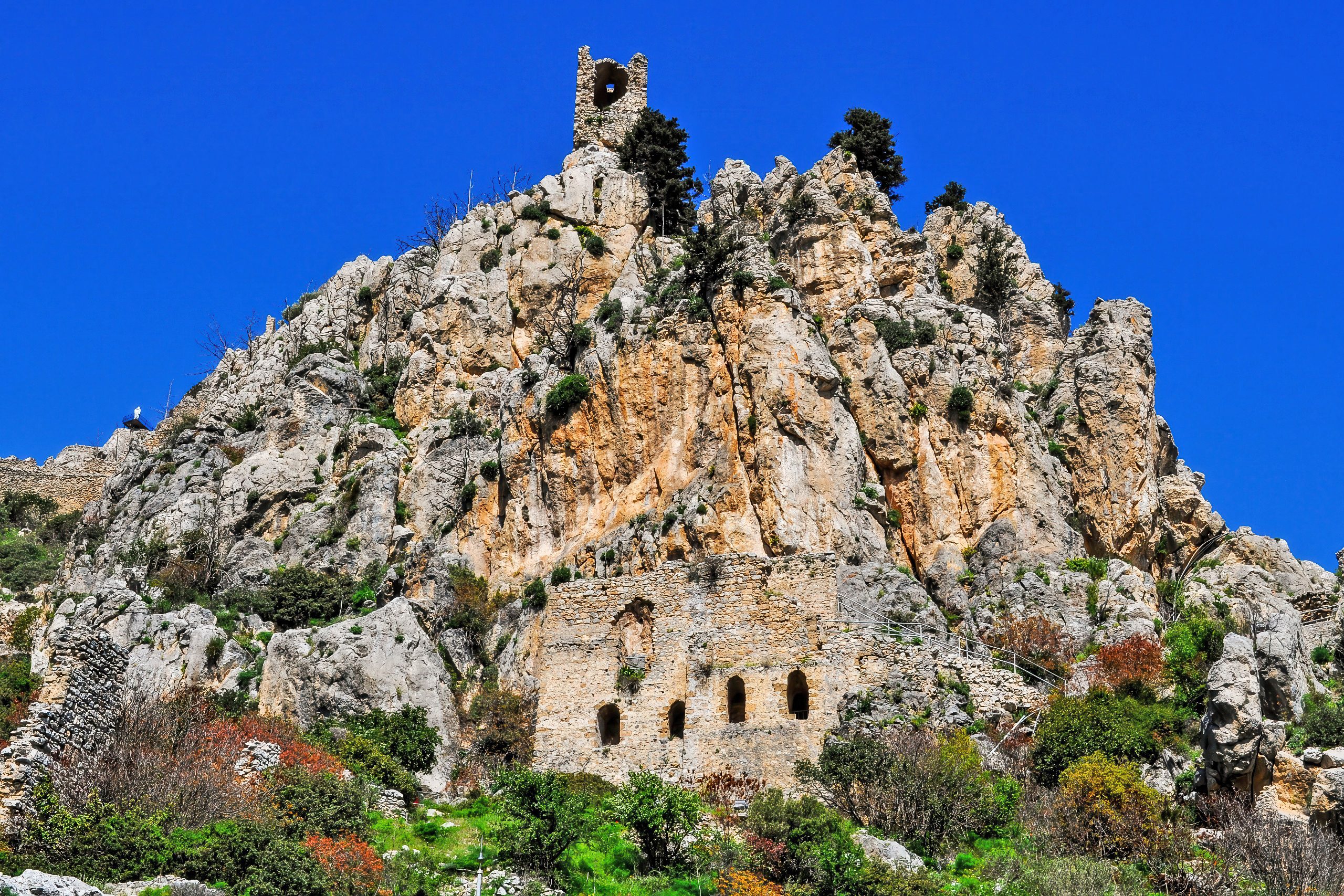
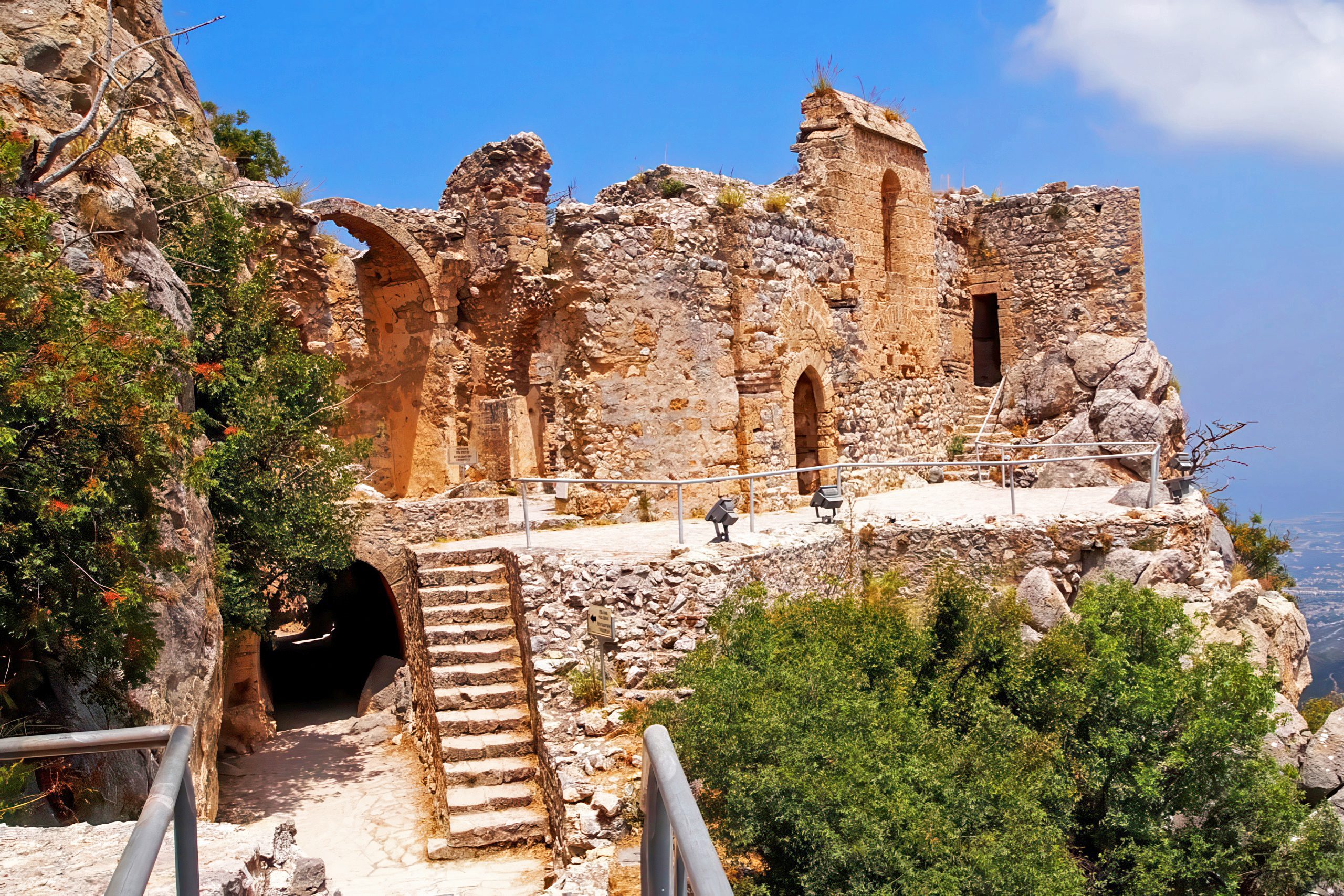
The strategic position of the Kyrenia Mountains made them ideal locations for defensive structures. Three major Byzantine and Crusader castles occupy commanding positions along the range: St. Hilarion, Buffavento, and Kantara. These fortifications date from the 10th through 15th centuries and served to guard the northern coast and mountain passes.
St. Hilarion Castle perches on rocky outcrops at 732 meters elevation. Built around a monastery dedicated to a hermit who lived on the mountain, it developed into a complex fortress with royal apartments. The castle’s fairytale appearance has led to claims it inspired Disney’s castle design.
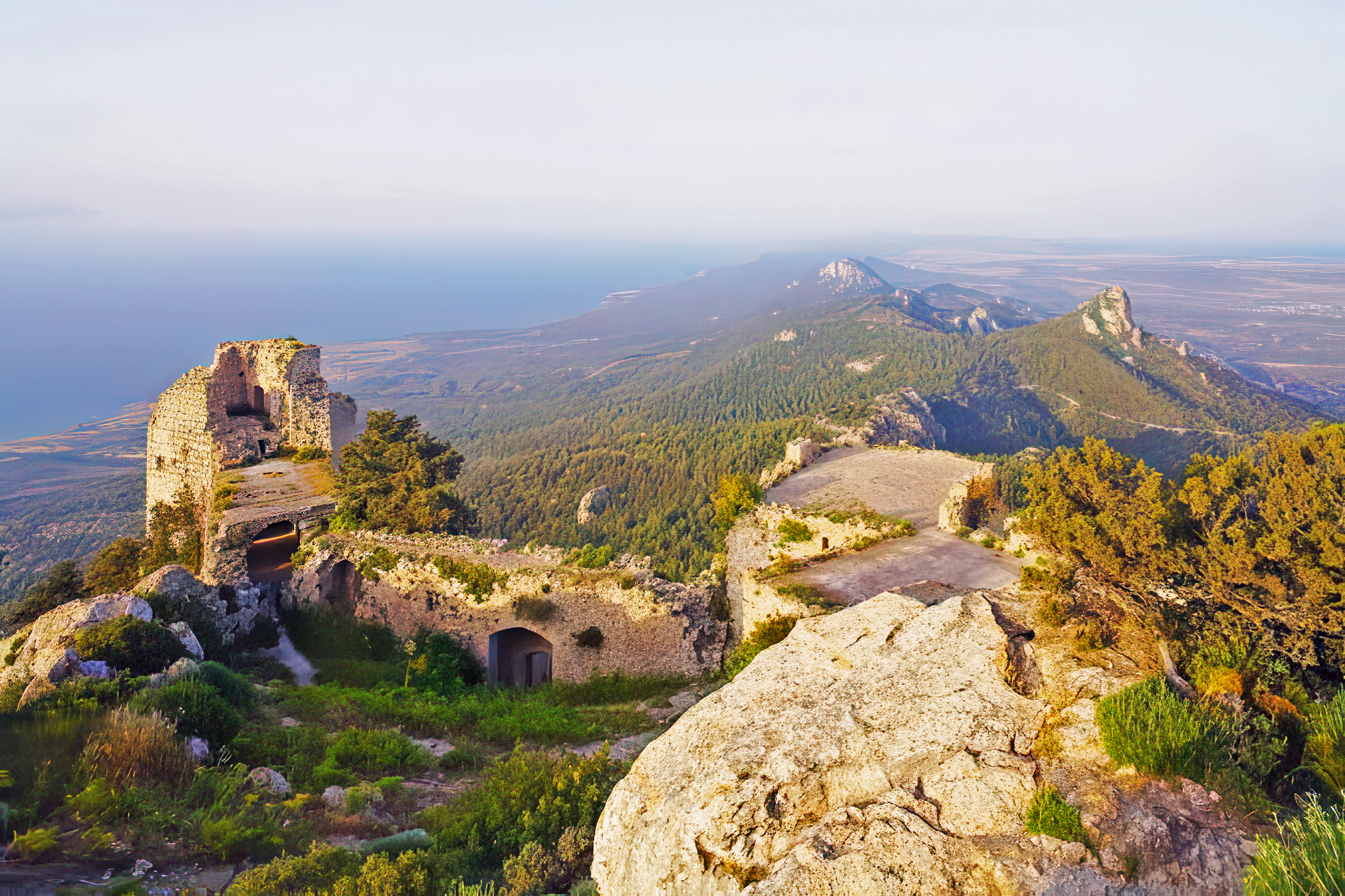
Buffavento, whose name means “Defier of the Winds,” sits at 960 meters and is the highest of the three. The ruins sprawl across a narrow ridge with spectacular views in all directions. Kantara Castle guards the eastern end of the range, monitoring the approach from the Karpasia Peninsula.
These castles saw action during conflicts between Byzantine, Crusader, and later Venetian forces. They changed hands multiple times and served various purposes from military strongholds to royal retreats to political prisons.
Trails and Mountain Access
Multiple nature trails and roads cross the mountains, providing access for visitors. Three main passes allow vehicle traffic through the range. Fire breaks run alongside many slopes, established after a devastating fire in 1995 that burned for three days and destroyed significant forest areas.
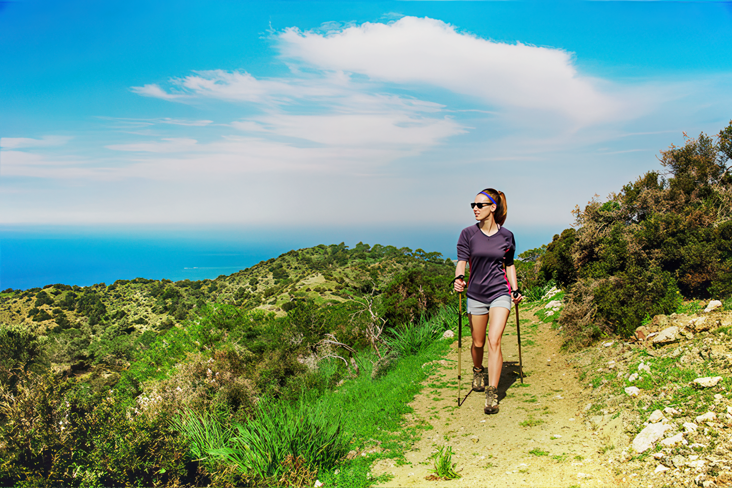
Paths lead to castle sites, viewpoints, and remote valleys. The terrain varies from paved roads to rough mountain tracks suitable only for experienced hikers. The most popular routes connect the coastal towns with the Mesaoria Plain, while other paths follow ridge lines with dramatic views.
Walking or driving through the mountains reveals constantly changing vistas. The northern approach from Kyrenia shows dense forests and steep cliffs rising from the coastal plain. The southern side presents drier, more exposed terrain with panoramic views across the Mesaoria toward the Troodos range.
Visiting the Kyrenia Mountains
The mountains are easily accessible from Kyrenia and other northern coastal towns. Roads wind up steep slopes to reach villages, castles, and viewpoints. The coastal highway offers continuous views of the range, with the distinctive peaks visible from many locations across Cyprus.
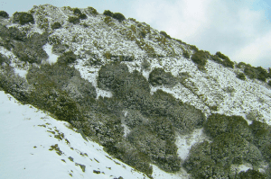
Spring provides ideal conditions for mountain visits, with moderate temperatures, blooming wildflowers, and active bird migration. Summer can be very hot at lower elevations, though higher areas remain cooler. Autumn brings pleasant weather and the return migration of birds. Winter occasionally brings snow to the highest peaks.
The castles charge modest entrance fees and maintain visitor facilities. Trails require no permits but visitors should prepare for rough terrain, limited shade, and minimal services. Water, suitable footwear, and sun protection are essential for mountain excursions.
Several villages in the mountains offer traditional accommodation and local cuisine. These settlements provide bases for exploring the range while experiencing mountain life. The cooler climate makes them popular summer retreats from the coastal heat.
Importance to Cyprus
The Kyrenia Mountains shape the geography, climate, and culture of Cyprus. They create a rain shadow that affects precipitation patterns across the island. The forests provide watershed protection and habitat for wildlife. The mountains served as natural defenses throughout history and continue to define the landscape.
For residents of Nicosia and other Mesaoria communities, the Kyrenia range forms the northern horizon. The distinctive silhouette of the five-finger peak appears in countless photographs and serves as a navigation reference. The mountains connect modern Cyprus to its geological past and medieval history while supporting unique ecosystems that require ongoing protection.