Avakas Gorge sits within Pegeia State Forest at the southwestern edge of the Akamas Peninsula, approximately 20 kilometers west of Paphos. The gorge follows the course of the Avgas River, which gave the canyon its name.
Constant erosive activity on sloping limestone rocks created this dramatic formation. The rocks consist of loams, chalks, reef limestone, grain limestone, and bentonitic clays that erode at different rates. The gorge area holds protected status as a Natura 2000 site and was designated a Plant Micro-Reserve under the Cyprus Forest Law in 2013.
Historical Background
Geologists believe Avakas Gorge emerged from the sea when tectonic forces lifted the entire region. The Avgas River began its work of erosion millions of years ago. Water flowing over the limestone gradually carved deeper into the rock, creating steep vertical walls. The gorge became narrower and deeper with each passing century as the river continued its relentless cutting.
The ancient Greek word “avakas” means without voice or mute, possibly referring to how the towering walls muffle sound within the canyon. Local shepherds and travelers have used this route for centuries. The gorge provided shelter, fresh water, and a passage through otherwise difficult terrain. People shared stories of mythical creatures inhabiting the shadowy recesses between the cliffs.
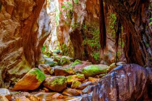
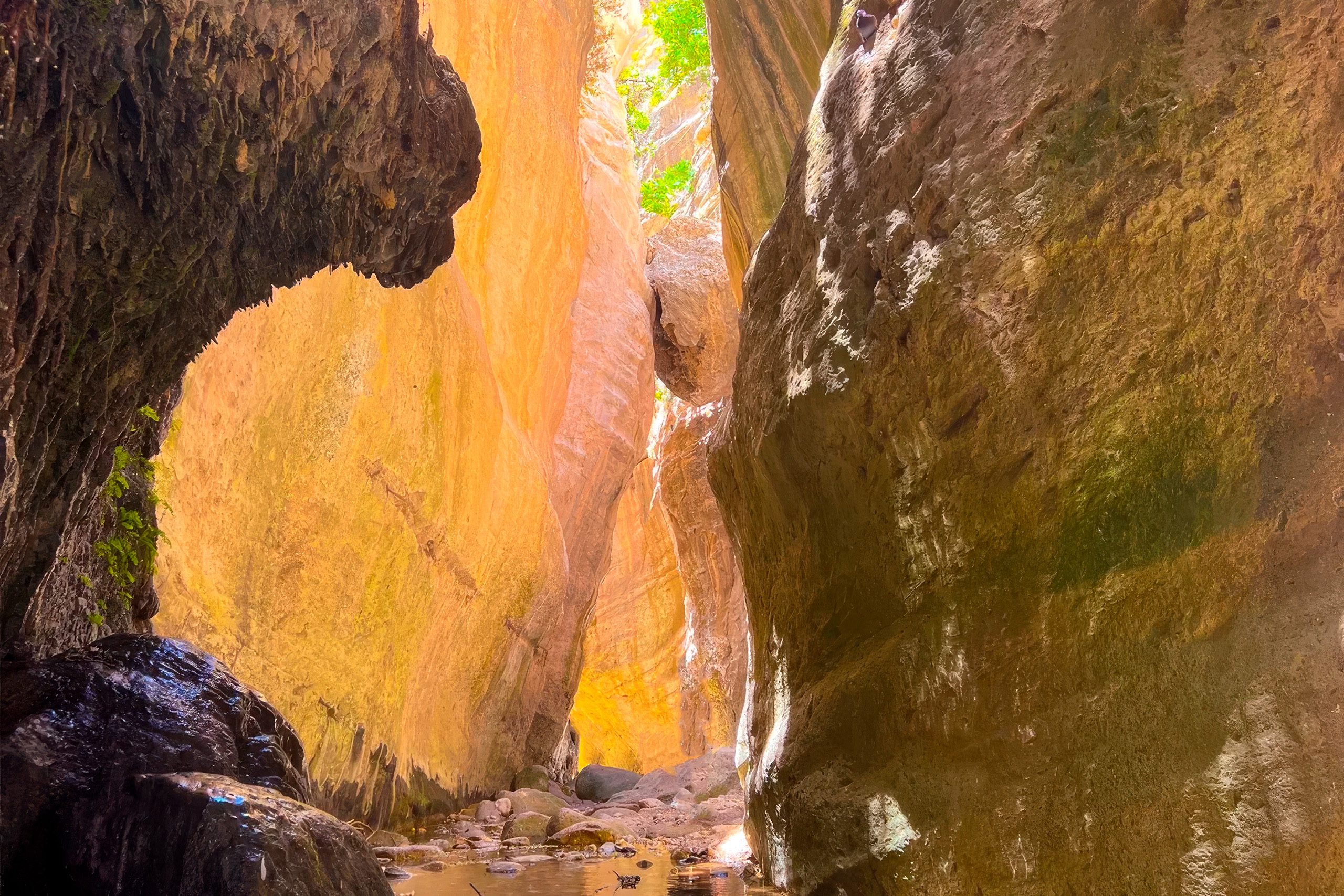
The geological formations visible in the gorge walls reveal layers deposited over millions of years. Different types of limestone show distinct colors and textures. Some sections display obvious stratification where ancient seabeds became stone. The gorge serves as an open geology textbook where visitors can see how natural forces shape landscape over deep time.
The Trail Through the Canyon
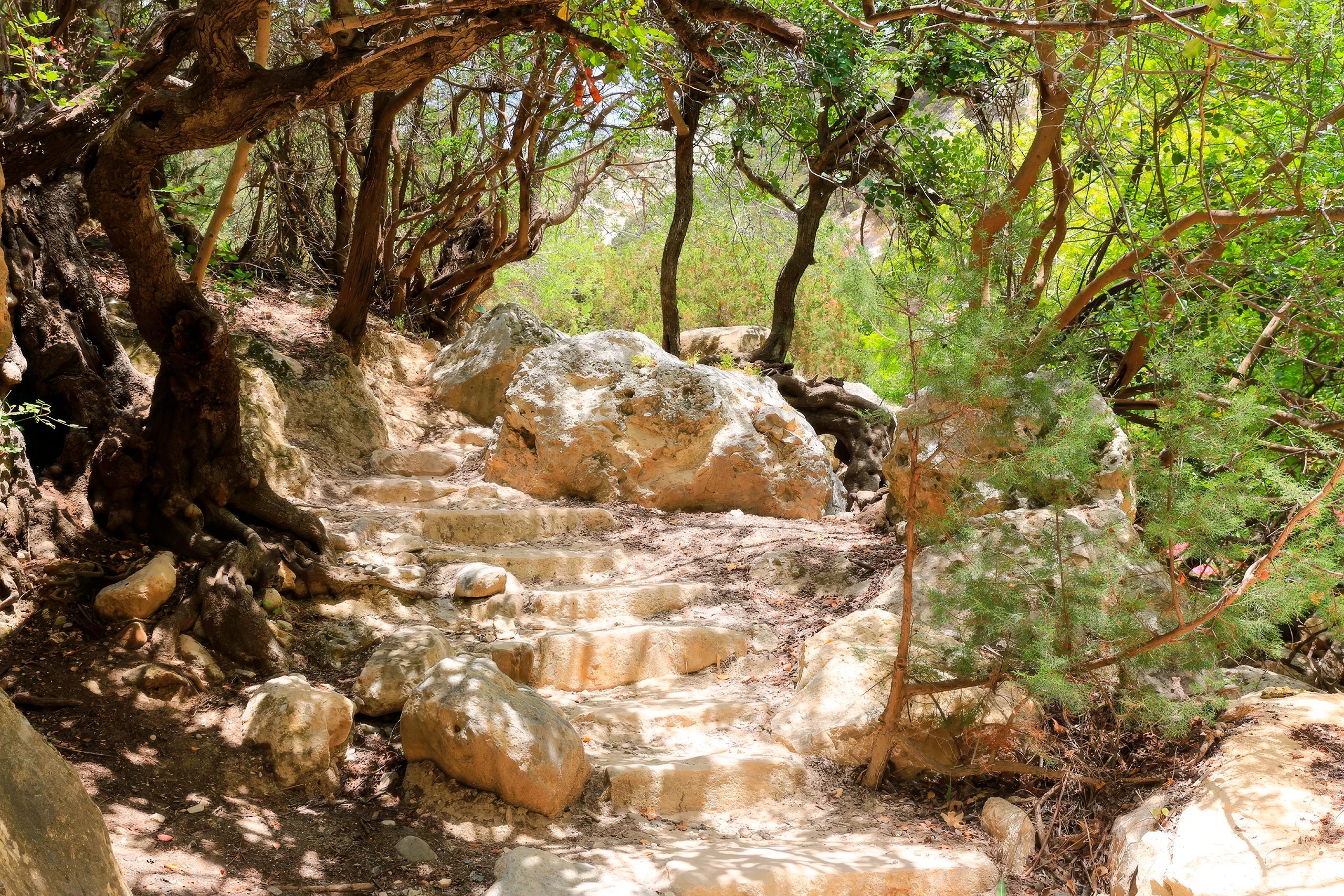
The official Avakas Gorge Nature Trail stretches approximately 3 kilometers one way, making a total round trip of about 6 kilometers. The trail begins on a dirt road closed to private vehicles. This initial section passes through an open valley with scattered vegetation and informational signs identifying local plant species. Many hikers describe this first 500 meters as resembling a botanical garden.
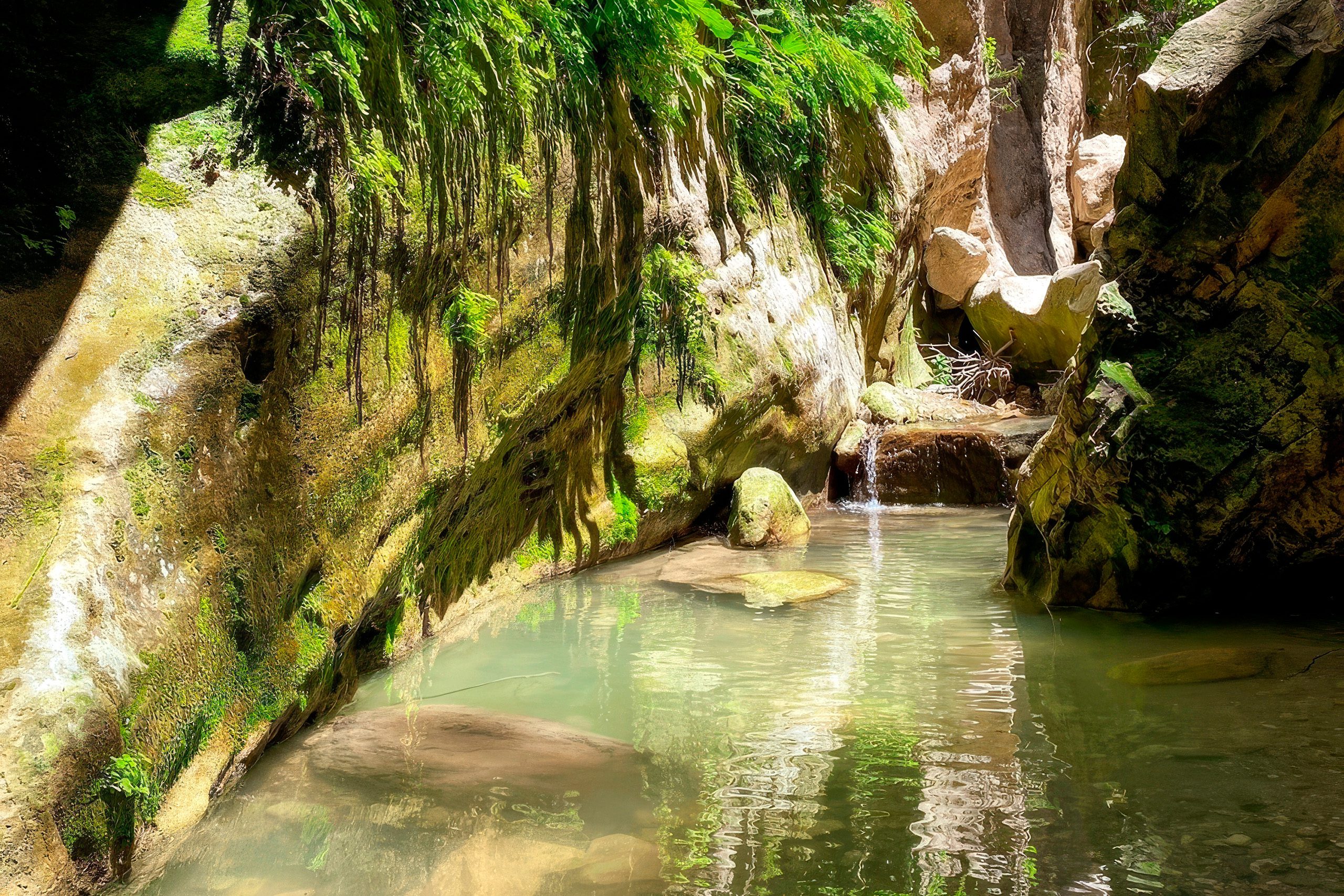
The path gradually narrows as it approaches the gorge entrance. Rock walls begin rising on both sides. The trail then enters the gorge proper and follows the streambed. Water typically flows year-round, though the volume varies with season and recent rainfall. During spring and after heavy rain, the peaceful stream can become a raging torrent that fills the entire canyon floor.
The most dramatic section occurs about 1.5 kilometers from the start. Here the canyon narrows to just two meters wide while walls soar 30 meters overhead. Light filters down from above, creating shadows and highlighting the layered rock formations. Water sometimes drips from the top, channeled away by pipes to keep the path passable. This narrow passage creates a cathedral-like atmosphere that leaves most visitors impressed by the scale.
Biodiversity across Avakas Gorge Trail
Avakas Gorge hosts remarkable botanical diversity. The microclimate created by the high walls, year-round water, and shade supports plant species that cannot survive in the surrounding dry landscape. The gorge contains junipers, pines, cypresses, oak trees, wild fig trees, and ferns. Oleanders bloom pink along the water. The storax tree grows in sheltered spots. Common smilax vines climb the rock faces.

The most significant plant in the gorge is Centaurea akamantis, known as Akamas centaurea. This flowering shrub exists in only three locations worldwide, all within a few kilometers of each other in the Akamas Peninsula. The entire global population numbers approximately 800 individual plants. The largest subpopulation grows on the vertical cliffs of Avakas Gorge.
Wildlife in the Gorge
The rich plant life supports diverse animal populations. Foxes hunt through the gorge at dawn and dusk. Hares shelter in rocky crevices. The hedgehog appears occasionally. Goats scramble along the steep slopes, sometimes kicking rocks loose that tumble into the canyon below.
Bird species include the endemic Cyprus wheatear, Cyprus warbler, and scops owl. The Blue Rock Thrush and the rare Wallcreeper nest on the vertical cliffs, making Avakas a destination for serious birdwatchers. The Wallcreeper is particularly notable as it only appears occasionally in Cyprus. Kestrels, wild pigeons, little owls, and partridges live in the area. During migration periods, hundreds of birds fly through the gorge in the morning.
Three species of frogs live near the water: marsh frog, iridescent frog, and tree frog. The Stellion lizard, Cyprus’s largest lizard species, perches on rocks and basks in patches of sunlight. Various snake species inhabit the gorge though they avoid humans. The Magnificent Emperor dragonfly, Europe’s largest dragonfly with a body length reaching 9 centimeters, can sometimes be seen near the water. This species has its main distribution in Asia but maintains small populations in Cyprus.
Worth Knowing Facts About the Hike
The trail difficulty rating varies depending on fitness level and experience. Some consider it moderate while others rate it as challenging. The first section on the dirt road is easy. The gorge itself requires scrambling over boulders, balancing on rocks, and sometimes wading through shallow water. Proper hiking boots with good grip are essential as many surfaces become slippery when wet.
The suspended rock is one of the gorge’s most photographed features. This large boulder appears wedged between the canyon walls, looking as though it might fall at any moment. Pigeons nest in crevices around it. The formation is both spectacular and slightly unsettling.
Early morning visits are strongly recommended. The gorge stays cooler than surrounding areas due to shade from the high walls, but it can still become hot during midday in summer. Starting early also helps avoid crowds. During peak tourist season, hundreds of people hike the trail daily, particularly between Christmas and New Year when Cyprus sees a temporary surge in visitors.
The access road to the trailhead can be challenging. Multiple dirt roads lead toward the gorge from different directions. Some are rough with potholes and loose stones. Regular rental cars can make it by driving slowly and carefully, though some rental companies exclude the Akamas area from their insurance coverage. Four-wheel drive vehicles handle the roads more easily. Signs can be confusing or absent in places.
Two parking areas serve the trail. Parking lot 2 is closer to the entrance and fills quickly. Parking lot 1 sits further back, requiring a 500-meter walk to the trailhead. During busy periods, cars park along the roadside. Banana plantations line the approach roads in some areas.
What to Bring and Expect
Water is essential as none is available on the trail. At least one liter per person is recommended, more in hot weather. The hike takes between two and four hours, depending on pace and how far into the gorge hikers choose to go. Many turn back at the narrowest section, while others continue to the end, where the gorge opens into agricultural land.
Food should be carried as no facilities exist at the site. The nearest restaurant sits on a hill some distance from the trailhead. Sun protection, including a hat and sunscreen, is necessary for the open sections before entering the gorge. A hiking pole can help with balance on uneven surfaces, particularly when crossing a stream.
Mobile phone coverage is limited or absent in parts of the gorge. Maps are useful, though the trail is relatively straightforward, following the stream through the canyon. Some hikers download GPS tracks in advance. The AllTrails app shows the route as 4.4 miles or about 7 kilometers, including approaches.
The trail is not suitable for pushchairs or wheelchairs. Dogs are not recommended due to the scrambling required. Very young children should not attempt the hike. Families with older children who have hiking experience can complete it together with supervision.
Wet weather creates additional hazards. Heavy rain can cause flash floods that fill the canyon with dangerous rushing water. Landslides and rockfalls become more likely when the ground is saturated. Thunderstorms should be avoided completely. Even light rain makes rocks more slippery. The best months for hiking are March through May and September through November when temperatures are moderate, and rainfall is less likely.
Why This Gorge Matters
Avakas Gorge demonstrates the power of water to shape rock over geological time. The canyon reveals Cyprus’s geological history in its layered walls. The formations show how ancient seabeds became dry land, how different types of sediment compressed into distinct types of limestone, and how persistent erosion carves dramatic landscapes.
The gorge serves as a refuge for biodiversity. The unique microclimate supports plant and animal communities that depend on the shade, moisture, and protection provided by the canyon. The critically endangered Centaurea akamantis would likely be extinct without this habitat. The gorge proves that small protected areas can preserve species found nowhere else on earth.
Avakas offers accessible adventure for people of varying fitness levels. Unlike remote wilderness that requires expedition planning, this gorge sits close to tourist infrastructure but provides a genuine wilderness experience. Hikers feel they are exploring wild nature despite being just 20 kilometers from Paphos.
Avakas Gorge connects people to deep time and natural processes. Standing between 30-meter walls, looking at layers deposited millions of years ago, watching water continue its endless work of erosion, hikers gain perspective on human timescales versus geological timescales. The gorge reminds visitors that powerful forces shaped Cyprus long before humans arrived and will continue shaping it long after we are gone.


