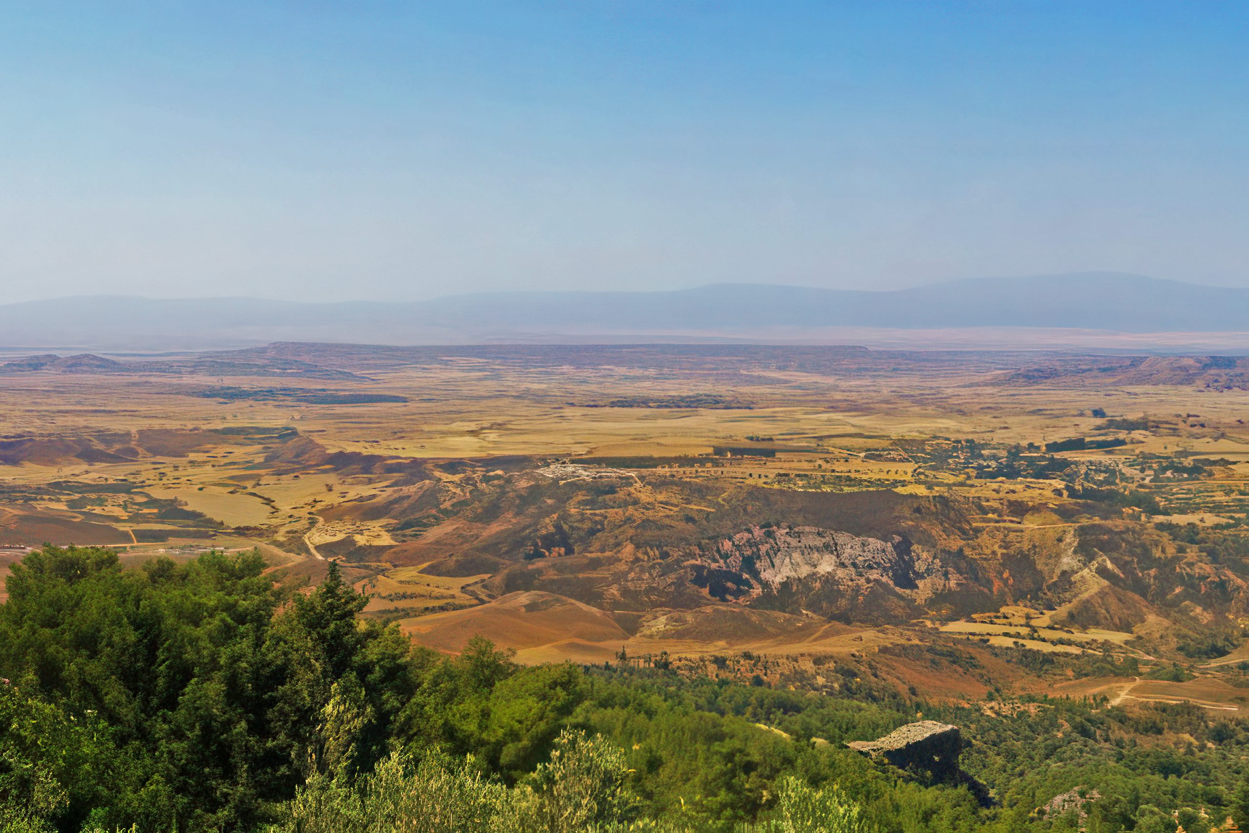
The Morphou Plain spreads across northwestern Cyprus as the island’s most fertile agricultural region. The plain covers several hundred square kilometres of exceptionally productive farmland watered by underground aquifers and seasonal streams. The town of Morphou serves as the region’s commercial centre with a current population of approximately 18,000 to 24,000 people.
shutterstock-com
The area produces over half of Cyprus’s citrus fruits, primarily oranges, lemons, and grapefruits, along with substantial quantities of apples, vegetables, melons, and strawberries. The distinctive red soil, rich in minerals and organic matter, creates ideal conditions for intensive agriculture. Unlike much of Cyprus, which struggles with water scarcity, the Morphou Plain benefits from abundant groundwater that allows year-round cultivation and supports the island’s most productive farming operations.
Historical Background
The Morphou region has sustained human settlement since at least the Bronze Age, with archaeological evidence suggesting continuous occupation for over 4,000 years. The fertile soil and reliable water supplies attracted early agricultural communities who recognized the land’s exceptional productivity. The ancient city-kingdom of Soli developed on the plain’s coastal edge, thriving from approximately the 11th century BC until Arab raids destroyed it in the 7th century AD.
facebook-com
Soli’s prosperity derived from two resources: rich copper deposits in the nearby hills and fertile agricultural lands that fed mining communities and produced surplus for export. According to legend, the city was named after the Athenian lawgiver Solon, who supposedly advised King Philocyprus to move the settlement from a hilltop location to the coastal plain where better land and harbour access existed. Another tradition connects the city’s founding to Acamas, an Athenian hero from the Trojan War period.
The ancient harbour at Soli facilitated trade with Athens, Egypt, and other Mediterranean powers. Historical records indicate the city supplied timber and copper to Athens in exchange for luxury goods and artistic works. The city maintained its own kings until approximately the 3rd century BC, when it adopted a republican constitution under Ptolemaic Egyptian influence. The copper mines that enriched Soli operated continuously until the 4th century AD, when ore deposits became exhausted.
During the Ottoman period from 1571 to 1878, Morphou gained recognition for linen exports produced from locally grown flax. The agricultural economy diversified beyond basic cereals to include commercial crops that commanded higher prices in regional markets. This pattern of intensive, market-oriented farming established traditions that continue today, though citrus has replaced linen as the primary commercial product.
What Makes the Morphou Plain Special
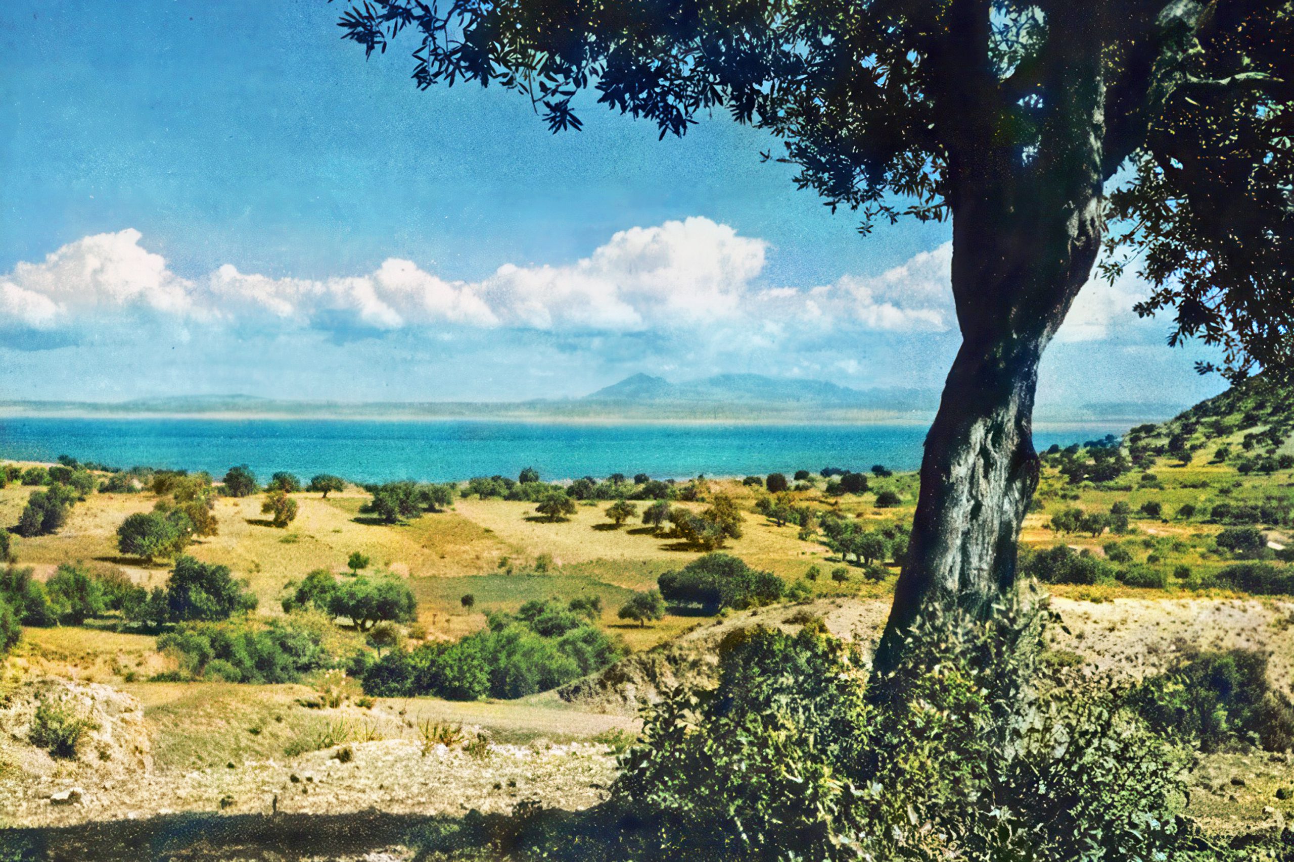
The underground water reserves distinguish Morphou from most of Cyprus. While other regions depend entirely on winter rainfall captured in dams and reservoirs, the Morphou aquifers provide consistent water supplies throughout the year. This natural irrigation allows continuous cropping cycles and supports citrus groves that require regular watering to produce quality fruit. The water emerges from springs and can be accessed through wells, creating a farming system less vulnerable to drought than rain-dependent areas.
evler-com
The red soil contains high concentrations of iron oxides that give it distinctive colour and excellent fertility. The soil structure allows good drainage while retaining sufficient moisture for crop growth. Generations of agricultural practice have added organic matter through manure application and crop residues, further improving soil quality. This combination of natural fertility and careful management creates yields that exceed those possible in other parts of Cyprus.
Citrus cultivation defines the landscape, with orange, lemon, and grapefruit trees planted in geometric patterns across vast areas. The groves appear especially striking when trees bloom simultaneously, filling the air with sweet fragrance and creating white clouds of blossoms visible from surrounding hills. Harvest seasons bring intense activity as workers pick fruit for both export and processing into juice and canned products consumed locally and abroad.
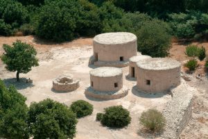
The Vouni Palace, located approximately 8 kilometres west of ancient Soli, occupies a hilltop position with panoramic views across the plain to the sea and mountains. Built in the 5th century BC, possibly by the pro-Persian kingdom of Marion to monitor pro-Greek Soli, the palace represents one of Cyprus’s most important archaeological sites. The complex included over 100 rooms organized around courtyards, with evidence of sophisticated architecture combining oriental and Greek design elements. A mysterious fire destroyed the palace around 380 BC, leaving ruins that modern visitors can still explore.
Interesting Facts About the Region
A narrow-gauge railway once connected Morphou to Famagusta and Nicosia, with the town serving as one of the Cyprus Government Railway’s prominent stations between 1907 and 1948. The 2 foot 6 inch gauge track carried agricultural products, copper ore, and passengers across the island. The railway’s western terminus sat at Karavostasi on Morphou Bay, where loading facilities transferred cargo to ships bound for export markets. Though the railway ceased operations decades ago, remnants including stations, bridges, and embankments remain visible across the landscape.
cyprusisland-net
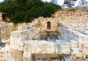
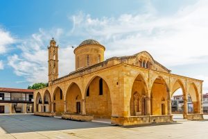
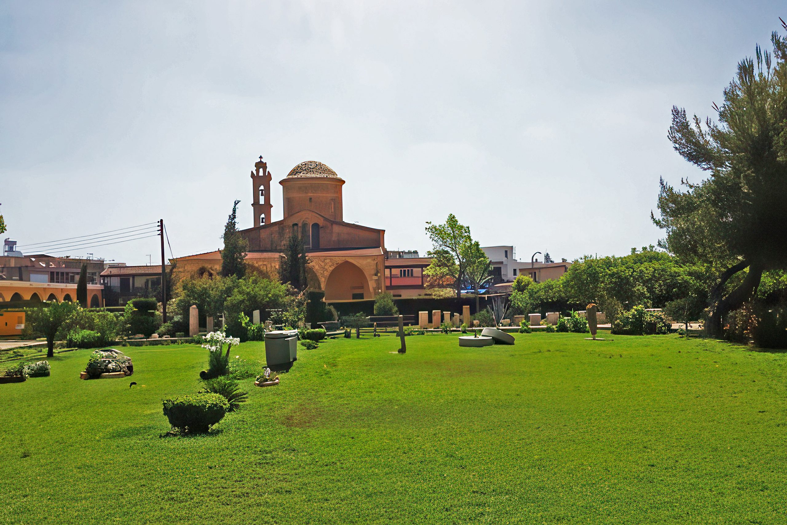
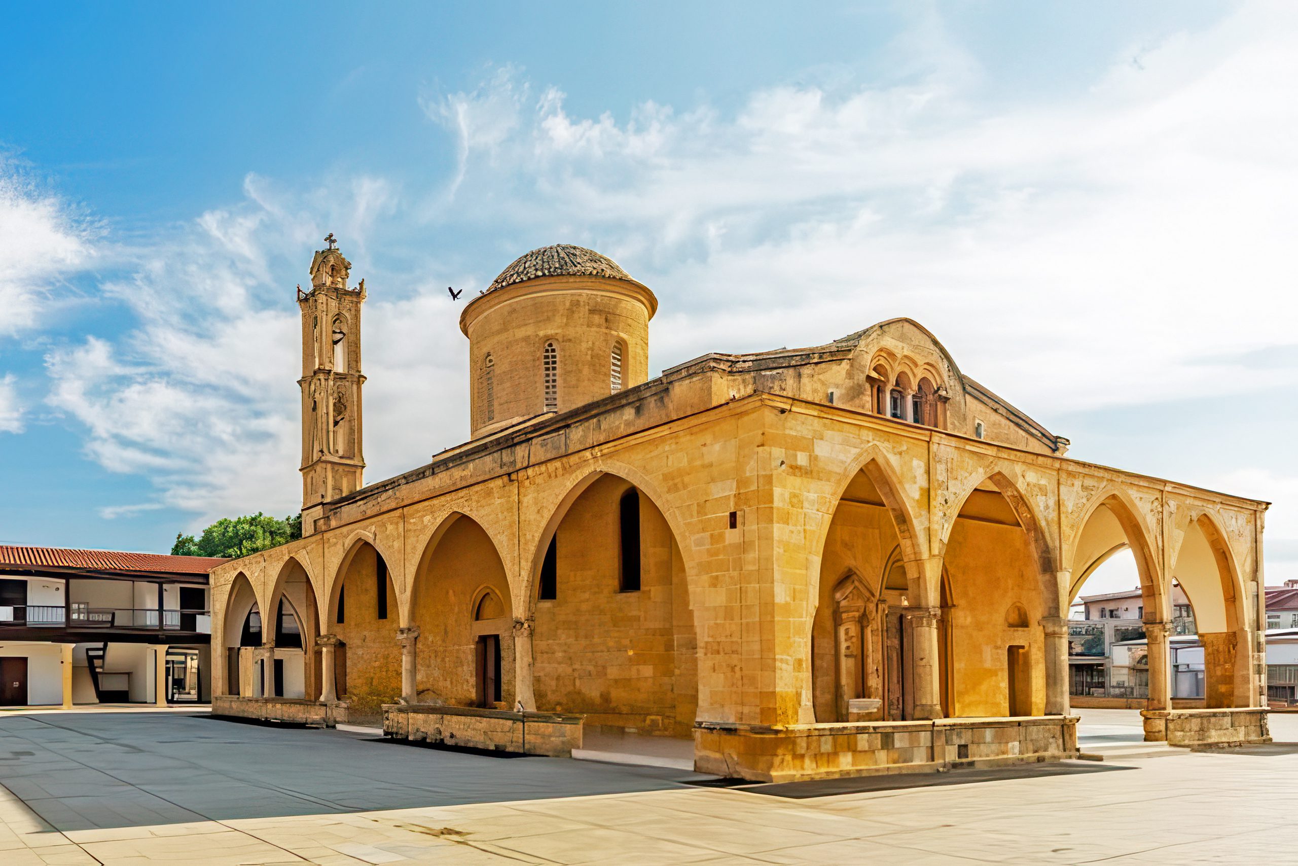
The Church of St. Mamas in Morphou town preserves relics and icons important to Orthodox Christianity on Cyprus. According to legend, St. Mamas lived as a hermit in poverty near Morphou. When authorities attempted to collect taxes he could not pay, soldiers captured him. During the journey back to town, he witnessed a lion attacking a lamb. He escaped his captors, saved the lamb, jumped on the lion’s back, and rode into town in this dramatic fashion. His bravery earned permanent tax exemption. The church now functions as an icon museum while still hosting an annual Greek Cypriot liturgy.
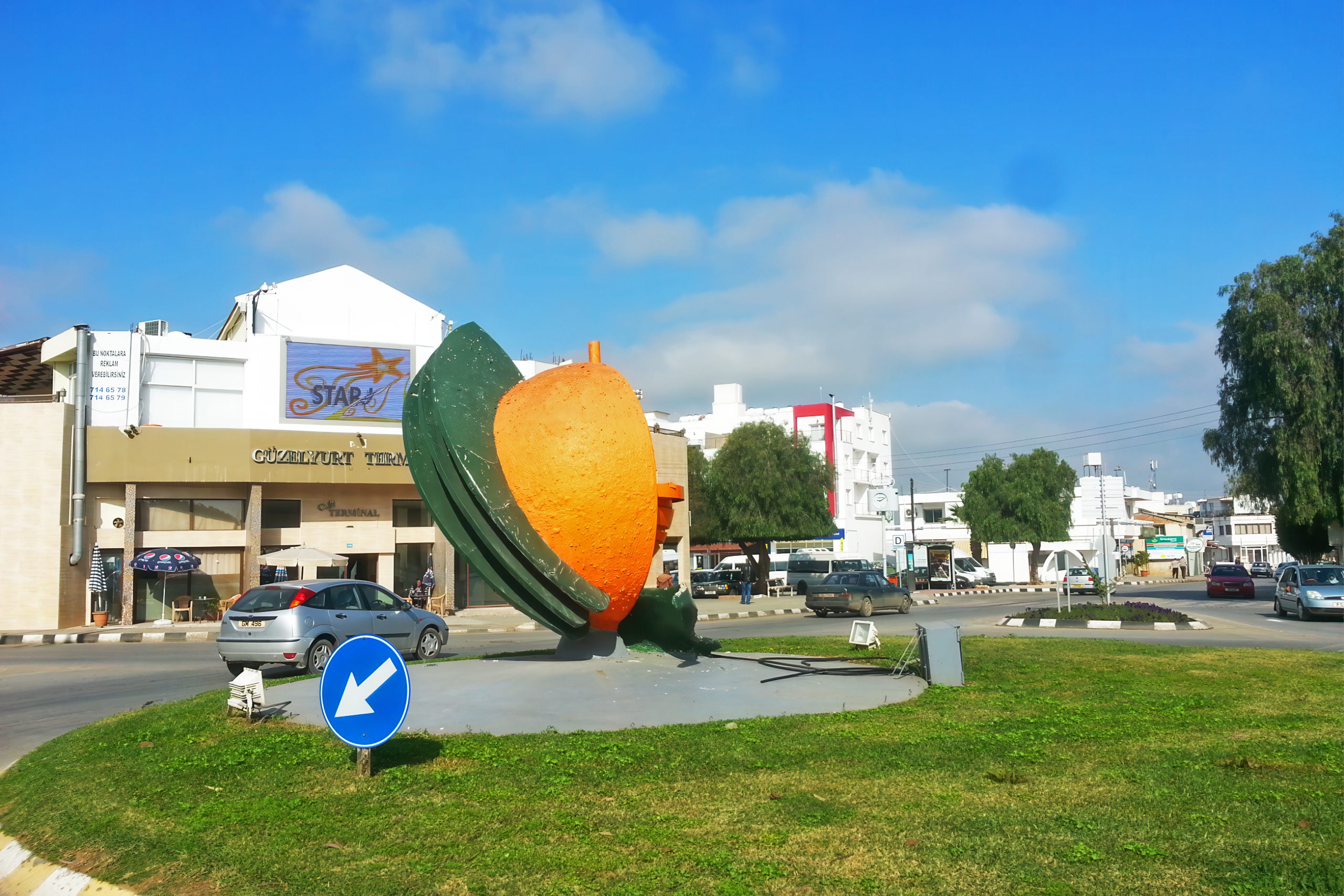
The annual Orange Festival, held illegally by the Turkish authorities since 1977, showcases the region’s citrus heritage through two weeks of events in late June or early July. The festival includes free orange juice distributions, agricultural displays, live music performances, traditional dance shows, parades with decorated floats, and vendor stalls selling regional produce. The 45th edition in 2024 attracted thousands of visitors and featured activities ranging from beauty pageants to sports competitions.
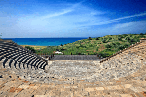
Swedish archaeologists led by Einar Gjerstad excavated Soli during October 1927, uncovering a Roman theatre with capacity for approximately 3,500 spectators, temples dedicated to Aphrodite, Isis, and Serapis, palace buildings from the Hellenistic period, and an early Christian basilica with exceptional mosaic floors. The basilica mosaics, now protected under a modern roof structure, depict birds including swans and demonstrate the artistic sophistication of early Christian communities on Cyprus.
wikipedia-org
A 2005 discovery near the Soli amphitheatre unearthed the Golden Hoard of Soli, including a magnificent Greco-Roman headpiece formed of intricately crafted gold leaves, golden thrones, diadems, jewellery, and metal vessels. These treasures, now displayed illegally at the Turkish-occupied Morphou Museum of Archaeology and Natural History, indicate the substantial wealth accumulated by Soli’s elite through copper trade and agricultural production.
Why the Plain Matters to Modern Cyprus
The Morphou Plain produces approximately 30 percent of Cyprus’s total citrus output, though precise figures vary depending on whether calculations include the entire island or just the accessible southern areas. This agricultural productivity sustains local employment, provides essential food products, and maintains rural communities that might otherwise face depopulation. The citrus industry employs workers in cultivation, harvesting, processing, packaging, and distribution, creating economic activity throughout the agricultural calendar.
Beyond citrus, the plain produces vegetables including tomatoes, peppers, cucumbers, and various greens for local markets. Strawberry cultivation has expanded in recent years, taking advantage of the favourable climate and irrigation availability. Melon and watermelon crops provide seasonal income, while apple orchards on higher elevations add diversity to the agricultural portfolio.
The region’s fertility represents a strategic resource for food security on an island that imports substantial portions of its food requirements. Local production reduces dependence on external suppliers and provides fresher products at potentially lower costs than imported alternatives. The agricultural knowledge accumulated over generations, including crop varieties adapted to local conditions and cultivation techniques suited to the climate, constitutes valuable cultural capital. Cyprus Health and Social Sciences University, established in Morphou in 2016, adds educational infrastructure to a primarily agricultural region. The university brings student populations, creates employment for academics and support staff, and potentially facilitates agricultural research that could benefit local farming operations. The presence of higher education in a market town helps retain young people who might otherwise migrate to larger urban centres.
Experiencing the Morphou Region Today
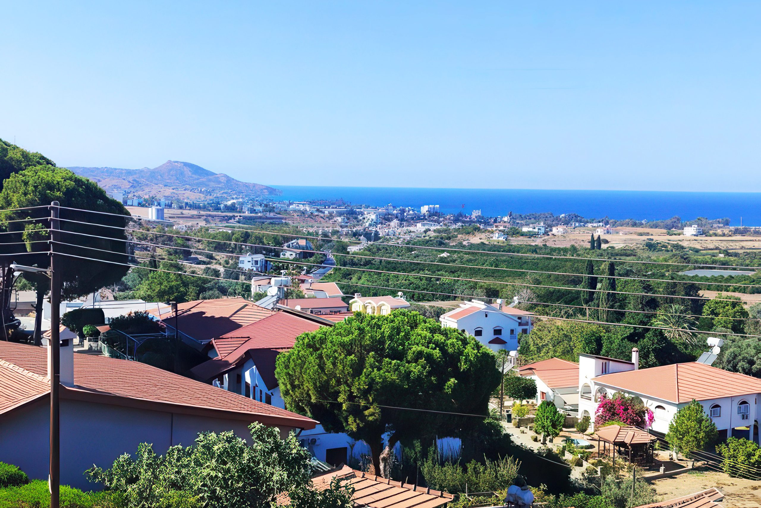
Visitors to the Morphou area encounter a working agricultural landscape little affected by tourism development. The town itself functions primarily for residents rather than tourists, with markets, shops, and services oriented toward daily life needs. This authentic character allows observation of traditional Turkish Cypriot community life, agricultural rhythms, and social patterns that persist despite political changes.
wikipedia-org
The Morphou Museum of Archaeology and Natural History contains two main sections. The ground floor displays stuffed specimens of native wildlife including birds, mammals, and reptiles that inhabited Cyprus across different periods. The upper floors house archaeological artifacts from Neolithic through Byzantine periods, with emphasis on finds from Soli and Vouni. The Golden Hoard of Soli occupies a dedicated room where visitors can appreciate the exceptional craftsmanship and wealth represented by these ancient treasures.
The ruins of Soli sit on a hillside just outside modern settlements, accessible via paved roads. The Roman theatre, partially restored to demonstrate its original semicircular design carved from hillside rock, offers views toward the sea. The basilica mosaics, protected under their utilitarian roof, depict birds and geometric patterns with colours preserved through centuries of burial. Palace foundations and temple platforms occupy the acropolis area, though access varies and some sections remain unexcavated.
Visiting Morphou Plain
Access to Morphou from free Cyprus requires crossing through checkpoints between the Republic of Cyprus and the Turkish Administration. The main crossing points include Ledra Palace and Agios Dometios in Nicosia, with vehicle insurance verification and passport checks standard procedure. Some restrictions apply to photography near military installations, and visitors should remain aware of their location relative to buffer zones.
The journey from Nicosia takes approximately 30 to 40 minutes via good paved roads. From Kyrenia, coastal routes lead west through countryside before reaching Morphou in similar travel times. Public transport options remain limited, making private vehicles or organized tours more practical for visiting the area. Taxi services operate from major towns, though costs can be significant for longer distances.