Explore Cyprus with Our Interactive Map

Explore our top stories and discover ideas worth your time.

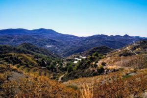
Papoutsa Peak Cyprus Eco Trails

Papoutsa Peak Cyprus Eco Trails

Papoutsa Peak stands at 1,554 metres in the eastern Troodos Mountains, surrounded by one of Cyprus's most important forest reserves. The forests are part of the Adelfoi Forest system, a vast protected area recognized within the Troodos Geopark for its ecological significance. The peak sits between Mount Olympus to the west and Madari to the north, creating a corridor of protected wilderness that covers over 120 square kilometres. Unlike more accessible Troodos peaks with developed facilities, Papoutsa maintains a wilder character with fewer visitors and more pristine ecosystems. The mountain lies within the Papoutsa and Adelfoi Forests mentioned by the Troodos Geopark as among the island's most noteworthy woodland areas. These forests protect crucial habitat for species found nowhere else on Earth. The combination of elevation, geology, and minimal human disturbance creates conditions where rare plants and animals can survive pressures that threaten them in more accessible locations. Historical Background The Troodos Mountains, including Papoutsa, emerged approximately 92 million years ago as oceanic crust from the ancient Tethys Ocean. Tectonic forces pushed this underwater rock upward through obduction, eventually creating the island's central mountain mass. Papoutsa consists of the same serpentinized harzburgite and peridotite rocks found throughout Troodos, representing mantle material from thousands of metres beneath the ancient seabed. These ultramafic rocks create unique soil chemistry with high concentrations of…

Read more

Kionia – Profitis Elias Nature Trail

Kionia – Profitis Elias Nature Trail

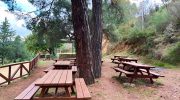
The Kionia to Profitis Elias Nature Trail represents a significant route within the Machairas forest network. This path connects the high peak of Kionia with the historic chapel of Profitis Elias. It offers a clear view of the eastern Troodos mountain range and the surrounding valleys. Visitors witness a landscape that transitions from dense pine thickets to open rocky ridges. The air at this altitude stays remarkably fresh and carries the scent of wild mountain herbs. This specific environment supports a variety of plants that flourish in the volcanic soil of the region. Each section of the track provides a new perspective on the natural history of the island. The path follows the ancient contours of the land to ensure a steady and rhythmic pace. It serves as an ideal destination for those who seek a quiet encounter with the wild peaks. Trail Overview Location: Machairas Forest, Nicosia District Distance: 4.3 miles (7 km) Route Type: Linear Difficulty: Moderate Elevation Gain: 980 feet (300 meters) Duration: 3 – 3.5 hours Best Time to Visit: February – May Terrain: Rocky and Dirt Path Botanical Composition and Forest Ecosystem The Kionia to Profitis Elias Nature Trail sits within a vast expanse of Calabrian pine forest. These trees dominate the northern slopes and provide a consistent canopy for the traveler. This shade is…

Read more
Kakopetria Gorge Cyprus

Kakopetria Gorge Cyprus

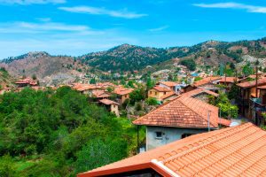
Kakopetria Gorge forms around the meeting point of two permanent mountain streams in the Troodos range. The Karkotis and Garillis rivers converge in this valley at 667 meters elevation, creating the Klarios River that flows 24.75 kilometers to Morphou Bay. The gorge sits in the heart of the Solea Valley, 55 kilometers from both Nicosia and Limassol, surrounded by dense pine forests and traditional stone villages that have preserved their character for centuries. The gorge takes form along the banks of two rivers that maintain year-round flow, unusual for Cyprus where most streams run dry during summer. The Karkotis originates from the northwestern slopes of Papoutsa peak, while the Garillis flows from the northeastern slopes of Mount Troodos. Hundreds of springs feed both rivers as they descend through the mountains before joining at Kakopetria village. The continuous water flow created the Solea Valley, one of Cyprus's most fertile mountain regions. Artificial canals branch from the rivers, directing water to surrounding villages for irrigation and domestic use. The reliable water supply supports extensive fruit orchards, vegetable gardens, and vineyards that thrive in conditions rare elsewhere on the island. The area forms part of the Natura 2000 network of protected sites, designated code CY2000012 under European conservation directives. The designation recognizes the valley's importance for diverse natural habitats and agricultural landscapes that…

Read more