Explore Cyprus with Our Interactive Map

Explore our top stories and discover ideas worth your time.

The Gymnasium of Salamis

The Gymnasium of Salamis

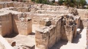
The ancient city of Salamis on Cyprus holds some of the Mediterranean's most remarkable Roman architecture. Among its treasures, the Gymnasium stands out as a testament to how Romans blended physical training, social interaction, and luxury bathing into a single sprawling complex. Located on the eastern coast near modern Famagusta, this site offers visitors a direct connection to daily life in Roman Cyprus. The Gymnasium traces its roots to the Hellenistic period, when Greek colonists first established athletic training facilities in Salamis. However, the structure visible today belongs to the 2nd century AD, specifically during the reigns of emperors Trajan and Hadrian. The transformation came after a devastating Jewish revolt in 116 AD that left much of Salamis in ruins. Rather than simply repairing the damage, Roman engineers rebuilt the Gymnasium on a grander scale. The new complex featured a colonnaded palaestra, a large open courtyard surrounded by covered walkways on all four sides. This provided athletes with shaded areas for training and spectators with comfortable viewing spots. The Romans added sophisticated bathing facilities that transformed the Gymnasium from a simple training ground into a complete social center. An inscription found in the pavement credits Trajan with constructing the roof over one of the swimming pools, while multiple honorific decrees mention Hadrian as a benefactor and savior of the city.…

Read more
Cyprus Valleys Summer Guide

Cyprus Valleys Summer Guide

When summer temperatures on coastal Cyprus climb past 40 degrees Celsius, the mountain valleys offer something different. These elevated landscapes carved into the Troodos Mountains maintain temperatures 10 to 15 degrees cooler than the scorching lowlands. The valleys provide more than comfortable weather. They create microclimates where fruit trees thrive, rivers flow year-round, and villages preserve centuries of mountain culture. Temperature drops about 5 degrees Celsius for every 1,000 meters of elevation gained. In July and August, when lowland areas reach 34 to 40 degrees, the mountain valleys average 28 degrees at their highest points. Night temperatures fall to comfortable levels, often 10 degrees cooler than daytime peaks. This temperature difference transforms the valleys into natural air conditioning systems for an island known for intense summer heat. Cedar Valley and the Paphos Forest Sanctuary Cedar Valley sits at the intersection of three districts, nestled within the 70,000-hectare Paphos Forest at elevations above 1,000 meters. The valley takes its name from 130,000 Cyprus cedars that grow nowhere else on Earth. Cedrus brevifolia represents an endemic subspecies closely related to the famous cedars of Lebanon. These trees, with their upright trunks and broad foliage, can reach 40 meters in height. The cedar forest shares space with Calabrian pines, which thrive in the Mediterranean climate and can grow to similar heights over 100…

Read more
Spilia Tis Athasias Hiking Trail

Spilia Tis Athasias Hiking Trail

The Spilia Tis Athasias Nature Trail is a pristine woodland route tucked away in the mountainous region of the Larnaca District in Cyprus. Known to the local community as the Moutti tis Athasias Trail, this route is one of the most serene and peaceful options for hikers exploring the higher reaches of the island. What makes the trail distinct is the seamless transition from an open panoramic path to a dense pine woodland. The journey culminates at a historic mining cave dating back to the Venetian era, offering a combination of pure natural beauty and historic intrigue. Trail Overview Location: Near Vavatsinia Village, Larnaca District Distance: 2.25 km (1.4 miles) one-way / 4.5 km (2.8 miles) out-and-back Route Type: Linear (Out-and-Back) Technical Difficulty: Easy to Moderate Duration: 1 to 1.5 hours total (round trip) Elevation Gain: 120–200 m (390–650 ft approx.) Maximum Altitude: 1,000–1,040 m (3,280–3,410 ft) Best Time to Visit: March – May and October – November Detailed Analysis of the Route Experience The Initial Forest Road Stage The journey begins on a wide, loose-surface gravel farm road. This first section covers approximately 1.5 kilometers of the hike. Because it is a repurposed rural access road, the terrain is quite even and poses very few technical challenges for walkers. The road curves gently around the mountain slope, operating as…

Read more