Explore Cyprus with Our Interactive Map

Explore our top stories and discover ideas worth your time.

Agios Onoufrios Nature Trail

Agios Onoufrios Nature Trail

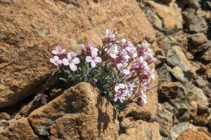
The Agios Onoufrios nature trail offers a profound look into the rugged beauty of the Machairas forest. This path winds through a landscape rich with history and diverse plant life. It provides a quiet space for those who want to see the wild side of the island. The route starts near the historic monastery and climbs toward the high ridges. Each step reveal a new part of the valley below. The air stay cool even in the heat of the summer months. This trek is a favorite for people who appreciate silence and natural views. The path is well mark and easy to follow for most hikers. It showcases the unique geology of the Troodos foothills. Visitors can see the impact of ancient volcanic activity in the rocks. This journey connects the soul to the ancient earth of Cyprus. Trail Overview Location: Machairas Forest, Nicosia District, Cyprus Distance: 5.2 miles (8.4 km) Route Type: Circular Difficulty: Moderate Elevation Gain: 1148 feet (350 meters) Duration: 3 – 3.5 hours Best Time to Visit: October–May Terrain: Rocky and Dirt Path Geological Foundation and Soil Composition The foundation of the Agios Onoufrios trail consists of diabase and gabbro rocks. These stones belong to the Troodos ophiolite complex which is a world famous geological site. This area once sat at the bottom of a…

Read more
Northern Coast Beaches of Cyprus

Northern Coast Beaches of Cyprus

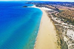
The northern coastline of Cyprus stretches from Morphou Bay in the west to the Karpasia Peninsula in the east, offering over 100 beaches of varied character. Unlike the southern coast dominated by golden sands, the northern shores feature more pebble beaches interspersed with sandy coves and dramatic cliffs. The Kyrenia mountain range, also called the Pentadaktylos or Five Finger Mountains, rises directly behind the coast, creating spectacular backdrops where pine covered peaks descend to turquoise waters.  The northern beaches remain less developed than their southern counterparts, with many small coves hidden behind rock formations requiring exploration to find. This area falls within Turkish controlled Cyprus, accessible through checkpoints from the Republic of Cyprus. The coastline varies dramatically from long stretches of sand at Famagusta Bay and the Karpasia Peninsula to rocky shorelines west of Kyrenia. Alagadi Turtle Beach protects endangered species Alagadi Beach, located approximately 16 kilometers east of Kyrenia near the village of Ayios Amvrosios, ranks among the most important nesting sites in the Mediterranean for loggerhead and green turtles. The beach extends just over 600 meters along the coast with soft golden sand perfect for turtle nesting. From June through September, female turtles come ashore to lay eggs in the dunes, with each nest containing 80 to 120 eggs.  The Alagadi Turtle Beach Project operates a conservation initiative…

Read more
Rural Farming Life in Cyprus

Rural Farming Life in Cyprus

Agriculture constituted the backbone of Cyprus's economy when the country achieved independence in 1960, consisting mostly of small farms and sometimes even subsistence operations. In the early 1970s, Cypriot farms, still overwhelmingly small owner-run units, furnished about 70 percent of commodity exports and employed about 95,000 people, or one-third of the island's economically active population. The traditional rural landscape featured fragmented holdings where families worked terraced hillsides and valley floors, producing grapes, olives, wheat, barley, carobs, and seasonal vegetables. This farming pattern shaped village life for centuries, creating rhythms of planting, harvesting, and communal celebration that defined Cypriot identity as much as the Orthodox church or family structures. How Villages Worked the Land Landholdings remained generally small, highly fragmented, and dispersed under traditional laws of inheritance. When a father died, his land divided equally among all children, creating increasingly smaller parcels with each generation. A single family might own a dozen tiny plots scattered across the village territory, requiring farmers to travel between distant fields throughout the day. This fragmentation made mechanization difficult and reduced efficiency. Traditional irrigation relied on natural springs, small rivers, and rainfall patterns. Farmers channeled spring water through stone aqueducts and earthen channels to reach thirsty crops during summer months. Villages located near reliable water sources prospered, while those depending solely on rainfall struggled during dry…

Read more