These fortifications originally served as watchtowers and defensive positions against Arab raids from the 7th to 10th centuries, with guards using fire signals to communicate between castles and warn coastal cities of approaching enemies. The strategic positioning allowed 360-degree views across both northern and southern coasts, with Kantara’s summit offering visibility extending to Turkey, Lebanon’s mountains 160 kilometers away, and across the Karpasia Peninsula.
Saint Hilarion’s Fairytale Architecture
Saint Hilarion Castle occupies an impregnable position on a rocky outcrop at 732 meters, creating a structure believed to have inspired Walt Disney’s design for Snow White and the Seven Dwarfs castle. The fortress divides into three distinct levels embedded into mountain rock, each featuring hidden rooms, secret tunnels, and gardens offering panoramic views of the Mediterranean and surrounding countryside. Byzantine builders originally constructed the castle in the 10th or 11th century, though some sources suggest earlier origins.
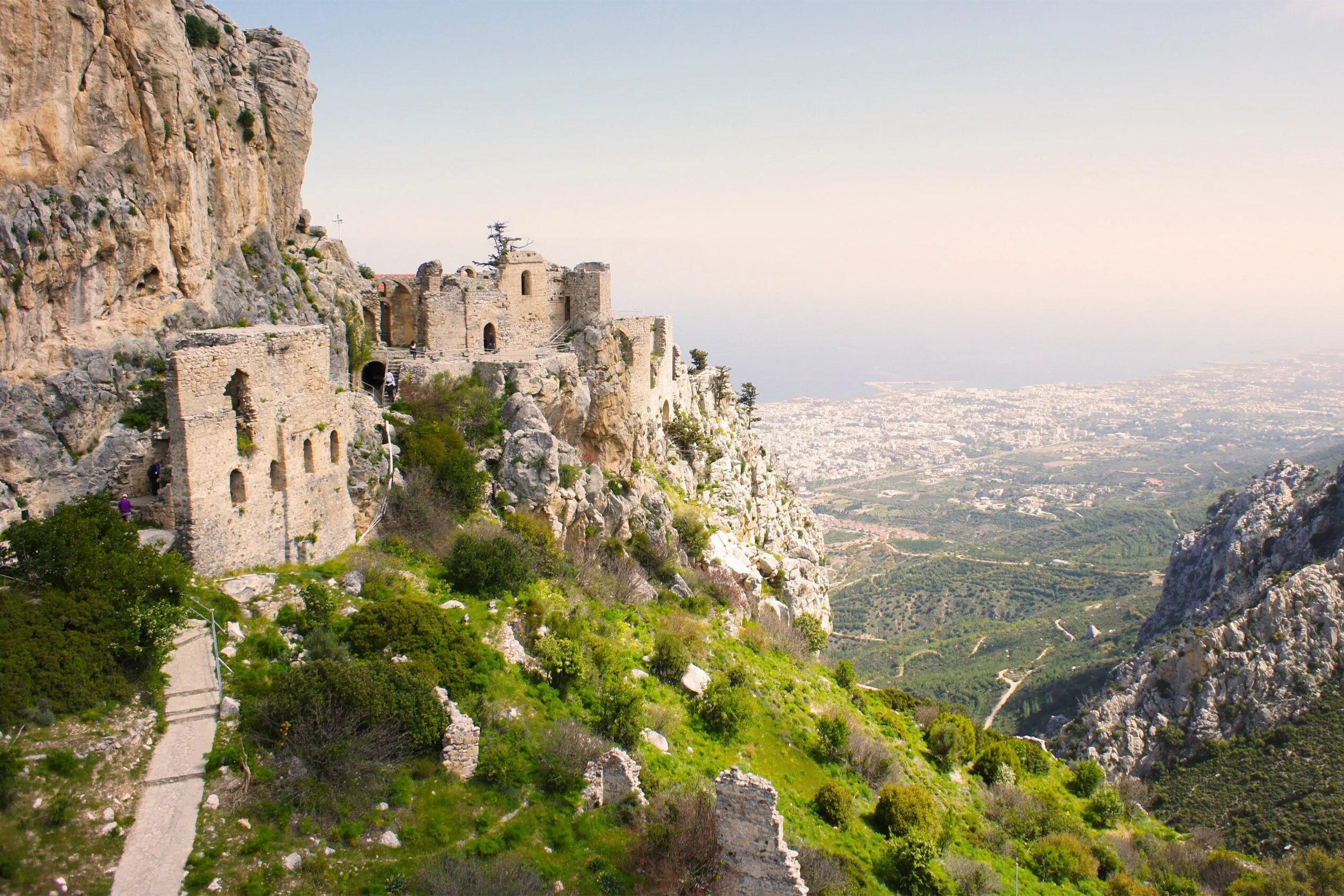
The Lusignan dynasty from 1192 to 1489 expanded the fortifications extensively, adding chambers for knights, royal families, and administrative functions. The castle served simultaneously as military outpost and royal summer residence, with the upper level containing royal apartments that provided escape from coastal heat. The Venetians who ruled from 1489 to 1571 added heavy defensive walls and strong towers, though they later abandoned mountain castles in favor of coastal fortifications at Kyrenia, Famagusta, and Nicosia.
The castle’s three-level structure reflects its multiple functions. The lower level contained stables, storage areas, and garrison quarters where soldiers lived during active service. The middle level housed administrative buildings, barracks, and the Byzantine church. The upper royal apartments featured elaborate windows including the famous princess window where legend claims a Lusignan prince threw suitors who failed to meet approval over the cliff to their deaths below.
Buffavento Castle of the Winds
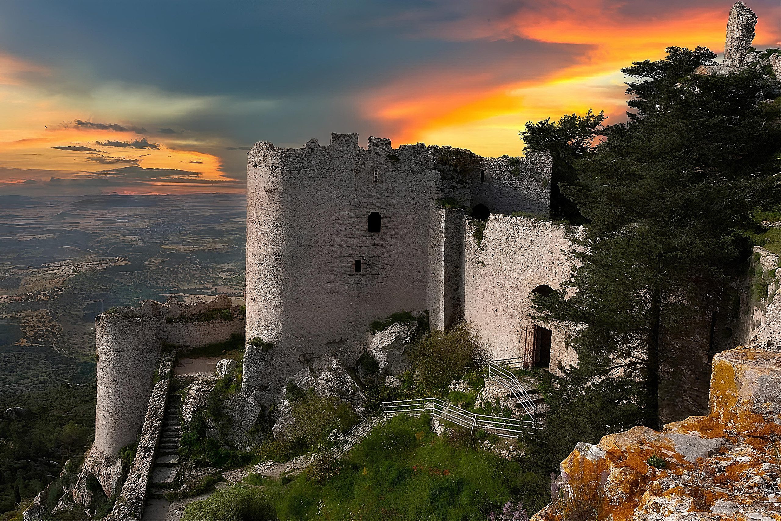
Buffavento, whose name translates from Italian as gusty wind or awakening wind, stands at 945 meters elevation making it the highest of the three mountain castles. The location between Saint Hilarion to the west and Kantara to the east allowed signal communication across the entire defensive network. The castle clings to steep cliff edges overlooking deep valleys, with sheer drops on north, west, and south sides creating virtually impregnable natural defenses.
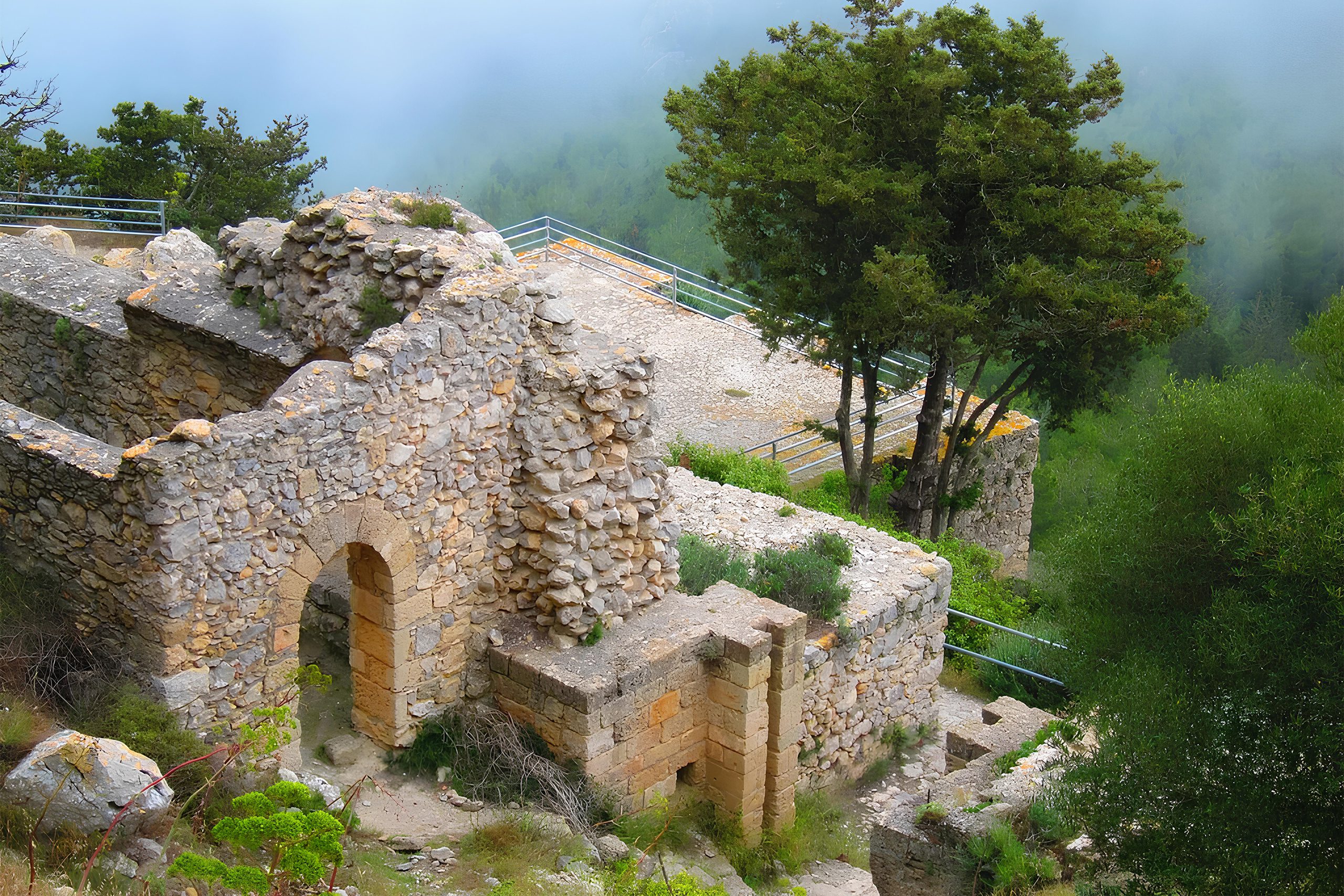
Byzantine king Isaac Komnenos reportedly took shelter at Buffavento in 1191 when Richard the Lionheart invaded Cyprus during the Third Crusade. During the medieval period, the castle earned the name Lion Castle or Chateau du Lion and functioned as a political prison where enemies of the state were held in remote mountain isolation. The 30 to 40 minute climb from the parking area to the summit follows steep stone steps past scattered ruined rooms between rocky peaks.
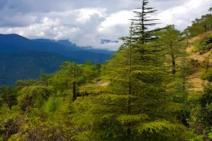
The castle operated on two levels, with stone rooms on the lower section serving various purposes over centuries and an upper section reachable by a ten-minute stair climb offering spectacular views. Water cisterns beneath the lower level provided essential water storage in an environment where natural sources were minimal. When weather permits, visitors see Kyrenia to the north, Famagusta to the east, Nicosia inland, and the Troodos Mountains to the south. The 1995 Cyprus forest fire destroyed surrounding trees but left Buffavento unharmed, a testament to its stone construction.
Kantara’s Panoramic Command Post
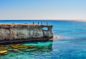
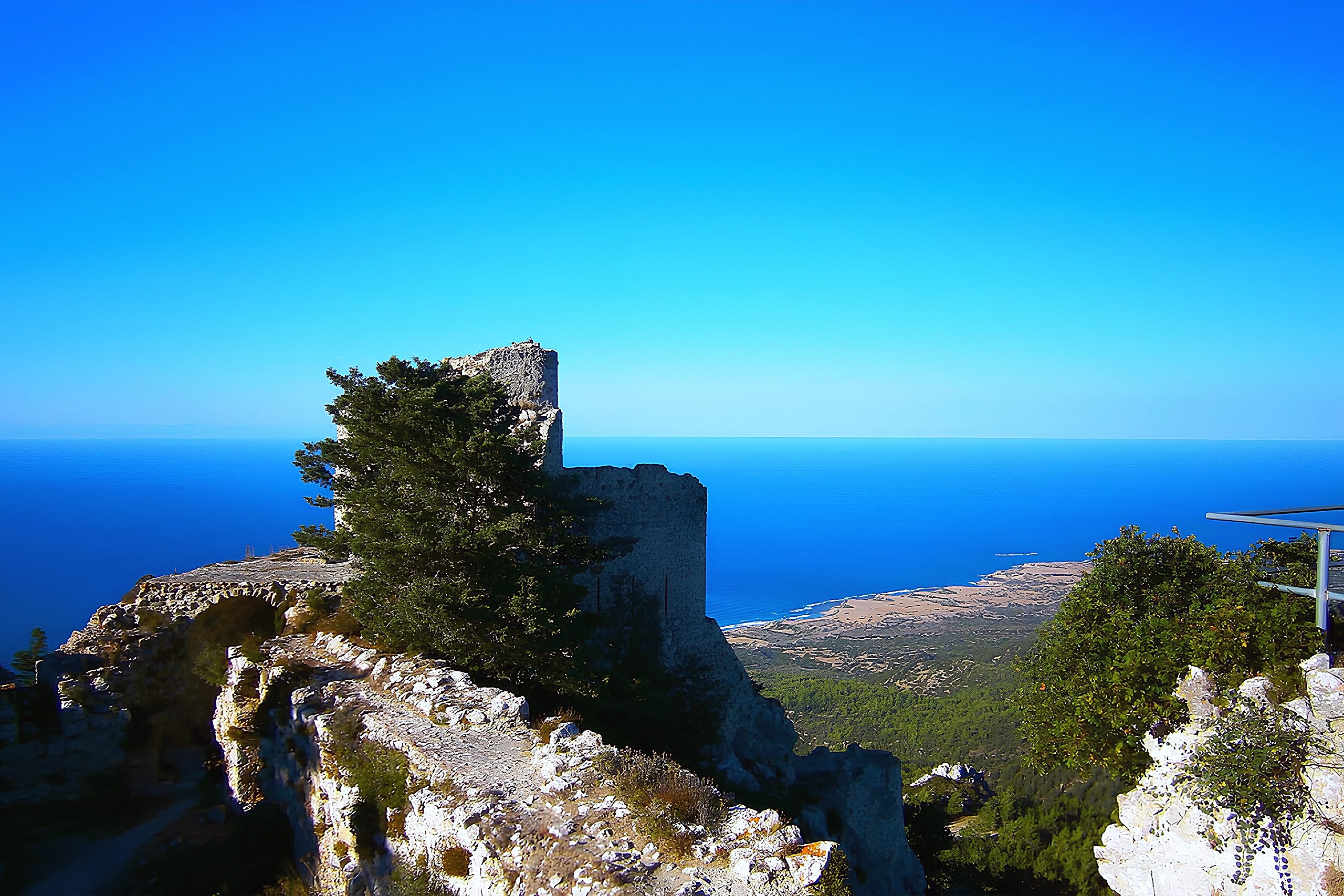
Kantara Castle occupies the easternmost position at 630 meters elevation, lower than its sister fortresses but commanding the best views across both north and south coasts. The Arabic name Kantara means bridge or arch, referencing the castle’s position bridging the mountain range with visibility across the entire Karpasia Peninsula. On clear days, observers see Turkey’s distant mountains and Lebanon’s snows 160 kilometers away, demonstrating the extraordinary surveillance capabilities these positions provided.
The castle controlled the entrance to the Karpasia Peninsula while monitoring both the northern coast and the Mesaoria Plain to the south. This strategic location made Kantara invaluable for detecting approaching threats from any direction. The rocky hilltop determined both the outer contour and internal arrangement of buildings, with steep cliffs on north, west, and south making approach impossible except from the east where the main gate controlled access.
In 1228, the castle endured siege by the Ibelins who bombarded it with trebuchets during power struggles between Emperor Frederick II and regent John d’Ibelin. The garrison surrendered after a year when commander Gauvain de Cheneche was killed by a crossbow bolt. In 1373, Prince John of Antioch escaped imprisonment in Famagusta and fled to Kantara, from which he organized successful counteroffensive that expelled the Genoese invaders who failed to capture the fortress.
Kyrenia Castle Harbor Defense
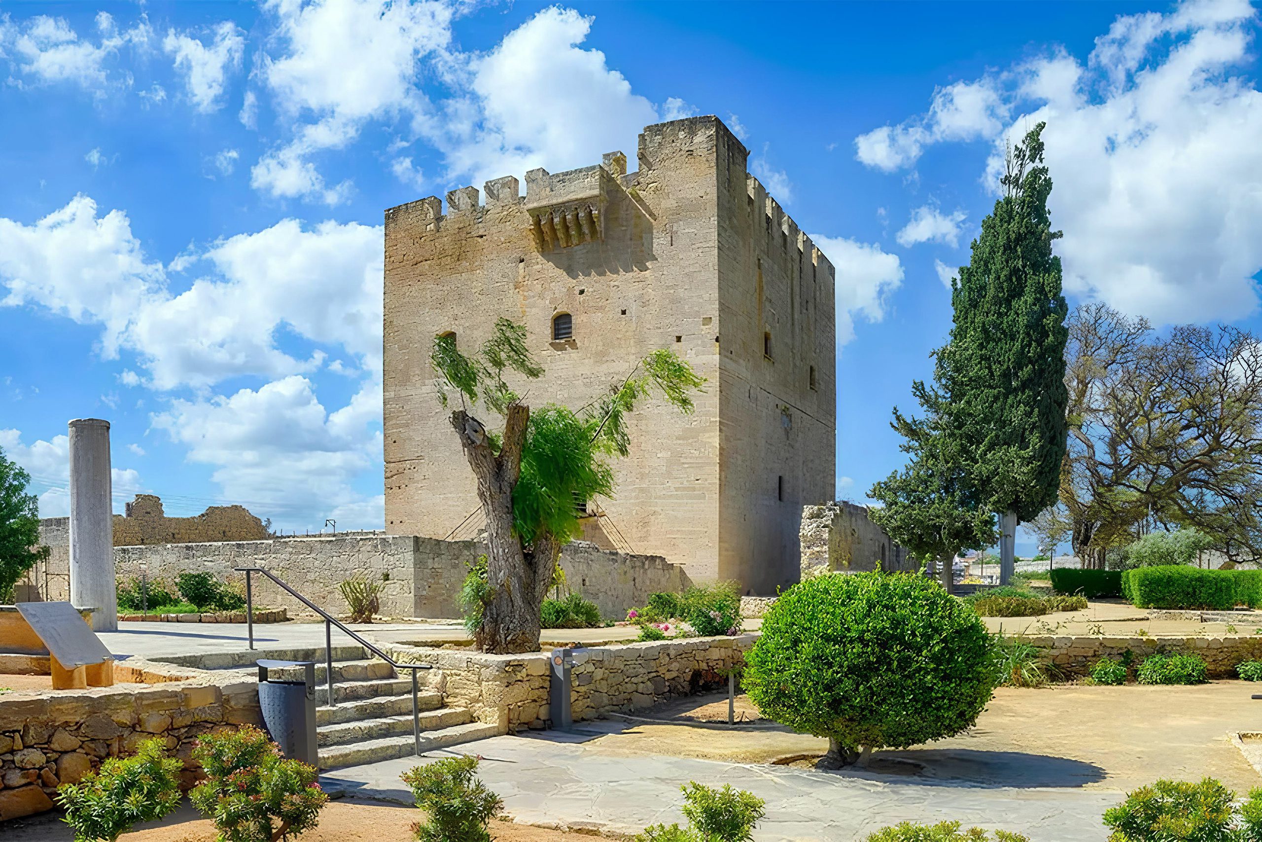
Kyrenia Castle dominates the small port city’s skyline from its rocky coastal outcrop where it has guarded the strategic harbor since Byzantine times. Four large towers connect high city walls that create an extremely spacious interior resembling a deserted stone city. The Shipwreck Museum inside displays a 4th century BC Greek merchant vessel discovered 800 meters offshore in 1967, one of the oldest shipwreck museums worldwide.
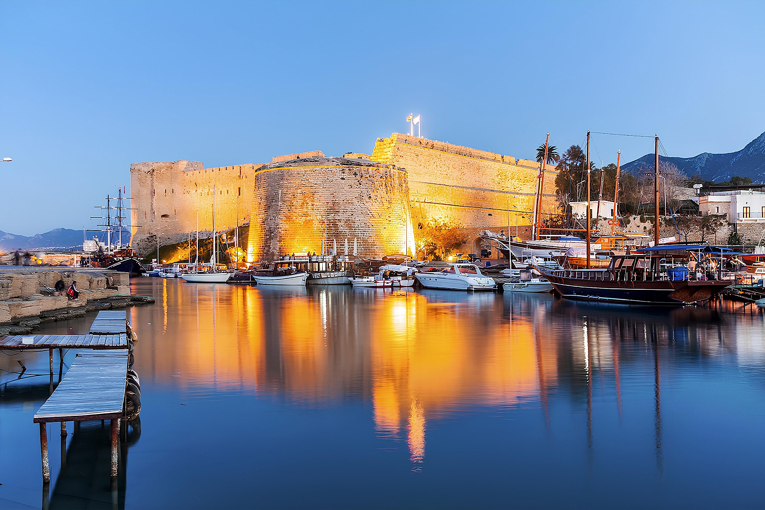
Roman or Byzantine emperors laid the foundations, though exact construction dates remain uncertain. The Franks renovated extensively, adding chambers for knights and royal families. Venetians reinforced fortifications further before Ottoman conquest in 1570 replaced Frankish and Venetian flags with the red banner of Islam. British colonial authorities used the castle as a prison during the 1950s EOKA independence struggle, imprisoning resistance fighters in the same chambers that had held political prisoners for centuries.
The castle withstands both the Mediterranean’s corrosive salinity and repeated military sieges from land and sea. Inside the cruciform Church of Saint George and various courtyard buildings demonstrate architectural evolution across Roman, Byzantine, Frankish, Venetian, Ottoman, and British periods. The moat, now dry, once provided additional defensive barrier when filled with water.
Communication Networks and Fire Signals
The three mountain castles functioned as an integrated early warning system using what historians call a visual telegraph. Guards posted at summit watchtowers maintained constant surveillance, scanning horizons for Saracen ships approaching from the Mediterranean. When enemy vessels appeared, guards lit signal fires visible at neighboring fortresses and in Kyrenia and Nicosia below. This communication network allowed rapid mobilization of defensive forces before raiders could land troops or attack coastal settlements.
The positioning enabled each castle to see the others, with Buffavento serving as the central relay point. Messages could travel the entire network within minutes, far faster than mounted messengers could carry warnings over difficult mountain terrain. The system remained operational throughout Byzantine and Frankish periods until changing military technology rendered mountain fortresses obsolete.
Abandonment and Modern Tourism
Italian engineers declared the mountain castles obsolete in 1519 as warfare evolved toward artillery and naval power. The Venetians strengthened fortifications at coastal Kyrenia, Famagusta, and Nicosia while abandoning mountain positions that could not withstand cannon bombardment and required large garrisons the Republic could not afford. The last soldiers departed Kantara in 1525, and by 1562 reports described it as ruined. Buffavento faced similar abandonment, with time and weather completing the destruction that military necessity began.
All three castles now serve tourism, their defensive role finished. The picturesque ruins attract visitors seeking dramatic landscapes where stone architecture merges with natural cliff formations. The combination of medieval history, architectural achievement, and spectacular views creates unique cultural experiences unavailable elsewhere on Cyprus. The structures demonstrate how strategic military positioning created locations of exceptional scenic beauty, with the same features that made them defensible making them visually stunning.