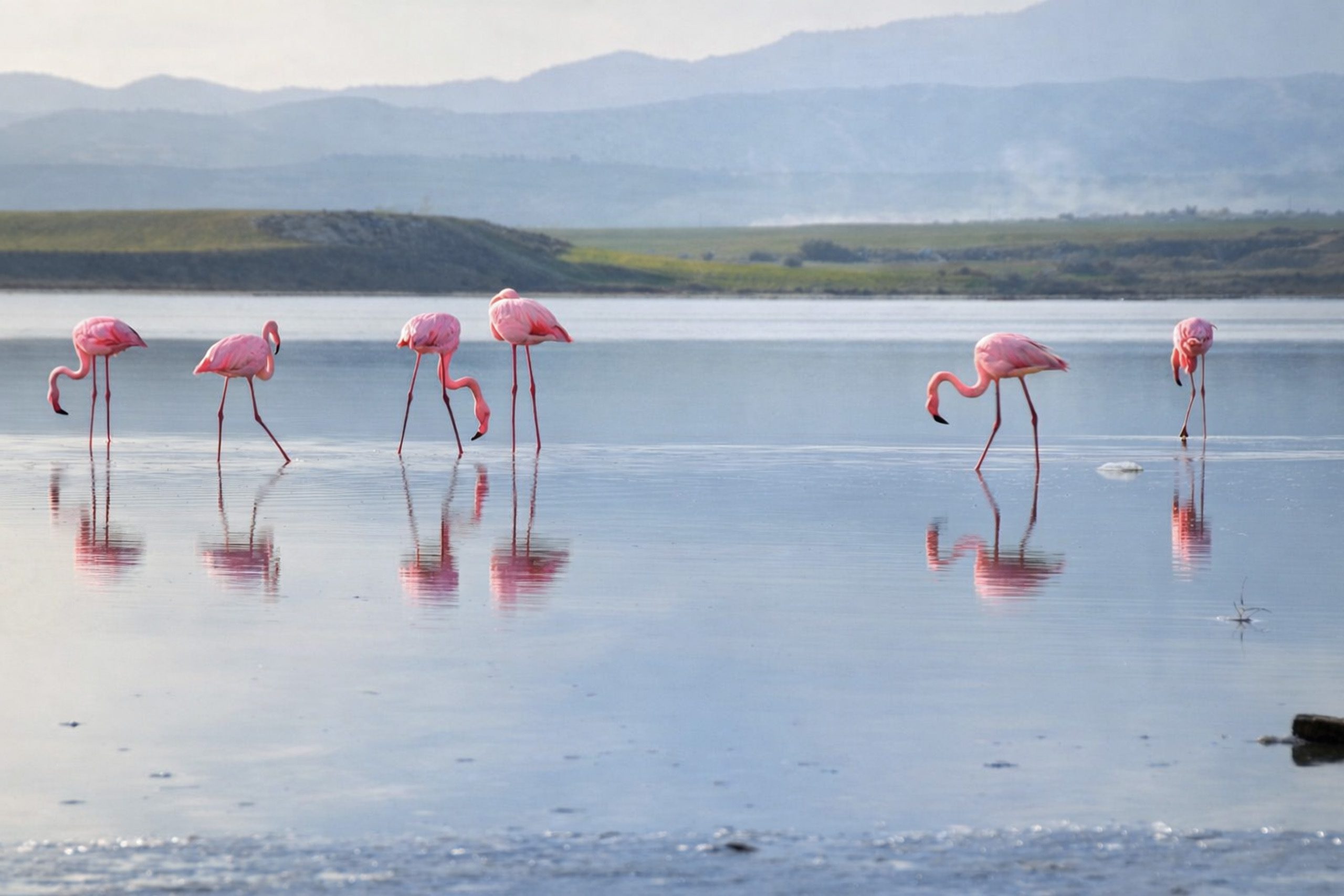
Cyprus is home to two major salt lake systems that serve as crucial stops for thousands of birds during their migration between Europe and Africa. The Larnaca Salt Lake complex lies near the island’s southeastern coast, while the Akrotiri Salt Lake sits southwest of Limassol. Both wetlands hold international ecological significance and attract up to 20,000 flamingos each winter, along with dozens of other bird species.
The Larnaca Salt Lake Complex
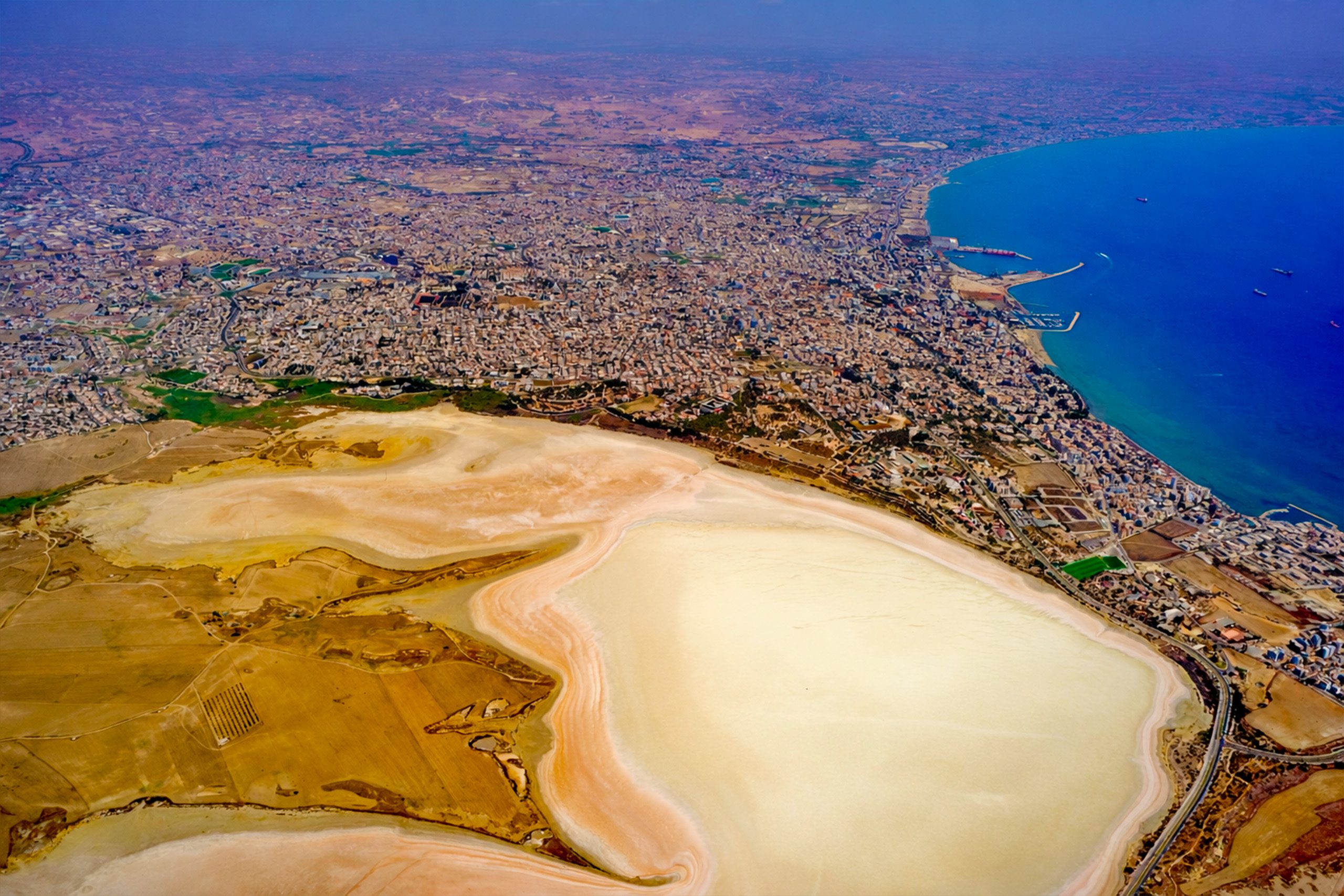
The Larnaca Salt Lake consists of four interconnected salt lakes covering 1,761 hectares southwest of Larnaca town. The largest lake is called Aliki, followed by Orphani, Soros, and the smallest, Airport Lake. The Airport Lake was separated from Orphani when Larnaca International Airport’s runway was built, cutting it off from the main complex.
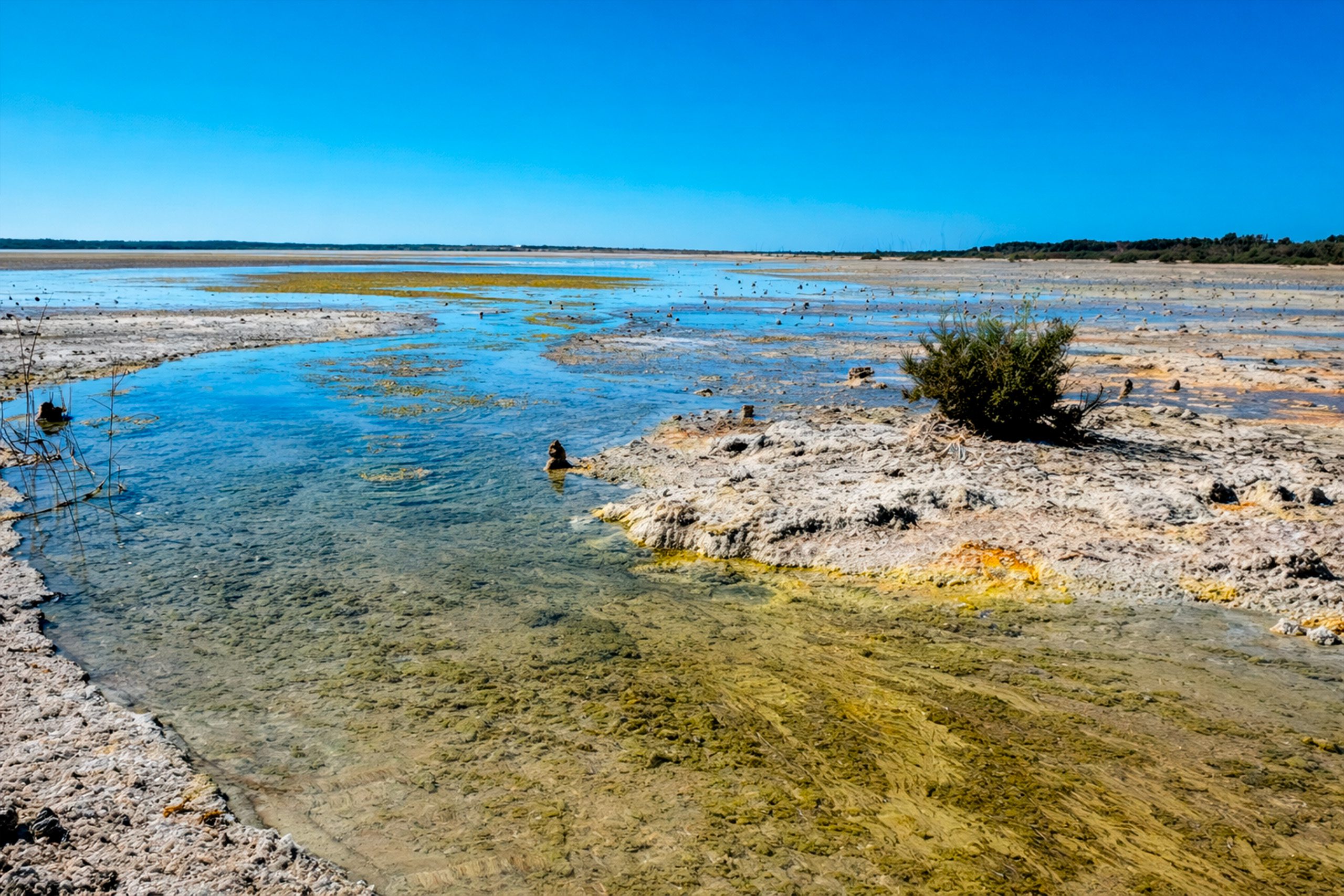
The lakes measure 2.2 square kilometers total and sit just off the road to Larnaca International Airport, making them one of the area’s most recognizable landmarks. Water depth reaches a maximum of one meter during winter. The lakes fill with water during the rainy season from November through March, then dry completely by summer, leaving exposed salt flats.
During winter, between 2,000 and 12,000 greater flamingos arrive at Larnaca Salt Lake to feed on abundant brine shrimp. The dark red algae in the lake forms the base of the food chain, as the small shrimp feed on it, and flamingos in turn consume the shrimp. This ecosystem also supports approximately 85 species of waterbirds, with populations estimated between 20,000 and 38,000 individuals.
The lakes were declared a protected area in 1997 under Cypriot law and the European Habitats Directive. International recognition includes designation as a Ramsar Wetland of International Importance, a Natura 2000 site, a Special Protected Area under the Barcelona Convention, and a BirdLife International Important Bird Area.
The Akrotiri Salt Lake
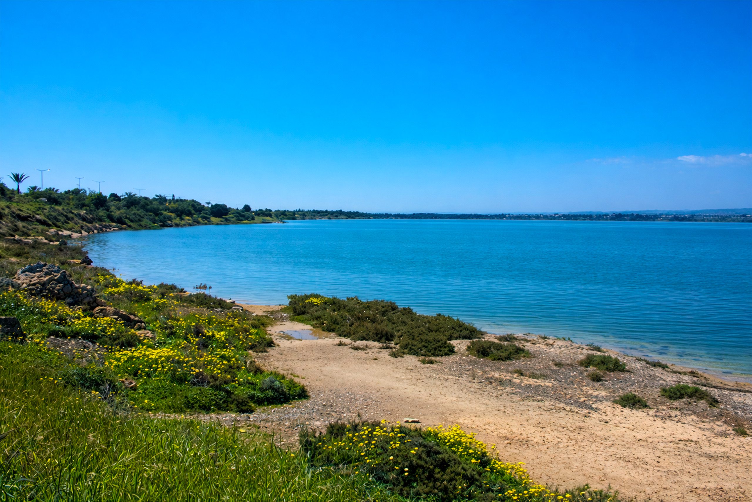
Akrotiri Salt Lake, also called Limassol Salt Lake, is the largest inland body of water in Cyprus. It measures 10.65 square kilometers and sits within the British Sovereign Base Area southwest of Limassol. The lake’s lowest point reaches 2.7 meters below sea level, and water depth at its deepest point measures about one meter, though this can reach 2.8 meters below sea level in winter.
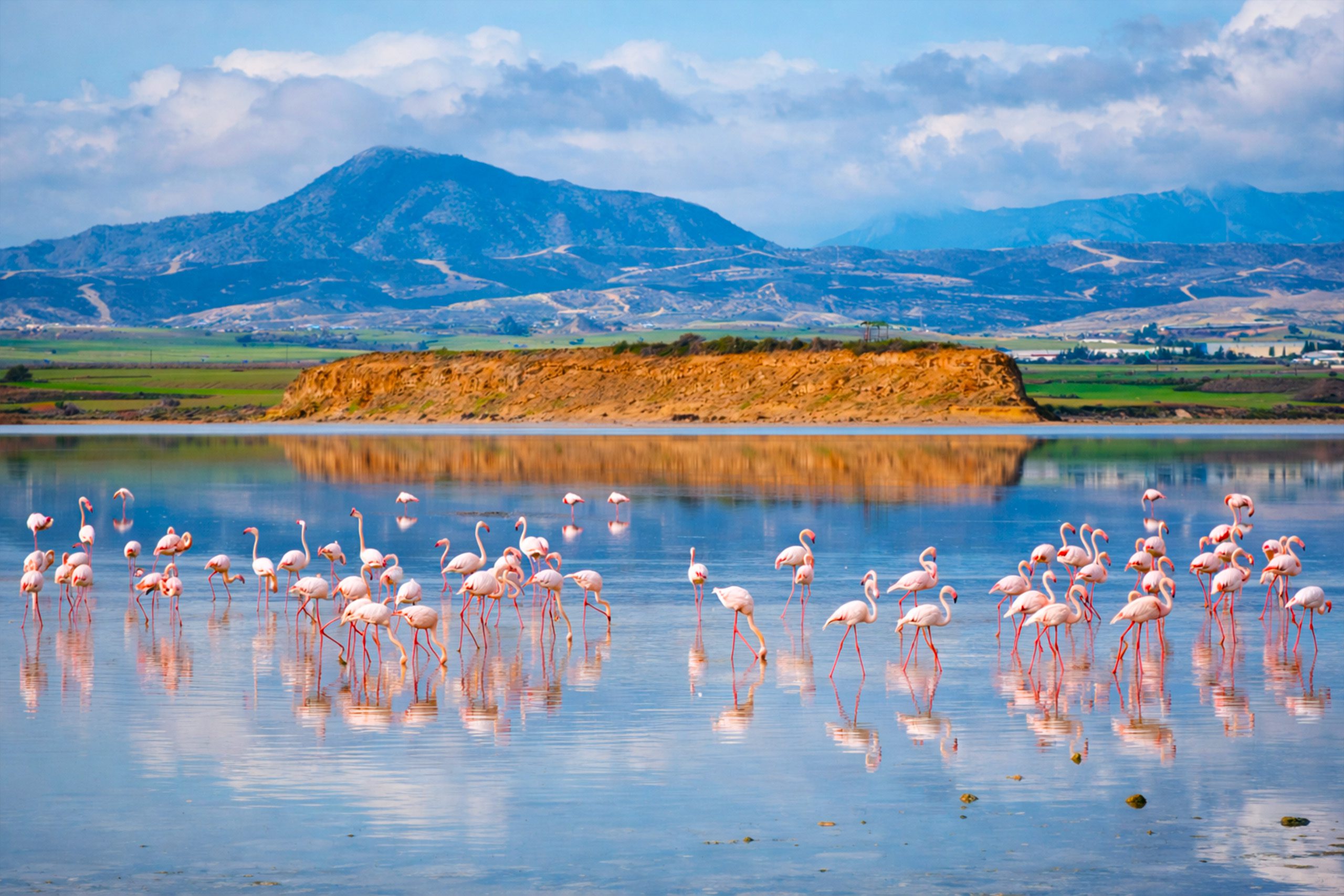
Between 2,000 and 20,000 greater flamingos spend winter months at Akrotiri, along with cranes, birds of prey, and various wading birds. The lake’s shallow depth of 30 centimeters across more than half its area creates ideal conditions for wading birds to feed. The ecosystem is based on fairy shrimp that live in the water and provide food for the bird populations.
Akrotiri Salt Lake holds similar protected status to Larnaca, with recognition under the Ramsar Convention, Natura 2000, and as an Important Bird Area. The lake formed through the gradual joining of an offshore islet to the southern coast of Cyprus over geological time.
Historical Background
Archaeological discoveries show that the Larnaca Salt Lake area was inhabited from the Late Bronze Age, during the 2nd millennium BC. Before sediment deposits blocked access to the Mediterranean Sea, the salt lakes formed a lagoon that functioned as Cyprus’s largest natural harbor.
Excavations near Hala Sultan Tekke revealed that Larnaca, known in ancient times as Kition, was one of the major urban and commercial centers of Late Bronze Age Cyprus from 1650 to 1050 BC. The natural harbor’s strategic location allowed easy access from Africa, Asia, and Europe, making Kition an important trading post in the ancient world.
When the town was eventually abandoned, the estuary filled with sediment and the natural harbor was destroyed, transforming into the salt lakes that exist today. This geological change preserved evidence of the ancient settlement while creating the wetland ecosystem that now supports migrating birds.
Walking and Nature Trails
A designated 4-kilometer linear nature trail winds through the Larnaca Salt Lake area, leading from the lake to the historic Kamares Aqueduct. The trail has two main starting points: one at the Kamares Aqueduct and another at the salt collection plateau on Artemis Avenue.
Trees, shrubs, and flowers along the path are marked with informational signs. Periodic benches provide rest stops and observation points. The trail is popular with walkers, joggers, and birdwatchers. A bird observation tower offers elevated views across the lake for better flamingo viewing.
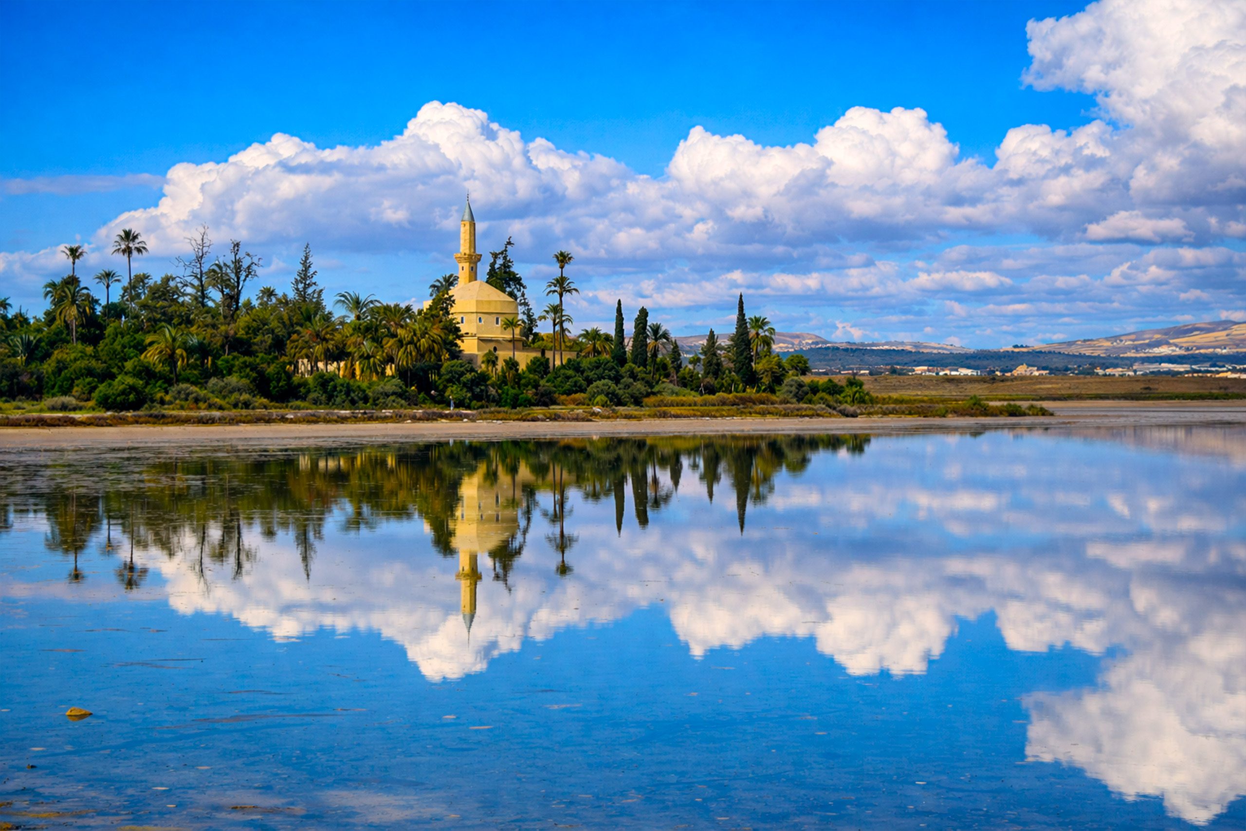
The path passes areas of historical and cultural interest. A sanctuary dedicated to the goddesses Artemis-Diana and Aphrodite-Astarte once existed here, though no structures survive. An elegant sculpture of Artemis-Diana was discovered at the site, and a copy now decorates the roundabout on Artemis Avenue.
Akrotiri Environmental Education Centre
The Akrotiri Environmental Education Centre sits opposite the Swan pub before the British base checkpoint in Akrotiri village. The center is free to visit and provides educational exhibits about the lake’s ecosystem, wildlife, and conservation efforts.
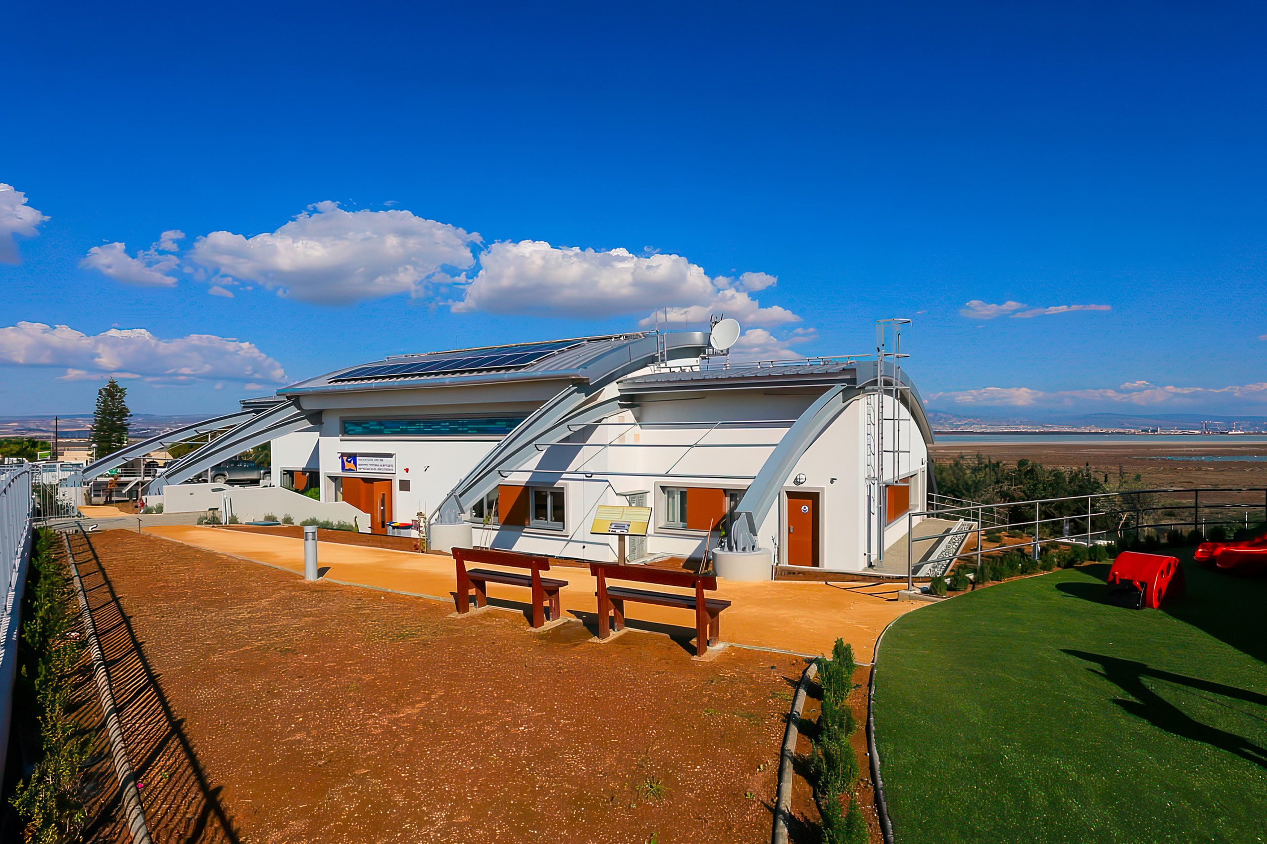
A viewing platform at the rear overlooks the salt lake, equipped with several telescopes for observing flamingos and other birds from a safe distance. Staff can advise visitors about recent bird sightings and the best viewing locations. The center includes displays about plants that exist only in Akrotiri and the conservation work to preserve them.
The facility also features a children’s play area that families can use for approximately 45 minutes of activity. The center manages to educate visitors while providing practical amenities that make the location family-friendly.
Visiting Akrotiri Salt Lake
From Limassol city center, visitors need to take bus number 24 from EMEL Bus Station toward Akrotiri. The bus departs hourly, and the journey tothe Akrotiri Community Board takes approximately 34 minutes. The bus continues to Akrotiri village as its last stop.
By car from Limassol, take the B6 road southwest. The drive takes around 25 minutes to reach Akrotiri village. From Paphos, start on the A6 highway toward Limassol, then follow the B6 south to Akrotiri. The distance is approximately 70 kilometers and requires a one-hour drive. From Larnaca, enter the A5 highway and continue on the B6 road south, a journey of about 1 hour and 15 minutes.
The Akrotiri Environmental Education Centre provides the best viewing point. Driving the perimeter of the lake allows multiple viewing opportunities, though some areas require walking to reach good vantage points.
Ecological Importance for Cyprus
The salt lakes represent two of Cyprus’s most significant natural habitats. They support 70 percent of the island’s bird population, including both resident and migratory species. This concentration makes the lakes essential for maintaining Cyprus’s biodiversity.
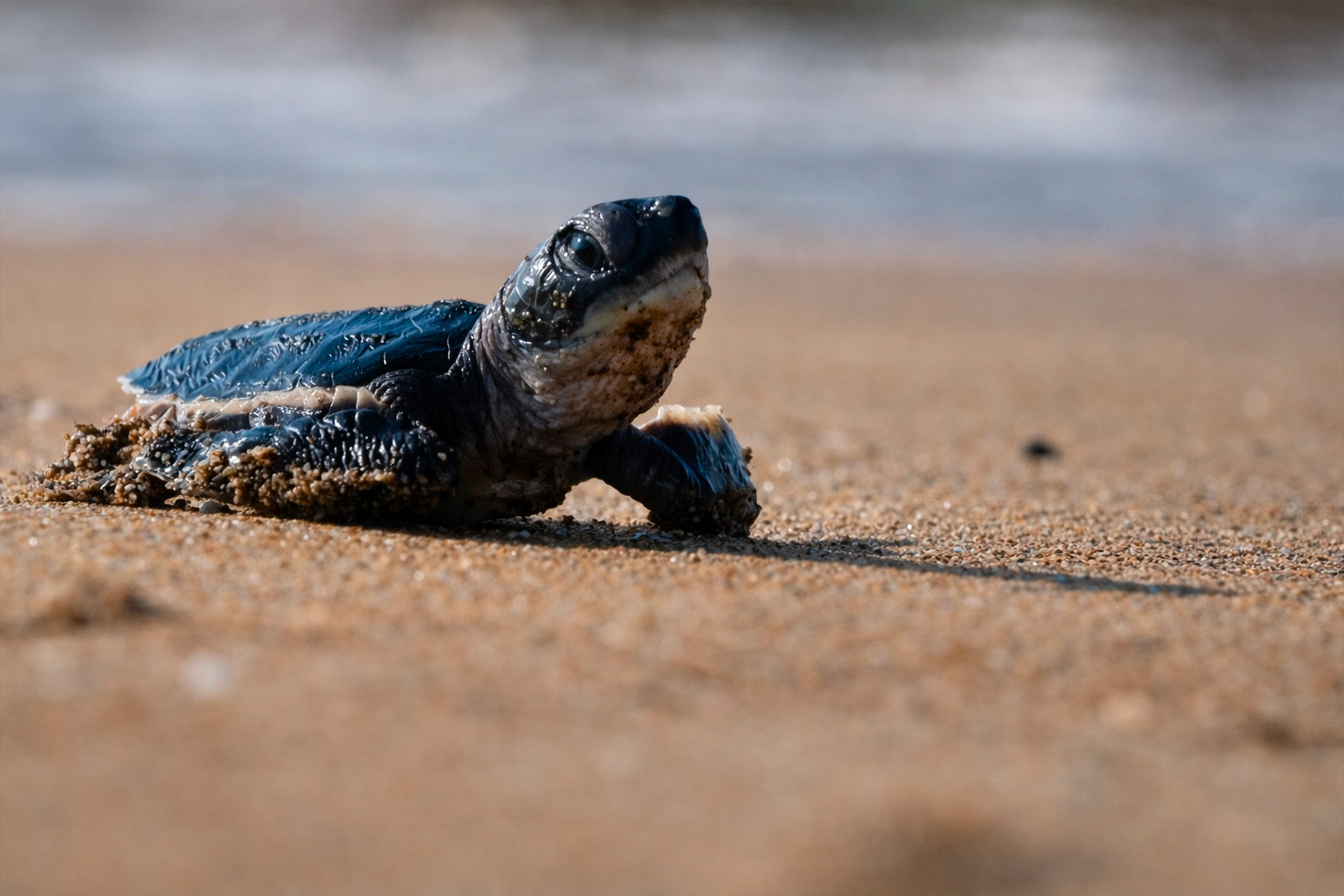
Green turtles and loggerhead sea turtles nest along beaches near Akrotiri Salt Lake. The wetland ecosystem provides feeding areas for young turtles before they mature and move to deeper waters.
Endemic plant species that exist nowhere else in the world grow in the halophytic scrubland surrounding both lakes. These salt-tolerant plants form specialized communities adapted to the harsh conditions of high salinity and seasonal flooding.
The lakes serve as natural filters that process water before it reaches the Mediterranean Sea. Vegetation in the wetlands absorbs nutrients and pollutants, improving water quality. This ecosystem service benefits both wildlife and human communities.
Educational Value and Research
Both salt lakes serve as outdoor classrooms for schools and universities. Students study ecology, ornithology, geology, and environmental science through field trips and research projects. The accessible locations near major towns make them practical for educational programs.
Long-term monitoring tracks bird populations, water quality, salt concentrations, and plant communities. This data helps scientists understand climate change impacts, pollution effects, and conservation needs. International research teams collaborate with Cypriot institutions on studies.
The contrast between the ancient harbor and the modern wetland provides lessons about geological change and human impact on landscapes. The transformation from commercial salt harvesting to a protected nature reserve demonstrates changing attitudes toward natural resources.
The Cultural Connection
For Cypriots, the salt lakes connect modern life to ancient history. The same landscape that hosted Bronze Age traders now welcomes international tourists. The continuity of the site through different uses over millennia creates cultural depth.
The annual arrival of flamingos has become part of the seasonal rhythm. Families visit each winter to show children the birds, creating traditions passed between generations. Local restaurants and cafes near both lakes incorporate flamingo imagery into their branding.
Artists and photographers draw inspiration from the changing landscapes. The pink birds, white salt, blue water, and surrounding mountains provide subjects for paintings, photographs, and other creative works. The salt lakes feature in tourism promotion as iconic Cyprus landscapes.
Long-Term Conservation Goals
Authorities continue to acquire private land around the lakes to expand protected areas and reduce development pressure. Future acquisitions are planned, except for areas owned by Muslim and Christian Orthodox religious organizations.
Education programs aim to reduce disturbance from visitors who enter the water or approach birds too closely. Increased awareness about proper viewing distances helps protect sensitive species while still allowing public access.
Habitat restoration projects address areas damaged by past activities. Native plants are reintroduced to areas where invasive species have taken over. Water management systems maintain appropriate salinity levels and seasonal flooding patterns.
The salt lakes of Cyprus demonstrate that conservation and public access can coexist when properly managed. These wetlands will continue to welcome flamingos and other migrating birds for generations to come, serving as vital rest stops on one of the world’s great migration routes.