Salamis stands as one of the most important archaeological sites on the island of Cyprus. Located on the eastern coast near modern Famagusta, this ancient city flourished for over 1,800 years before nature forced its abandonment. The ruins spread across one square mile along the coast, offering visitors a remarkable glimpse into ancient Mediterranean civilization.
cyprusparadise.com
According to Greek legend, Salamis was founded by Teucer, son of King Telamon. After the Trojan War ended, Teucer could not return home because he failed to avenge his brother Ajax. Banished by his father, Teucer sailed to Cyprus and established a new city named after his birthplace, the island of Salamis near Athens.
Archaeological evidence dates the earliest settlement to the 11th century BC during the Late Bronze Age. The city likely emerged as a replacement for nearby Enkomi, which was abandoned when its harbor silted up. Cyprus held immense strategic value due to its rich copper deposits, and Salamis became a crucial hub in Mediterranean trade networks.
From Kingdom to Capital
By the 6th century BC, Salamis had grown into the most powerful city on Cyprus. King Euelthon, who ruled from 560 to 525 BC, claimed authority over the entire island and became the first Cypriot king to mint coins. The city came under Persian control in 525 BC but maintained considerable autonomy. In 450 BC, Salamis became the site of a significant battle between Athens and Persia.
cgbfr.com
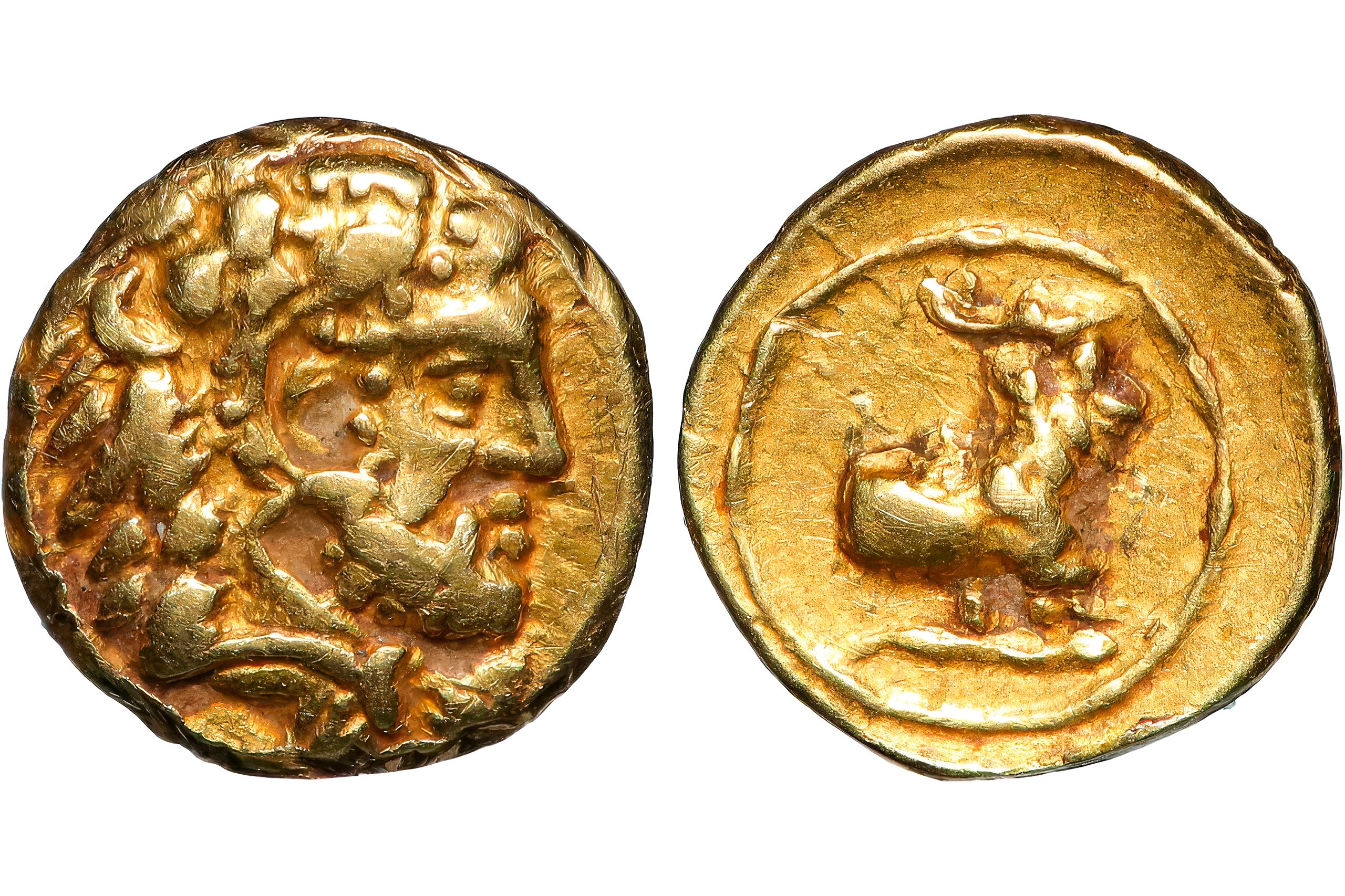
King Evagoras I, who reigned from 411 to 374 BC, led the city through its golden age. Under his leadership, Greek culture and art flourished. He successfully worked to free Cyprus from Persian domination, and gold coins from his era demonstrate the considerable wealth that flowed through the city.
Burial Customs That Echo Homer
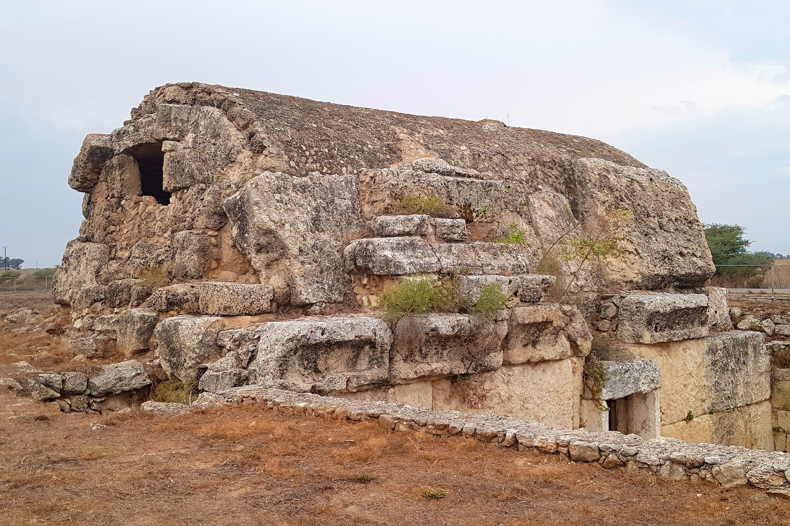
West of the main city lies the royal necropolis, where archaeologists uncovered tombs dating from the 7th to 6th centuries BC. These burial sites reveal customs that closely mirror the Homeric epics. The tombs featured large sloping passageways called dromoi where excavators found skeletons of horses still wearing their iron bits, sacrificed to honor the dead. Clay vessels held offerings of olive oil, while most grave goods came from Egypt and the Levant, showcasing extensive trade connections.
flickr.com
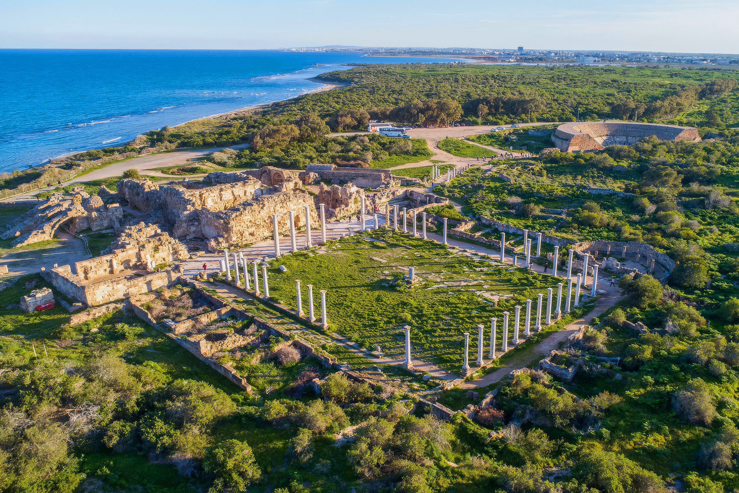
After Alexander the Great conquered the Persian Empire, Cyprus fell under Ptolemaic rule. Although Paphos became the administrative capital, Salamis retained its status as the island’s premier commercial center. The city stretched two kilometers along the shoreline and reached one kilometer inland.
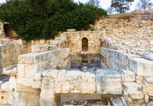
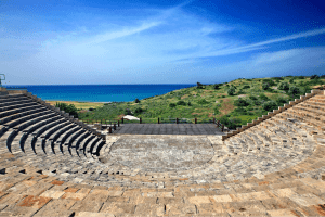
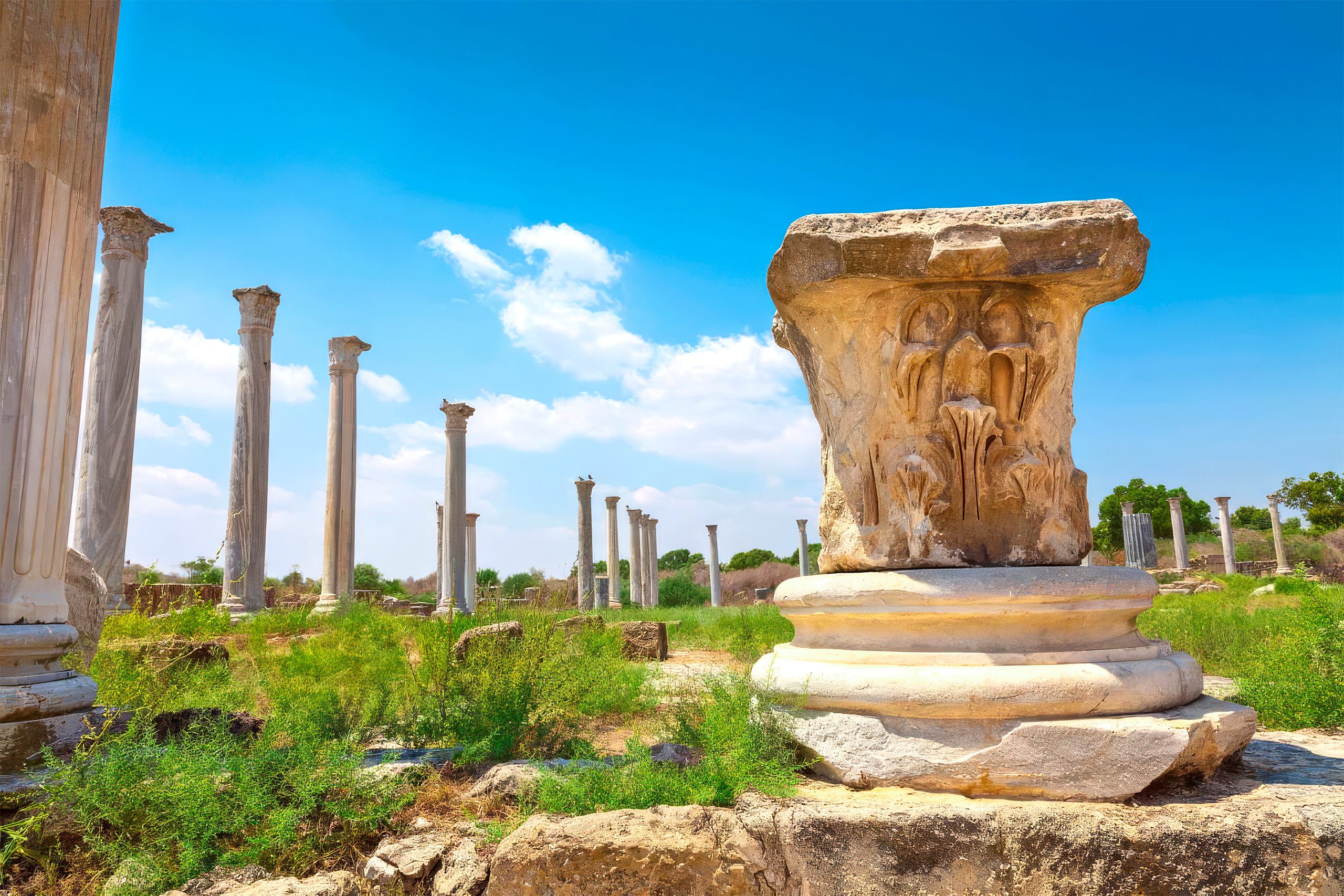
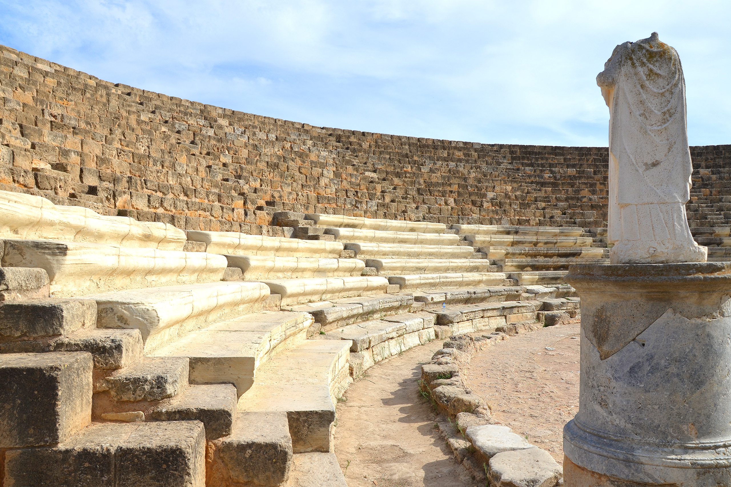
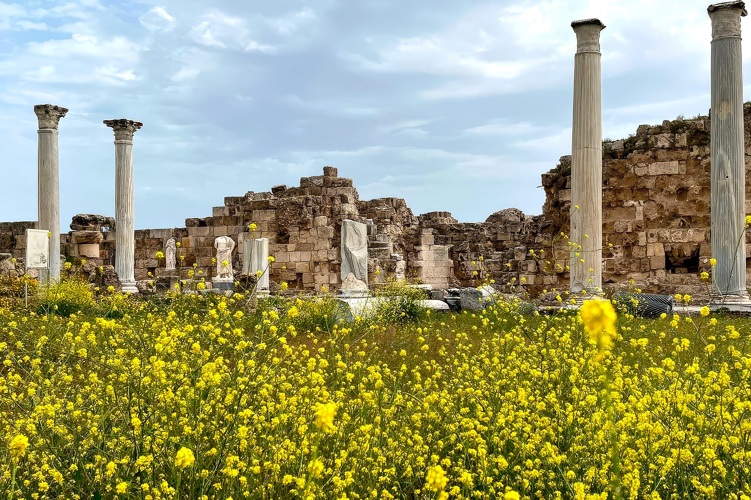
In 58 BC, Salamis became part of the Roman Empire and prospered under Roman rule. Emperors Trajan and Hadrian invested heavily in public buildings. The northern section developed into a cultural center featuring a gymnasium, theater, amphitheater, stadium, and elaborate public baths. The gymnasium, originally constructed during the Hellenistic period, was destroyed by an earthquake in 76 AD and rebuilt with a colonnaded palaestra. The theater, built during Augustus’s reign, could seat 15,000 spectators.
wikipedia.org
The Dawn of Christianity in Cyprus
Salamis holds special significance in early Christian history. During the First Missionary Journey described in Acts, Paul the Apostle and Barnabas made Salamis their first stop after leaving Antioch. Barnabas, born in Cyprus, is considered the founder of the Church of Cyprus. Tradition holds that he was stoned to death in Salamis around 61 AD. His tomb, discovered in 488 AD, reportedly contained the Gospel of Mark, which granted the Cypriot church its autocephalous status.
aktivatours.nl
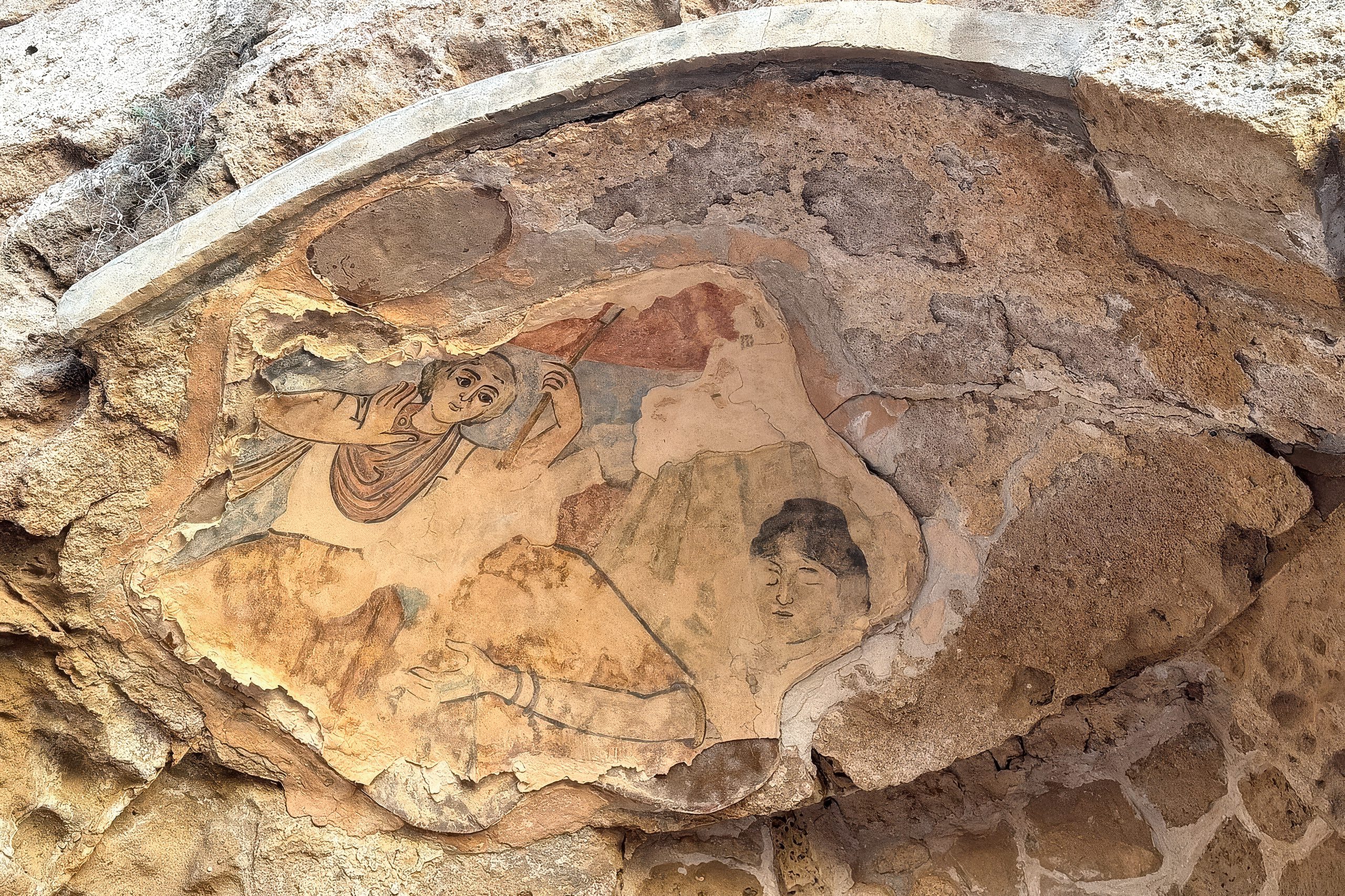
After Jewish revolts severely damaged the city in 116-117 AD, the Christian community grew during rebuilding. When Christianity became the state religion, statues depicting nude figures were destroyed and colorful mosaics showing pagan themes were defaced.
When the Earth Shook
Devastating earthquakes struck in 332 and 342 AD, followed by destructive tidal waves. Byzantine Emperor Constantius II undertook massive reconstruction but the rebuilt city covered a much smaller area. He renamed it Constantia and made it the capital of Cyprus from 368 to 403 AD. Saint Epiphanius served as bishop during this period, and the basilica named after him features seven aisles.
tripadvisor.com
Despite reconstruction efforts, Constantia never regained its former grandeur. The harbor continued silting up, and Arab invasions around 648 AD delivered the final blow. Forces under Muawiyah I destroyed what remained. Survivors moved to Arsinoe, a fishing village that would eventually become modern Famagusta. Ironically, shifting sands covered and preserved Salamis for future generations.
European visitors first identified the ruins in the 1860s and 1870s. Formal excavations began in the late 19th century, and many artifacts now reside in the British Museum. Systematic excavations resumed in 1952 and continued until 1974 when the Turkish invasion of Cyprus halted international work. The site remains maintained by the antiquities service, with important collections kept at the Saint Barnabas monastery and District Archaeological Museum.
Visiting the Ruins Today
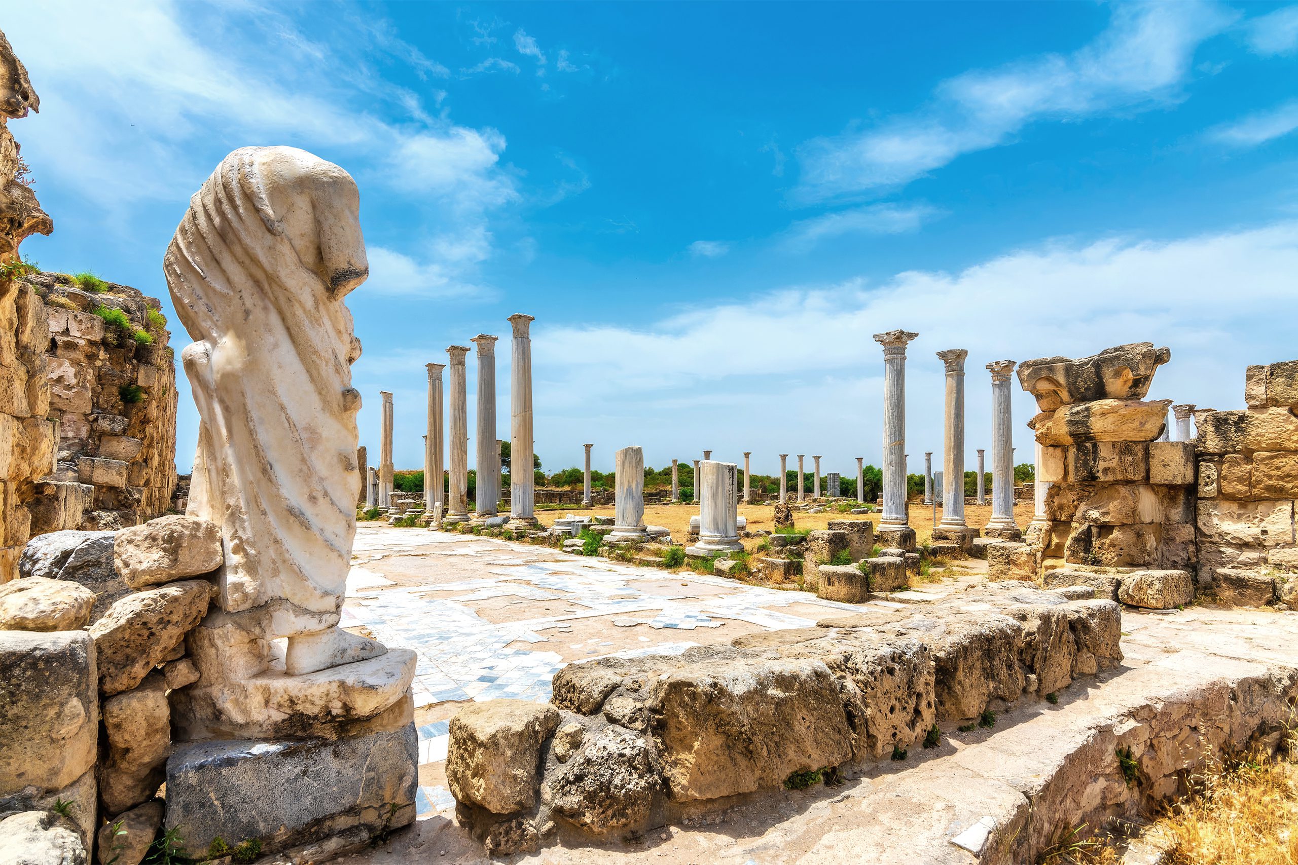
Today, Salamis is located in eastern Cyprus near Famagusta. The site spans approximately one square mile, though much remains buried under forests of mimosa, pine, and eucalyptus. The most impressive restored areas include the gymnasium with its striking colonnade, Roman baths with sophisticated heating systems, and the massive theater that occasionally hosts performances.
aktivatours.nl
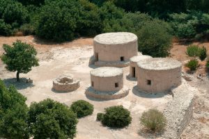
Visitors can also explore the Temple of Zeus, which held the right to grant asylum, a Hellenistic and Roman agora, harbor walls, and early Christian basilicas. The site rewards exploration, though visitors should plan at least two hours to see the major features.
A Testament to Human Achievement
Salamis reminds us that even mighty cities are temporary. For nearly two millennia, this settlement served as a crossroads of Mediterranean civilization, witnessing the rise and fall of empires and the birth of new religions. The ruins stand as monuments to the Greeks who founded it, the Romans who embellished it, and the Christians who transformed it.
tripadvisor.com
Walking among the columns and arches today, we can imagine the voices of merchants in the agora, athletes training in the gymnasium, and audiences gathering in the theater. Salamis lives on not in its stones alone, but in the stories those stones tell about the people who built one of the ancient world’s great cities.