Explore Cyprus with Our Interactive Map

Explore our top stories and discover ideas worth your time.

Cyprus Carob Black Gold

Cyprus Carob Black Gold

For centuries, the carob tree quietly underpinned life in Cyprus. Long before sugar, tourism, or modern industry reshaped the island, carob sustained rural families economically, nutritionally, and socially. Known locally as “black gold,” it was never glamorous, but it was dependable. In a land shaped by drought, invasion, and uncertainty, the carob tree endured, feeding people, funding villages, and anchoring tradition in the Cypriot landscape. A Tree Built for Hard Conditions The carob tree, Ceratonia siliqua, is perfectly adapted to Cyprus’s dry Mediterranean climate. Its deep roots draw moisture from far below the surface, allowing it to survive long summers without irrigation. Thick, leathery leaves reduce water loss, and slow growth produces a tree that can live for centuries. This resilience explains why carobs thrived where other crops failed. On rocky slopes and marginal land unsuitable for cereals, carob trees continued to produce reliable harvests. For rural communities, they were less a crop and more a form of insurance, offering stability in an unpredictable environment. Why It Was Called “Black Gold” The name "black gold" was not a poetic exaggeration. Ripe carob pods darken to a deep brown, almost black, and for generations, they ranked among Cyprus's most valuable exports. Even in years when wheat failed or rainfall was scarce, carob trees continued to bear fruit. For many families, a…

Read more
Byzantine Cyprus: Eastern Mediterranean Defense

Byzantine Cyprus: Eastern Mediterranean Defense

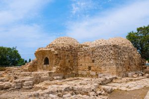
Cyprus was never a distant outpost of the Byzantine Empire. From late antiquity through the Middle Ages, it functioned as a frontline maritime shield, protecting the sea lanes that connected Anatolia, the Levant, and the Aegean. Byzantine naval defense on Cyprus was not limited to fleets and battles. It was a layered system combining geography, coastal fortifications, mountain surveillance, communication networks, and naval presence. Together, these elements allowed the empire to detect threats early, control movement at sea, and preserve stability in one of the Mediterranean’s most contested regions. An Island Positioned to Watch the Sea Cyprus sits at a natural crossroads of the Eastern Mediterranean. From its shores, routes radiate toward southern Anatolia, Syria and Palestine, Egypt, and the Aegean. This position made the island unavoidable for any power seeking maritime dominance in the region. For the Byzantine Empire, Cyprus acted as a forward sentinel. Control of the island meant early visibility over naval traffic moving between the Islamic-controlled Levant and the Byzantine heartlands of Asia Minor. Losing Cyprus would have meant losing advance warning, leaving the southern coast of Anatolia and the Aegean islands exposed to sudden raids. This strategic reality shaped every aspect of Byzantine policy on the island. From Roman Province to Maritime Bastion In the early Roman and late antique periods, Cyprus was relatively peaceful.…

Read more
Labyrinth Streets of Cyprus Villages

Labyrinth Streets of Cyprus Villages

The narrow labyrinth streets of Cyprus villages create distinctive spatial patterns that developed organically over centuries without formal planning. These winding lanes, rarely exceeding 2 to 3 meters in width, twist through compact settlements where stone houses press close together along irregular paths dictated by terrain, water sources, and family land divisions. Cypriot villages were built without original master plans, with street locations determined by natural conditions including slope, rivers, and agricultural boundaries. The compact layouts served practical purposes including defense against raiders, social cohesion through proximity, protection from summer heat through shade creation, and efficient land use that maximized agricultural acreage surrounding settlements. The resulting maze-like networks connect homes to central squares where churches, mosques, coffee shops, and taverns anchored community life while radiating outward to agricultural fields and vineyards that sustained village economies. Organic Growth Without Urban Planning Traditional Cyprus villages developed through accretion as families built homes adjacent to relatives and neighbors without coordinating with central authority or following predetermined layouts. When young people married, they typically constructed new houses near their parents' property, creating family clusters that expanded outward from original settlement cores. This pattern repeated across generations, producing intricate networks of connected buildings separated by the minimum passages needed for human and animal movement. The terrain fundamentally shaped village morphology. Mountain villages like Kakopetria and…

Read more