Explore Cyprus with Our Interactive Map

Explore our top stories and discover ideas worth your time.

Machairas Monastery

Machairas Monastery

Machairas Monastery, officially known as the Monastery of Panagia Machaira, is a historic monastery located about 40 kilometers from Nicosia in the mountainous interior of Cyprus. Built near Mount Kionia at an elevation of approximately 870 meters, the monastery is surrounded by dense pine forests and overlooks the Pediaios River, the island’s longest waterway. Its fortress-like position on a steep hillside makes it one of the most recognizable monastic sites in Cyprus. Machairas Monastery is considered one of the island’s three most historically significant monasteries alongside Kykkos Monastery and Agios Neophytos Monastery. The monastery historically held stavropegic status, which granted it administrative independence from the Archbishopric of Cyprus. The Discovery of a Sacred Icon According to local tradition, the monastery’s famous icon was associated with the Byzantine period and linked to the Church of Blachernae in Constantinople. During the eighth-century period of iconoclasm, when many religious images were removed or destroyed across the Byzantine Empire, the icon was reportedly transported to Cyprus and hidden in a cave for preservation. Around 1145, two hermits named Ignatios and Neophytos are said to have discovered the cave concealed behind thick vegetation. Tradition states that they used a knife to clear access to the site. The Greek word for knife, machairi, later influenced both the icon’s name, Machairiotissa, and the monastery’s name. Machairas Monastery…

Read more
National Forest Park of Machairas

National Forest Park of Machairas

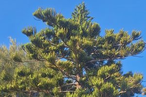
The National Forest Park of Machairas protects one of Cyprus's most important natural areas through 6,057 hectares of Mediterranean forest. It supports over 600 plant species and serves as the source of the island's two largest rivers. The park was officially declared a National Forest Park on December 22, 2004, through decree 61.368. The designation initially covered the Machairas forest at 43.93 square kilometers and the smaller Lythrodontas forest at 1.31 square kilometers. On June 1, 2005, decree 62.114 added the adjacent area called Vounia tou Anemou, which covers 1.126 square kilometers. The total protected area now spans 60.6 square kilometers across parts of Nicosia and Larnaca districts. The forest takes its name from the historic Machairas Monastery, which occupies a commanding position at the head of a wooded valley on one of the highest slopes of Kionia Peak. The monastery's name derives from the Greek word for sword or knife. By 1921, Machairas Forest covered 15.26 square miles and was recognized as one of the five main state forests in Cyprus, though it was smaller than the largest, Paphos Forest. The park received designation as a Natura 2000 site and Important Bird Area due to its ecological significance. Part of the forest has been declared a Special Protection Area to safeguard its biodiversity. The Department of Forests manages the…

Read more
Cape Greco National Forest Park

Cape Greco National Forest Park

Cape Greco National Forest Park occupies 385 hectares on a rocky promontory at the southeastern tip of Cyprus, nestled between the resorts of Ayia Napa and Protaras. The park was designated as a National Forest Park in 1993 to protect this area of unspoiled natural beauty. The broader Natura 2000 site encompasses 1,876 hectares, including 915 hectares of terrestrial area and 961 hectares of marine zones. The dramatic limestone cliffs rise 30 feet above turquoise Mediterranean waters, creating spectacular coastal scenery. Sea caves carved by thousands of years of wave action punctuate the coastline, while natural rock arches frame views of the endless blue horizon. The park combines hiking trails, cycling paths, endemic plant species, and coastal beauty in a relatively compact area. Visitors experience Cyprus at its wildest and most beautiful, with pine scented paths overlooking crystal clear waters. The lost juniper forest and current vegetation Cape Greco was originally covered by a dense juniper forest that gave the area its distinctive character. Between 1910 and 1920, these trees were rapidly cut down and burned to power steam flour mills that operated in abundance in the Paralimni area. Since then the slow growing juniper has never fully recovered, though scattered specimens still survive alongside varieties of pine. Today the vegetation consists mostly of sparse low level growth, including 14…

Read more