Explore Cyprus with Our Interactive Map

Explore our top stories and discover ideas worth your time.

Omodos to Vouni Wine Route Cyprus

Omodos to Vouni Wine Route Cyprus

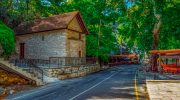
The route from Omodos to Vouni represents one of Cyprus's most scenic drives through the Krasochoria, or wine villages, of the Troodos Mountain foothills. This stretch of approximately 15 kilometers connects charming settlements at altitudes between 700 and 900 meters above sea level, where traditional architecture meets centuries-old viticulture. The drive passes through Lofou, Koilani, and other villages that form the backbone of Cyprus's wine production, offering panoramic viewpoints across vineyards, valleys, and distant coastlines. The route belongs to Wine Route 4, known as Krasochoria Lemesou, home to the greatest concentration of wineries on the island. Omodos and Its Cobbled Square Omodos sits at the foothills of Troodos Mountain at approximately 800 meters altitude and serves as one of the most popular destinations on the wine route. The village dates back to the Frankish period when it was called Homodos, derived from the Greek word odos meaning street. The cobbled central square remains the village's focal point, surrounded by traditional stone-built houses with narrow balconies and wooden doors. The Monastery of Timios Stavros, or Holy Cross, dominates the square with its impressive woodcarvings and pristine icons. This monastery ranks among Cyprus's oldest and most historic, with the current structure dating to different periods of renovation and expansion. Within the monastery complex, visitors find a museum dedicated to the National Liberation…

Read more
Troodos Hill Stations Platres and Square

Troodos Hill Stations Platres and Square

The Troodos Hill Stations refer to two main areas in the Troodos Mountains where the British colonial administration established summer retreats. Platres, located at an altitude of 1,100 meters on the southern slopes, became the premier mountain resort with luxury hotels, villas, and tree-lined walks. Troodos Square, situated near Mount Olympus at approximately 1,700 meters, served as the administrative center where the British governor relocated his entire government during the hot summer months. Together, these hill stations formed a unique mountain retreat system that shaped Cyprus tourism for over a century. Historical Background When Lieutenant-General Sir Garnet Wolseley arrived in Larnaca on July 22, 1878, as the island's first High Commissioner, he immediately recognized a serious problem. British troops stationed on the coastal plains suffered terribly from extreme heat that often exceeded 40 degrees Celsius, and malaria was widespread in low-lying areas. Coming from their experience in India, where hill stations had successfully reduced mortality rates among troops and civilians, the British knew exactly what to do. In September 1878, just two months after taking control of the island, construction began on the Troodos Hill Station. The site was chosen because elevations above 1,500 meters provided relief from tropical diseases and heat stress. Wooden huts were ordered from England, though records suggest these may never have arrived. By May 1879,…

Read more
Kalavasos Tenta, Cyprus

Kalavasos Tenta, Cyprus

Four kilometers from the village of Kalavasos, on a small hill overlooking the Vasilikos River valley, archaeologists uncovered one of Cyprus's earliest permanent settlements. Kalavasos-Tenta dates to around 8000-6000 BC and predates the more famous Choirokoitia by nearly a millennium. Today, a distinctive cone-shaped shelter protects the circular stone houses where some of the island's first farming communities lived over 9,000 years ago. Kalavasos-Tenta is an Aceramic Neolithic settlement located 38 kilometers southwest of Larnaca and 45 kilometers south of Nicosia. The site occupies a naturally defensible hill on the west side of the Vasilikos valley, positioned to command views of the surrounding agricultural land and the river that provided water for crops and livestock. The settlement represents the Aceramic Neolithic period, meaning its inhabitants lived before pottery was introduced to Cyprus. Archaeological evidence shows occupation from around 8000 BC through the 6th millennium BC, making it contemporary with other early Cypriot sites like Shillourokambos and Mylouthkia. The population during its peak likely never exceeded 150 people based on the size and number of structures excavated. According to local tradition, the site's name derives from a much later event in 327 AD, when Saint Helena, mother of Constantine the Great, stayed in a tent at this location during her visit to Cyprus following the discovery of the True Cross in…

Read more