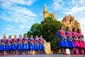
Explore Cyprus with Our Interactive Map

Explore our top stories and discover ideas worth your time.

Cyprus Birthplace Mediterranean Copper Trade

Cyprus Birthplace Mediterranean Copper Trade

Long before Cyprus became known for beaches or crossroads of empires, it was known for something far more fundamental. Copper. Drawn from its mountains and carried across open water, this metal placed the island at the center of the ancient Mediterranean world. Cyprus did not merely export a resource. It supplied the material that powered the Bronze Age and, in doing so, helped shape the earliest long-distance trade networks ever formed at sea. This is not a story of passive geography or accidental wealth. It is the story of how an island learned to move its resources outward, turning stone into influence and distance into connection. An Island Defined by What Lay Beneath Copper was the first metal to change how societies lived. It allowed stronger tools, more effective weapons, and eventually the creation of bronze, the alloy that defined an entire era. Control of copper meant control of technology, agriculture, and military power. Cyprus stood apart because of scale. Its copper deposits, concentrated in the Troodos Mountains, were among the richest and most accessible in the ancient world. Mining was not scattered or marginal. It was continuous, extensive, and organized. The island’s association with copper became so strong that the Latin word cuprum ultimately derived from Cyprus. While the name of the island itself likely predates the metal trade,…

Read more
Governor’s Beach, Cyprus

Governor’s Beach, Cyprus

Governor's Beach is actually two connected beaches near Pentakomo village, about ten kilometers east of Limassol. The main section features dark volcanic sand framed by striking white chalk cliffs, while the neighboring Kalymnos beach extends as a narrow sandy strip approximately 200 meters to the west. Together they form a two-kilometer coastline recognized for exceptional water quality and environmental standards. The area sits roughly 40 kilometers west of Larnaca and 30 kilometers east of Limassol, positioned far enough from major tourist strips to maintain a more peaceful character. Historical Background The beach earned its name during British colonial rule when high-ranking officials chose this location for recreational activities. The striking white cliffs and gray sand apparently reminded them of the Dover coastline back home. A British governor maintained a summer residence nearby in Maroni village, though he frequently visited this particular stretch of coast. The first president of independent Cyprus, Archbishop Makarios III, also enjoyed the former colonial cottage, which still stands today awaiting government decisions about its future use. The western section carries the name Kalymnos after professional sponge divers from the Greek island of Kalymnos who berthed their ships in this bay during the late 19th and early 20th centuries. These divers harvested natural sea sponges until overexploitation and disease destroyed the sponge fields throughout the Dodecanese archipelago,…

Read more
Painted Churches In the Troodos Region

Painted Churches In the Troodos Region

Ten small medieval churches scattered across the Troodos Mountains preserve some of the finest surviving examples of wall painting traditions in the Eastern Mediterranean. These UNESCO World Heritage sites document around 500 years of artistic development through richly decorated interior fresco cycles. Nine of the ten structures are located in the Nicosia District, while one, Timios Stavros in Pelendri, is situated in the Limassol District. The buildings date from the 11th to the 16th centuries and reflect a combination of high-quality metropolitan artistic styles and strong local artistic identity. These structures range from small rural chapels to larger monastic complexes such as Agios Ioannis Lampadistis. Their external simplicity contrasts sharply with their richly decorated interiors, where walls are covered with detailed narrative scenes and symbolic compositions. Historical Background Cyprus became part of the Byzantine administrative system in 965 AD when imperial forces re-established control over the island after a period of Arab raids. For the following centuries, the island functioned as a strategic frontier province in the Eastern Mediterranean. Urban centers such as Nicosia, Famagusta, Limassol, and Kyrenia expanded significantly during this period, supported by trade, agriculture, and artisanal production. During this relatively stable phase, wealthy patrons and local communities funded the construction and decoration of churches in the Troodos Mountains. The region’s isolated geography played a major role in…

Read more