Explore Cyprus with Our Interactive Map

Explore our top stories and discover ideas worth your time.

Karpasia Peninsula Climate

Karpasia Peninsula Climate

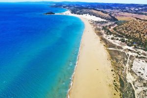
Karpasia Peninsula Sub-Humid Climate is marked by a slightly wetter profile in Cyprus's northern region, supporting lush scrub, wetlands, and seasonal agriculture. This climate, with higher rainfall than the island's interior, creates diverse habitats from coastal dunes to inland plains, fostering unique biodiversity and human activities. It shapes a landscape where moisture gradients influence everything from plant life to settlement patterns, highlighting the peninsula's role as a transitional zone in the eastern Mediterranean. A Wetter Northern Haven on the Island The Karpasia Peninsula, also known as the "panhandle" of Cyprus, extends 80 kilometers into the Mediterranean from the island's northeast, encompassing a sub-humid climate that distinguishes it from the drier central Mesaoria Plains. Annual rainfall averages 450-550 millimeters, about 20-30% higher than inland areas, concentrated in winter months from November to March, with mild temperatures ranging from 15-20°C. Summers are warm, with highs of 30-35°C moderated by sea breezes, and lower evaporation rates due to coastal proximity. This slight increase in moisture supports lush maquis scrub dominated by evergreen shrubs like lentisk (Pistacia lentiscus) and wild olive (Olea europaea), wetlands that form ephemeral lagoons, and seasonal agriculture focused on rain-fed crops like wheat and barley. The climate's balance creates isolated niches, where freshwater sources and salt marshes coexist, making Karpasia a biodiversity hotspot with over 600 plant species and a…

Read more

Cyprus Scenic Mountain Passes

Cyprus Scenic Mountain Passes

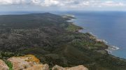
Cyprus mountain roads offer some of the Mediterranean's most spectacular drives, with routes that climb from sea level to nearly 2,000 meters through ancient forests, traditional villages, and panoramic viewpoints. These roads showcase the island's dramatic geography while connecting travelers to centuries of history and natural beauty. Mount Olympus Road The road to Mount Olympus climbs to 1,952 meters above sea level, making it the highest point on the island. Two military bases occupy the summit, one British and one Cypriot, limiting public access to the very top. However, roads leading toward the peak provide stunning views of surrounding valleys and forests. The journey starts from several possible directions, with routes from Limassol through Platres being among the most popular. The ascent features countless switchbacks and hairpin turns as the road gains elevation. Dense pine forests cover the mountainsides, giving way to more exposed terrain at higher altitudes. Winter transforms this area into Cyprus's only ski destination, with snow covering the peaks from January through March. Drivers should fill fuel tanks before attempting the climb because petrol stations become scarce above 1,000 meters. The temperature drops noticeably with altitude, sometimes falling 10 degrees Celsius cooler than coastal areas. This makes the mountain roads a welcome escape during summer heat but creates challenging conditions in winter when ice forms on shaded…

Read more
Adonis Nature Trail

Adonis Nature Trail

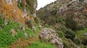
The Adonis Nature Trail sits near the Baths of Aphrodite within the Akamas Peninsula. This path follows a historic route where myth and nature meet on the northwest coast. A steep ascent leads toward the Pyrgos tis Rigainas, where ancient ruins stand silent. Every step reveals a wide view of the blue Mediterranean Sea below.  The air carries the scent of wild thyme and salty breeze throughout the year. This trek serves as a physical challenge for those who seek high vantage points. It offers a direct look at the rugged beauty of the Cypriot landscape. Each segment provides a unique perspective of the coastal cliffs. Trail Overview Location: Akamas Peninsula, Paphos District, Cyprus Distance: 4.7 miles (7.5 km) Route Type: Loop Difficulty: Moderate to Hard Elevation Gain: 1,300 feet (400 meters) Duration: 3 hours Best Time to Visit: January to May Terrain: Rocky paths, dirt tracks, and coastal cliffs Technical Ascent and Path Structure The trek begins at the same point as the Aphrodite Trail near the botanical gardens. A clear split in the path marks the start of the Adonis loop. The incline starts almost at once and requires steady effort. Loose stones cover the track and demand focus for a safe foot placement.  This part of the hill consists of limestone and sandstone formations. These rocks create…

Read more