Explore Cyprus with Our Interactive Map

Explore our top stories and discover ideas worth your time.

Hidden Waterfalls & Springs in Cyprus Mountain Valleys

Hidden Waterfalls & Springs in Cyprus Mountain Valleys

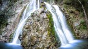
Cyprus contains a surprising network of waterfalls and natural springs hidden within the Troodos mountain range. These water features flow year-round despite the island's reputation as a dry Mediterranean destination. The mountains capture rainfall that would otherwise evaporate in coastal plains, creating conditions where water persists through even the hottest summers. Most waterfalls cluster between 650 and 1,600 meters elevation where annual precipitation reaches 1,000 millimeters compared to 300 millimeters at sea level. The Troodos region produces 80 percent of Cyprus's surface water, feeding rivers that supply reservoirs and aquifers across the island. These waterfalls and springs formed over millions of years as mountain streams carved through volcanic diabase and limestone rock, creating spectacular cascades surrounded by dense pine forests, golden oak trees, and endemic plant species found nowhere else on earth. Ancient Water Sources That Shaped Civilization Cyprus earned the name "green island" in ancient times because its forests extended from mountain peaks to coastlines, sustained by abundant surface and spring water. Archaeological evidence shows Neolithic settlers around 7000 BCE chose locations based entirely on water availability. Ancient Kourion featured sophisticated water systems with terracotta pipes fed by perennial springs near Sotira. Salamis constructed a 40-kilometer aqueduct connecting the city to water sources in the Kyrenia hills, demonstrating the engineering lengths civilizations pursued to secure reliable water. The therapeutic…

Read more
Cyprus Sustainable Wine Production

Cyprus Sustainable Wine Production

Cyprus hosts more than ten indigenous grape varieties that evolved over millennia to thrive in hot, dry Mediterranean conditions. These local grapes require significantly less water, fewer synthetic fertilizers, and minimal pesticide applications compared to international varieties. Research conducted by Cyprus University of Technology found that indigenous varieties like Xynisteri adapt better to drought and heat waves than introduced varieties such as Chardonnay. The indigenous white grape Xynisteri has earned recognition as one of the world's most environmentally friendly varieties. Studies measuring carbon footprints from vineyard to market found that Xynisteri produces lower greenhouse gas emissions than introduced varieties like Cabernet Sauvignon. This native grape thrives without irrigation in Cyprus's dry climate, conserving precious water resources while maintaining quality. The Carbon Footprint of Cyprus Wine Production Researchers at Cyprus University of Technology conducted the first comprehensive carbon footprint study of Cypriot wine in 2020. They analyzed data from 20 vineyards cultivating Xynisteri and tracked emissions through the entire production process. The study found that producing 76,000 bottles generated 99,586 kilograms of carbon dioxide equivalent, or 1.31 kilograms per 750 milliliter bottle. The research identified three main sources of emissions. Electrical energy consumption accounted for 46 percent of the total carbon footprint, making it the largest single contributor. Glass bottle production and packaging represented 18 percent of emissions, while vineyard operations…

Read more
Cape Greco Sea Cliffs And Caves

Cape Greco Sea Cliffs And Caves

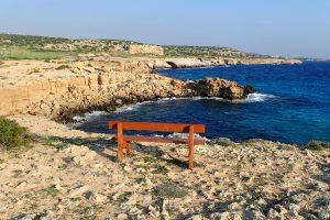
Cape Greco rises from the Mediterranean Sea at Cyprus's southeastern tip, where limestone cliffs drop sharply into turquoise waters, and erosion has carved spectacular sea caves that extend up to 80 metres into solid rock. Cape Greco, also known as Capo Greco or Kavo Greko, forms a rocky peninsula jutting into the Mediterranean between the resort towns of Ayia Napa and Protaras. The headland marks the easternmost point of both the Republic of Cyprus and the European Union, excluding outlying territories. The area covers 385 hectares protected as National Forest Park under the Cyprus Forestry Department since 1993, with additional recognition as part of the Natura 2000 network for its European ecological significance. Historical Background The limestone cliffs at Cape Greco formed from sediments deposited when shallow seas covered the region millions of years ago. Marine organisms including mollusks, corals, and microscopic creatures contributed calcium carbonate that accumulated on the seabed and eventually compressed into rock layers. Tectonic activity lifted these sediments above sea level, creating the elevated plateau that characterizes the cape today. Wave erosion shaped the detailed features that make Cape Greco distinctive. Constant pounding by Mediterranean storms exploits weaknesses in the limestone, gradually hollowing out caves, cutting through narrow points to form arches, and creating vertical channels where waves compress and release with explosive force. This process…

Read more