Explore Cyprus with Our Interactive Map

Explore our top stories and discover ideas worth your time.

Cyprus Three Continents Landscape

Cyprus Three Continents Landscape

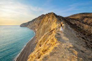
Cyprus isn't just sitting on the Mediterranean - it's rising from deep inside the Earth itself. The island's mountains, plains, and dramatic coastlines tell a story millions of years in the making, a story written by colliding continents, ancient oceans, and forces powerful enough to lift the ocean floor into the sky. Understanding Cyprus's geography means understanding why civilizations flourished here, why copper made the island famous, and why the landscape itself feels almost mythical. An Island Shaped by Deep Forces Cyprus stands where Europe, Asia, and Africa nearly touch, and this position at the crossroads of three continents isn't just cultural - it's geological. The island's dramatic landscape reflects its location along active tectonic boundaries where massive plates of Earth's crust push, pull, and collide. This created an island unlike almost anywhere else on Earth, with features that have fascinated geologists, attracted ancient miners, and shaped human history for thousands of years. The island is defined by contrasts: dark volcanic mountains in the south, pale limestone ridges in the north, and a flat plain stretched between them. Rocky headlands meet sandy beaches, mountain forests give way to sun-baked lowlands, and seasonal rivers carve valleys that run dry under the summer sun. This geographic diversity packed into one relatively small island created the conditions for civilization to take root and…

Read more
Cyprus Crossroads That Accumulated

Cyprus Crossroads That Accumulated

Cyprus is best understood as a layered island, where newcomers rarely erased what came before, and daily life absorbed languages, customs, and beliefs over centuries of close contact. Positioned between Europe, the Levant, and Anatolia, it became a crossroads early through trade, then accumulated Roman, Byzantine, Arab, Latin, Venetian, Ottoman, and British influences without turning into any single one of them. This article traces how those layers formed, where coexistence was practical rather than ideal, and why "Cypriot" identity still carries many histories at once. Ten Thousand Years of Settlement Human settlement in Cyprus stretches back more than ten thousand years. Long before empires arrived, early communities established farming villages and ritual spaces that tied life closely to land and seasons. These foundations mattered because when later cultures arrived, they did not start from nothing. As Cyprus entered the Bronze Age, copper transformed the island into a hub of Mediterranean trade. This was not just an economic shift. It brought constant contact with Egypt, the Levant, and the Aegean, embedding Cyprus into international networks very early in its history. From that point on, isolation was no longer possible. The island’s identity was shaped by exchange. Greeks and Phoenicians Intertwined Greek-speaking settlers arrived in large numbers during the late Bronze Age, establishing language, myths, and social structures that would endure for…

Read more
Ayios Nikolaos Sea Cave

Ayios Nikolaos Sea Cave

Cape Greco is a headland located between Ayia Napa and Protaras at the southern end of Famagusta Bay. The area covers 385 hectares and was designated as a National Forest Park under the administration of Cyprus's Forestry Department. The coastline here features dramatic limestone cliffs that reach 30 feet (roughly 10 meters) in height and contains numerous sea caves carved by wave action. The caves are formed from layered limestone that was deposited in warm seas millions of years ago. The rock consists of hard and soft layers that erode at different rates. Waves constantly pound against the cliffs and dissolve the softer limestone faster than the harder layers above and below. This differential erosion creates the caves, arches, and tunnels that characterize the Cape Greco coastline. Historical Background The formation process began thousands of years ago when sea levels and wave patterns were different. Water enters cracks in the limestone and widens them through both mechanical force and chemical dissolution. Seawater contains salt and is slightly acidic, which helps dissolve calcium carbonate in the limestone. The caves show an almost horizontal layer of soft limestone that waves eroded easily. The overlying harder layer protected the caves from collapse and created roof structures. The lower layer is also harder and forms a several-meter-wide ledge. At some locations, this ledge is…

Read more