Explore Cyprus with Our Interactive Map

Explore our top stories and discover ideas worth your time.

Loumata ton Aeton Nature Trail

Loumata ton Aeton Nature Trail

The Loumata ton Aeton Nature Trail provides a detailed look at the rugged beauty of the Limassol district. This path winds through the heart of the Amiantos region within the Troodos National Forest Park. It offers a unique window into the geological and botanical wealth of the island. Every section of the track reveals a landscape that remains wild and largely untouched by modern life. The air stays fresh and carries the scent of pine and wild herbs throughout the seasons. This specific environment supports a wide array of rare plants that thrive only in this mountain climate. History and nature merge along this route as it follows the path of old mountain streams. The terrain shifts from dense woods to open ridges with vast views of the surrounding peaks. It serves as a vital destination for those who seek a profound connection with the earth. Trail Overview Location: Amiantos, Limassol District Distance: 1.5 miles (2.5 km) Route Type: Linear Difficulty: Moderate Elevation Gain: 492 feet (150 meters) Duration: 1 hour Best Time to Visit: March – May Terrain: Rocky and Forest Floor Botanical Diversity and Local Plant Life The Loumata ton Aeton Nature Trail hosts a vast collection of flora that defines the mountain zone of the island. The Pinus brutia or Calabrian pine dominates the lower sections of…

Read more
Aphrodite Nature Trail

Aphrodite Nature Trail

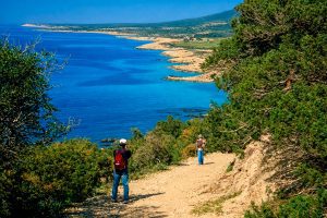
The Aphrodite Nature Trail cuts through the Akamas Peninsula, one of the last untouched wildernesses in Cyprus. This 7.5-kilometer circular route starts at the legendary Baths of Aphrodite and climbs to viewpoints where the entire northwest coast unfolds below. The path combines mythology with genuine ecological significance, passing through an area that hosts 39 of Cyprus's 141 endemic plant species and serves as protected habitat for endangered sea turtles. The route reaches a maximum elevation of 370 meters at Moutti tis Sotiras, a rocky plateau that offers panoramic views across Chrysochou Bay to Cape Arnaoutis. Despite covering 7.5 kilometers, the trail maintains a moderate difficulty level, with most elevation gain concentrated in the middle section. Walking time ranges from 3 to 4 hours. The entire Akamas Peninsula covers 230 square kilometers and is designated as a NATURA 2000 protected area, recognized by the European Environment Agency as one of only 22 areas of endemism in Europe. The Goddess Who Rose from the Sea According to Greek mythology, Aphrodite emerged from sea foam off the coast of Cyprus. The Baths of Aphrodite, where the trail begins, is a natural grotto where the goddess supposedly bathed. Local legend claims this is where she met Adonis, her mortal lover, when he stopped to drink from the spring while hunting. The peninsula takes its…

Read more
Mesaoria Plain, Cyprus

Mesaoria Plain, Cyprus

The Mesaoria Plain stretches 96 kilometres across central Cyprus between two mountain ranges. Mesaoria, meaning "between the mountains" in Greek, is a broad central plain that extends from Morphou Bay in the west to Famagusta Bay in the east. The Troodos Mountains rise to the south, while the Kyrenia Range forms a wall to the north. The plain covers approximately 1,000 square kilometres with elevations ranging from 100 metres on average up to 325 metres at its highest points. Nicosia, the capital of Cyprus, sits roughly in the centre of the plain along the Pedieos River. This positioning reflects centuries of strategic thinking, as the location provided access to both coasts. The plain contains dozens of villages and several major towns, making it the most densely populated region on the island despite its harsh summer climate and winter-dependent water supply. Historical Background Twenty million years ago, Cyprus existed as two separate islands corresponding to what would become the Kyrenia and Troodos mountain ranges. Approximately one million years ago, tectonic forces pushed up the land between these islands, creating the Mesaoria Plain and joining them into the single landmass known today as Cyprus. The Mediterranean Sea covered and exposed the plain multiple times as sea levels changed, but it has remained in its current form since the end of the Pleistocene…

Read more