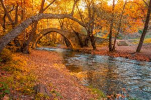
Larnaca Salt Lake is a complex network of four salt lakes of different sizes to the west of the city of Larnaca. The largest is Lake Aliki, followed by Lake Orphani, Lake Soros, and Lake Spiro. Three of these lakes interconnect to form the second largest salt lake complex in Cyprus after Limassol Salt Lake.
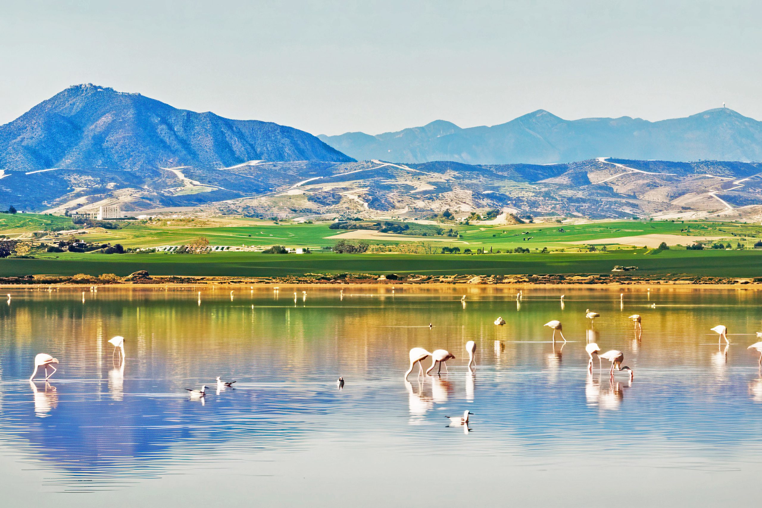
The total surface area of the lakes adds up to 2.2 square kilometers, positioned between Larnaca International Airport and the historic Hala Sultan Tekke mosque. This location makes the salt lake one of the most visible natural landmarks for anyone arriving in Cyprus by air.
Historical Background
Archaeological finds show that the salt lake area has been inhabited since the Late Bronze Age, with a harbor that served the town unearthed near where the Hala Sultan Tekke mosque stands today. Ancient Larnaca, then known as Kition, functioned as one of Cyprus’s major urban and commercial centers between 1650 and 1050 BC. The natural harbor provided strategic access to trading routes connecting Africa, Asia, and Europe.
Before sediment deposit cordoned off the salt lakes, they formed a lagoon that was connected to the Mediterranean Sea. Over centuries, sediment accumulated in the channels linking the lagoon to the sea. Evidence suggests Bronze Age Cypriots dug an artificial channel to maintain port operations as natural waterways became increasingly shallow. Eventually the estuary silted up completely, the harbor was destroyed, and the trapped water evolved into the salt lake system visible today.
Throughout medieval times, salt harvesting became a major industry. The lake produced such quantities that salt ranked among Cyprus’s primary export commodities, shipped as far as Venice and generating thousands of pounds in annual revenue. Commercial salt collection continued until 1986 when operations ceased and the area transitioned to conservation.
The Seasonal Transformation and Ecology
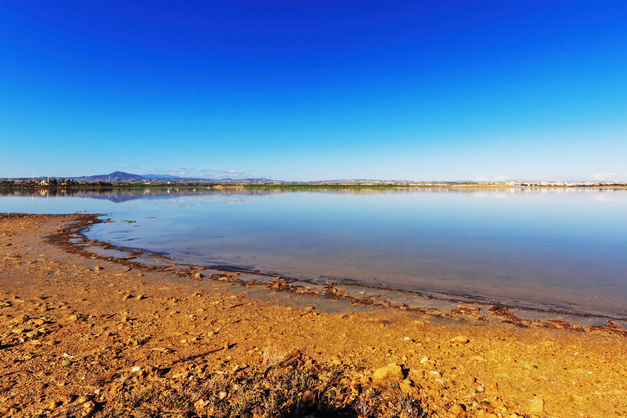
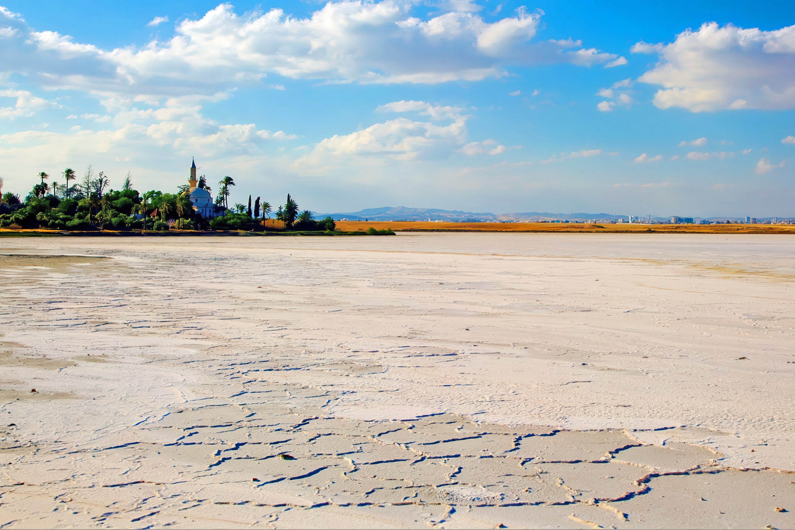
The small Mediterranean island’s summers don’t see much precipitation, consequently the lake becomes so dry that in certain areas all that is left is an exposed layer of caked salt. During peak summer, temperatures and evaporation create a white crust covering the entire lake bed, resembling snow from a distance. A grey dust haze often hovers above the dried surface.
Winter rains begin refilling the lakes in November. Come winter, heavy rains inundate the island and the lake fills again. The shallow waters, rarely exceeding a meter in depth, create ideal conditions for aquatic life to flourish. Dark red algae which grows in the salt lake is the basis of the food chain, as the small shrimp in the lake feed on it.
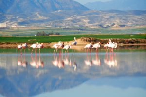
In these waters, ostracods or seed shrimp, Branchinella spinosa or fairy shrimp, and Artemia salina, a species of brine shrimp, propagate and are an essential source of food for the flamingos. These tiny crustaceans thrive in the brackish conditions unsuitable for most other aquatic species. When shrimp populations decline or water dries up, birds must move to other feeding grounds or continue migration toward Africa.
Important Facts About Birds and Conservation
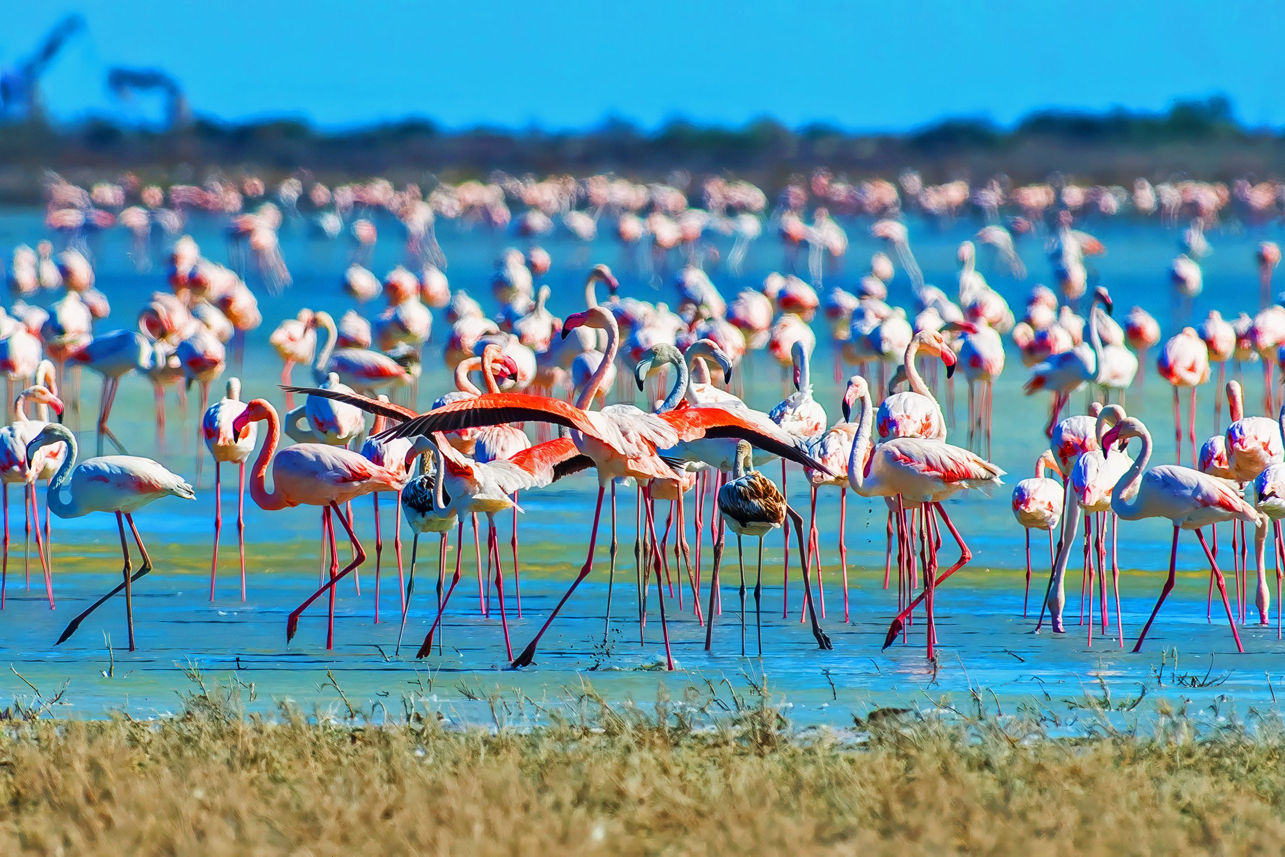
Besides its picturesque beauty, the lake is the haunt of 85 species of water-birds with estimated populations between 20,000 and 38,000. Other important bird species are cranes, Kentish plovers, black-headed gulls, black-winged stilts, stone-curlews, spur-winged lapwings, Cyprus wheatears and Cyprus warblers.
The Larnaca Salt Lake complex was declared as a protected area by a decision of the Council of Ministers in 1997. It is considered one of the most important wetlands of Cyprus and has been declared a Ramsar site, Natura 2000 site, Special Protected Area under the Barcelona Convention and an Important Bird Area.
One remarkable sighting made headlines in recent years. A black flamingo, the only one known in the world, was spotted at Larnaca Salt Lake. This rare melanistic individual stands out dramatically against the sea of pink birds, making it a sought-after observation for birdwatchers.
Recent data from BirdLife Cyprus and the authorities have raised serious concern, as at Akrotiri Salt Lake the number of wintering flamingos has fallen to historical lows. For the first time since systematic counts began in 1992, only 30 flamingos were recorded in January 2025 at Akrotiri, far fewer than the usual thousands. The decline signals severe pressure on wetlands from pollution, abnormal water inflows, and environmental stress.
Why This Wetland Matters for Cyprus
It is one of the important migratory passages through Cyprus. The island sits at the intersection of three continents, making it a crucial stopover point for birds traveling between breeding grounds in Europe and Asia and wintering areas in Africa. Without healthy wetlands like Larnaca Salt Lake, these migration routes would lose essential resting and feeding stations.
The lake provides ecosystem services beyond bird habitat. The wetland stores floodwater during winter storms, reducing flood risk in surrounding areas. Water infiltrating through the porous lake bed helps recharge underground aquifers. The salt-tolerant vegetation stabilizes soils and provides habitat for insects, reptiles, and small mammals.
Culturally, the salt lake shaped Larnaca’s identity and economy for centuries. The town’s prosperity partly derived from salt exports during medieval times. Today the lake remains a defining landscape feature, visible from aircraft and featured prominently in local tourism materials.
On the western shore stands Hala Sultan Tekke, one of Islam’s most important shrines. The mosque contains the tomb of Umm Haram, believed to be a companion of Prophet Muhammad who died in Cyprus in 647. The combination of natural beauty and religious significance makes this location meaningful to both Muslims and nature enthusiasts.
Visiting and Observing Responsibly
Greater flamingos migrate to the Larnaca Salt Lake every winter, tending to arrive in November and stay until around March, though dates vary from year to year. To see flamingos in large numbers, visit between December and February when populations peak. Lake Aliki is the largest lake and where the majority of flamingos tend to congregate.
A 4-kilometer trail at the Salt Lake has two main starting points, the first at the Kamares Aqueduct and the second at the salt collection plateau on Artemis Avenue toward the old airport. The nature trail includes interpretive signs explaining local flora, fauna, and geology, with benches positioned at viewpoints.
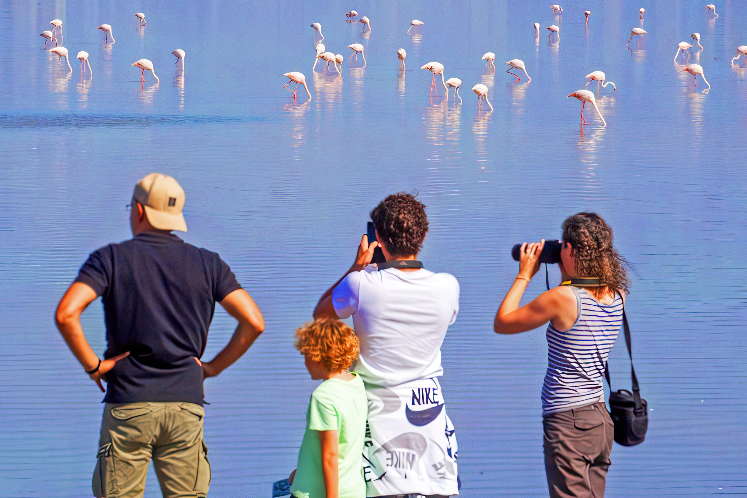
The best times to view flamingos are early morning and sunset when soft light reduces crowds. Photography benefits from golden hour lighting, though any daylight visit during winter months offers good chances of flamingo sightings. Bring binoculars or telephoto lenses between 300 and 600 millimeters for close-up observations while maintaining appropriate distance.
It is important to note that wading out into the salt lake to get closer to the flamingos is prohibited as this is highly damaging for the very sensitive birds. Flamingos are highly sensitive to disturbance, especially during winter when they need to rest and feed before the breeding season. Getting too close forces them to flee, expending energy they need for survival and migration.
The Importance of Wetland Protection
Larnaca Salt Lake demonstrates how seasonal wetlands support remarkable biodiversity despite appearing barren for half the year. The annual cycle of flooding and drying creates specialized habitat unavailable in permanent water bodies. Protection of such ecosystems requires understanding their unique ecology and the threats they face.
Pollution from urban runoff, agricultural chemicals, and other sources degrades water quality. Changes to natural water flows affect the timing and depth of seasonal flooding. Development pressure around lake margins fragments habitat and increases disturbance. Climate change threatens to alter rainfall patterns that the entire ecosystem depends upon.
The flamingos serve as indicators of wetland health. Their declining numbers at some Cyprus salt lakes signal environmental problems requiring urgent attention. Maintaining stable water levels, protecting water quality, and minimizing human disturbance will determine whether these birds continue finding refuge here.
For visitors, observing these magnificent birds connects them to global migration patterns and the interdependence of ecosystems across continents. The flamingos at Larnaca Salt Lake link breeding sites thousands of kilometers away to this small Mediterranean island, demonstrating how conservation requires international cooperation and local stewardship working together.