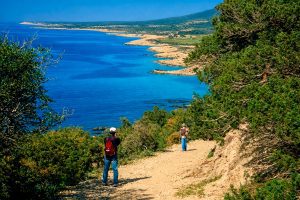
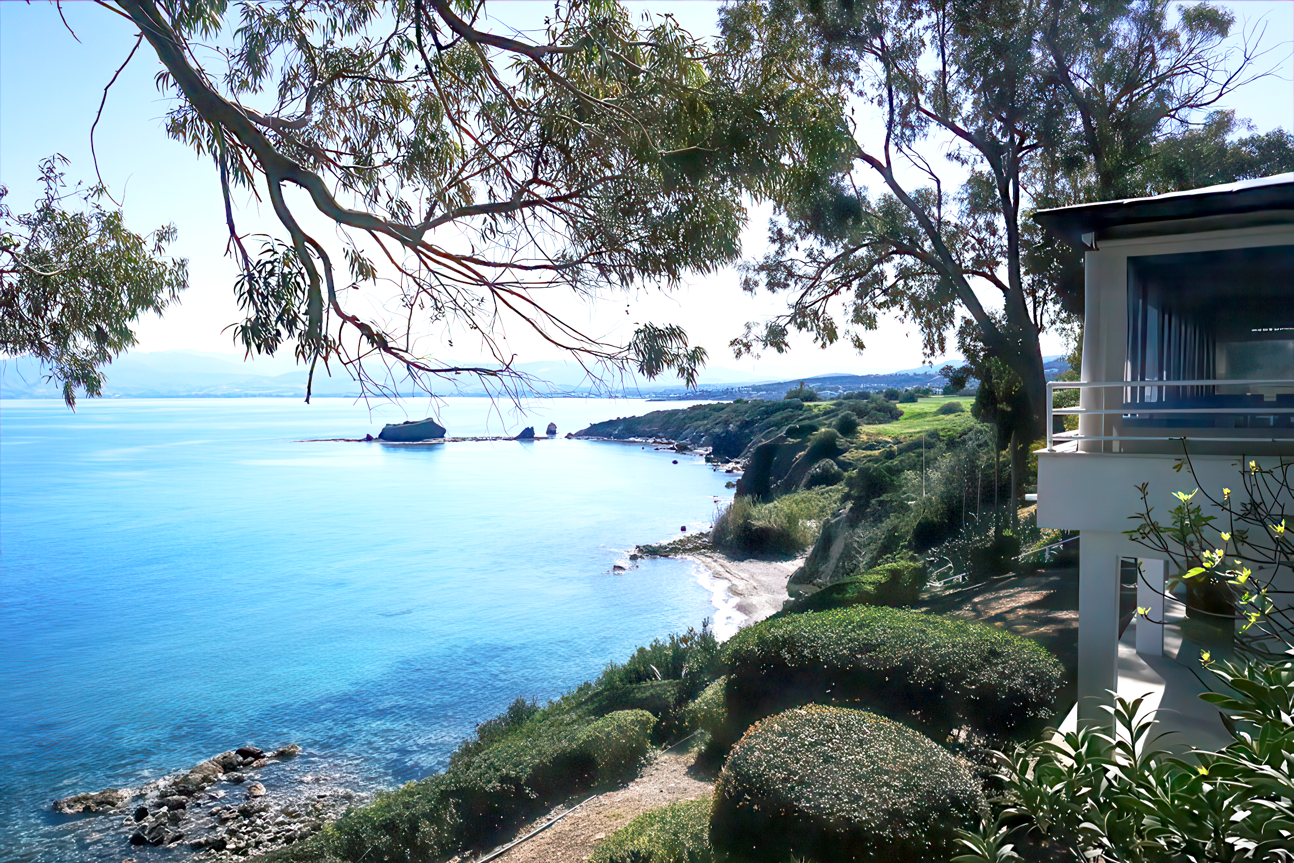
The Aphrodite Nature Trail cuts through the Akamas Peninsula, one of the last untouched wildernesses in Cyprus. This 7.5-kilometer circular route starts at the legendary Baths of Aphrodite and climbs to viewpoints where the entire northwest coast unfolds below.
The path combines mythology with genuine ecological significance, passing through an area that hosts 39 of Cyprus’s 141 endemic plant species and serves as protected habitat for endangered sea turtles.
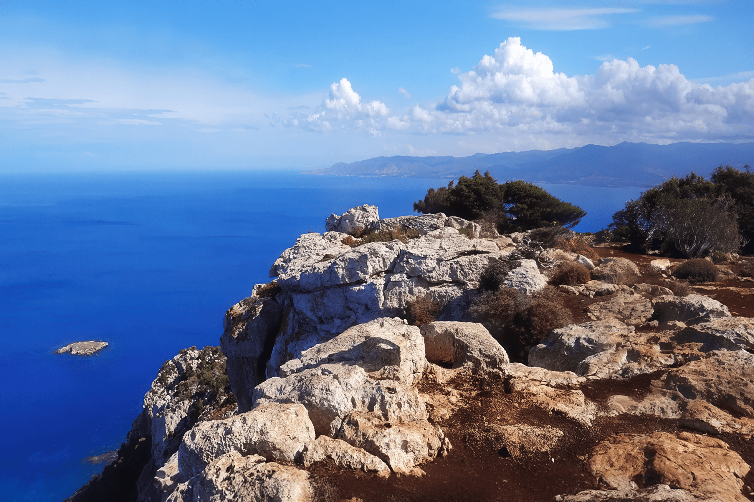
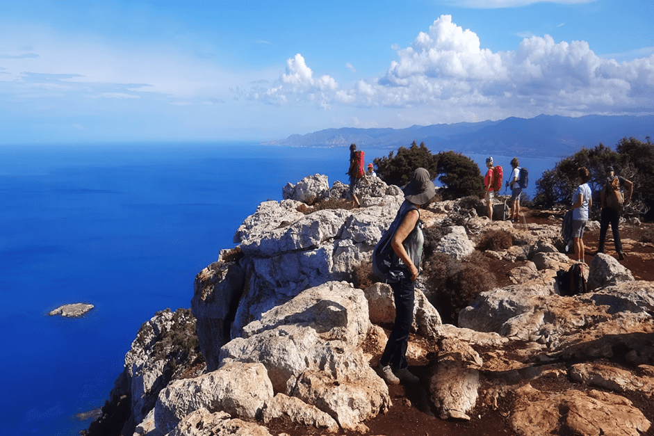
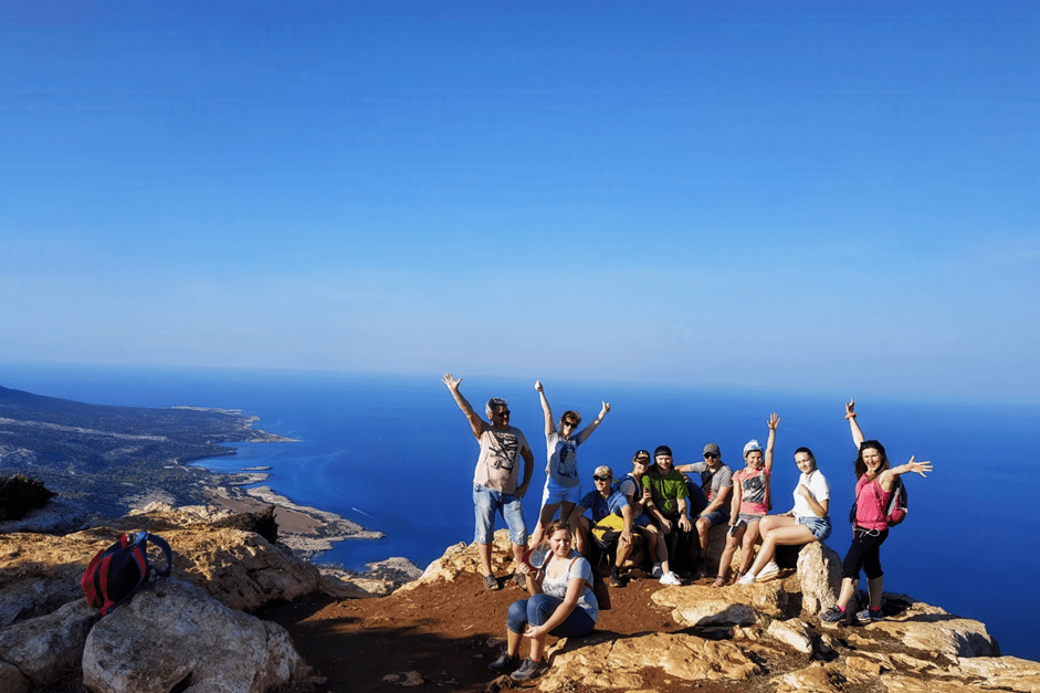
The route reaches a maximum elevation of 370 meters at Moutti tis Sotiras, a rocky plateau that offers panoramic views across Chrysochou Bay to Cape Arnaoutis. Despite covering 7.5 kilometers, the trail maintains a moderate difficulty level, with most elevation gain concentrated in the middle section.
Walking time ranges from 3 to 4 hours. The entire Akamas Peninsula covers 230 square kilometers and is designated as a NATURA 2000 protected area, recognized by the European Environment Agency as one of only 22 areas of endemism in Europe.
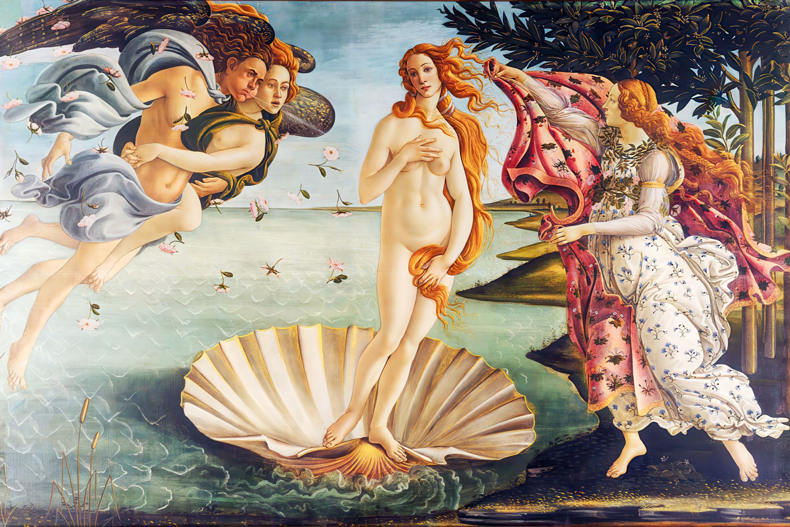
The Goddess Who Rose from the Sea
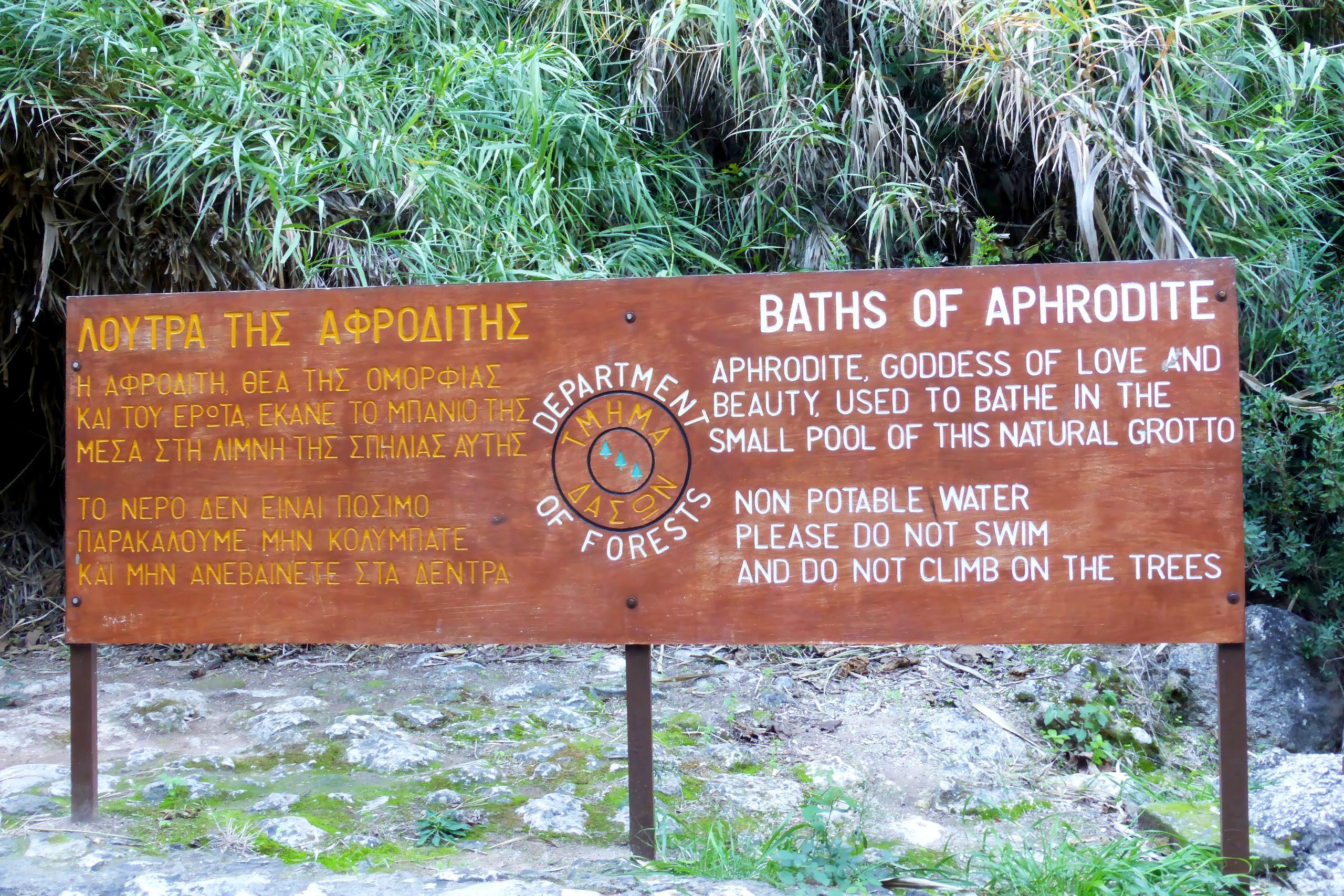
According to Greek mythology, Aphrodite emerged from sea foam off the coast of Cyprus. The Baths of Aphrodite, where the trail begins, is a natural grotto where the goddess supposedly bathed. Local legend claims this is where she met Adonis, her mortal lover, when he stopped to drink from the spring while hunting. The peninsula takes its name from Akamas, son of Theseus and hero of the Trojan War. The ruins of Pyrgos tis Rigainas along the trail are believed to belong to a medieval monastery, though local tradition claims Aphrodite would rest here under a massive oak tree after bathing.
Rocky Terrain Through Protected Wilderness
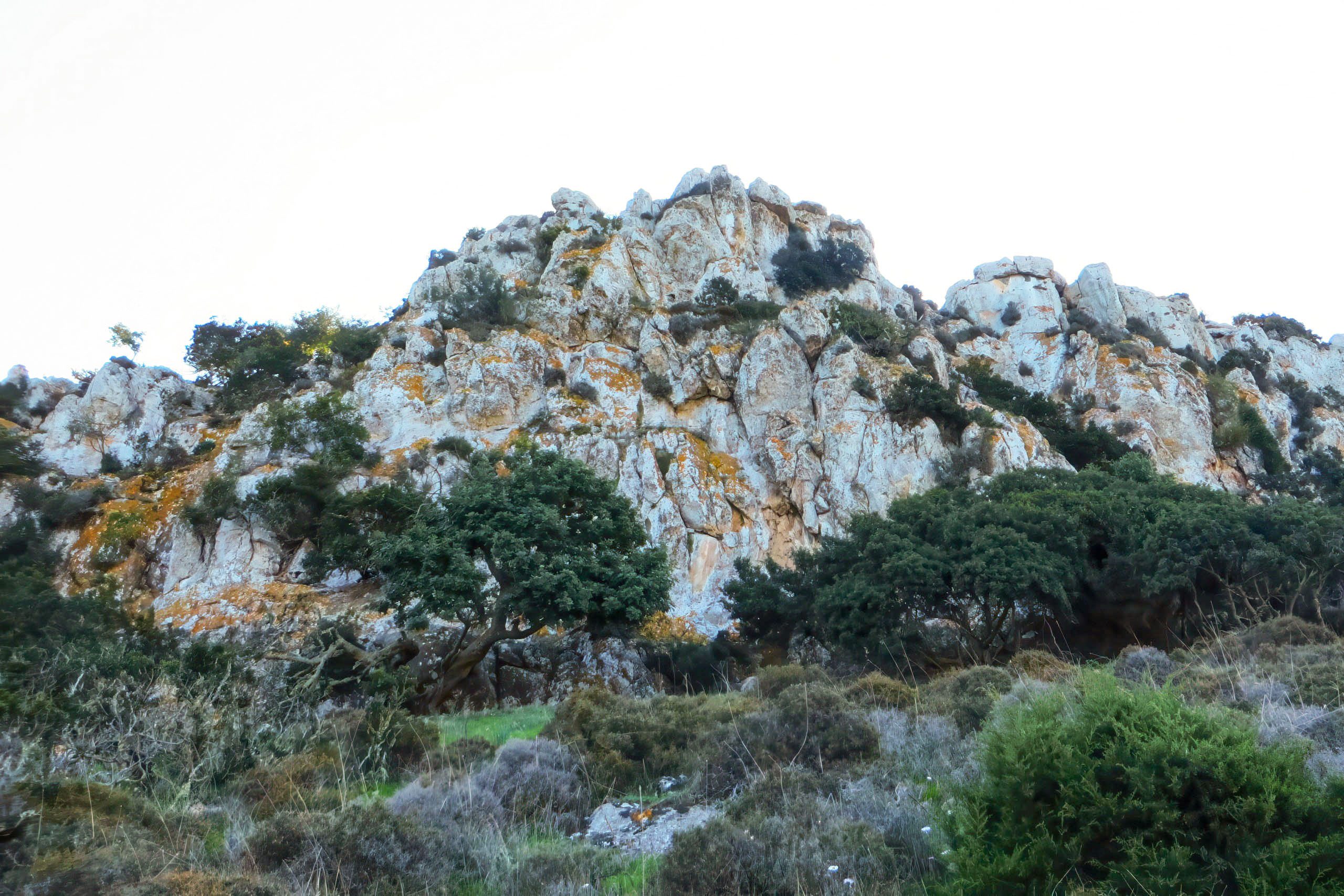
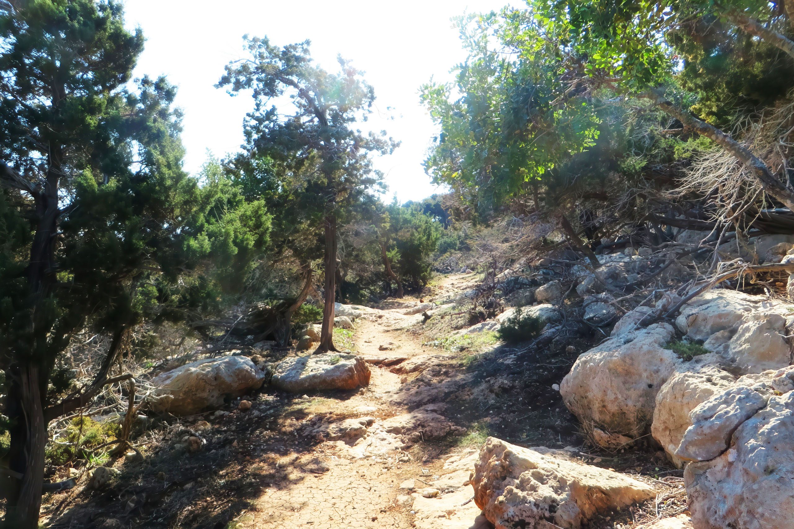
The trail follows a rocky, uneven path that climbs steadily from the Baths of Aphrodite. For the first 2.5 kilometers, the route coincides with the Adonis Nature Trail, another path in the area. The surface consists primarily of exposed limestone with loose stones in many sections. The path winds through low scrubland and maquis vegetation, with gnarled juniper trees, wild thyme, and carob trees creating a distinctive Mediterranean landscape. The terrain becomes more challenging as hikers approach Moutti tis Sotiras, where the path narrows and requires careful footing on steep switchbacks.
Two water fountains provide non-potable water along the route. One sits near Pyrgos tis Rigainas, the other between the Baths and Kakoskali. An 800-year-old oak tree stands near the monastery ruins, one of the oldest trees on the island.
The views from Moutti tis Sotiras extend across the entire peninsula. On clear days, hikers can see Chrysochou Bay, the town of Polis, Paphos Forest to the east, and the rocky islets of Chamili and Agios Georgios. The descent from Moutti follows steep switchbacks down the northern side of the ridge. Many hikers choose to walk the trail in reverse, ascending the switchbacks rather than descending them, which reduces the visual impact of the steep drops.
One of Europe’s Biodiversity Hotspots
The Akamas Peninsula hosts over 600 plant species in its varied terrain of rocky hills, deep gorges, coastal cliffs, and fertile valleys. Of Cyprus’s 141 endemic species, 39 grow nowhere else on Earth except in Akamas. Two of the rarest plants in the world exist only here. The Akamas tulip has a total world population of approximately 200 plants, all found in a small area of the peninsula. The Akamas centaurea consists of no more than 800 plants worldwide, found only on vertical cliffs in three gorges including the nearby Avakas Gorge.
The peninsula supports 34 of Cyprus’s 46 orchid species. Seventeen species of bee orchids grow here, which are orchids that mimic wild bees to attract pollinators. Plants visible along the trail include Cyprus golden-drop, Cyprus sage, lentisk, strawberry tree, and several juniper varieties. The endemic Cyprus cyclamen blooms in the area. Information tags placed by the Forestry Department identify various species for hikers interested in learning about the local flora.
Until 2000, the British Army used the Akamas Peninsula for military exercises and as a firing range. Under the 1960 Treaty of Establishment, Britain was allowed to use the area for up to 70 days per year. Military activities ceased when the peninsula gained protected status before Cyprus joined the European Union.
The Egyptian fruit bat, Europe’s only representative of this tropical bat family, finds refuge in Akamas caves. With a wingspan of approximately 60 centimeters, it represents the largest bat species in Cyprus. These bats feed on ripe fruit rather than insects, making them unique among European bat species. Cyprus is the only European country where this species occurs naturally.
Wildlife in a Protected Environment
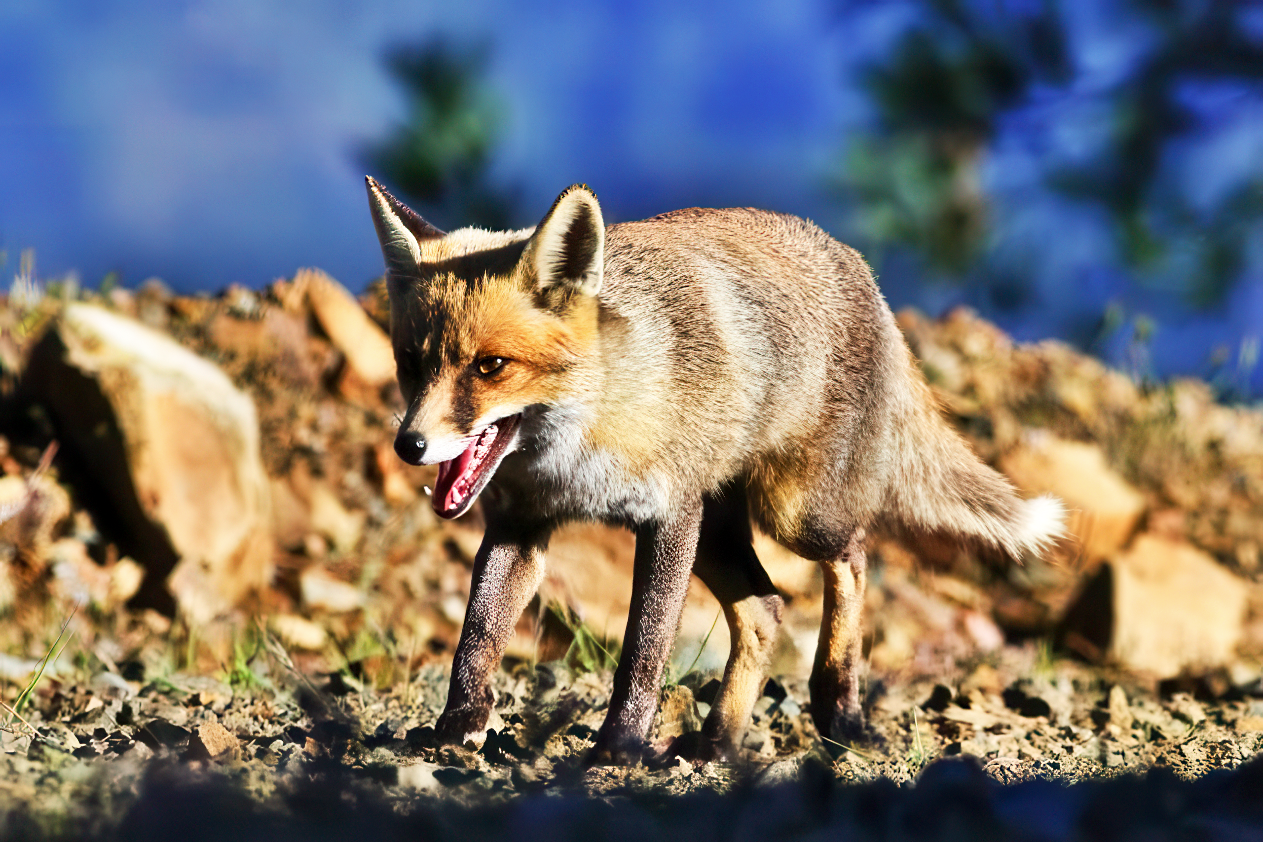
The trail passes through habitat for various mammal species, though most are nocturnal and rarely seen during daylight hours. The Cyprus red fox, a small subspecies, appears with some frequency. Long-eared hedgehogs cross the roads at night during spring and summer. Cyprus has the Asian species with notably larger ears than European hedgehogs. The endemic Cyprus spiny-mouse lives in the area, though its nocturnal habits make sightings uncommon.
Bird species recorded in Akamas number 168, including the endemic Cyprus warbler with its distinctive black and white plumage. Griffon vultures nest on cliff faces in the peninsula. The Cyprus scops owl inhabits forested areas. Migration seasons bring additional species through the area as birds travel between Europe and Africa.
Six snake species live in Akamas, three of which are venomous. The blunt-nosed viper represents the only truly dangerous species. The Cyprus whip snake reaches up to 3 meters but is harmless. Hikers should avoid approaching snakes and seek immediate medical help if bitten.
A Conservation Priority for Modern Cyprus
The Akamas Peninsula represents one of the last remaining undeveloped coastlines in Cyprus. The area has faced ongoing pressure from development interests, leading to conflicts between conservation and economic development. Two turtle-nesting beaches in Akamas were designated Sites of Community Importance within the NATURA 2000 network. The Polis-Gialia area became a Special Area of Conservation, and the entire peninsula received designation as a Special Protection Area for birds.
Green turtles and loggerhead turtles nest on Akamas beaches, with a protected hatchery at Lara Bay where eggs are monitored and protected. Both species are endangered worldwide, making the peninsula crucial for their survival in the Mediterranean. The Mediterranean monk seal, one of the rarest marine mammals on Earth, occasionally appears in waters around Akamas, though sightings remain extremely rare.
Since 2017, the peninsula has experienced approximately 80 arson attacks, with fires often occurring just before conservation meetings. Environmental groups view the fires as attempts to undermine protection efforts. The situation reflects ongoing tensions over land use in one of Cyprus’s most ecologically significant areas.
How to Experience the Trail
The trail starts at the Baths of Aphrodite, accessible via the coastal road from Polis Chrysochous to Neo Chorio. Free parking is available at the Baths of Aphrodite car park. A cafe-restaurant operates at the trailhead, serving Cypriot cuisine and providing trail information. A small botanical garden adjacent to the parking area displays specimens of the peninsula’s flora.
The Aphrodite Nature Trail provides access to one of the Mediterranean’s most important conservation areas. The combination of endemic species, endangered wildlife, and geological significance makes Akamas exceptional even by European standards. The trail allows visitors to experience this protected wilderness while learning about the plants and animals that exist nowhere else on Earth.
For Cyprus, the peninsula represents both a conservation challenge and a success story, where former military land has become a refuge for species that might otherwise disappear. Walking where Aphrodite supposedly walked, modern hikers encounter not mythology but measurable biodiversity, rare plants that number in the hundreds rather than thousands, and coastline that remains largely as it was before human development transformed most Mediterranean shores.