The ancient city of Salamis on Cyprus faced the same problem that confronted many Roman settlements across the Mediterranean. The city needed vast quantities of water to serve its growing population, public baths, and commercial activities, but local sources were not enough. The Romans solved this challenge with one of their most impressive engineering achievements on the island: a 40-kilometer aqueduct that brought fresh water from the springs of Kythrea to the bustling coastal metropolis.
Why Salamis Needed an Aqueduct
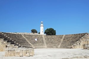
Salamis stood as one of Cyprus’s most important cities during Roman times. The city stretched two kilometers along the coastline and reached one kilometer inland. At its peak, between 50,000 and 100,000 people called Salamis home. This large population created enormous water demands that local wells and rainwater collection systems could not meet.
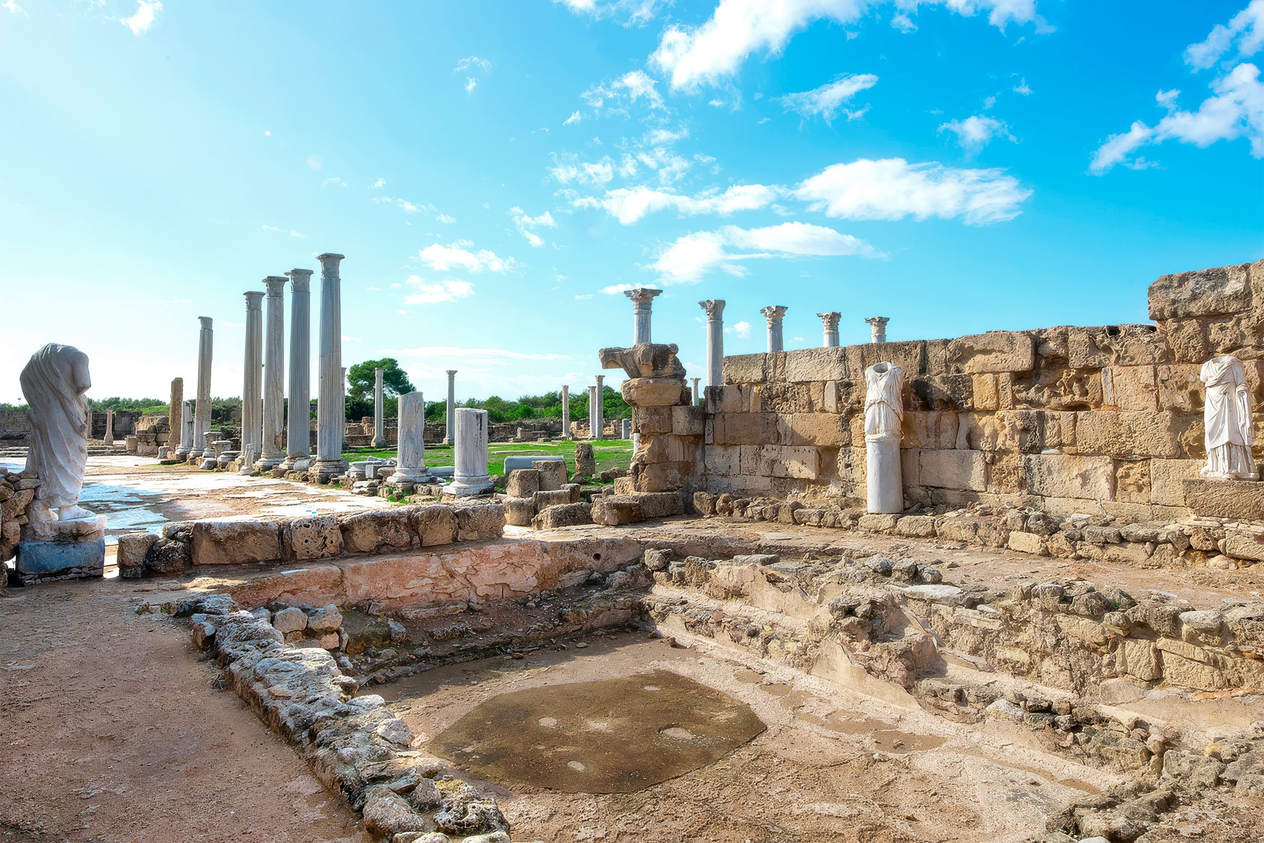
The city housed at least two major bathhouse complexes, a gymnasium with a colonnaded courtyard, and numerous other public buildings. Roman bath culture was central to social life, and these facilities consumed tremendous amounts of water.
The elaborate thermal baths included hot rooms, steam rooms, and cold plunge pools that required constant water circulation. Cyprus is naturally arid, and despite careful water management through cisterns and reservoirs, the city needed a more reliable source.
The Engineering Marvel from Kythrea
The solution came from Kephalovrysi, the main spring at Kythrea, located at the foot of the mountains north of what is now Nicosia. This abundant spring supplied Cyprus’s largest natural water source. An inscription discovered at Angastina suggests the aqueduct was constructed during the reign of Emperor Nero in the mid-first century AD, though the exact date remains debated among historians.
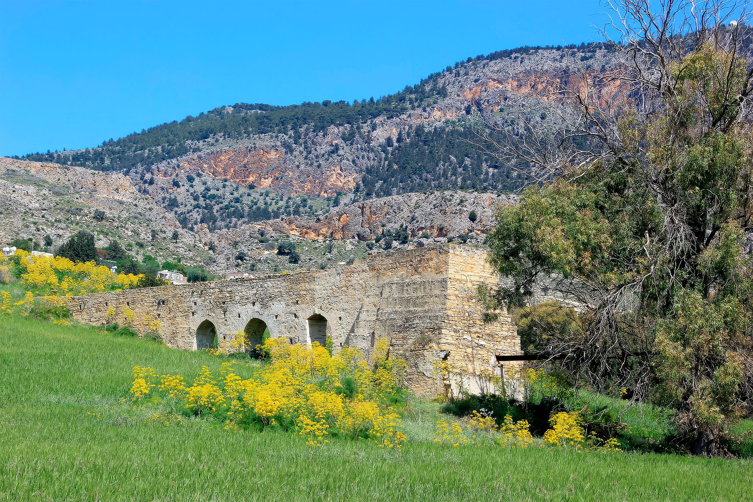
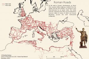
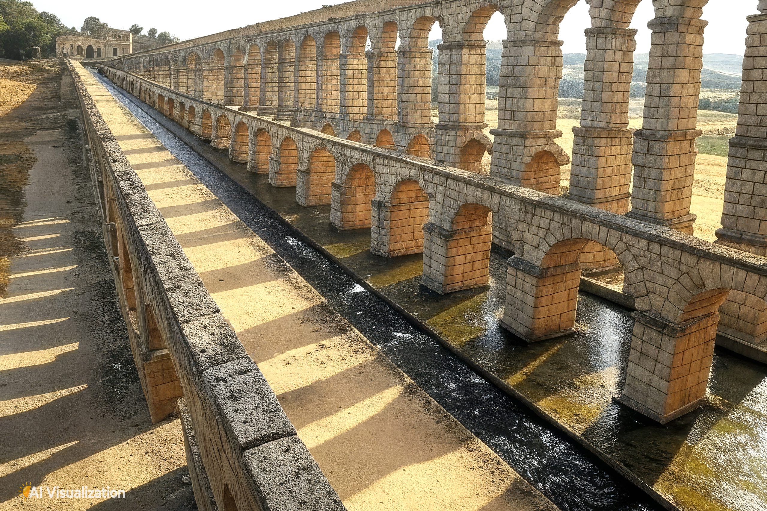
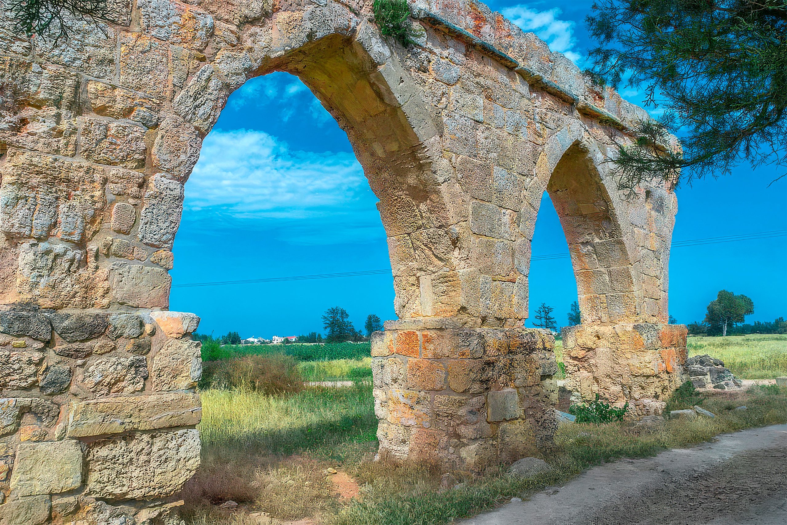
The aqueduct stretched approximately 40 kilometers as the crow flies, though the actual channel length was longer because it had to follow the natural contours of the land to maintain a consistent downward slope. The construction varied depending on terrain. Where the aqueduct crossed the plain near Agios Serghios, engineers built it on pillars and arches. These stone supports lifted the water channel above ground level, allowing it to maintain the proper gradient and cross valleys.
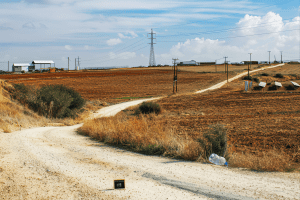
As the route approached the Karpasia foothills, the builders changed their approach. Instead of expensive pillars and arches, they placed the conduit directly on the ground or on low masonry supports. Remains of this ground-level construction can still be traced for about five kilometers near villages like Petra tou Digeni and Chatos. The aqueduct’s path included a junction where it received additional water from a secondary conduit before reaching the springs at Kythrea.
Construction Details and Materials
The builders used sandstone blocks for both the supporting pillars and walls. Each pillar measured 1.1 meters by 1.1 meters, while the walls reached 2.0 to 2.5 meters in width. Workers joined these blocks with mortar to create stable structures. The construction showed typical Roman engineering practices, with careful attention to gradients and water flow.
Near Salamis, the conduit split into two branches. The southern branch led to a massive reservoir north of the Roman forum, while the northern branch followed or ran atop the ancient city wall toward the palaestra and bath complex. This dual distribution system allowed water to reach different parts of the city efficiently.
The Great Reservoir at Salamis
The main reservoir, known locally as the Loutron, stands as one of the most impressive surviving structures from ancient Salamis. This massive water tank measured 52.5 meters long, 15.3 meters wide, and about 5 meters deep, giving it a capacity of roughly 4,000 cubic meters. The rectangular basin was partly below ground level and partly above, with a vaulted roof originally supported by 36 square pillars. Today, visitors can still see the walls and pillar remains.
The reservoir adjoined the agora, or Roman forum, placing it at the heart of civic life. Three major openings in the eastern wall served as water inlets from the aqueduct. The structure ran parallel to the city wall of Constantia (as Salamis was later renamed), with a branch pipeline or channel connecting it to the aqueduct system. The builders used sandstone blocks pointed with mortar, though no traces of a watertight lining have survived.
The Byzantine Period and Later Repairs
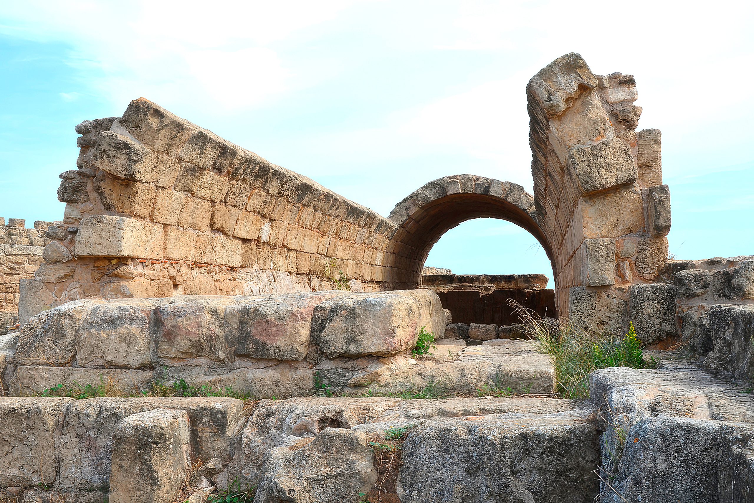
After devastating earthquakes struck Cyprus in 332 and 342 AD, Emperor Constantius II rebuilt much of Salamis and renamed it Constantia. The aqueduct required significant repairs during this period. The visible remains near Bogazi include three pillars and two arches that date to the 6th or 7th century AD, suggesting Byzantine reconstruction work.
Historical records mention that Byzantine bishops Ploutarchos and later Arcadius oversaw major restoration work on the aqueduct around 619-631 AD. These repairs brought water from Kythrea to the outskirts of Constantia. An inscription references work completed in 631 AD on the final arches leading from an unlocated hippodrome toward the city’s main cistern. Some early travelers noted Greek inscriptions on the arches mentioning an archbishop, though most Gothic-style arches they observed are better preserved than those visible today.
The Byzantine writer Procopius mentioned an aqueduct of Saint Conon in Cyprus as one of Emperor Justinian’s works, though scholars debate whether this refers to the Kythrea-Salamis aqueduct. Despite its importance to the island, no ancient or medieval author described the aqueduct in detail until the late Middle Ages.
Roman Engineering Philosophy in Practice
The Salamis aqueduct demonstrates several key principles of Roman engineering. The builders worked with natural terrain rather than against it, choosing the most economical construction method for each section. Where they needed height, they built arches. Where the ground provided adequate elevation, they saved resources by laying pipes directly on or in the earth.
The dual-branch distribution system shows sophisticated planning. By splitting the flow near the city, engineers could serve different elevation zones and building types efficiently. The massive reservoir provided storage capacity that allowed the system to handle variations in demand and supply. The Romans understood that water infrastructure required redundancy and storage to function reliably.
Water management was crucial for Roman cities, especially in arid regions. The Kythrea springs provided year-round flow, unlike seasonal streams or wells that might run dry in summer. This reliability allowed Salamis to maintain its bathhouses and fountains even during dry periods, supporting the urban lifestyle that Romans valued across their empire.
Legacy of the Salamis Aqueduct
The aqueduct from Kythrea to Salamis represents Roman engineering at its most practical. Built during the 1st century AD and maintained through Byzantine times, it served one of Cyprus’s major cities for over 600 years. The structure combined careful surveying, solid construction, and practical design choices that adapted to local geography.
Though only fragments survive, the aqueduct’s scale and longevity speak to the skills of ancient engineers. They created infrastructure that not only met immediate needs but continued functioning through earthquakes, reconstructions, and political changes. The water that flowed 40 kilometers from mountain springs to coastal city enabled Salamis to thrive as a center of commerce, culture, and Roman civilization on Cyprus.
Today, visitors to the archaeological site can see the great reservoir that once stored this water, standing as a reminder of the engineering vision that brought abundance to an ancient city in an arid land.