Ancient Ledra was a city-kingdom in the center of Cyprus where modern Nicosia stands today. It was established around 1050 BC and it became one of ten Cypriot kingdoms by the 7th century BC. Unlike coastal kingdoms that thrived on maritime trade, Ledra developed as an agricultural settlement in the fertile Mesaoria Plain. By Hellenistic times, it had dwindled to a small village before transforming into the capital city that continues to this day.
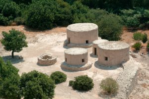
Archaeological remains from ancient Ledra have been found in several areas around modern Nicosia. The Bronze Age settlement was located on Leontari hill, approximately 6.5 kilometers southeast of the historical city center. This platform measures about 200 by 300 meters and includes a small cemetery.
Historical Background
The kingdom of Ledra appears for the first time in historical records on a clay prism of the Assyrian king Esarhaddon, dated to 672 BC. The inscription refers to the settlement as “Lidir” and records its ruler as “Unasagusu,” generally identified as Onasagoras, the only king of Ledra whose name we know. He is listed ninth among ten Cypriot kingdoms that paid tribute to Esarhaddon.
The Assyrian text identifies Ledra as a “mat,” meaning country or land, rather than a “kur,” which denotes a city. This suggests that Ledra lacked a significant urban center and functioned more as a rural territory. The designation explains why archaeologists have struggled to find substantial architectural remains from the Iron Age period, as the kingdom probably consisted of scattered settlements rather than a concentrated city.
During the first quarter of the 4th century BC, several Cypriot mercenaries carved their names on the walls of the temple of Achoris in Karnak, Egypt. Among them was a soldier from Ledra, providing one of the few additional references to the kingdom during the Classical period. This inscription confirms that Ledra continued to exist, though it remained minor compared to coastal city-kingdoms.
By 330 BC, during the Hellenistic period, Ledra had declined to a small and unimportant town. Various explanations exist for this reduction. Some historians suggest that Ledra consolidated with neighboring kingdoms to form larger territorial units, losing its independence in the process. The kingdom’s economy, based primarily on agriculture rather than the lucrative maritime trade that enriched coastal cities, may have limited its growth and political power.
Around 280 BC, according to tradition, Leucos, son of Ptolemy I Soter of Egypt, rebuilt the settlement and renamed it Leukotheon, meaning “white gods” in Greek. The name was also recorded as Lefkotheon and later became Leucusia. However, some historians consider this story a later invention based on false etymology rather than historical fact.
The exact transition from Ledra to Leukotheon remains unclear, though the change reflects Ptolemaic influence in Cyprus following Alexander the Great’s campaigns. The new name stuck, and Byzantine sources later referred to the settlement as Lefkon, meaning “poplar grove,” or Lefkosia, the modern Greek name for Nicosia.
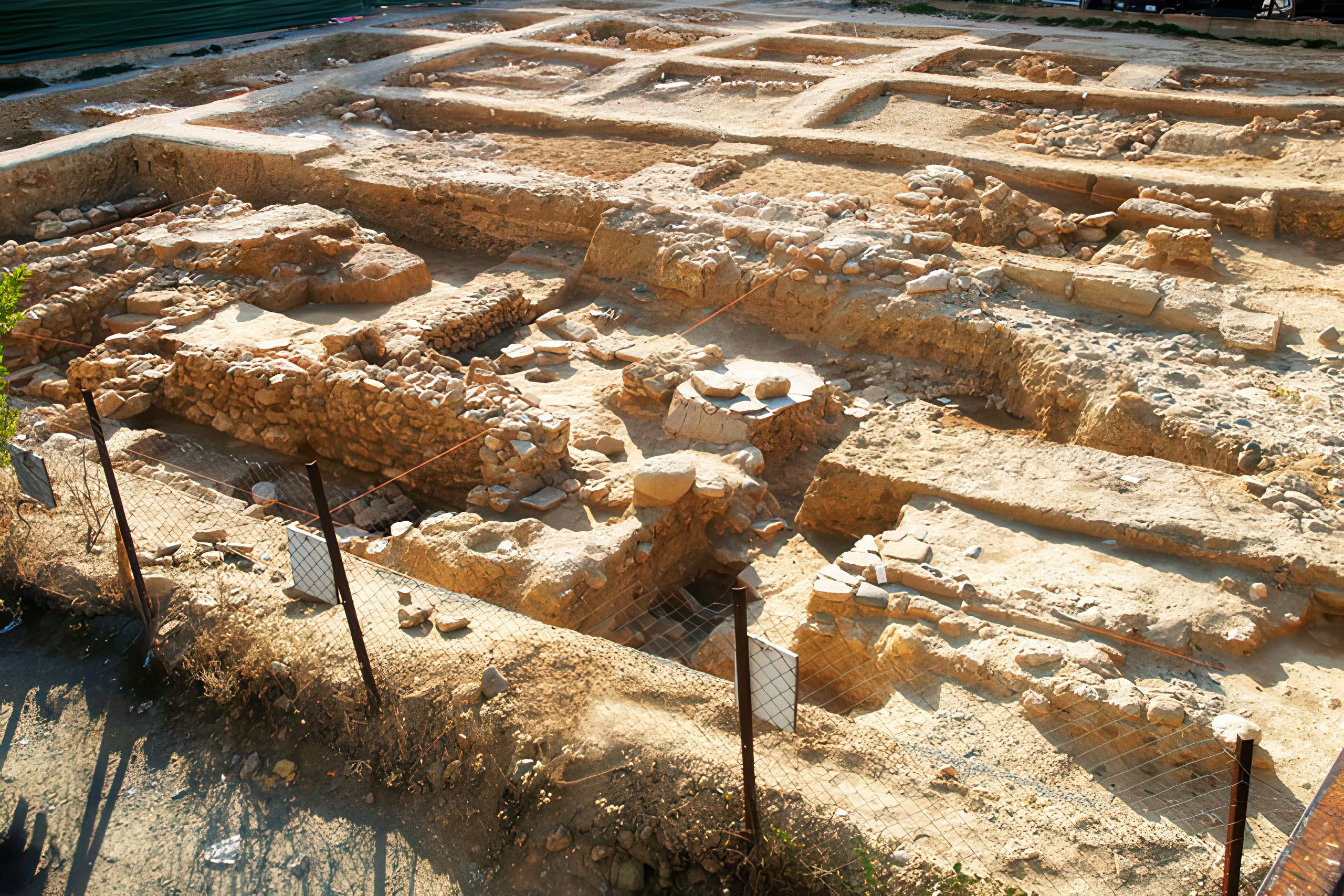
Archaeological Evidence from Excavations
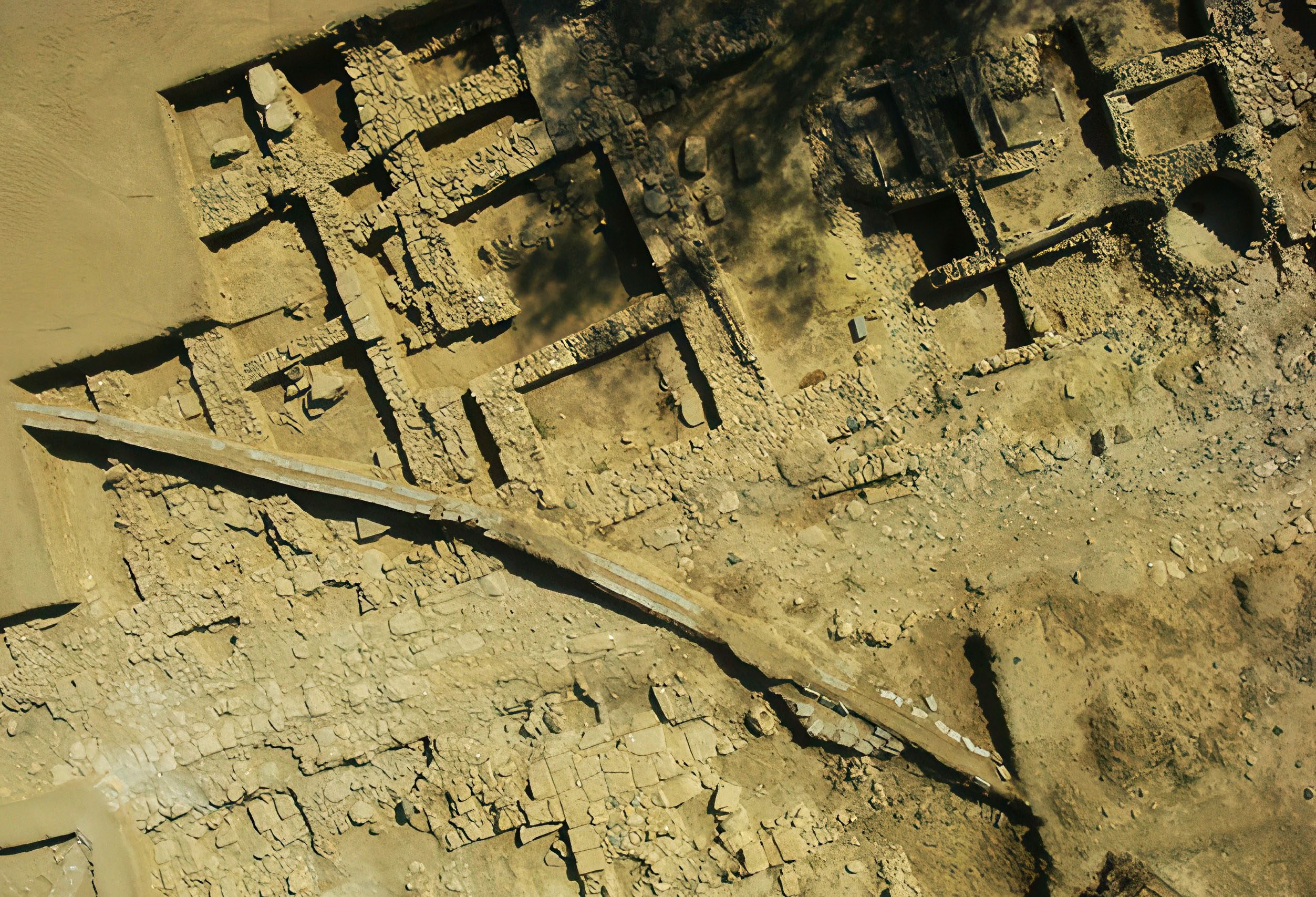
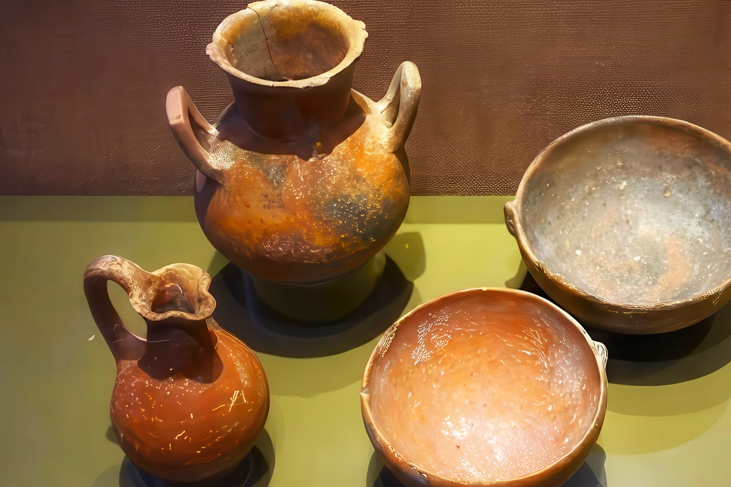
Excavations from 1996 to 2010 revealed an extensive settlement with successive occupation phases. Archaeologists uncovered building complexes, pottery workshops, weaving facilities, and other structures that confirm the existence of a significant Iron Age population. A large olive press found at the site demonstrates agricultural processing activities. The discoveries show continuous occupation from the Bronze Age through the Byzantine period.
Other excavated areas include Agioi Omologia, Koupati, and two tombs at the Old Municipal Baths of Nicosia. The area directly south of the historical city center was permanently occupied, though the remains are relatively poor compared to major coastal cities. Most finds come from cemeteries rather than urban structures, supporting the theory that Ledra functioned as a dispersed agricultural settlement.
Early Christian Period and Bishop Triphyllius
Ledra experienced a revival during the early Christian period, becoming more significant than it had been during Roman times. In the 4th century AD, the settlement became the seat of a bishopric under various name forms including Ledron, Leuteon, or Leucotheon. The town had a bishop despite its small size, reflecting the importance of Christian organization in Cyprus.
The most famous bishop of Ledra was Triphyllius, described by the Christian writer Sozomen as “a man otherwise eloquent, who on account of practicing the law, had lived alone while at Berytus.” Triphyllius was a student of Saint Spyridon and served during the reign of Emperor Constantius II between 337 and 361 AD. He wrote a Commentary on the Song of Songs that was known in antiquity.
The church historian Jerome refers to the bishopric as “Ledra or Leucotheon,” suggesting that Bishop Triphyllius oversaw two villages close to each other. This confirms that Ledra and Leucotheon were nearby settlements, possibly merging into a single administrative unit by this time. Triphyllius is said to have given everything he owned to the poor following the earthquake of 365 AD that destroyed several Cypriot towns.
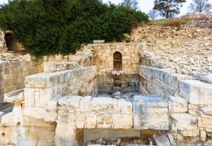
Archaeological evidence supports the existence of a prosperous Christian community. Excavations have uncovered two or three basilicas decorated with opus sectile, a type of decorative flooring made from shaped pieces of colored stone. Marble decorations with high relief carvings indicate the presence of wealthy patrons who could afford sophisticated artwork. These churches demonstrate that early Christian Ledra was more substantial than the small Roman town that preceded it.
Museum and Local Heritage
The Local Archaeological Museum Ledroi opened to preserve and display finds related to ancient Ledra. Located near the excavations on Agios Georgios hill, the museum showcases materials from the Bronze Age through medieval periods. The collection documents the continuous occupation of the Nicosia area across several millennia.
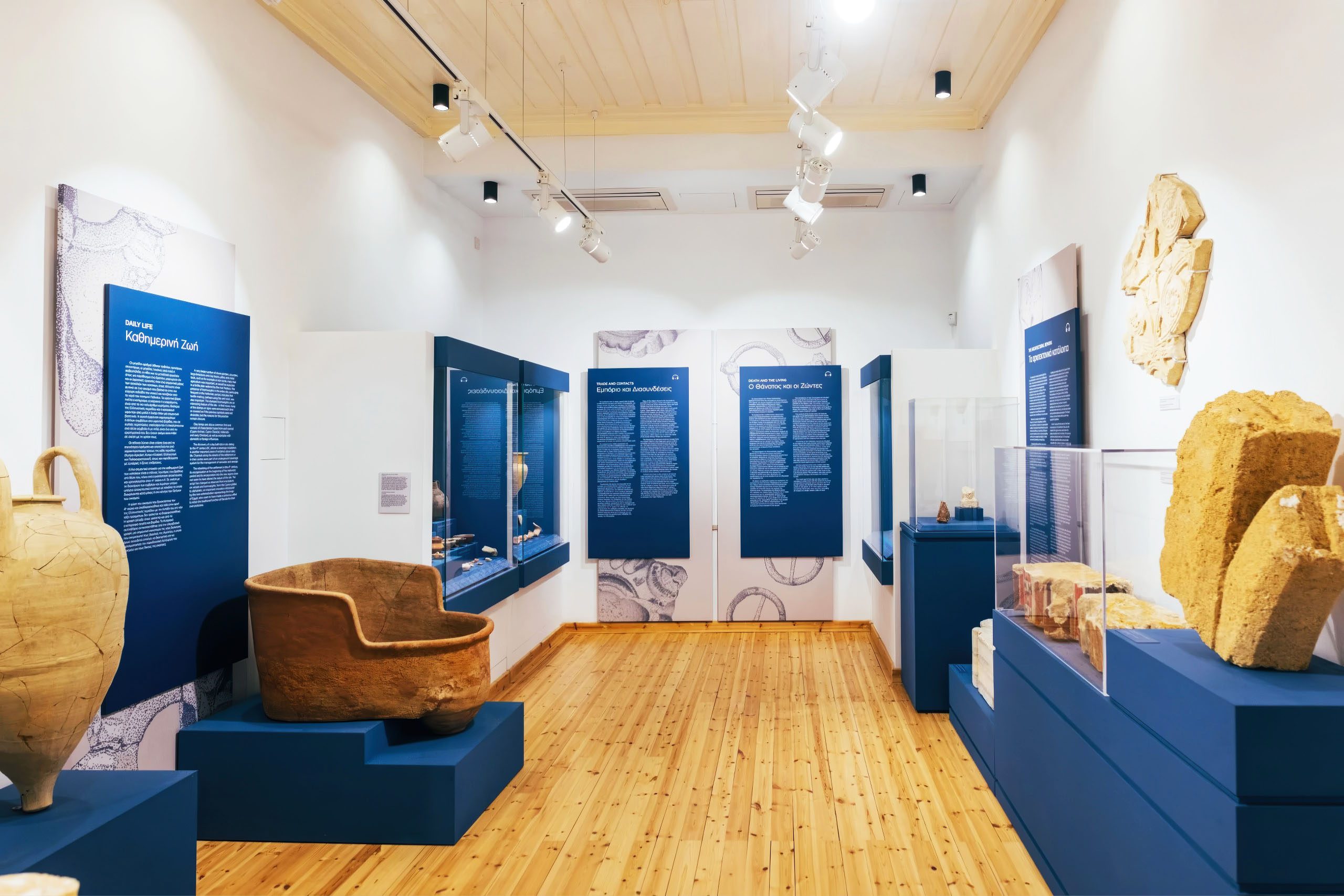
The museum building itself represents adaptive reuse of the archaeological site. Rather than destroying remains, developers incorporated the excavated areas into a protected zone with public access. This approach balances urban development needs with heritage preservation, allowing residents and visitors to engage with the ancient history beneath modern Nicosia.
Exhibits include pottery, tools, architectural fragments, and other artifacts that illustrate daily life in ancient Ledra. Information panels explain the settlement’s development from Bronze Age village through Iron Age kingdom to Byzantine bishopric. The museum demonstrates how archaeological work enhances understanding of Cyprus’s past.
Connection to Modern Nicosia
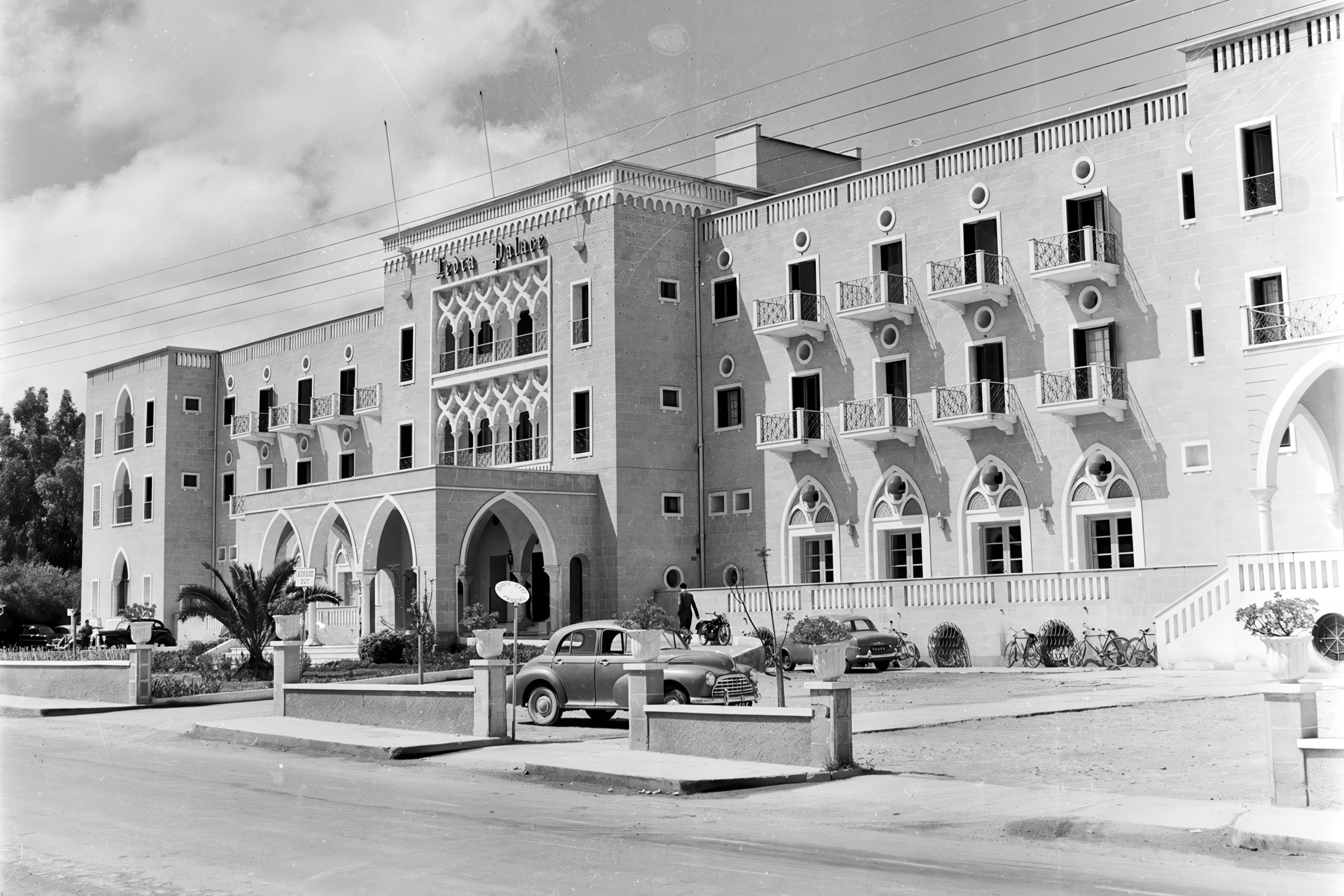
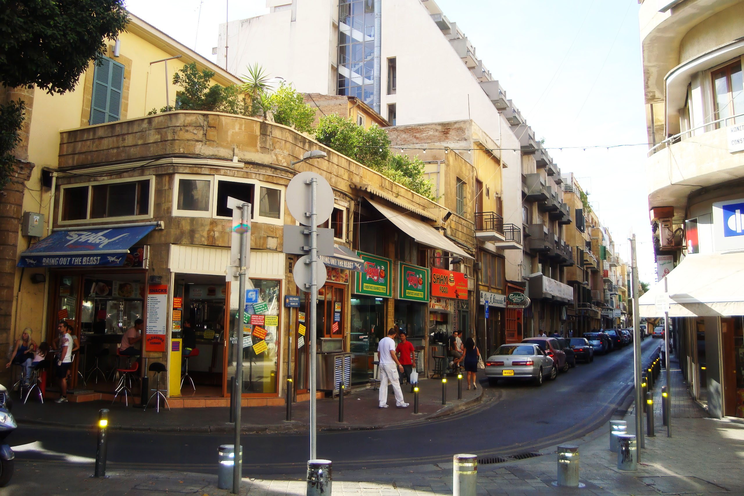
The name Ledra survives in modern Nicosia through Ledra Street, the main commercial thoroughfare that runs through the old city. During the EOKA struggle from 1955 to 1959, British colonists nicknamed it “The Murder Mile” because of frequent attacks by nationalist fighters. In 1963, the street became part of the dividing line between Greek and Turkish Cypriot communities.
The Ledra Street crossing through the UN buffer zone remained closed from 1974 until April 3, 2008, when it reopened as the sixth official crossing point between the southern and northern parts of divided Nicosia. The reopening ceremony included officials from both communities who cut a ribbon to mark the occasion. Citizens immediately began crossing between the two sides.
Today, Ledra Street functions as a symbol of both division and hope for reunification. The street connects Greek Cypriots with Turkish Cypriots, allowing people to move freely between the two sectors after decades of separation. Human chain demonstrations have been held along Ledra Street to express support for peace and reunification.
Archaeological Significance for Cyprus
Ancient Ledra represents the continuous occupation of central Cyprus from prehistoric times to the present. The settlement evolved from a Bronze Age village to an Iron Age kingdom, declined to a small town during the Classical and Roman periods, revived as a Christian bishopric, and ultimately became the island’s permanent capital.
This transformation demonstrates how political and economic conditions shape urban development. Ledra never achieved the prosperity of coastal trading cities during antiquity, yet its central location ultimately made it more important than any of them. The strategic advantages that seemed minor during the maritime trading era became crucial when security concerns outweighed commercial considerations.
The archaeological work at Nicosia has filled gaps in Cyprus’s history. Previously, knowledge about inland settlements was limited because excavation focused on major coastal sites. The Ledra excavations show that significant communities existed throughout the island, not just along the coast. These inland populations developed their own economic systems and cultural practices.
Visiting the Ledra Sites
Most ancient Ledra sites lie beneath modern Nicosia, making them inaccessible to casual visitors. The excavations on Agios Georgios hill can be viewed from outside, though access to the actual dig sites is restricted. The Local Archaeological Museum Ledroi provides the best opportunity to see materials from ancient Ledra and understand the settlement’s development.
The museum operates regular hours and charges a modest entrance fee. Guided tours can be arranged for groups interested in detailed explanations of the finds. The location near the city center makes it easy to combine with visits to other Nicosia attractions.
Ledra Street itself offers a different kind of historical experience. Walking through the crossing point allows visitors to pass through layers of history, from ancient city-kingdom to divided modern capital. The street demonstrates how places evolve over time while maintaining connections to their past through names and locations.
Legacy of Ancient Ledra
Ancient Ledra survived for over a thousand years as an independent kingdom and later as a small settlement before becoming the foundation of Cyprus’s modern capital. This transformation from minor agricultural kingdom to major urban center shows how historical circumstances can reverse the fortunes of places.
The name Ledra connects modern Nicosia to its ancient past. Every person who crosses Ledra Street or visits the archaeological museum engages with this heritage, whether consciously or not. The continuity of settlement from Bronze Age to the present day makes Nicosia one of the world’s oldest continuously inhabited cities.