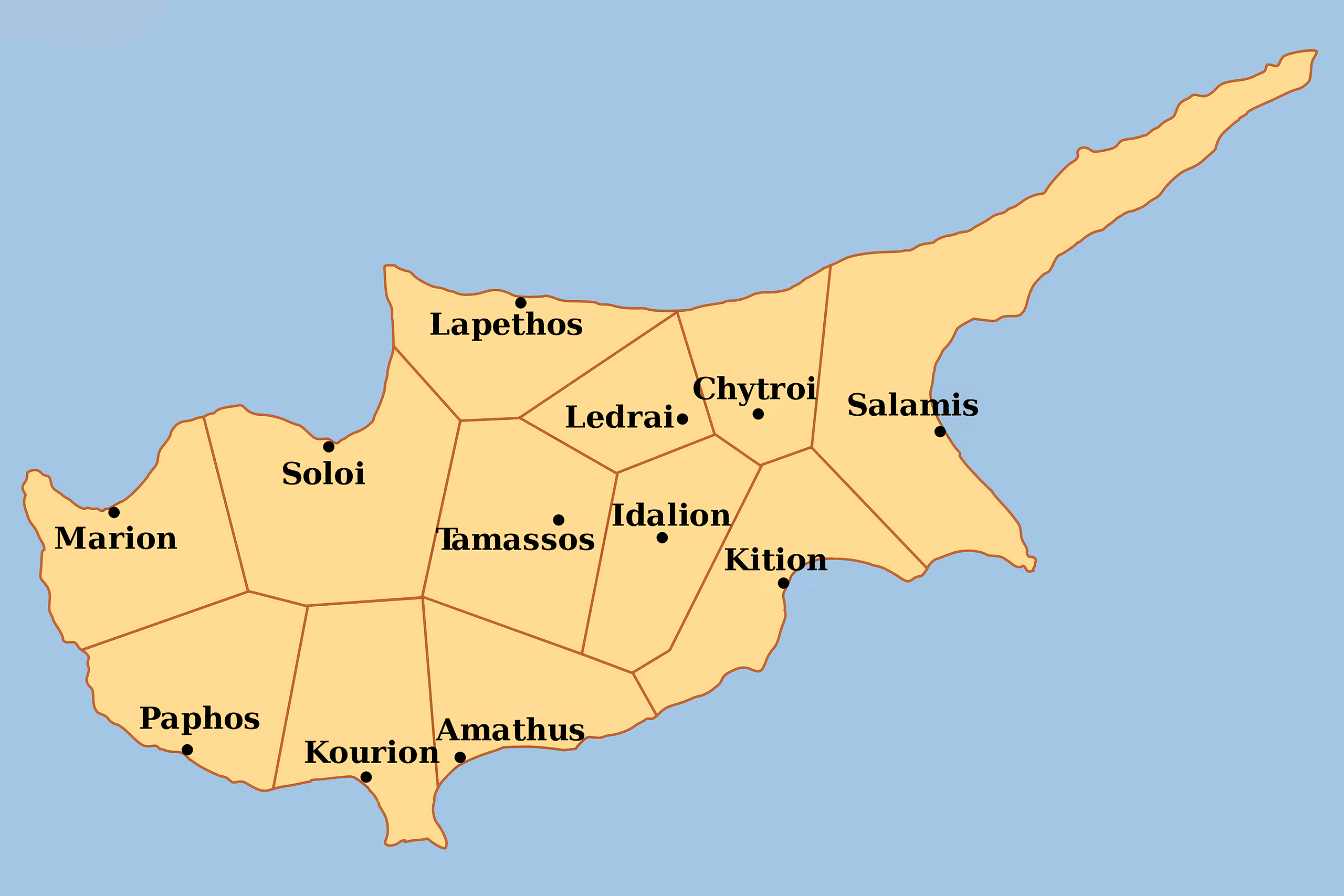
Idalion was an ancient city in Cyprus, in modern Dali, Nicosia District. The city was founded on the copper trade in the 3rd millennium BC. Located in the fertile Gialias valley between two hills, this powerful kingdom left behind one of the most important historical documents in ancient Cyprus, a bronze tablet that recorded a social welfare system 2,500 years old.
The ancient city was located in the fertile Gialias valley and flourished there as an economic centre due to its location close to the mines in the eastern foothills of the Troodos Mountains and its proximity to the cities and ports on the south and east coast.
Idalion prospered and became so wealthy that it was listed as the first among the ten Cypriot kingdoms on the prism of the Assyrian king Esarhaddon (680-669 BC). This ranking shows how important the city was in the ancient Mediterranean trade network.
Historical Background
The ancient city was founded by the Achaean hero of the Trojan war, Chalcanor, descendant of Teucer, the founder of Salamis. This foundation legend connects Idalion to the wave of Greek colonization that followed the Bronze Age collapse around 1200 BC. The worship of Apollo Amyclae reveals that the Greeks came from Laconia. This detail shows that the settlers originated from the Peloponnese in southern Greece, bringing their religious practices with them.
The city that became known as Idalion in the first millennium BCE was probably that mentioned in the Ramesses III list of Cyprus locales in ca. 1175 BCE as “Ithal,” now believed to be the urban center founded around 2200 BCE in the modern village of Agios Sozomenos. The site in Dali where we will be working in 2025 was founded in the 13th century, apparently as an industrial area attached to Ithal. By the 8th century BC, this industrial area had grown into the central copper trading metropolis of the island’s interior.
The city’s name appears in Assyrian records from the 7th century BC. Its name does not appear on the renowned “Kition Stele”, i.e., the Sargon Stele of 707 BC, but a little later on the Prism of Esarhaddon wherein the name is prefixed by the modifier URU as URU.e-di-ʾi-il and in similar spellings in Ashurbanipal’s annal. These references confirm that Idalion paid tribute to Assyrian kings and was recognized as an independent kingdom.
The Legendary Death of Adonis
According to legend, Ancient Idalion is where Adonis, Aphrodite’s lover, was killed by her jealous lover Aris, the Olympian God of War. The myth tells that Adonis was an exceptionally handsome young man who became the object of Aphrodite’s affection. Adonis ignored her advice and was killed while hunting by a wild boar, that was actually God Ares. Ares, who had been Aphrodite’s lover, could not tolerate her devotion to the mortal youth.
When Aphrodite heard Adonis’s cries, she rushed to his side but arrived too late. As he died in her arms, his blood soaked into the earth. From this blood, anemone flowers sprang up, forever marking the spot where the beautiful youth fell. The story of Adonis and Aphrodite connects Idalion to one of the most important fertility cults in the ancient Mediterranean. The annual cycle of Adonis’s death and resurrection symbolized the seasonal death and rebirth of vegetation, which made the myth particularly relevant to an agricultural society..
The Idalion Tablet and Ancient Healthcare
The Idalion Tablet is a 5th-century BC bronze tablet from Idalion. The script of the tablet is in the Cypriot syllabary and the inscription itself is in the Arcadocypriot dialect of Greek. The tablet was kept in the ancient official depository of the temple of Athena on the western acropolis of Idalion, where it was discovered in 1850 by a farmer from the village of Dali. A French duke named Honoré Théodoric d’Albert de Luynes purchased the tablet and donated it to the Bibliothèque Nationale de France in 1862, where it remains today in the Cabinet des Médailles.
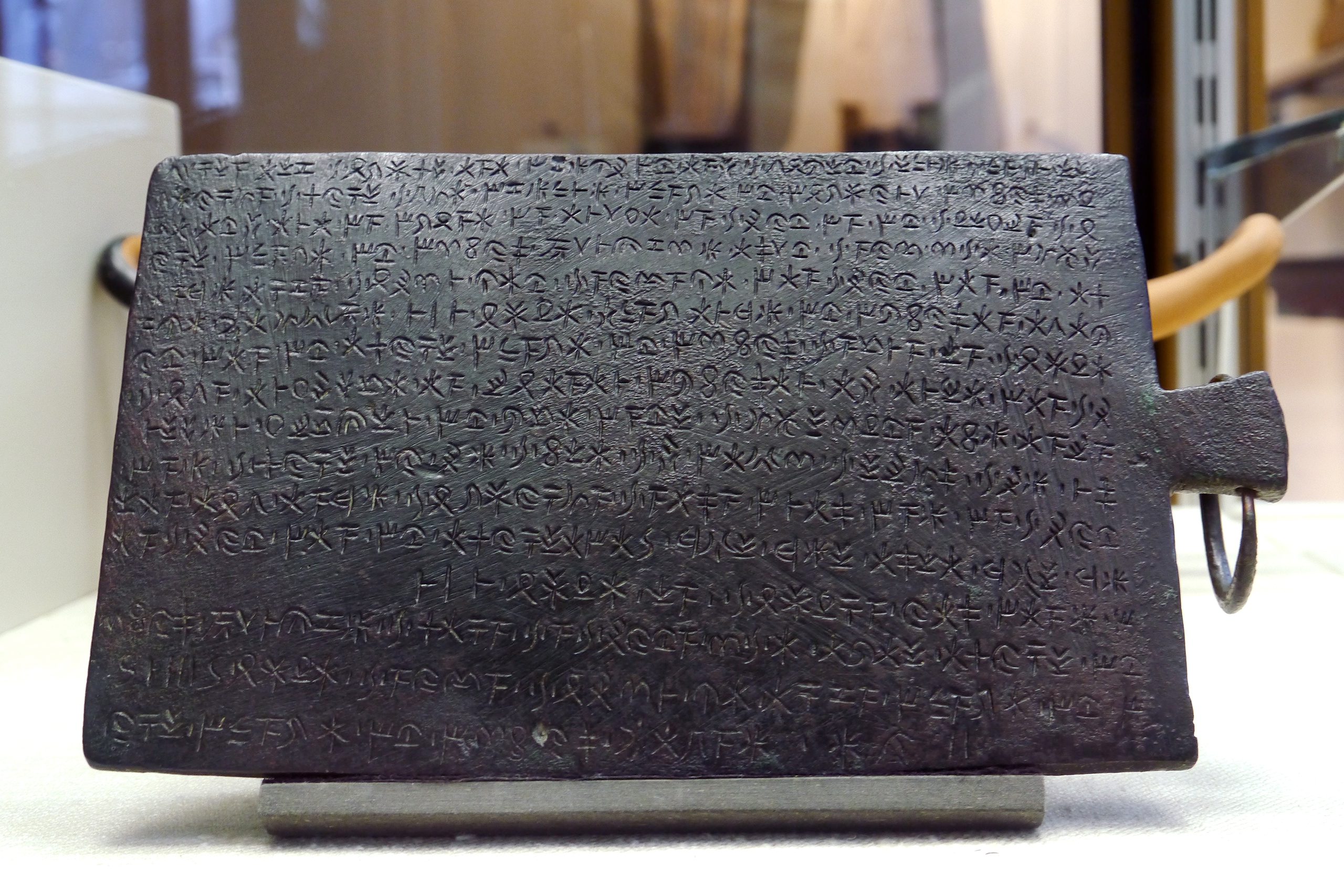
The tablet is made of bronze with a handle on one side. It is inscribed on both sides, measuring 21.4 cm x 14 cm on the incised part, with a thickness of 4-6 mm. The text runs continuously for 16 lines on side A and additional lines on side B. The script was not deciphered until after 1870, when another bilingual inscription in both Phoenician and Cypriot syllabary was discovered at the same site.
It is engraved on both sides with a long inscription recording a contract entered into by ‘the king and the city’ and gives a reward to a family of physicians who provided free health services for the casualties when the city was besieged by the Persians and the Kitians. The tablet records that King Stasikypros and the citizens of Idalion made an agreement with the physician Onasilos, son of Onasikypros, and his brothers. The doctors agreed to treat all people wounded during the Persian and Kitian siege of 478-470 BC without charging fees.
In return for this service, the king promised to give the physicians specific plots of land. It also shows that there was a social welfare system during the sieges of the city by the Persians and Kitions of 478-470 BC. The king was the biggest landowner and borders of plots were registered. The contract was placed under the protection of the goddess Athena, which made it sacred and legally binding. This represents one of the earliest documented social welfare programs in European history.
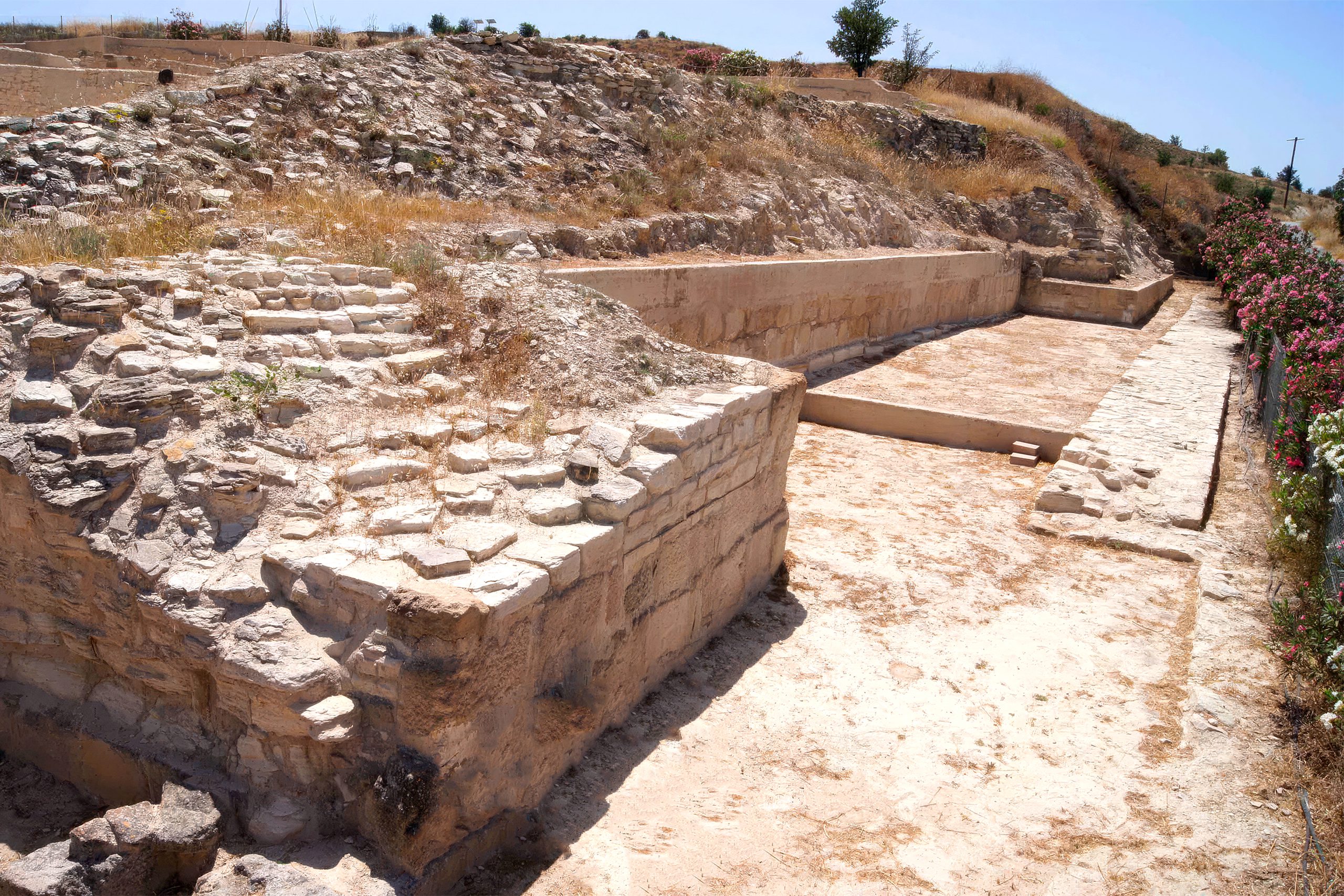
Excavation History and Looting
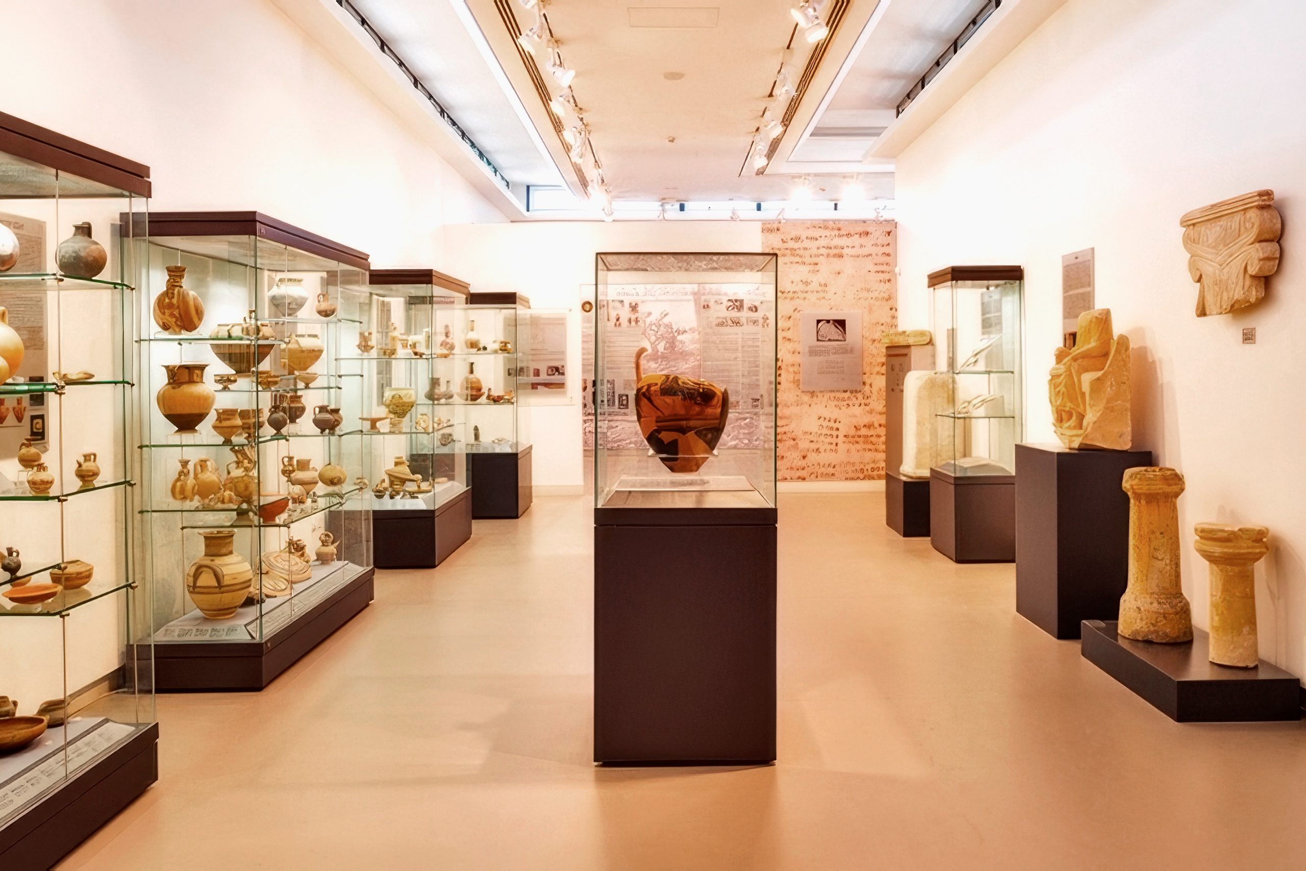
Off and on between 1867 and 1875, Luigi Palma di Cesnola, antiquarian, treasure hunter and American and Russian consul to the Ottoman government of Cyprus dug at Idalion. He claimed to have opened 15,000 tombs. Cesnola shipped three vessels loaded with antiquities to New York. One ship, the Napried, sank in the Mediterranean in 1872 with its cargo lost. The others reached New York and helped found the Metropolitan Museum of Art, where many objects from Idalion remain on display.
In 1868 and 1869, R. Hamilton Lang, the British Consul, excavated the East Acropolis. He found an open-air sanctuary of a deity which one Phoenician inscription called “Reshef-Mikal” and a Greek inscription called “Apollo Amyklos”. It contained 142 limestone sculptures, now in the British Museum. This discovery revealed that the same deity was worshipped under different names by different cultural groups in the city.
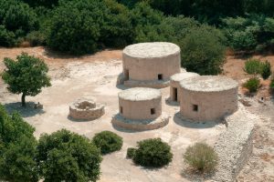
For a few months in 1928, a Swedish Cyprus Expedition effort, led by Erik Sjöqvist, worked at Idalium. Their primary work was a complete excavation of the upper portion of the West Acropolis finding a fortified sanctuary of Anat-Athena. The excavation revealed votive gifts consisting mainly of weapons and tools, along with personal accessories such as pins, fibulae, earrings, and bracelets. They also excavated a number of tombs ranging from the Cypro-Archaic to the Hellenistic periods.
Interesting Archaeological Details
The city worshipped a blend of Greek and Phoenician deities. The goddess Anat-Athena combined the Canaanite war goddess Anat with the Greek goddess Athena. This religious fusion reflects the multicultural nature of ancient Idalion, where Greek colonists, indigenous Cypriots, and Phoenician traders lived together.
The famous “Idalion Tablet”, a bronze tablet engraved with a script in the Cypriot syllabary, was unearthed in the western acropolis. The tablet testifies the events of the siege and submission of Idalion. The siege mentioned in the tablet likely occurred during the Ionian Revolt of 499-498 BC or shortly afterward, when Persian forces were trying to reassert control over Cyprus with the help of their Phoenician allies from Kition.
One significant discovery involved Proto-Aeolic capitals, which are architectural elements that adorned funerary monuments and the palace. These capitals show a distinctive design style that originated in the Near East and spread across the Mediterranean. Their presence at Idalion demonstrates the city’s connection to broader architectural trends in the region.
The Cypriot syllabary used at Idalion represents one of the last surviving scripts from the Bronze Age Aegean world. The Cypriot syllabary consists of 56 signs. Each sign generally stands for a syllable in the form of “(consonant) + (vowel)” or “(vowel)”. This script was related to the earlier Linear A and Linear B scripts used in Minoan Crete and Mycenaean Greece. Unlike alphabetic writing, where each symbol represents a single sound, syllabic scripts use symbols that represent entire syllables.
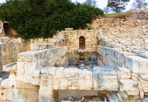
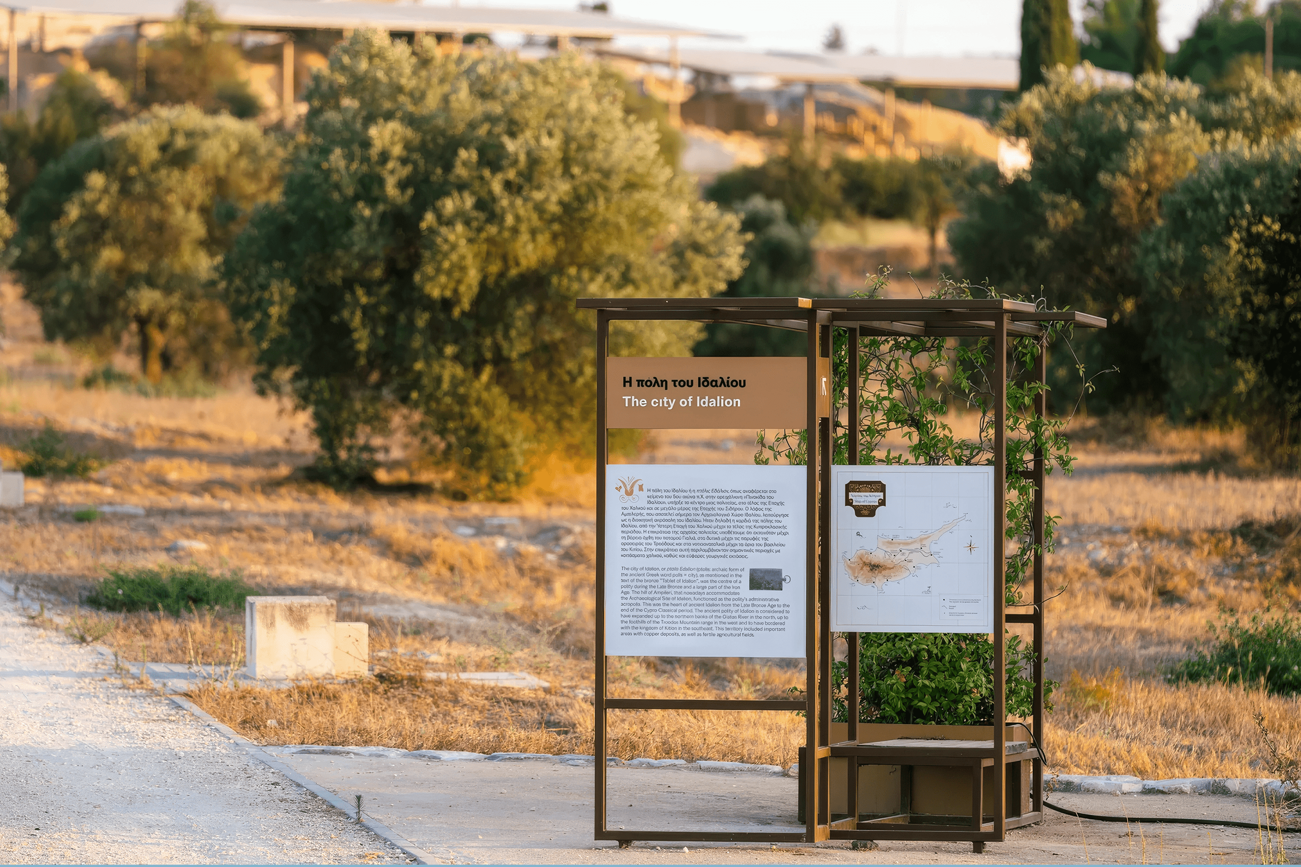
Visiting Idalion Today
The site is located in the village of Dali, about 17 kilometers south of Nicosia. The museum and archaeological site are open Monday through Friday. A small entrance fee provides access to both the museum and the ruins. Visitors watch a video about the history of Idalion before exploring the museum collections and then proceeding to the excavation site.
The walk from the museum to the ruins takes about 10 minutes uphill on a paved path. The terrain is uneven, with ancient stone pathways and steps. Comfortable shoes are essential. Summer visits require sun protection and water, as there is little shade on the exposed hilltops. The best times to visit are early morning or late afternoon when temperatures are cooler.
The village of Dali itself has several traditional coffee shops and tavernas where visitors can experience local Cypriot hospitality. The Church of Saints Constantine and Helen dates from the Byzantine period and contains interesting frescoes. The area around Dali includes other archaeological sites and rural landscapes that give a sense of how the ancient kingdom controlled its agricultural territory.
Why Idalion Matters to Cyprus
Idalion represents the sophisticated political and social organization that existed in ancient Cyprus. The Idalion Tablet provides concrete evidence that ancient kingdoms cared for their citizens during wartime and maintained organized systems of land ownership and legal contracts. The fact that doctors provided free healthcare to wounded soldiers 2,500 years ago demonstrates a level of social responsibility that many assume is a modern invention.
The city’s position as the first among Cypriot kingdoms in Assyrian records shows its economic power based on copper trade. The blend of Greek, Phoenician, and indigenous Cypriot cultures visible in the archaeological remains demonstrates how ancient societies adapted and merged different traditions. The royal palace, fortifications, temples, and residential areas provide a complete picture of how a medium-sized Bronze Age and Iron Age kingdom functioned. For anyone interested in ancient governance, early Greek civilization, or the history of social welfare, Idalion offers unique insights based on actual documentary evidence rather than just archaeological remains.