
Cape Greco National Forest Park sits on the southeastern tip of Cyprus between the resort towns of Ayia Napa and Protaras. This protected area covers 385 hectares of dramatic coastal landscape where limestone cliffs drop into clear Mediterranean waters. The park opened in 1993 and remains free to visit 24 hours a day throughout the year.
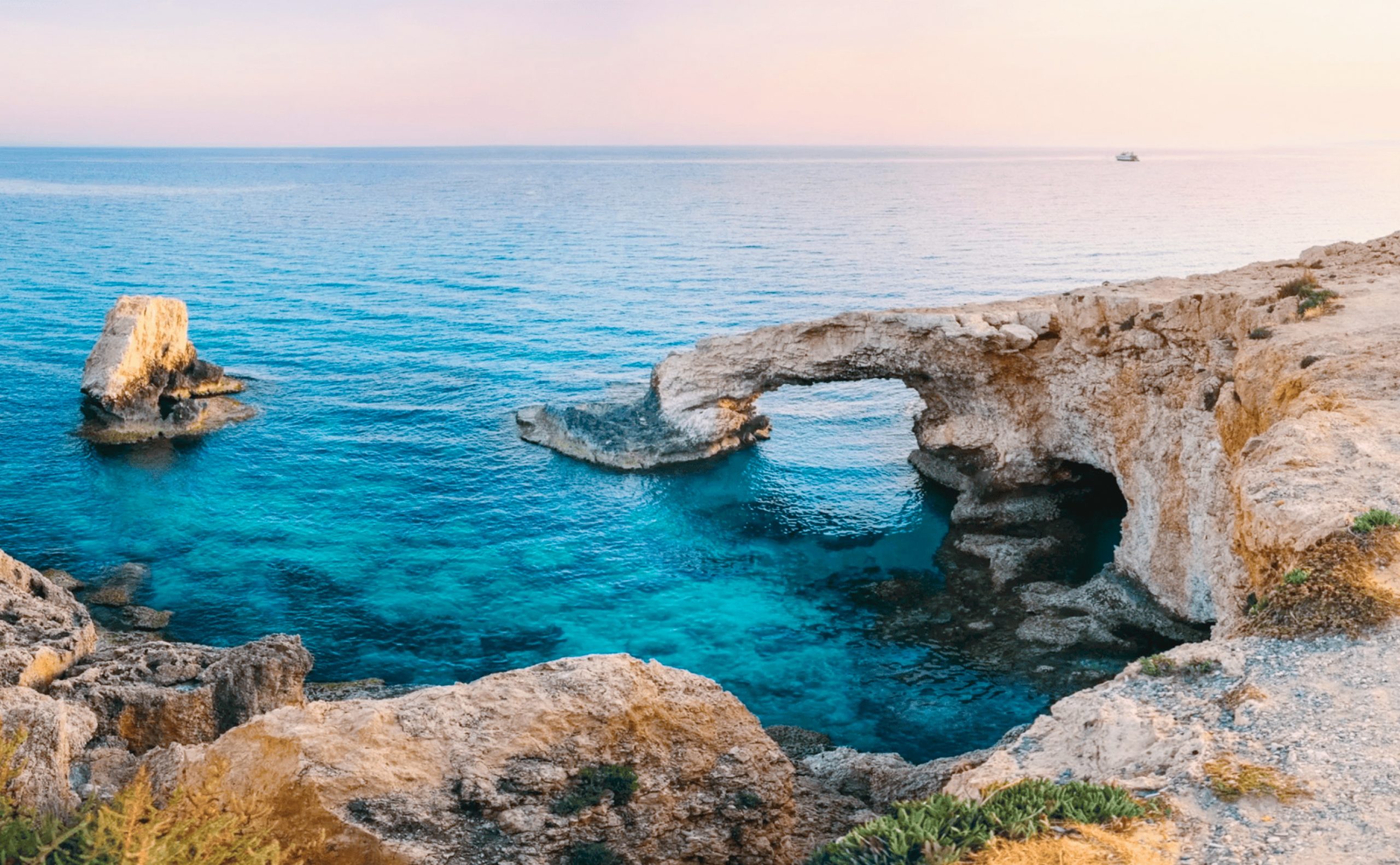
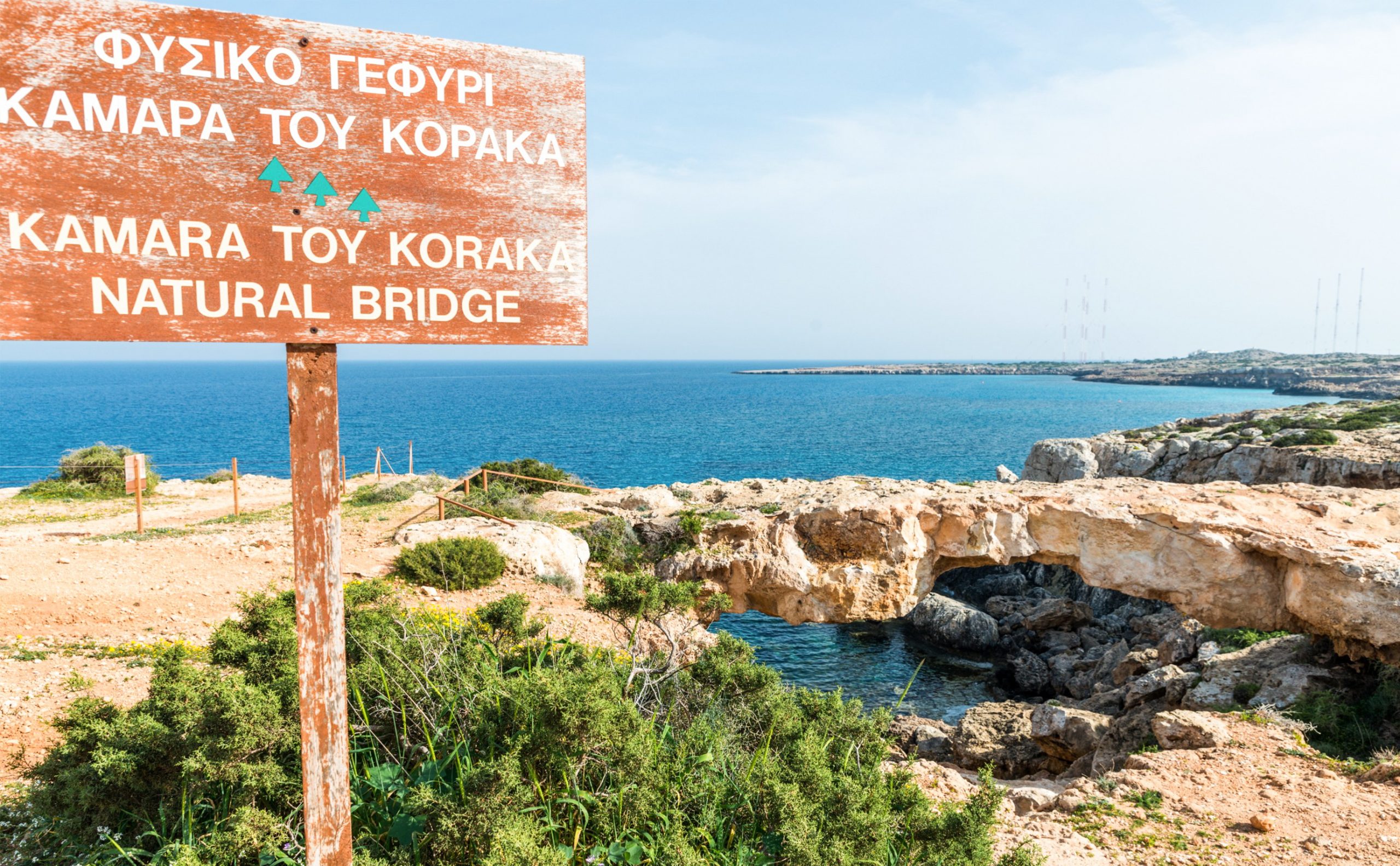
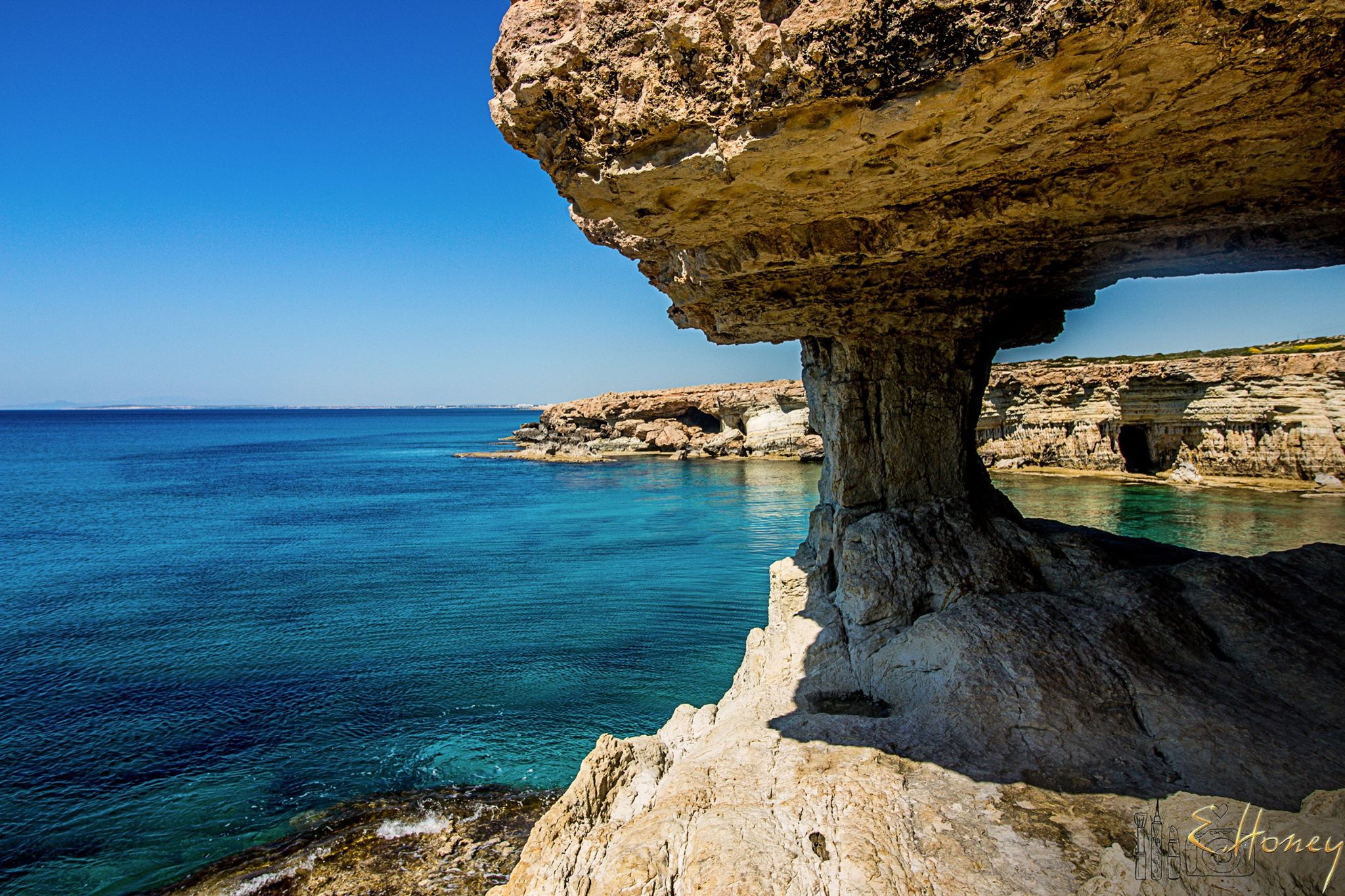
The park features white limestone cliffs carved by wind and waves over thousands of years. These geological formations created numerous sea caves, natural rock bridges, and coastal platforms. The most famous rock formation is Kamara tou Koraka, a natural arch that stands 50 feet high and 23 feet wide. Erosion continues to shape this landmark, though roots from plants have unfortunately accelerated the process in recent years.
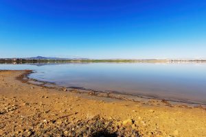
The coastline offers crystal-clear water with visibility reaching up to 40 meters in good conditions. Sea temperatures range from 16 degrees Celsius in winter to 28 degrees Celsius in summer. These conditions combined with the rocky underwater landscape attract divers and snorkelers from across the island.
Important Bird Area Status
BirdLife International designated Cape Greco as an Important Bird Area in 2009 because it serves as a key migration site for thousands of birds traveling between Europe and Africa. The cape creates a migratory bottleneck where birds concentrate before crossing to or from the Mediterranean coast.
Over 3,000 raptors pass through the area each autumn. The most numerous species are honey buzzards, red-footed falcons, and common kestrels. Two globally threatened species, the red-footed falcon and pallid harrier, use Cape Greco in significant numbers during migration. Other raptors include European honey buzzards and various harrier species.
The park supports breeding populations of three important species. Cyprus wheatears and Cyprus warblers are endemic to the island and nest in the rocky terrain. Black francolins, a game bird species, also breed in the protected area. These resident birds benefit from the hunting prohibition within park boundaries.
Spring migration runs from March to May, while autumn passage occurs from August to October. Birdwatchers position themselves at various vantage points to observe and count the passing birds. The area also serves as a stopover for many passerine species that rest and feed before continuing their journeys.
Despite protection, illegal bird trapping remains a threat. Trappers target migrating birds using illegal nets and lime sticks. Conservation organizations continue to work with authorities to reduce this destructive practice.
Walking Trails and Routes
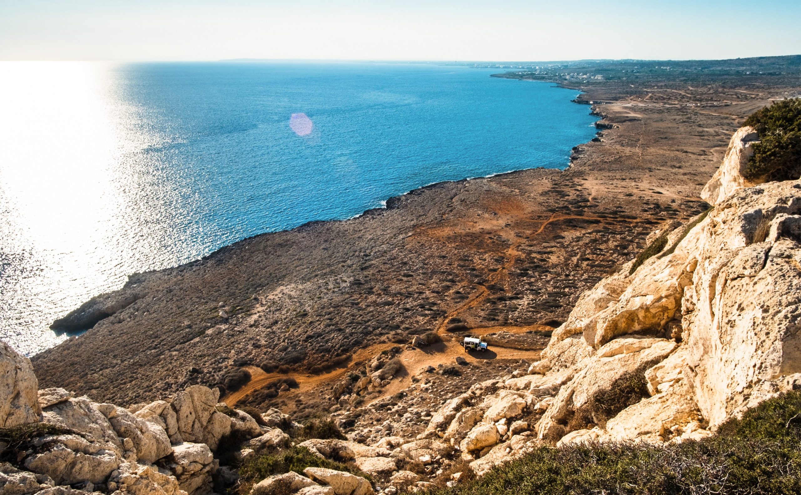
Approximately 14 kilometers of marked nature trails wind through the park. These paths connect major features and provide access to viewpoints, beaches, and points of interest. Trail surfaces vary from paved sections to rocky natural paths.
The Aphrodite Trail forms a 2-kilometer circular route along the northeast coast. This relatively easy walk offers panoramic views of the sea and coastline. The trail is named after the goddess whose mythical birthplace lies elsewhere on the island, though ancient worship of Aphrodite occurred in this region.
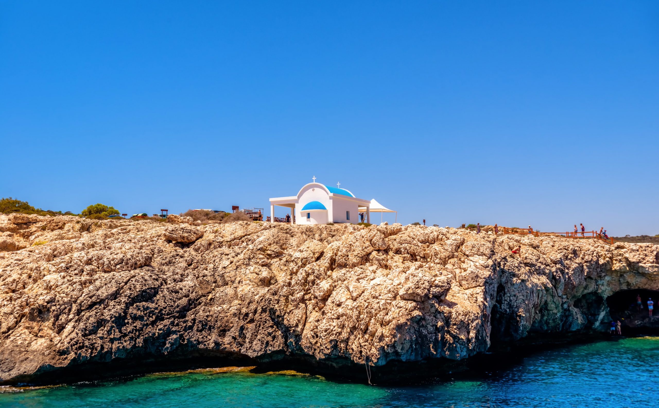
The Agioi Anargyroi Trail runs in a linear path from the park entrance to the small chapel and sea caves. This route passes the natural rock arch and continues along cliff edges to Konnos Beach. Numerous benches line the trail at viewpoints.
Part of the European Long Distance Trail E4 crosses through Cape Greco. This path connects Cyprus to Gibraltar as part of a trans-European hiking network. The Cyprus section follows coastal routes through some of the island’s most scenic areas.
A circular route around the entire park covers approximately 6.4 kilometers with an elevation gain of 734 feet. This walk takes most visitors 2 to 3 hours at a moderate pace with stops for photos and rest. The trail reaches the highest point of the cape where a viewpoint provides 360-degree vistas.
Specially constructed cycling paths accommodate mountain bikes throughout the park. Cyprus’s mild climate and low annual rainfall make cycling possible year-round, though summer heat requires early morning or evening rides.
Sea Caves and Coastal Features
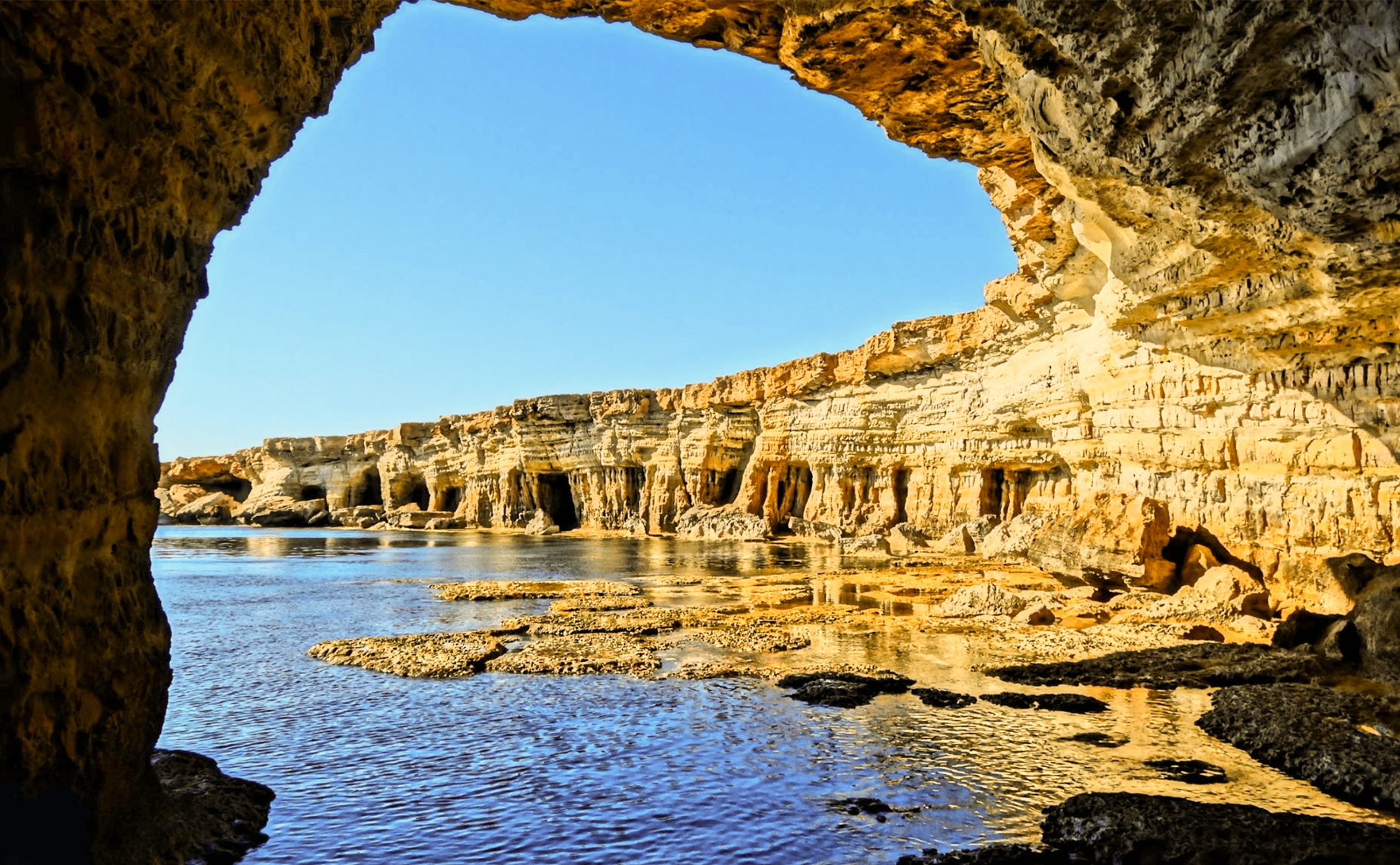
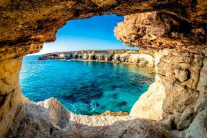
Dozens of sea caves penetrate the limestone cliffs along the coastline. These natural caverns were carved by wave action over millennia. Some caves extend 240 feet deep into the rock face. The Palace Caves and Smugglers Caves are among the largest and most accessible.
During calm seas and low tide, swimmers can enter many caves. The water inside remains clear despite rocky floors. Some caves can be walked into when conditions are right. Local fishermen arrive before dawn to fish from cave entrances and rock platforms.
Boat tours pass the caves daily during tourist season. Tour operators provide views of the caves from the sea and often include swimming stops in sheltered coves. Some tours combine cave visits with trips to the Blue Lagoon, a particularly clear swimming area near the cape.
Rock platforms along the coast provide access for cliff jumping. Deep water pools between rocks attract people who enjoy this activity, though it requires careful assessment of conditions and depth.
Staircases descend from trail level to various coastal access points. These steps allow swimmers and snorkelers to reach the water safely. The Agioi Anargyroi Chapel has steps leading down to sea level where a hermit’s cave is mentioned in local legend.
Wildlife Beyond Birds
Mediterranean foxes roam the park, though they are shy and usually active at dawn and dusk. Hares can sometimes be spotted in open areas. Hedgehogs, mostly nocturnal, live in the protected habitat.
Several lizard species bask on rocks throughout the day. The most common is the starred agama, which changes color depending on temperature and mood. Snakes include both harmless species and the venomous blunt-nosed viper, though snake encounters are rare.
Marine life visible from shore includes various fish species in the clear shallow water. Octopuses hide in rocky crevices. Sea urchins cover some underwater surfaces. Lucky observers occasionally spot sea turtles swimming near the coast, though these encounters are uncommon.
Dolphins sometimes appear offshore, visible from the higher viewpoints. These marine mammals travel in small groups and occasionally come close enough to shore for clear viewing.
Konnos Beach and Bay
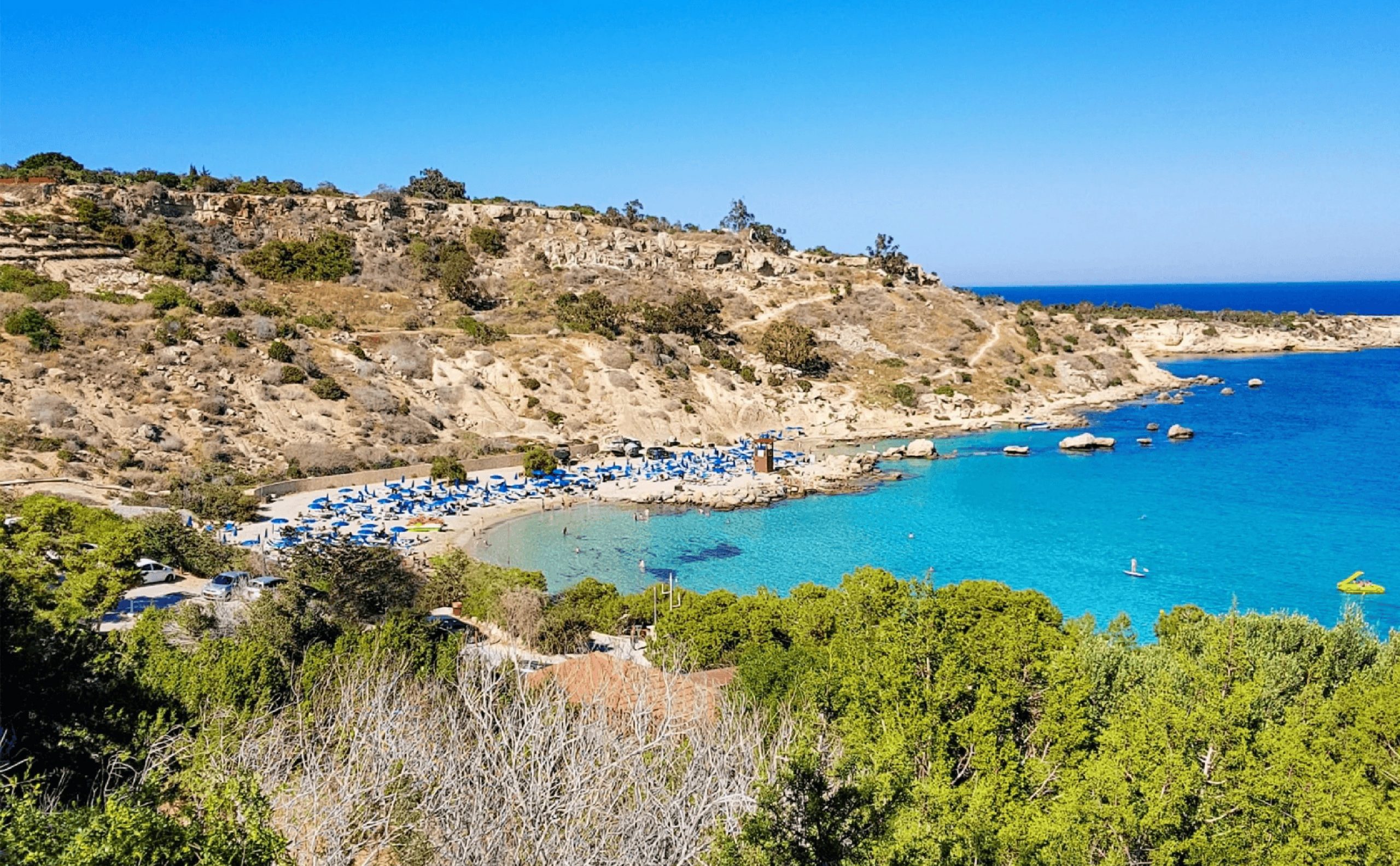
Konnos Beach lies on the northern edge of the park. This small beach stretches 200 meters in length and only 35 meters in width. Golden sand covers the beach, sheltered from strong winds by surrounding headlands. This protection results in calm water with minimal waves.
The beach offers sunbeds, umbrellas, and water sports facilities during summer months. A cafe and restrooms serve visitors. The compact size and calm conditions make Konnos popular with families.
Access to the beach is easy from the main road with a large parking area nearby. A walking path connects Konnos to other sections of the park. The Agioi Anargyroi Trail begins near the beach.
Blue Lagoon and Swimming Areas
The Blue Lagoon designation refers to an area of particularly clear turquoise water near the cape. The depth and underwater rock formations create the distinctive color. Swimming and snorkeling here provide excellent visibility of the rocky seabed and fish.
Several other swimming spots exist throughout the park where rock platforms or small beaches provide water access. These areas lack facilities but offer more isolated experiences. Swimmers should assess conditions before entering as some spots have currents or deep water immediately from shore.
The best swimming conditions occur from May through October when water temperatures are warmest. Spring and autumn still allow swimming for those comfortable in cooler water. Winter swimming is possible but appeals mainly to hardy local residents.
Historical Context
Although Cape Greco is primarily known for its natural features, some historical elements exist. The Radio Monte Carlo transmitter site operated from the early 1970s. This powerful medium-wave station broadcast French and Arabic programs to Middle Eastern and North African audiences. Trans World Radio also used the facility for broadcasts in Arabic, Armenian, and Persian.
The strategic location allowed radio signals to reach across the Eastern Mediterranean. The facility eventually closed, and the site now stands unused.
During various periods, the cape’s isolation made it suitable for activities requiring privacy or security. Its position at the island’s southeastern tip has given it strategic importance throughout history.
Cape Greco’s Value Today
Cape Greco National Forest Park provides Cyprus with a protected natural area that serves multiple purposes. The park preserves coastal ecosystems, supports biodiversity, offers recreation, and contributes to tourism.
The combination of natural beauty, wildlife habitat, and accessibility makes the park valuable to different user groups. Birdwatchers, hikers, swimmers, photographers, and casual visitors all find activities suited to their interests.
The park demonstrates that conservation and tourism can coexist when properly managed. Protected status preserves the features that attract visitors while allowing public enjoyment of natural landscapes.
For residents of Ayia Napa and Protaras, the park provides green space and outdoor recreation close to town. For visitors to Cyprus, it offers an easily accessible introduction to the island’s coastal ecology and natural heritage.
The distinctive limestone formations, clear waters, and dramatic cliffscapes create landscapes that differ from typical beach resort settings. This variety enhances the overall visitor experience of southeastern Cyprus.