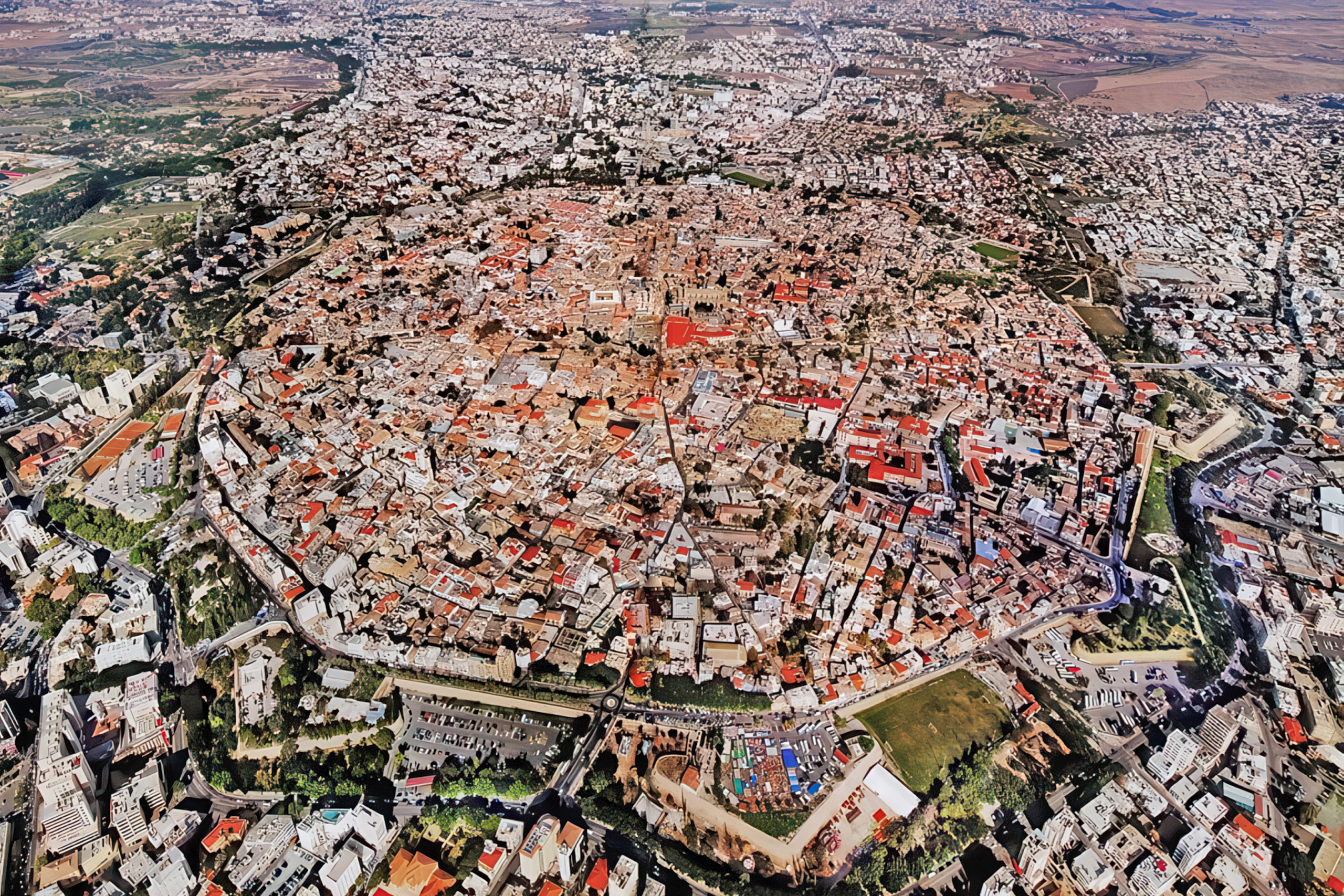
The Venetian Walls of Nicosia form a circular defense system around the capital city of Cyprus. Built between 1567 and 1570 by the Republic of Venice, these Renaissance fortifications remain largely intact and represent one of the best-preserved examples of 16th-century military architecture in the Eastern Mediterranean.
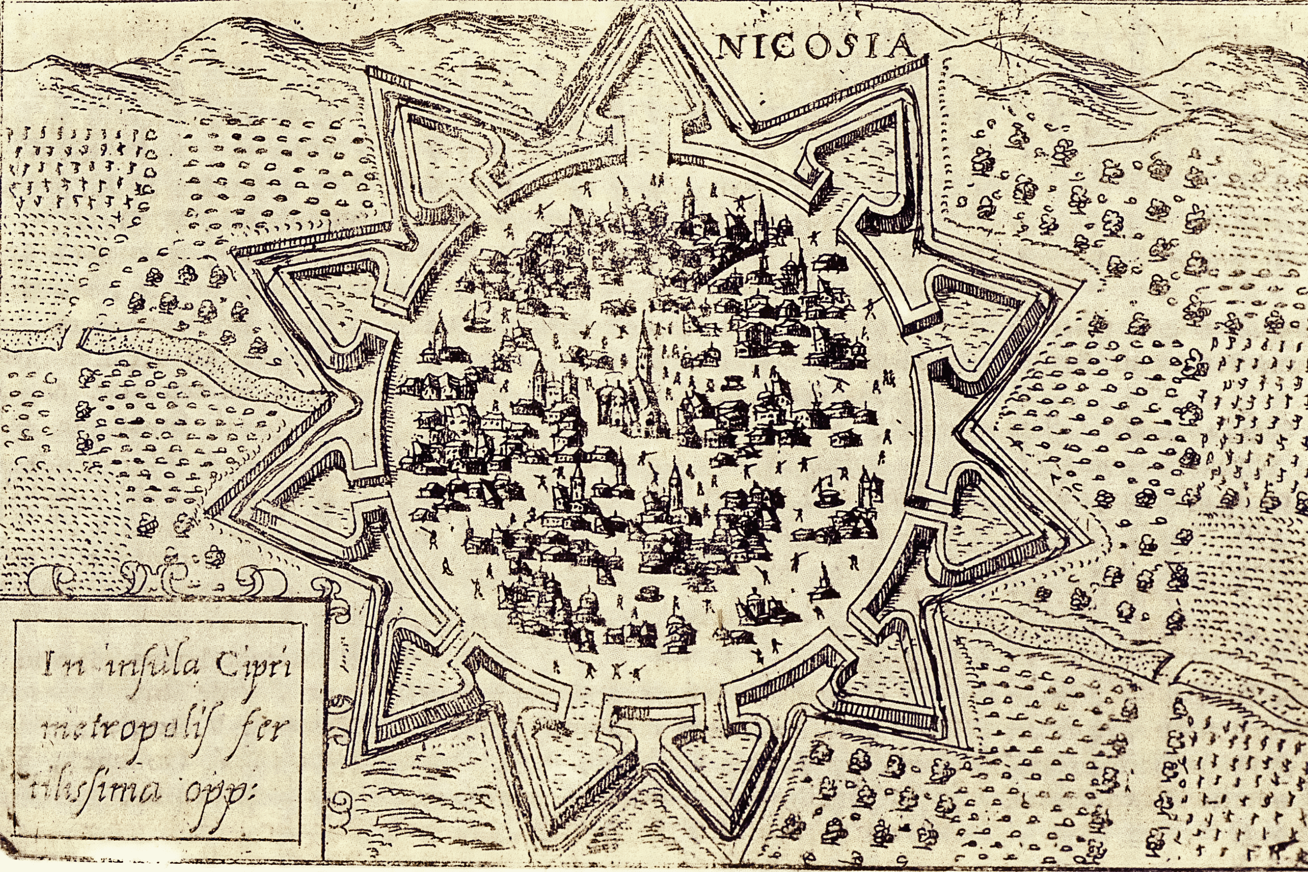
The walls create an almost perfect circle around the old city with a circumference of approximately 5 kilometers. This circular shape was innovative for its time and reflected the latest military engineering principles from Renaissance Italy. The design eliminated the weaknesses of medieval fortifications and created a more efficient defensive perimeter that required fewer soldiers to defend.
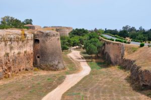
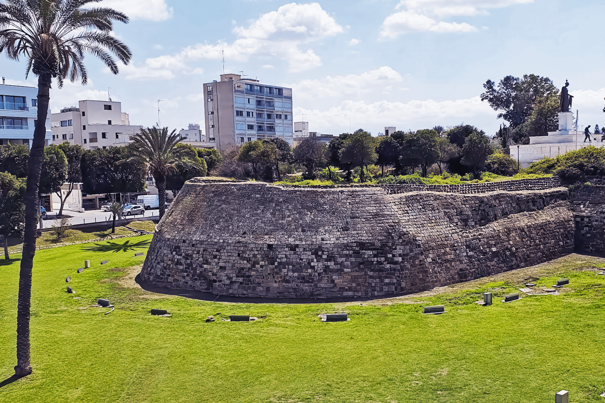
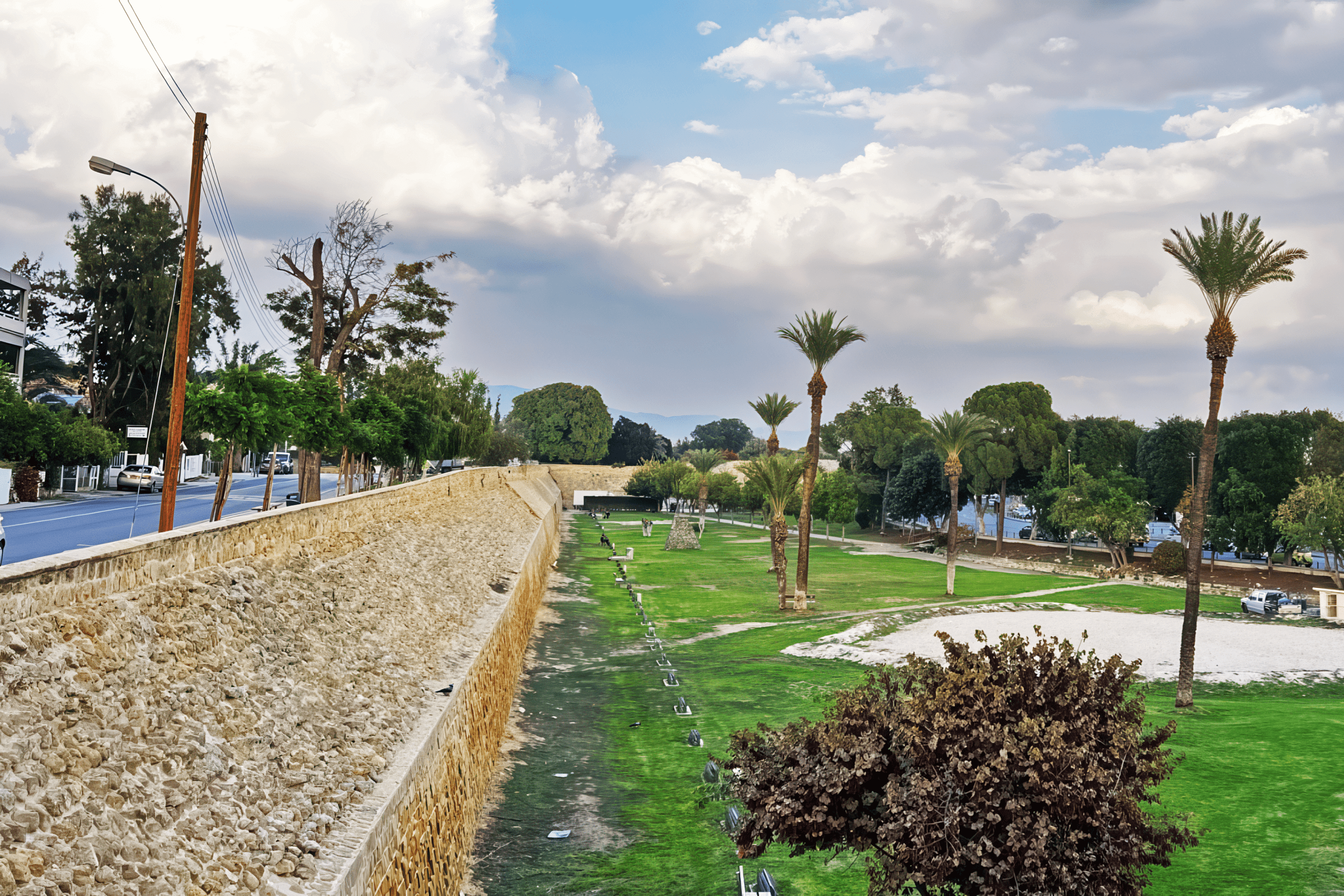
The walls were built primarily from mud brick with the lower sections reinforced with stone. A wide moat 80 meters across surrounded the entire fortification, providing an additional obstacle for attackers. The moat was designed to be filled with water from the Pedieos River, which was diverted outside the city walls during construction.
Historical Background
Before the Venetian walls existed, earlier fortifications protected Nicosia. The first defensive structure was a castle built in 1211 during the Lusignan period. King Peter I constructed the Margarita Tower in 1368, a large defensive tower that stood as a major landmark. His successor, Peter II built the first walls surrounding the entire city, though he demolished the Margarita Tower as part of this expansion.
These Frankish walls, built in the 14th century, enclosed a much larger area than the later Venetian fortifications. The medieval walls stretched almost 6.5 kilometers and included numerous semicircular towers in the old style. When the Venetians took control of Cyprus in 1489, they initially did nothing to improve the fortifications despite warnings from their governors that the defenses were inadequate.
This changed dramatically in 1565 after the Great Siege of Malta. The Ottomans nearly captured Malta from the Knights of St. John, demonstrating their growing naval and military power in the Mediterranean. The siege alarmed Christian states across the region, and many began strengthening their fortifications. Cyprus, positioned between Ottoman territories and the Mediterranean sea lanes, was particularly vulnerable.
In 1567, the Venetian Republic commissioned two Italian military engineers, Giulio Savorgnan and Francesco Barbaro, to design modern fortifications for Nicosia. Their plan called for completely demolishing the old Frankish walls and building an entirely new defensive system based on the latest military science.
Construction and Demolition
The construction project was massive and controversial. The engineers determined that the old Frankish walls were too large for the available garrison to defend effectively and too close to the hills southeast of the city, which would give attackers advantageous firing positions. The new circular design reduced the perimeter that needed defending and positioned the walls further from potential artillery positions.
To build the new walls, the Venetians demolished the entire medieval fortification system. They also destroyed approximately 1,800 houses, 80 churches and chapels, two large monasteries, numerous gardens, and several palaces including the royal palace. These demolitions served two purposes: acquiring building materials and creating a clear field of fire around the new walls so attackers would have no cover when approaching.
About 10,000 people were displaced by the demolitions. Most received no shelter and lived in makeshift wooden structures while working on the construction project. The prominent families of Nicosia were put in charge of construction on specific bastions, and the desperate economic situation made it easy to recruit workers who needed income.
Approximately 500 to 800 men and women worked on each bastion. They labored in two shifts, from 6:00 AM to 1:00 PM and again from 7:00 PM to midnight. This demanding schedule allowed construction to proceed rapidly, though it took a heavy toll on the workers.
Ottoman and British Periods
After the Ottoman conquest, Nicosia experienced a steady decline in population and importance. Although the Ottomans repaired the fortifications after the siege, by the early 17th century the walls were described as “breached or decayed” and the city was practically defenseless. The garrison was reduced and maintenance neglected.
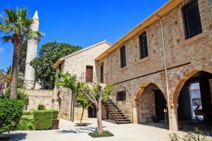
The city eventually began to revive in the mid-19th century as trade increased and administrative reforms improved conditions. The population remained confined within the walls throughout the Ottoman period. When the British occupied Cyprus in 1878, Nicosia was still entirely contained within the circular fortifications.
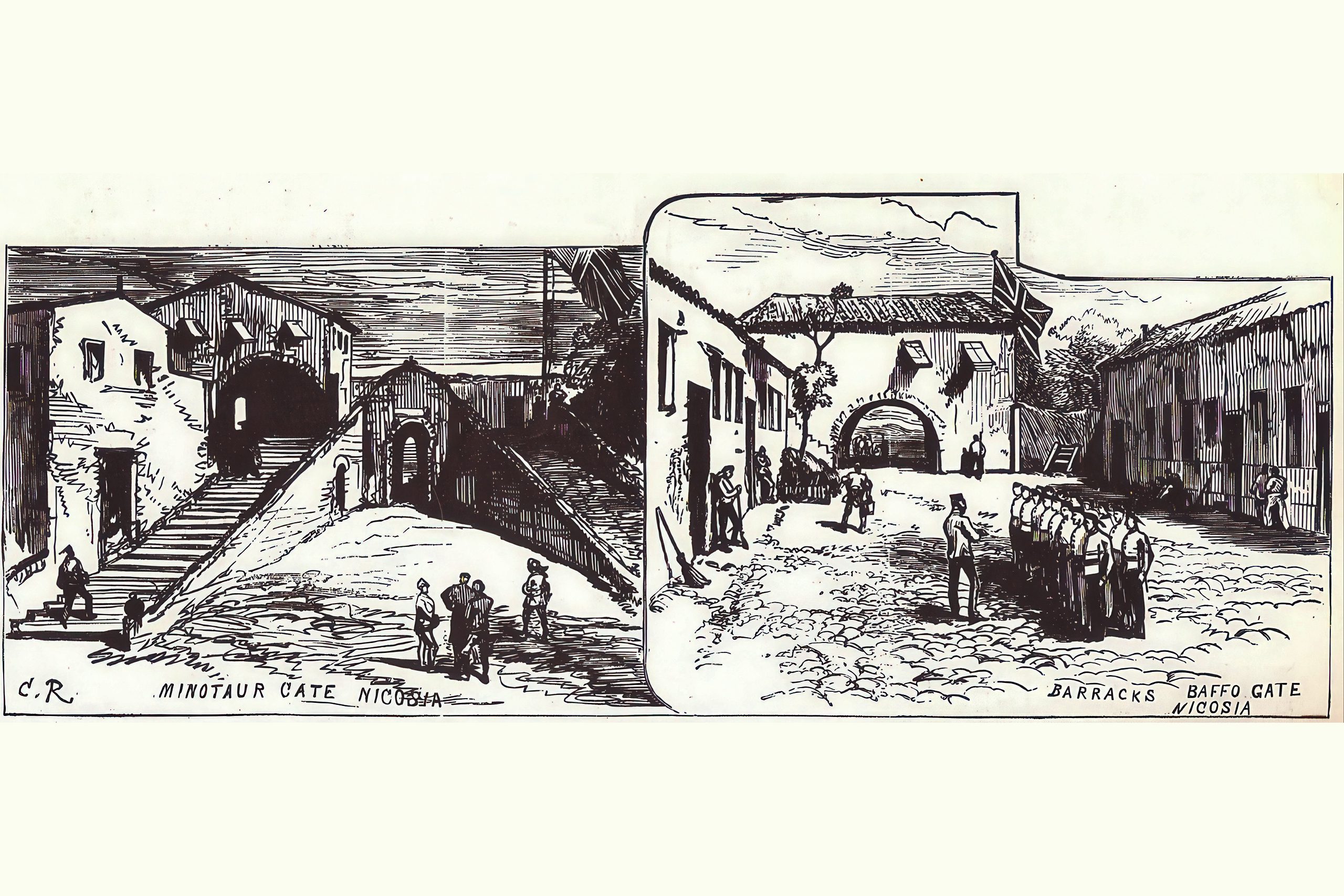
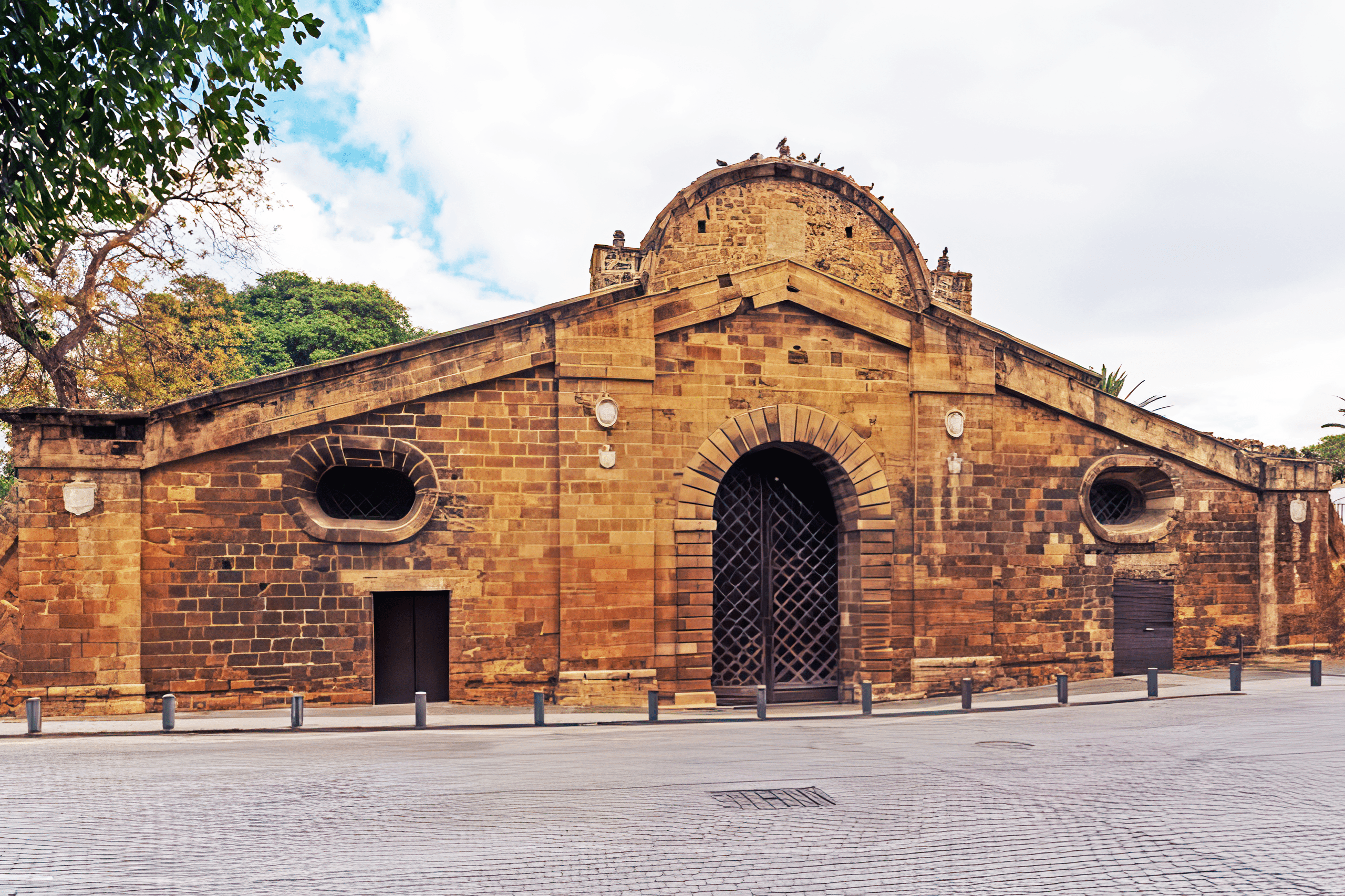
The British made the first opening in the walls in 1879 near Paphos Gate to facilitate access to the surrounding area. This marked the beginning of the city’s expansion beyond the medieval confines. Further openings were created during the 20th century as traffic increased and the city grew. These new passages supplemented the three original gates but were not designed with the same architectural care.
Division of the Walls
Today the walls physically embody the division of Nicosia, the world’s last divided capital. Five bastions (Caraffa, Podocattaro, Constanza, D’Avila, and Tripoli) lie in the southern sector controlled by the Republic of Cyprus. Five bastions (Roccas, Mula, Quirini, Barbaro, and Loredano) are in the northern sector controlled by the Turkish Republic of Northern Cyprus. The Flatro Bastion on the eastern side lies in the UN Buffer Zone, occupied by Turkish, Greek Cypriot, and UN military forces.
The Green Line, established in 1974 after the Turkish military intervention, runs through the old city dividing it into Greek Cypriot and Turkish Cypriot sectors. This division is most visible where it crosses through the old city, with abandoned buildings, military positions, and barbed wire marking the boundary. However, several crossing points allow people to move between the two sides, including checkpoints at Ledra Street and near the Ledra Palace Hotel.
Modern Uses of the Moat
The wide moat that once surrounded the walls has been transformed for various modern purposes. Large sections function as parking areas. Other portions have been converted into sports fields where local teams practice and play matches. Public gardens occupy several sections. This provides green space and recreational areas for residents and visitors.
Some moat sections host open-air sculpture exhibitions, combining cultural activities with the historic setting. The juxtaposition of contemporary art against Renaissance military architecture creates an interesting contrast. Other areas serve as venues for outdoor concerts and festivals, particularly during summer months when the weather is suitable for evening events.
Comparison to Other Ideal Cities
Nicosia was designed as an ideal city of the Renaissance, similar to Palmanova in Italy and Valletta in Malta. These planned cities incorporated the latest theories about urban design, fortification, and civic life. The geometric precision of the circular walls and radial street pattern reflected Renaissance ideals of order and rational planning.
Palmanova, built by Venice starting in 1593, features a very similar design with a nine-pointed star of bastions. The resemblance is clear because both cities were designed by Venetian military engineers using the same principles. Valletta, constructed by the Knights of St. John beginning in 1566, also employed advanced bastioned fortifications, though its layout follows the peninsula on which it stands rather than forming a perfect circle.
These three cities represent the culmination of Renaissance military engineering before the development of more advanced artillery made even these sophisticated fortifications vulnerable. Nicosia’s walls predate both Palmanova and Valletta’s completion, making them an early example of this style.
Exploring the Walls Today
The walls can be explored on foot, though visitors cannot walk on top of the ramparts themselves as they are protected structures. The areas immediately around the walls and throughout the former moat provide excellent walking routes. The entire circuit measures approximately 5 kilometers and can be completed in about two hours at a leisurely pace.
Different sections offer different experiences. Some bastions have been converted into public parks with benches and shade trees. The Podocattaro Bastion features the Liberty Monument, commemorating Greek Cypriot liberation from British colonial rule. The monument depicts 14 figures representing fighters in the national struggle for independence.
The walls look most impressive from certain vantage points. The Shacolas Tower Museum and Observatory on Ledra Street provides an 11th-floor viewing deck with panoramic views of the entire circular fortification and both sectors of the divided city. From this height, the geometric precision of the design becomes clear, and visitors can understand how the bastions create overlapping fields of fire.
The Walls in Cypriot Culture
The Venetian Walls have become symbols of Nicosia’s identity. They appear in official emblems, tourist literature, and local branding. The circular shape is instantly recognizable on maps and has shaped the city’s development for over 450 years.
The walls serve as reference points in giving directions and describing locations. Cypriots speak of being “inside the walls” or “outside the walls” when describing where something is located. The division between old and new Nicosia is primarily defined by these fortifications.
Cultural events often use the walls as venues or backdrops. Concerts, festivals, and ceremonies held near the bastions connect contemporary celebrations to the city’s historic core. The gates serve as gathering points for demonstrations, parades, and official occasions.
Historical Significance
The Venetian Walls represent a transitional period in military architecture when traditional fortifications were being adapted to defend against cannon artillery. The design principles used at Nicosia influenced fortress construction across Europe and European colonies worldwide. Military engineers studied the Venetian system and incorporated similar features in their own projects.
The failure of the walls to prevent the Ottoman conquest in 1570 demonstrated that even the most advanced fortifications could not guarantee safety. The incomplete state of the defenses at the time of the siege raises the question of whether finished walls might have changed the outcome. Military historians continue to analyze the siege and the performance of the fortifications under attack.
The walls document the final years of Venetian rule in Cyprus and the beginning of the Ottoman period that would last until 1878. They stand as monuments to the strategic importance of Cyprus in Mediterranean power struggles between Christian and Muslim states during the 16th century.