Explore Cyprus with Our Interactive Map

Explore our top stories and discover ideas worth your time.

Transportation and Mobility in Cyprus

Transportation and Mobility in Cyprus

Cyprus holds one of the highest car ownership rates in the world with 742 cars per 1,000 people according to International Road Federation figures from 2007. Private car ownership in the country ranks as the fifth highest per capita globally. With more than 658 automobiles per 1,000 people in recent years, Cyprus relies heavily on private vehicles for daily mobility. Only 3 percent of journeys in the Greater Nicosia urban region are made by public transportation, while cycling remains even less common at 2 percent. This dominance of private vehicles creates traffic congestion in major cities, particularly during peak hours, while contributing to air pollution and urban sprawl. The Road Network and Driving Conditions From the 12,118 kilometers of roads in the areas controlled by the Republic of Cyprus, 7,850 kilometers were paved while 4,268 kilometers remained unpaved as of 2006. The island boasts the highest number of motorways per capita in the EU as of 2025, with major routes linking key cities including Limassol, Larnaca, Nicosia, Paphos, and Ayia Napa. One significant advantage for travelers is the absence of toll roads in Cyprus, making exploration of the island more accessible and cost-effective. As a legacy of British rule, Cyprus is one of only three EU nations where vehicles drive on the left. Road signs appear in both English and…

Read more
Piracy and Naval Conflict in Cyprus

Piracy and Naval Conflict in Cyprus

For centuries, Cyprus lived with a constant awareness of the sea. Its position at the crossroads of Europe, the Middle East, and North Africa brought trade, wealth, and cultural exchange, but it also exposed the island to piracy and naval warfare. Ships on the horizon were never neutral. They could mean commerce and connection, or sudden violence and loss. Over time, this uncertainty shaped how Cyprus was built, governed, and defended. Piracy and naval conflict were not interruptions to Cypriot history. They were defining forces. An Island That Could Not Be Ignored Cyprus sits directly along major east–west Mediterranean sea routes. Any ship moving between the Aegean, the Levant, and Egypt passed close to its shores. This made the island strategically valuable to empires and dangerously attractive to pirates. Its long coastline offered sheltered bays and natural harbours that were ideal for trade, but equally useful as hiding places for raiders. Cyprus was never isolated from maritime traffic. It was embedded within it, and that visibility made avoidance impossible. Piracy as a Constant, Not an Exception Piracy in the eastern Mediterranean did not belong to a single era. From the Bronze Age onward, coastal communities in Cyprus faced the risk of seaborne raids. Archaeological sites such as Maa-Palaeokastro show early attempts to respond, featuring Cyclopean-style walls designed to protect against…

Read more
Almyras Mudstones

Almyras Mudstones

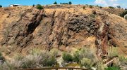
Almyras mudstone is a clay-rich badlands landscape in central Cyprus where ancient marine sediments, lifted from the Tethys Ocean, are exposed in sharply eroded hills and gullies. Its colours, microfossils, and altered volcanic ash make the area one of the island’s clearest geological records, and the same clays later supported early copper-smelting activity at Agia Varvara–Almyras. This article explains how Almyras formed, what the terrain reveals, and how people learned to use the land’s materials for industry. Quick essentials (for skimmers) Image Credit: like.philenews.com Where: Central Cyprus, mainly around Agia Varvara–Almyras, south of Nicosia  What it is: Marine mudstones and clay formations shaped into badlands  Why it matters: Records Cyprus's emergence from the sea and supports early metallurgy  Best time to visit: Autumn to spring, after rain but not during storms  What to expect: Fragile terrain, strong visual contrasts, limited formal facilities Why “Almyras” Means Brackish The word Almyras comes from the Greek term for “salty” or “brackish.” Across Cyprus, it is used for places where mineral salts influence soil and water. In geology, the name became attached to clay-rich zones where marine sediments, salts, and evaporitic minerals shaped both the land and groundwater. The most important site carrying this name is Agia Varvara–Almyras, a small hill within the Gialias River basin. While the term appears elsewhere in Cyprus, this…

Read more