Colonial Roads and Infrastructure
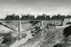
British-built roads, bridges, and public works that transformed mobility, trade, and communication across the island. Colonial Road and Infrastructure Networks in Cyprus mark a pivotal era of transformation under British rule from 1878 to 1960, where engineered roads, bridges, and public works revolutionized the island's connectivity, boosting trade, communication, and economic integration. These projects, spearheaded by the colonial administration, shifted Cyprus from Ottoman-era isolation to a modernized network, linking remote villages to urban centers like Nicosia, Limassol, and Famagusta. Key features included macadamized roads, stone bridges (including the Trimiklini Double Bridge) over seasonal rivers, and irrigation dams that supported agriculture, reflecting imperial strategies to exploit resources while imposing control. As symbols of progress and domination, they facilitated troop movements and commerce but also sparked local resistance, highlighting tensions between development and exploitation. Today, many endure as vital arteries, preserved for heritage while adapting to contemporary needs, underscoring Cyprus's journey from colony to independent nation amid ongoing debates on legacy and sustainability. A Transformative Colonial Network Colonial road and infrastructure networks reshaped Cyprus's landscape, creating a web of paved routes, sturdy bridges, and essential public works that connected its rugged terrain, from the Troodos Mountains to coastal plains. Spanning thousands of kilometers by independence, the system included major arteries like the Nicosia-Limassol road and rural links to villages, built to withstand…
Read more