Akamas Peninsula National Park occupies 230 square kilometers on the northwest tip of Cyprus, stretching from rugged coastal cliffs to the foothills of the Troodos Mountains. The peninsula was named after Akamas, son of Theseus and hero of the Trojan War who founded the ancient city kingdom of Soli. Ptolemy described it as a thickly wooded headland divided by summits that rise toward the north.
The area contains valleys, gorges, wide sandy bays, and dense forests that remained largely untouched due to its remote geography and challenging terrain. Until the year 2000, the British Army and Navy used the peninsula for military exercises and as a firing range under the 1960 Treaty of Establishment. This military use ironically protected the area from tourism development and agricultural expansion.
The peninsula became part of the Natura 2000 network in 2009, with turtle nesting beaches designated as Sites of Community Importance and the area declared a Special Protection Area for birds. The region supports exceptional biodiversity with many vulnerable species, some endemic only to Akamas.
Wildlife from fruit bats to monk seals
The peninsula provides habitat for 168 varieties of birds, 20 different reptile species, 16 butterfly species, and 12 mammal species. Rare migratory birds use Akamas as a stopover point, while endemic Cyprus warblers and Cyprus wheatear nest in the scrubland. Griffon vultures soar on thermals above the cliffs, and Bonelli’s eagles breed in mountainous sections. Cyprus scops owls hunt at night through the forests.
The European roller bird with its brilliant blue plumage attracts birdwatchers during migration seasons. Mammals include fruit bats that live and breed in limestone caves, shrews, hedgehogs, and foxes that can be spotted at dawn and dusk. The critically endangered Mediterranean monk seal occasionally visits secluded coves, though sightings remain extremely rare.
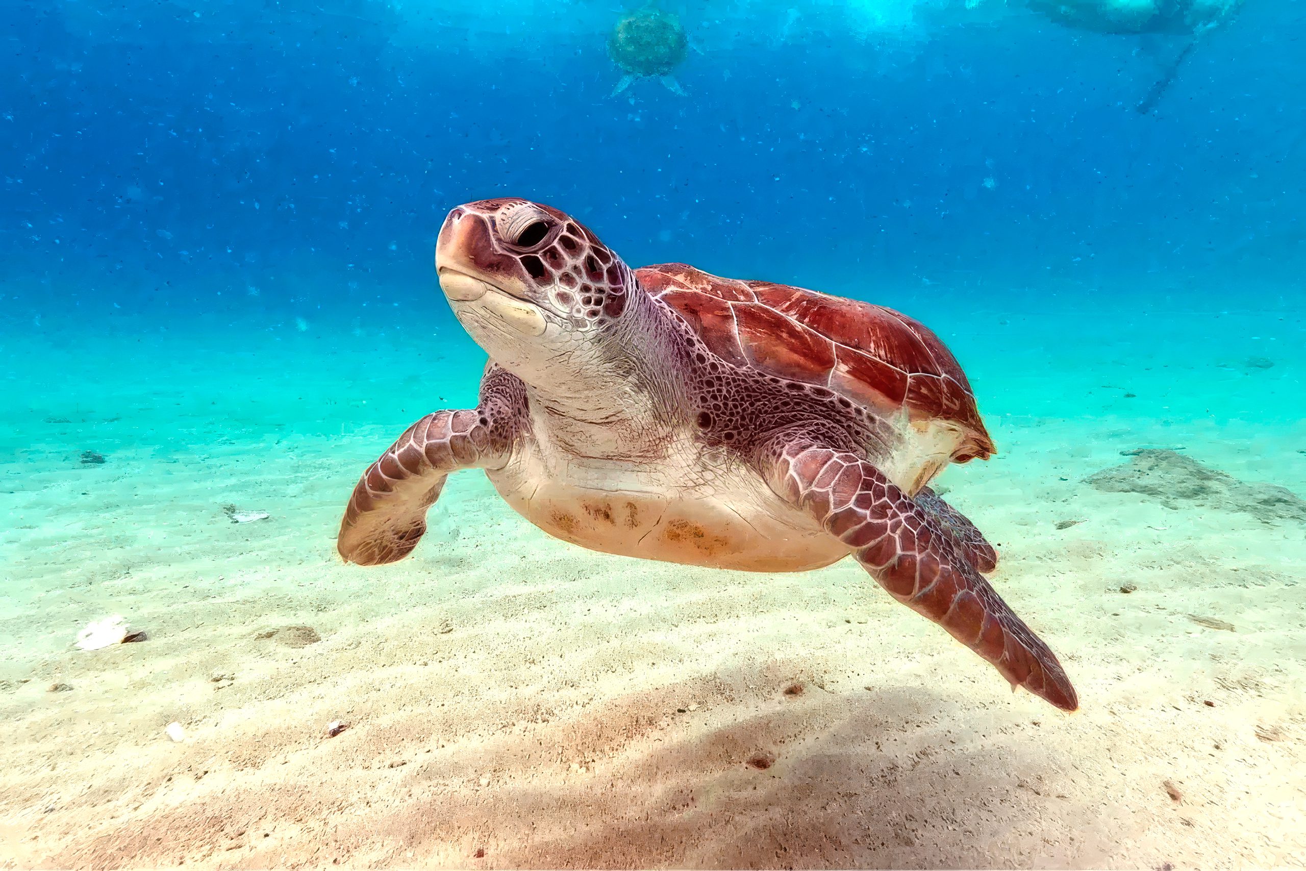
Reptiles include the black snake, blunt nosed viper, and numerous lizard species that grow larger at higher elevations. The peninsula serves as one of the most important nesting sites in the Mediterranean for green turtles and loggerhead turtles. Lara Bay hosts a turtle hatchery where rangers protect eggs from predators and human disturbance. British broadcaster David Attenborough filmed segments about the fruit eating bats in Akamas caves.
Avakas Gorge carved by water and time
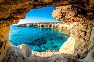
Avakas Gorge extends approximately 3 kilometers through limestone formations on the southern edge of the peninsula. The Avgas River carved this dramatic canyon over millions of years through constant erosive activity on the limestone rock composed of loams, chalks, reef and grain limestone, and bentonitic clays. The gorge walls rise up to 30 meters in height, creating a narrow passage that measures only 2 to 3 meters wide at its tightest point.
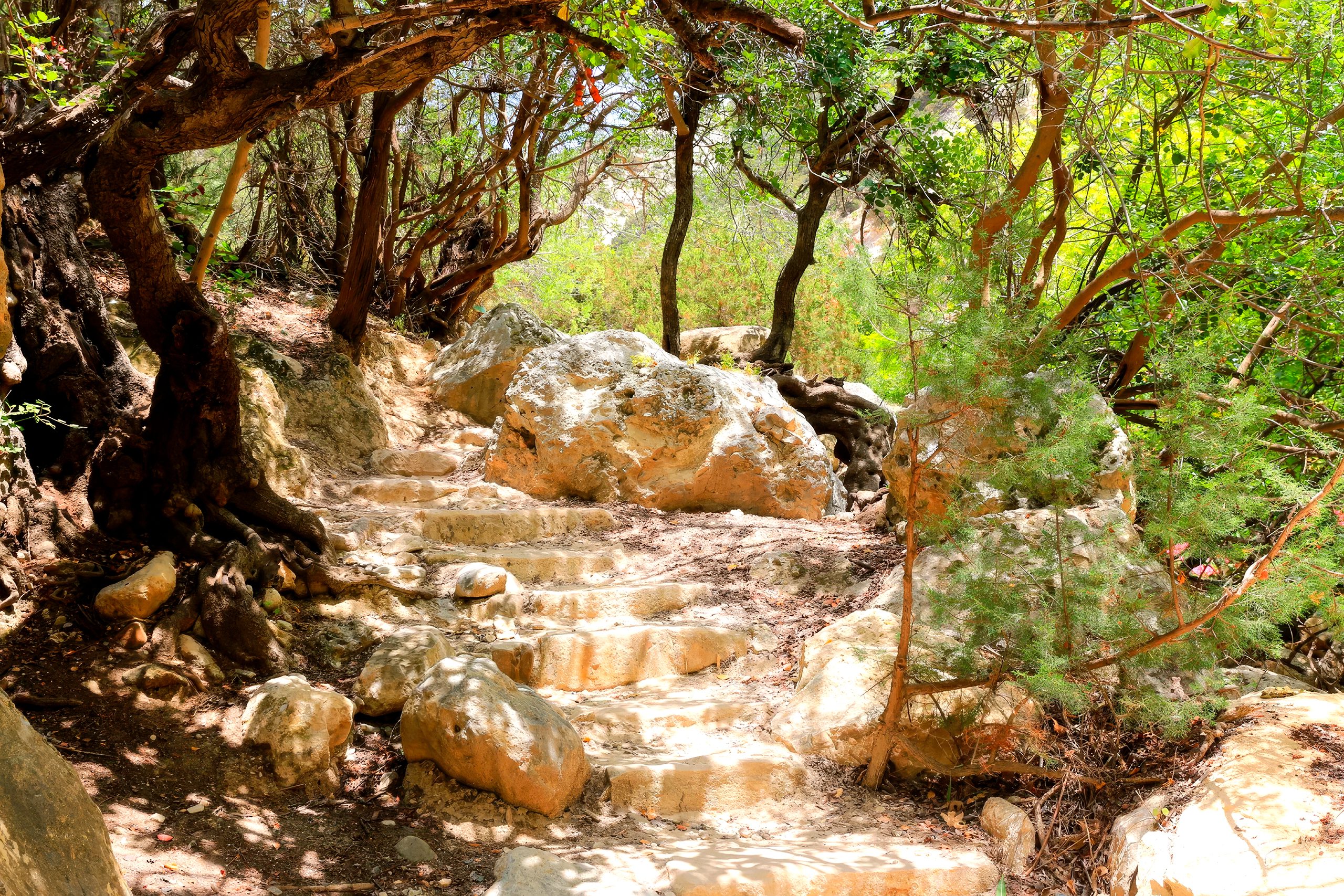
These towering cliffs display layers of geological history and provide dramatic sense of scale. The gorge receives approximately 100,000 visitors annually according to forestry authorities. Water usually flows throughout the year in the stream that runs through the gorge bottom, creating a particularly attractive, shady, and moist environment.
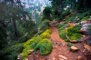
The combination of cool air, flowing water, and tranquility makes it ideal for experiencing nature. Thick vegetation includes wild fig trees, oleanders, junipers, pines, and cypresses that cling to rock walls and fill shaded areas. The gorge trail follows a linear route of 1,200 meters one way, making a 2,400 meter round trip. The path becomes challenging in sections with rocky terrain, narrow passages, and some scrambling required over boulders and slippery stones.
The mythical Baths of Aphrodite
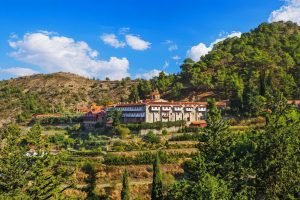
The Baths of Aphrodite occupy a grotto on the edge of Akamas National Park between Polis and Cape Arnaoutis, offering magnificent views over Chrysochou Bay. Greek mythology identifies this natural spring as the pool where Aphrodite bathed and first met her lover Adonis. Local tradition claims the waters possess rejuvenating powers. The site consists of a small waterfall and pool surrounded by ferns and a large fig tree that provides shade.
The natural cavern sits approximately 18 miles from Paphos. The location serves as a major starting point for exploring Akamas, with a tourist information center and the end of paved roads into the park. Three official nature trails begin here: the Adonis Trail, Aphrodite Trail, and Smigies Trail. The Aphrodite Trail stretches 7.5 kilometers past medieval ruins, pine woods, rugged landscapes, and panoramic viewpoints.
The route follows the mythical goddess’s footsteps toward the Tower of Rigena, the remnants of a Catholic monastery, and continues on a rising path to Moutti tis Sotiras hill. The Adonis Trail ventures toward the western part of the park toward Lara Bay, taking approximately 3 hours with a difficulty rating of level 3 and not considered suitable for young children.
Blue Lagoon and coastal beauty
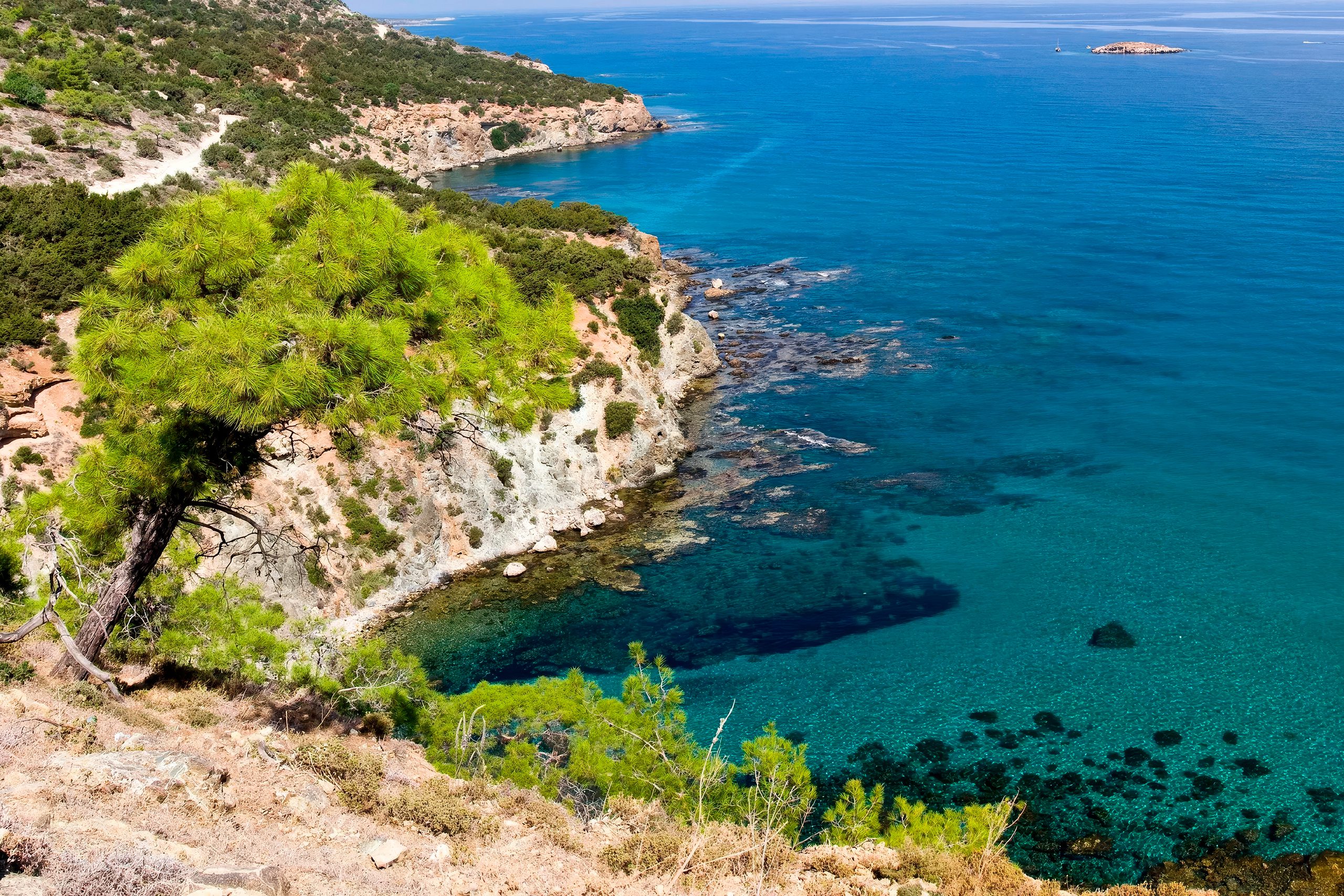
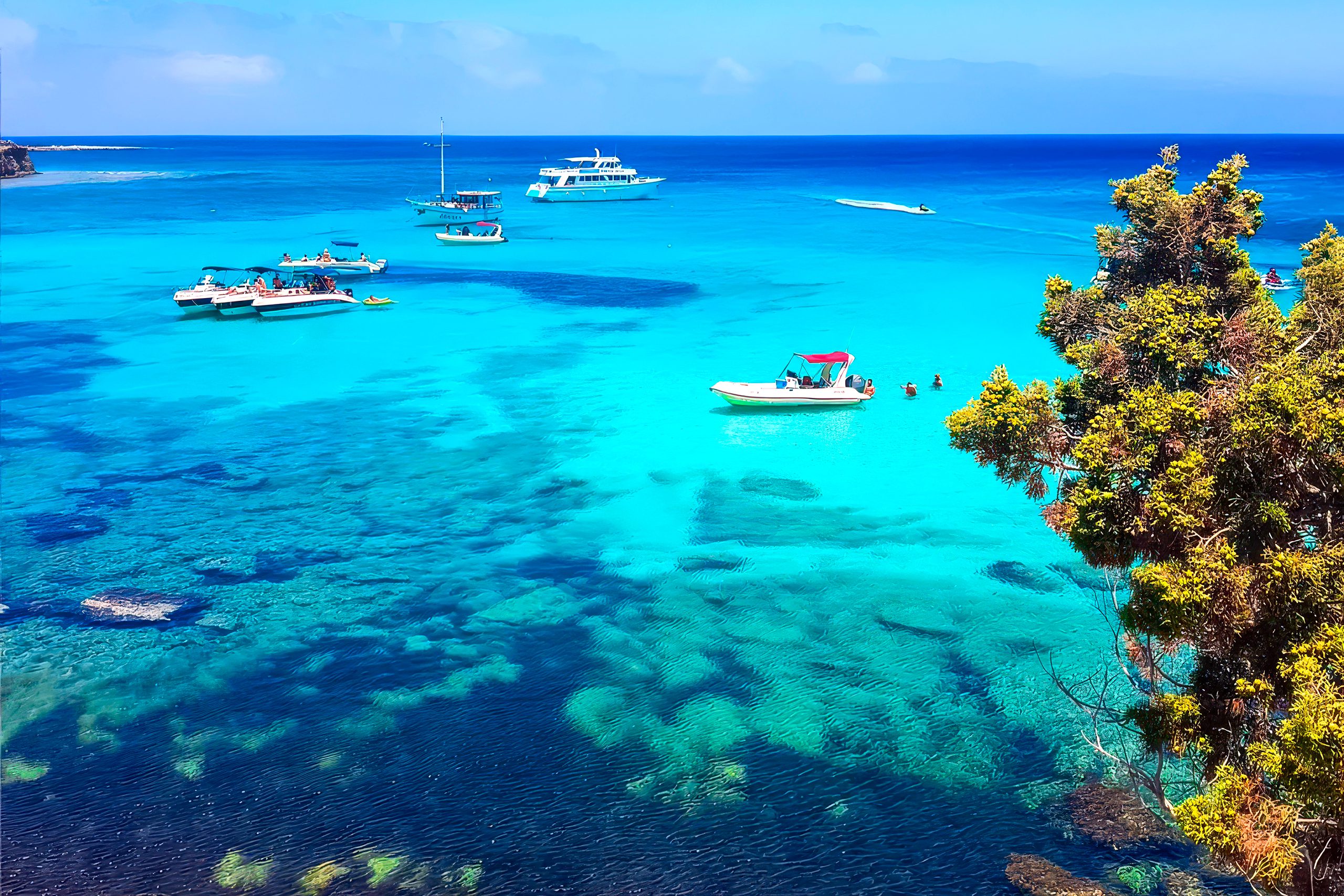
The Blue Lagoon ranks as the most popular destination in Akamas, attracting thousands of visitors by boat. The pristine beach with its rugged hills creates a postcard destination. Crystal clear turquoise waters allow visibility to the sandy bottom, perfect for swimming and snorkeling. The lagoon can be reached by public jeep that runs from the Baths of Aphrodite tourist information point through the park, or by approximately one hour walk through the national park trails. Boat trips from Latchi harbor bring day trippers who swim in the protected bay.
Fontana Amoroza, the next stop after Blue Lagoon on the jeep route, takes its name from the Franks in the 16th century and means source of love, another site associated with Aphrodite. The beach features crystal clear waters with sandy bottom in a more rugged and wild setting than classic sand beaches.
Lara Bay on the western coast remains remote but accessible by off road vehicle. This isolated beach serves as one of the most important nesting sites for green turtles and loggerhead turtles in the Mediterranean. A turtle conservation station operates here with rangers protecting nests and monitoring hatchlings. Access is controlled during nesting season to minimize disturbance to the endangered sea turtles.
Conservation battles and development threats
The peninsula faces various pressures including fly tipping, arson, legal and illegal hunting, overgrazing, uncontrolled movement of motor vehicles, unlicensed structures, and tourist development proposals. Since 2017, arsonists have set approximately 80 fires in or around the National Forest Park. A 2019 fire required six aircraft from the National Guard, Police, and Forestry Department to extinguish flames nine hours after they broke out. The head of the forestry department called the arsonists senseless, noting that fires often break out the day before meetings to discuss Akamas protection.
Economic interests appear behind deliberate fires set to sabotage plans to declare the area as a National Forest. The government designated only 50% of the terrestrial area proposed as Natura 2000 in 2003 when formal designation occurred in 2009. The area has different ownership statuses including state owned forest land and private land, governed by three different spatial planning regimes. Five government departments share responsibility for protection and management, along with several local authorities, creating fragmentation that contributes to lack of coordination. Environmental organizations including the Green Party of Cyprus, Greenpeace, and Friends of the Earth continue lobbying for enhanced protection and full National Park status.
Exploring the peninsula responsibly
The peninsula can be accessed from Paphos or Polis by public transportation, rental car, or organized tours. Bus route 622 runs from Polis to the park entrance at the Baths of Aphrodite. Driving provides the easiest access to main tourist points, though beyond paved roads only 4×4 vehicles can navigate the dirt tracks that cross the interior. No paved roads run through the heartland of the peninsula due to its mountainous nature.
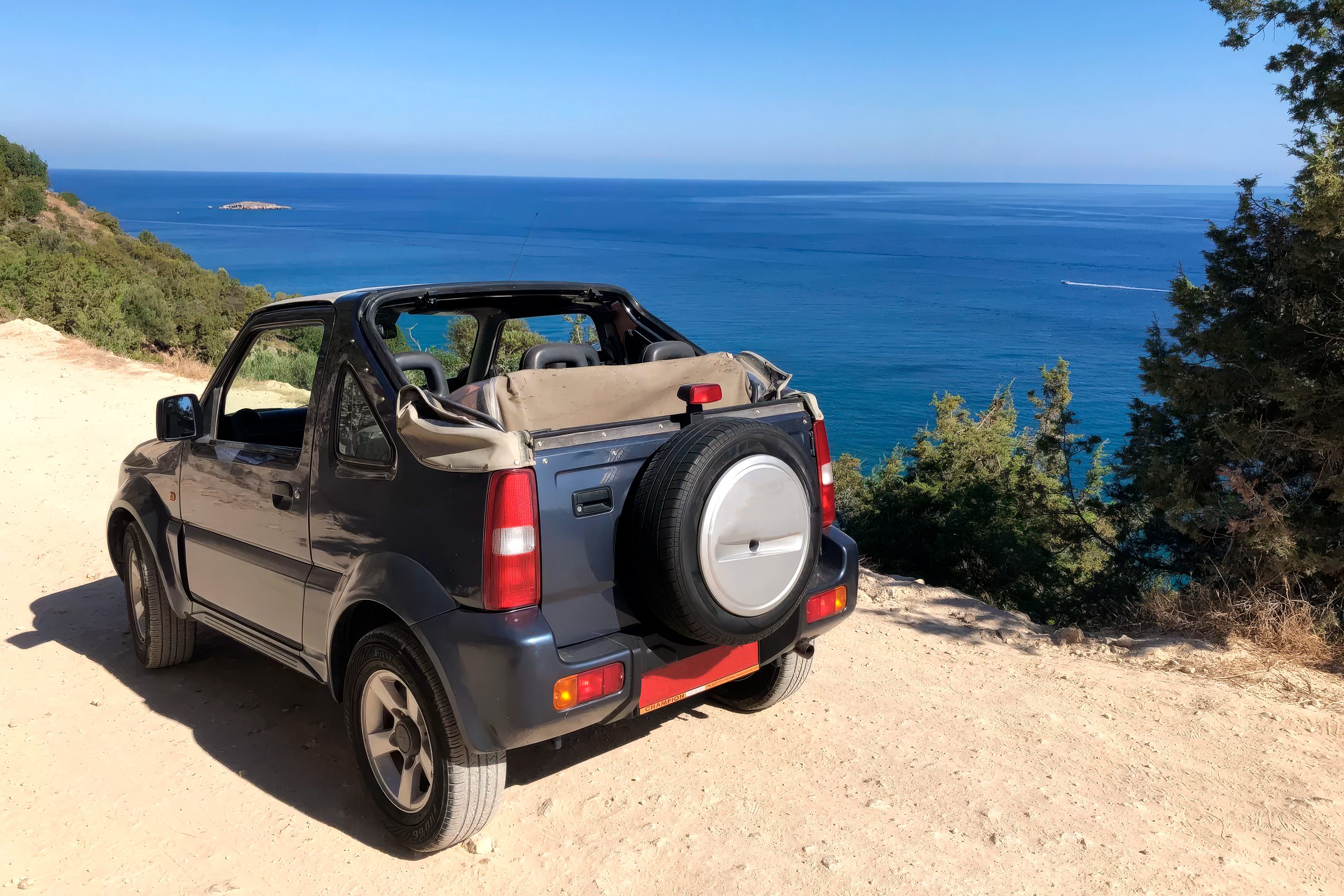
Some roads marked on maps are not sealed and require high clearance vehicles. Organized jeep tours provide guided access to interior locations including Blue Lagoon, Fontana Amoroza, and Avakas Gorge. Quad bike rentals allow independent exploration of dirt roads. Hiking and mountain biking provide the most environmentally friendly ways to experience the wilderness.
Visitors should stay on designated trails to avoid damaging fragile vegetation and disturbing wildlife habitats. Dispose of all waste properly and consider picking up litter left by others. Avoid entering Avakas Gorge during heavy rainfall due to dangerous flooding risk. The best seasons for visiting are spring from March to May when wildflowers bloom and temperatures remain moderate, or autumn from September to November when crowds thin and golden oak leaves turn bronze.
Why Akamas matters to Cyprus and beyond
Akamas Peninsula represents one of the last truly unspoiled natural regions in Cyprus and the entire Mediterranean. The peninsula demonstrates what the island looked like before mass tourism and agricultural development transformed coastal areas. The biodiversity preserved here includes species found nowhere else on earth, making conservation efforts globally significant.
The turtle nesting beaches provide essential habitat for endangered marine species whose populations depend on protected sites throughout the Mediterranean. The endemic plants serve as genetic reservoirs that could prove valuable for future scientific research and conservation. For Cyprus, Akamas anchors the island’s commitment to balancing tourism development with environmental protection.
The peninsula attracts nature based and adventure tourism that provides economic benefits to nearby communities without requiring extensive infrastructure. The landscapes and biodiversity give Cyprus credibility in international conservation discussions and demonstrate responsible stewardship of natural resources.