Cyprus roads and routes

Articles: Cyprus roads and routes

Stories in this category and its subcategories.

Cyprus Driving – Cities vs Mountains vs Village Roads

Cyprus Driving – Cities vs Mountains vs Village Roads

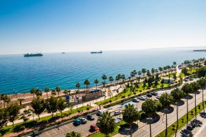
Cyprus offers drivers dramatically different experiences depending on where they travel. City streets demand alertness for roundabouts and parking challenges, mountain roads require careful handling on steep grades, and village lanes test patience with narrow passages. Understanding these differences helps drivers navigate the island safely and confidently. In-Cyprus-com Major cities like Nicosia, Limassol, and Paphos feature modern infrastructure with well-maintained roads, but they also present unique obstacles. Roundabouts appear frequently, especially at highway exits and major intersections. Traffic already on the roundabout has the right of way, so drivers must yield before entering. Local drivers move quickly through these circles, which can intimidate newcomers. Parking in city centers presents significant difficulties. Limassol has metered street parking along the seafront Molos…

Read more
How Infrastructure Overcomes Cyprus’s Rugged Terrain

How Infrastructure Overcomes Cyprus’s Rugged Terrain

The Troodos Mountains cover roughly one-third of Cyprus, stretching across most of the western portion. Mount Olympus rises to 1,952 meters, making it the island's highest peak. These mountains formed through the collision of African and European tectonic plates, pushing ancient seabed rock formations skyward over millions of years. Climbfinder The landscape varies dramatically within short distances. Coastal areas sit at sea level while mountain villages perch at elevations exceeding 1,000 meters. Steep valleys cut through the terrain, with rivers carving gorges that modern roads must somehow cross. Wanderlog In 2011, heavy rainfall triggered 128 separate landslide incidents in Paphos, causing significant damage to roads and buildings. These geological realities force engineers to constantly assess slope stability when planning new…

Read more
Green Transportation Options in Cyprus

Green Transportation Options in Cyprus

Cyprus faces a unique transportation challenge. With 658 automobiles per 1,000 people, the island holds one of the highest car ownership rates globally. Only 3% of journeys in Greater Nicosia use public transport, while cycling accounts for just 2%.  i-ytimg-com This heavy reliance on private vehicles contributes to traffic congestion, air pollution, and carbon emissions. However, the island is actively developing sustainable alternatives through government initiatives, infrastructure improvements, and European Union support. Building a Greener Transport Network Cyprus has committed to ambitious environmental targets. The National Energy and Climate Plan aims to increase renewable energy sources to 23% of total consumption and 14% in the transport sector by 2030.  sb-cyprus The government launched Sustainable Urban Mobility Plans for Limassol and…

Read more
Salamis to Paphos Historic Routes

Salamis to Paphos Historic Routes

The story of Cyprus roads spans over 3,000 years, from Bronze Age trade routes to Roman highways and modern infrastructure. This network transformed the island from scattered settlements into a connected civilization, linking major cities and remote villages while facilitating trade across the Mediterranean. In-Cyprus-com The earliest roads in Cyprus date back to the Bronze Age, when the island served as a crucial trading hub between the Aegean, Egypt, and the Levant. Cyprus became the principal intermediary station for Mycenaean Greece in accessing Middle Eastern markets, largely due to its copper resources in the Troodos Mountains. By the end of the Hellenistic period, the road network encircled the entire island. During the Late Bronze Age between 1400 and 1150 BCE,…

Read more