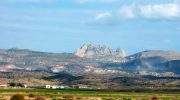
Kakopetria is a mountain village in the Troodos range that combines well-preserved traditional architecture with important medieval heritage sites. Located about fifty-five kilometers from both Nicosia and Limassol at an altitude of 667 meters, the village offers a clear example of rural Cypriot life shaped by its natural environment and long historical continuity.

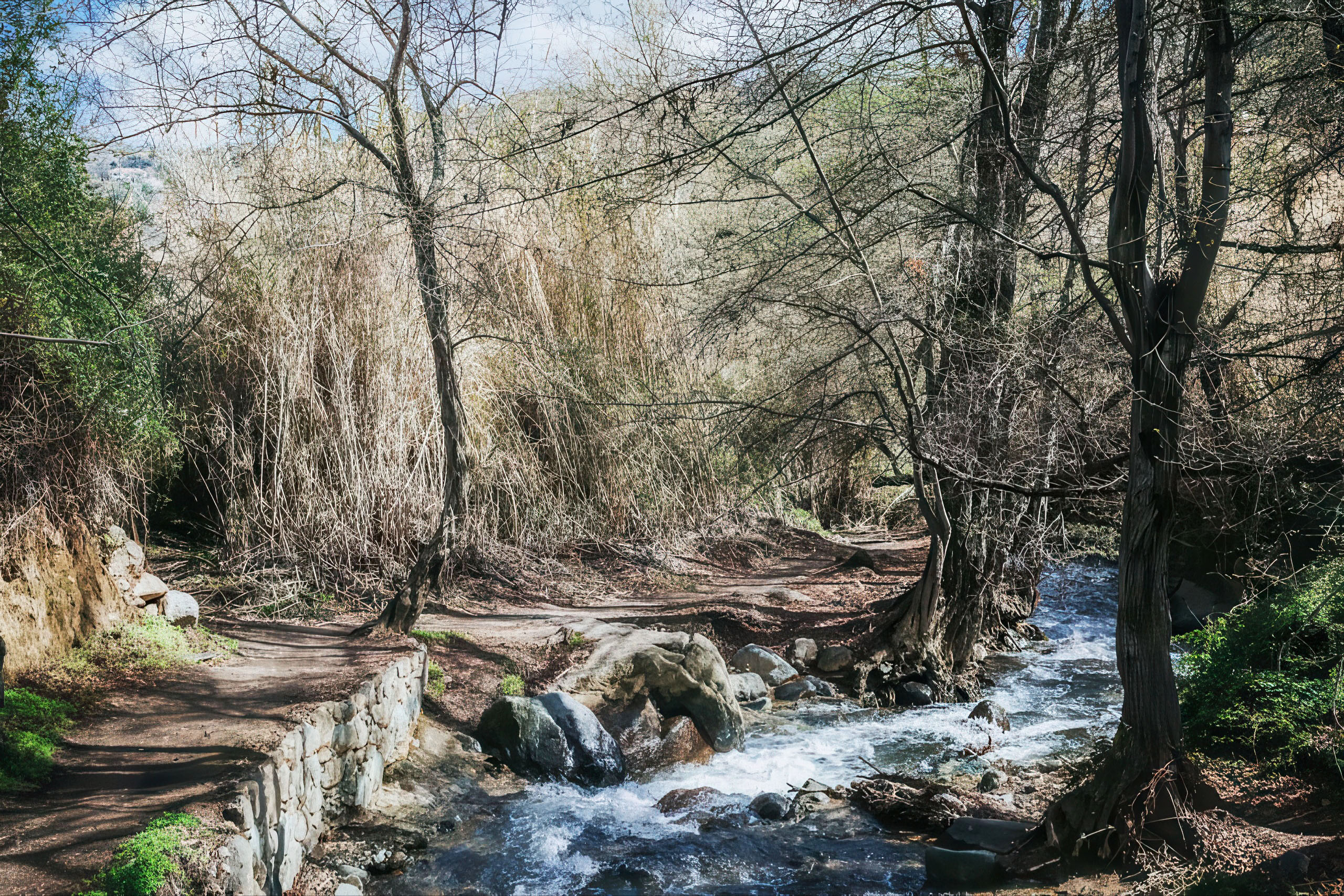
Two rivers, the Kargotis and the Garillis, flow through the settlement and merge to form the Klarios River, which continues toward Morphou Bay. This constant water supply has played a central role in the village’s development, supporting fertile greenery, dense vegetation, and year-round cultivation. Plane trees, orchards, pine forests, and cultivated gardens create a landscape that stands out in comparison to much of the island’s drier terrain. The higher elevation also provides cooler temperatures and a more temperate climate throughout the year.
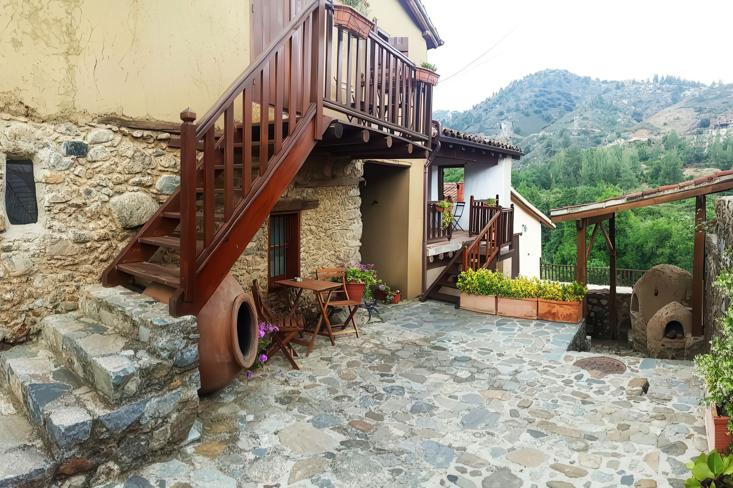
The village is divided into two distinct sections. Old Kakopetria, known locally as Palia Kakopetria, sits between the two rivers and preserves its traditional identity through narrow stone streets and two-story stone houses with wooden balconies. New Kakopetria extends toward the eastern valley and includes more modern residential development. The older section has been granted protected heritage status, ensuring the preservation of its 18th and 19th-century architectural character.
Historical Development
Archaeological findings from excavations in the surrounding area indicate human presence dating back to the 6th–7th centuries BCE. Discoveries include terracotta figurines, limestone sculptures, and metal artifacts from earlier historical periods, suggesting that the region was inhabited long before the medieval settlement developed.
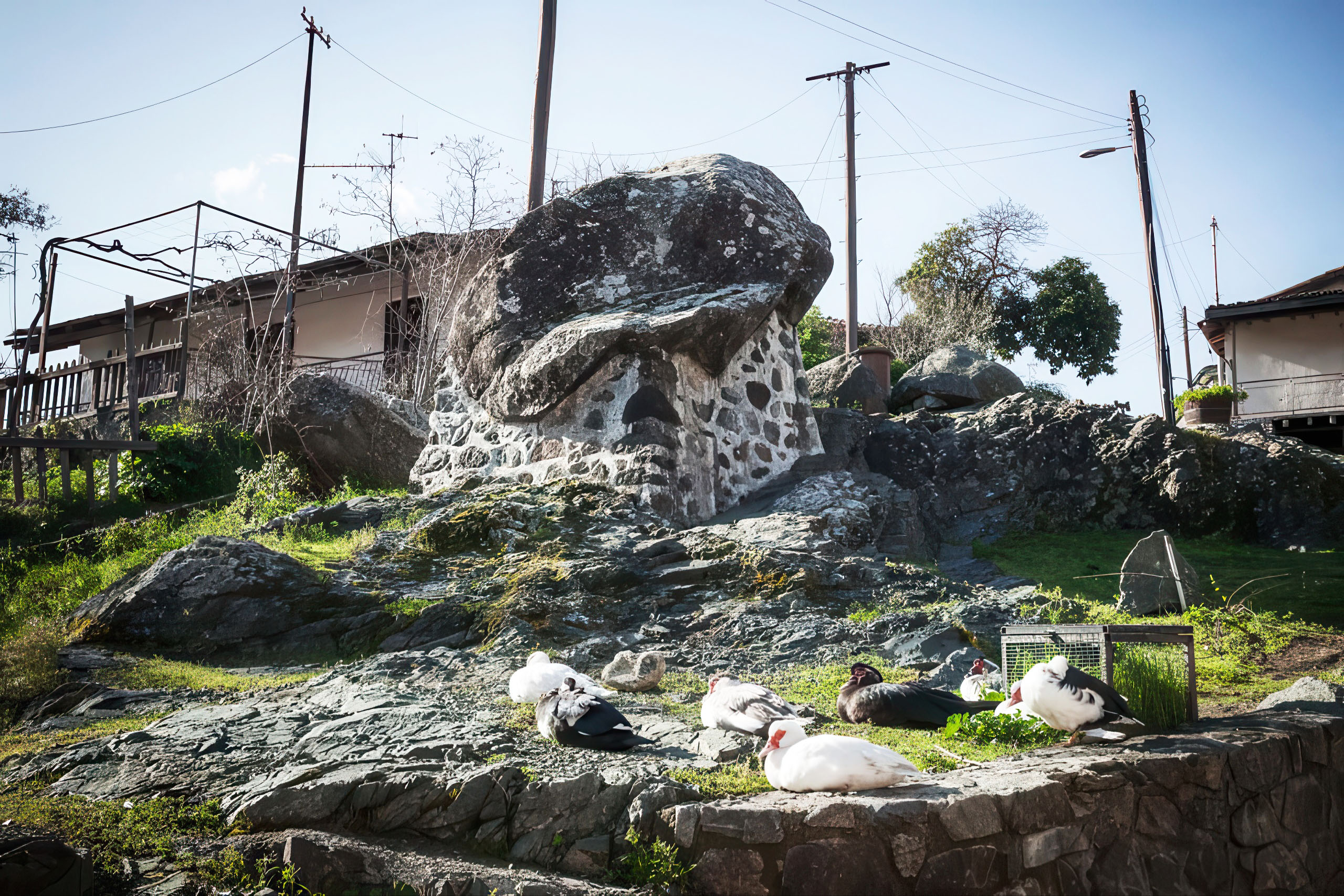
During the medieval era, the village appears in historical records under variations of its current name, indicating continuous habitation through the Frankish period (1192–1489). The name “Kakopetria” is traditionally linked to a local legend involving a large boulder that once moved in the area, becoming part of the village’s identity and folklore. The rock remains near the entrance of the settlement as a preserved landmark.
A major phase of modern development occurred in the early 20th century when land redistribution led to the planned expansion of New Kakopetria. Building plots were allocated to residents, resulting in an organized settlement pattern with a central plaza and structured residential layout.
Historically, the village also played an important role in rural industry. Silk production was a significant activity until the mid-20th century, when it gradually declined due to economic and global market changes. During the Second World War period, agricultural production in the region was also affected by external demands linked to wartime supply chains.
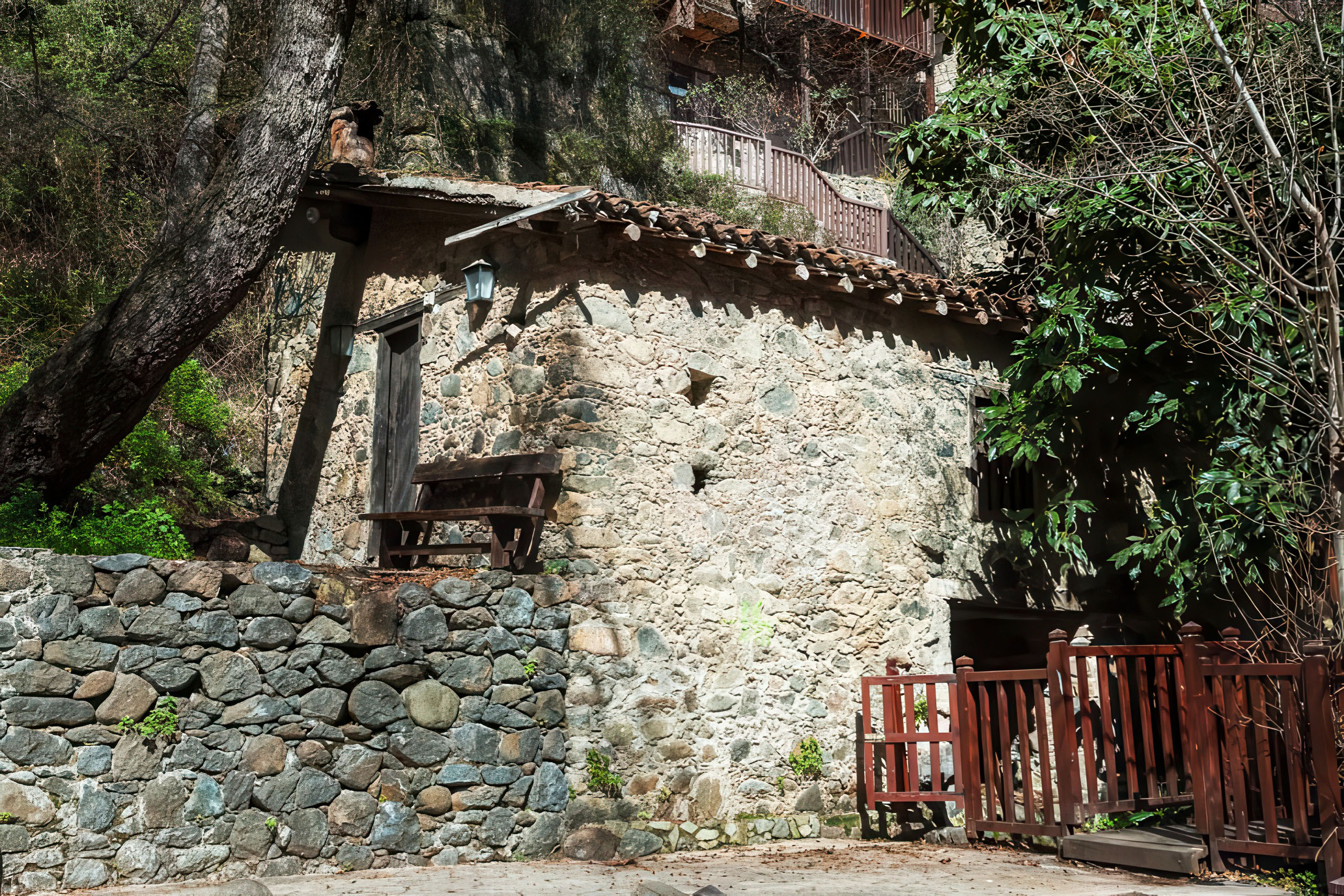
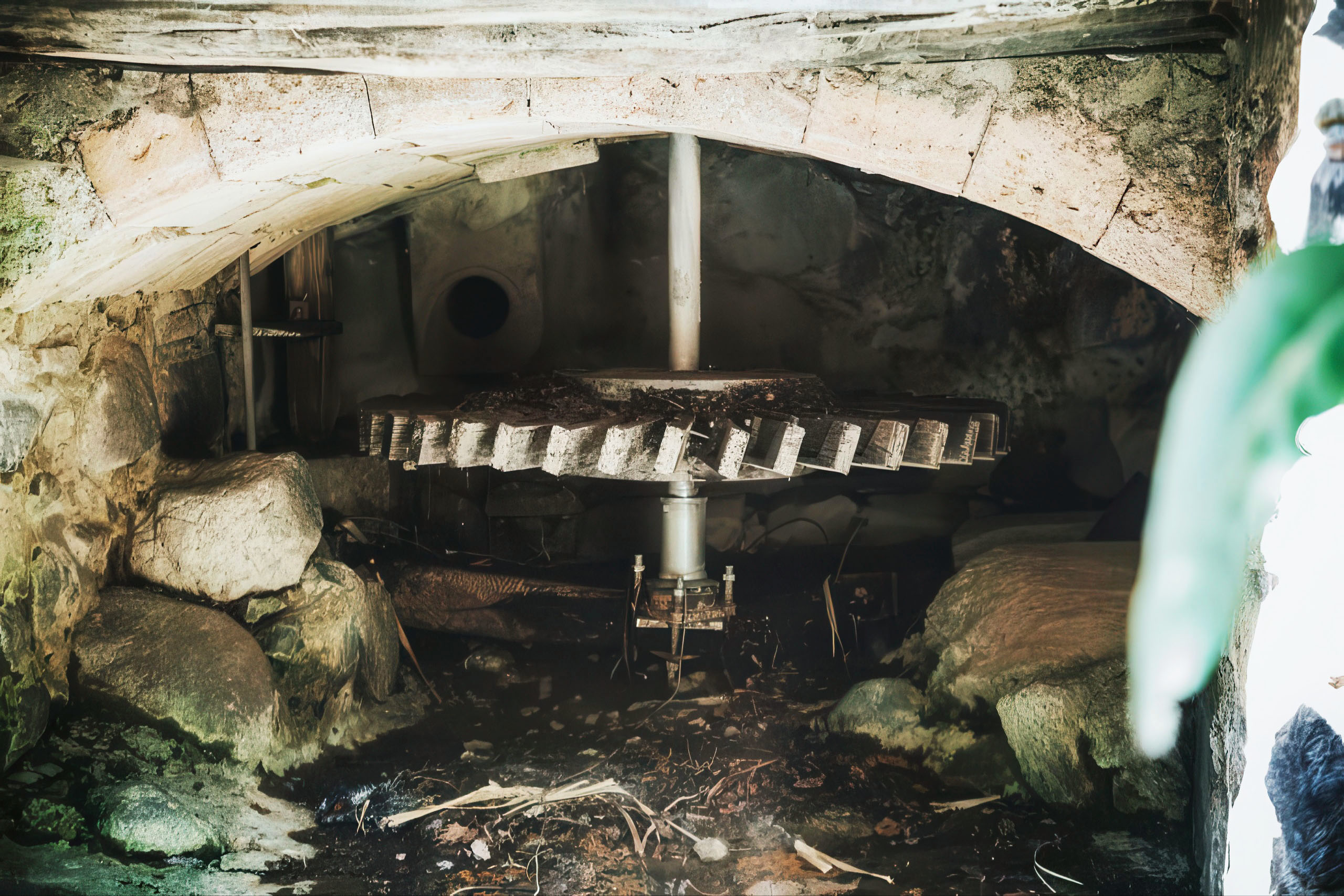
Water-powered mills once formed a key part of the local economy. These mills processed grain and supported surrounding villages, sometimes attracting visitors from distant areas. Later, in the early 20th century, Kakopetria also adopted one of the island’s early rural hydroelectric systems, reflecting a gradual shift toward modern infrastructure.
Agriculture remains an important part of local life, with orchards producing apples, pears, plums, apricots, peaches, cherries, and grapes, along with vegetables such as tomatoes and potatoes.
Byzantine Churches
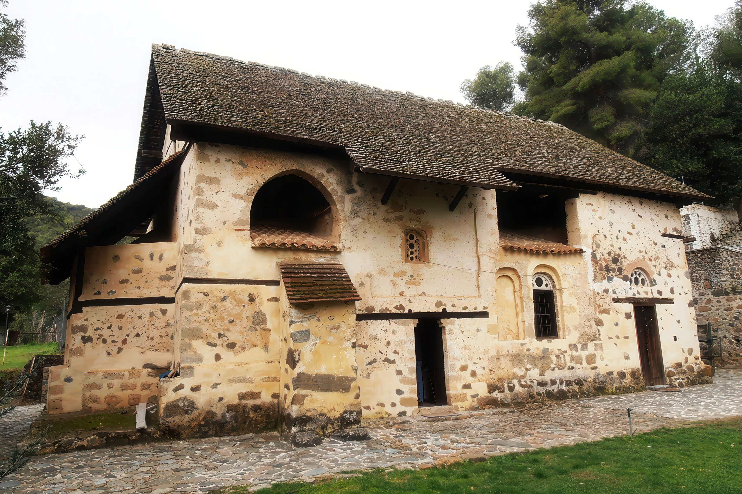
One of the most significant historical monuments in the region is Agios Nikolaos tis Stegis, located a short distance from the village. This 11th-century structure is among the best-preserved medieval painted monuments in Cyprus and has been recognized internationally for its artistic and historical value as part of the Troodos cultural heritage landscape.
The building is notable for its architectural design, featuring a domed structure with a wooden roof added later for protection. Inside, the walls preserve layers of mural painting spanning several centuries, offering a rare visual record of artistic development over time.
In Old Kakopetria, the Church of the Transfiguration of the Savior (Metamorfosis tou Sotiros) stands as another important historical structure. Built in the early 16th century, it served as the central place of community gatherings for generations. Renovation works over time uncovered earlier decorative fragments, suggesting that even older artistic phases existed beneath the current structure.
These monuments collectively highlight the artistic traditions of the medieval Eastern Mediterranean and reflect the cultural importance of religious architecture in shaping village identity across centuries.
Cultural Preservation
Kakopetria maintains two important museums that document traditional rural life and agricultural practices.
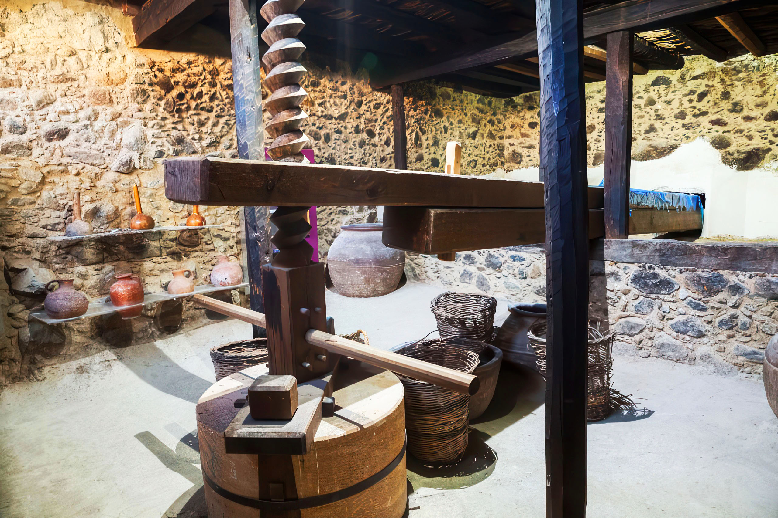
The Linos Museum focuses on three major elements of village economy: wine, bread, and olive oil production. Exhibits include traditional tools, storage systems, and reconstruction of historical production methods. The museum building itself has been carefully restored to preserve its architectural authenticity while adapting it for educational use.
The Olive Mill Museum presents traditional olive oil production techniques that were once common across rural Cyprus. Large stone mills, wooden mechanisms, and pressing systems demonstrate the labor-intensive processes used before industrial modernization. These displays help illustrate how communities relied on shared labor and seasonal production cycles.
Together, these museums preserve knowledge of everyday life in rural Cyprus, showing how agriculture, craftsmanship, and community cooperation shaped village economies.
Tourism and Modern Development
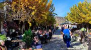
Kakopetria began attracting visitors in the early 20th century due to its cooler climate, scenic environment, and accessibility from major cities. Over time, tourism gradually became an important part of the local economy alongside agriculture.
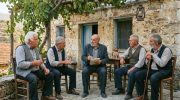
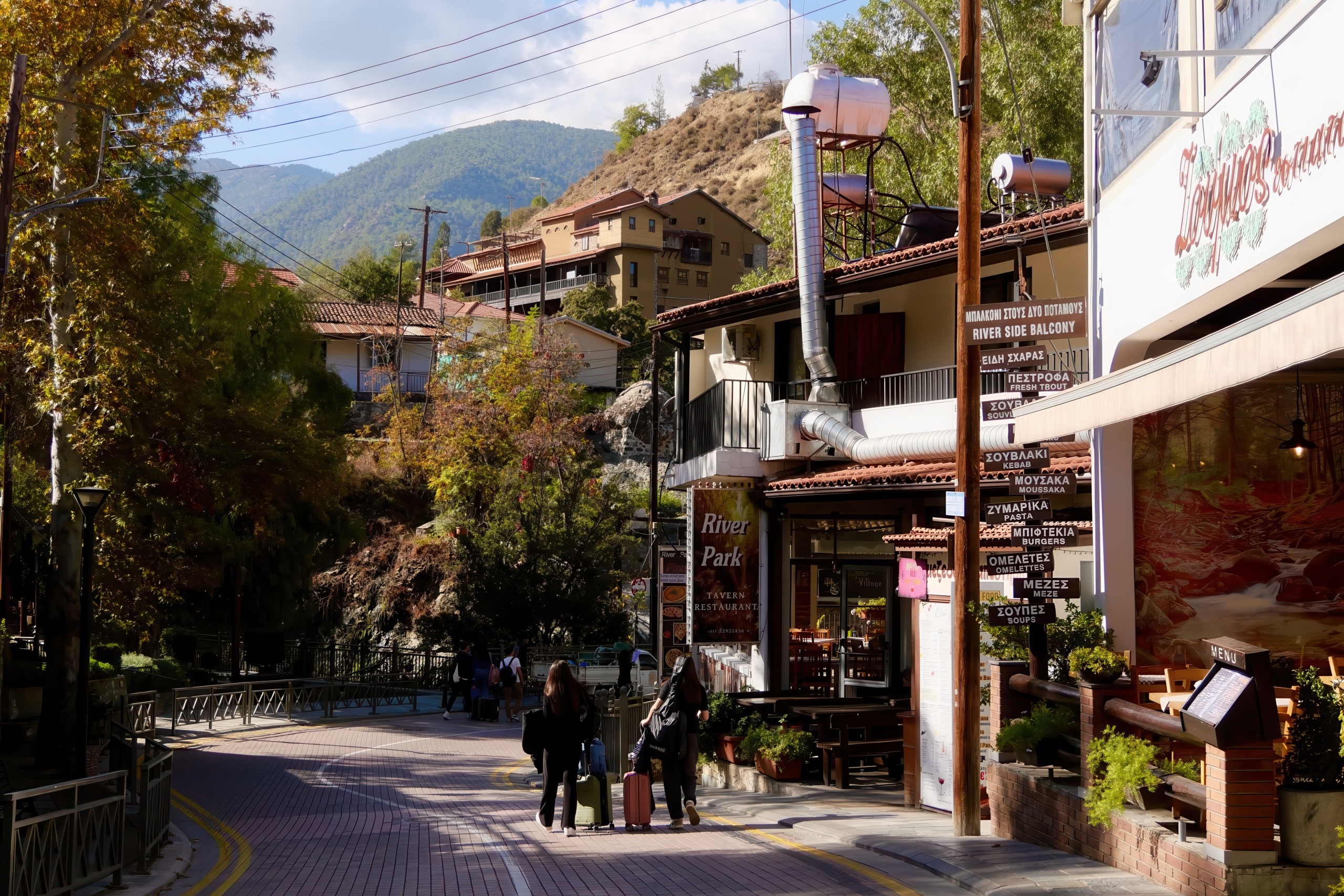
Today, the village maintains a permanent population of around 1,200 residents, which increases during summer months when former residents and visitors return. Many traditional homes in Old Kakopetria have been restored and repurposed as guesthouses, cafés, and small shops, allowing architectural preservation to coexist with economic activity.
Nature trails along the riverbanks and surrounding forest areas provide walking routes through pine-covered landscapes, old mills, and shaded paths. Seasonal changes bring variety to the scenery, with spring greenery, autumn colors, and occasional winter snowfall in higher elevations.
Contemporary Significance
Kakopetria stands as an important example of heritage conservation in Cyprus. The protected status of Old Kakopetria has encouraged careful restoration of traditional buildings, many of which now function as guesthouses, cafes, and craft shops. This adaptive reuse protects architectural character while also supporting the local economy through tourism.
The village hosts various seasonal festivals that maintain local customs and heritage. Sites like Agios Nikolaos tis Stegis attract scholars of medieval art and architecture, as they represent the high level of craftsmanship reached during the Byzantine period. These structures serve as historical museums that document the island’s artistic evolution through the centuries
Enduring Significance of Kakopetria
Kakopetria represents a successful example of heritage preservation combined with modern rural living. Its protected old town, natural landscape, and historical monuments create a setting where multiple layers of Cypriot history remain visible in one location.

The Byzantine-era monuments in the surrounding area contribute to the broader cultural landscape of the Troodos region, which is internationally recognized for its artistic and architectural heritage. At the same time, the village itself continues to function as a living community shaped by agriculture, tourism, and tradition.
For visitors and researchers alike, Kakopetria offers insight into how mountain villages in Cyprus have evolved over centuries while preserving their identity through architecture, landscape, and cultural continuity.